Categories
News Politics Transportation

Cincinnati’s $109M Capital Acceleration Plan Ignores Adopted Bike Policy

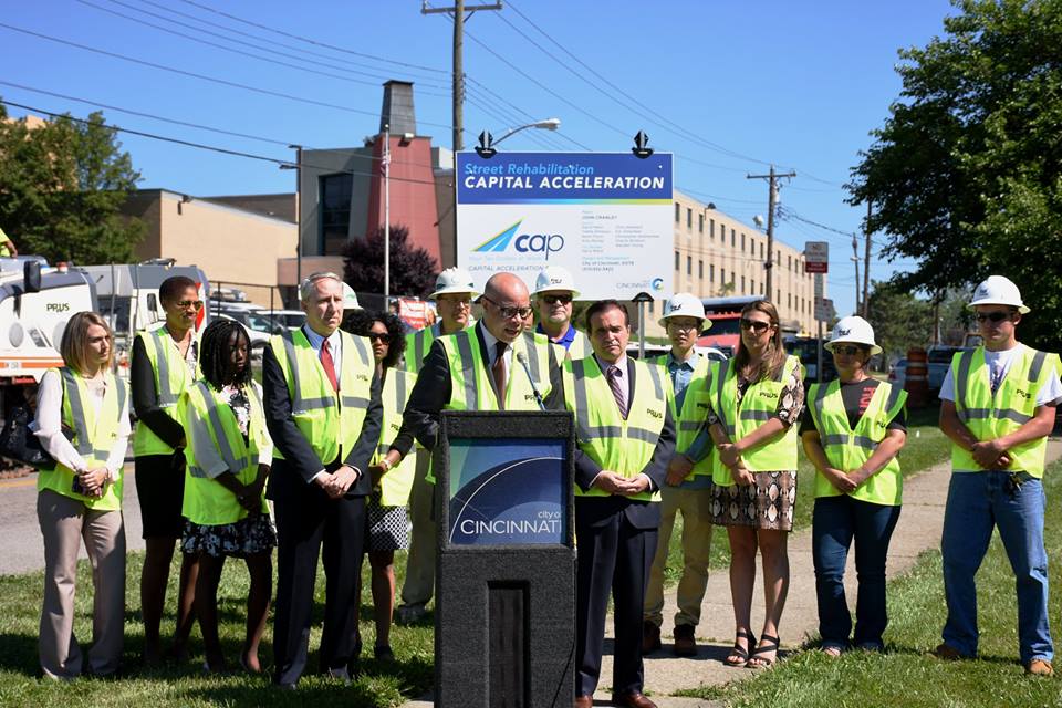
On Thursday, the City of Cincinnati celebrated the start of its bold, new road rehabilitation effort. The six-year program will include the resurfacing and rehabilitation of aging streets, replacement of city vehicles outside of their life cycle, and establish a new focus on preventive road maintenance that city officials will save money in the long-run.

The $109 million Capital Acceleration Plan is a strategic policy shift at City Hall, and represents a large infusion of money into road repair. The new focus on preventive maintenance is particularly noticeable as it represents an eight-fold increase in spending on that front.

“This is much bigger than just spending money to improve the condition of local streets. CAP is about making an investment in the city and people who live here,” City Manager Harry Black said in a prepared release. “This strategic investment in our roadways and infrastructure will serve as the foundation of Cincinnati’s sustained long-term growth.”

City officials say that the investments will improve the condition of 940 center-line miles of streets over the next six years. In its first year, its $10.6 million for street rehabilitation and $4 million for preventive maintenance, officials say, will impact 16 different neighborhoods and improve 120 center-line miles of roads.

With so many streets poised to be improved over the coming years, many people advocating for safer bicycling and walking conditions on the city’s roadways were optimistic that across-the-board improvements could be made. In fact, their cause for optimism is not without cause. The City of Cincinnati’s Bicycle Transportation Plan, which was adopted by City Council in June 2010, calls for incremental improvements to the city’s bike network as road resurfacing projects take place.

“Many of the facilities recommended in this plan can be implemented in conjunction with already scheduled street rehabilitation projects,” the Bicycle Transportation Plan notes. “When this coordination occurs, costs for implementing the bicycle facilities may be reduced by over 75%.”

According to officials at the Department of Transportation & Engineering, such savings can be achieved since the capital costs can be shared for both sets of improvements, and labor costs can be maximized.

The Bicycle Transportation Plan goes on to state that City Hall will be opportunistic and take advantage of every occasion where bicycle facilities can be included with street rehabilitation projects or other capital projects. Taking such an approach, the adopted policy says, “will reduce costs to the lowest levels possible.”

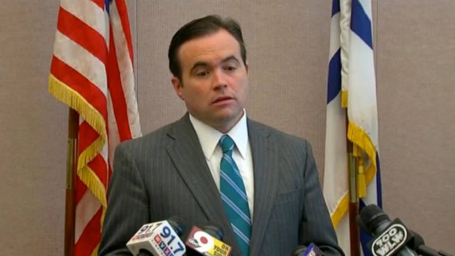
City Hall, however, has fallen woefully behind on the implementation of the recommendations made in the Bicycle Transportation Plan; and the current administration has even made a point of noting that they do not generally support the idea of on-street bike facilities. Rather, Mayor John Cranley (D) and his administration have focused on investing in off-street recreational bike trails.

Such an approach has left many people who use bikes as a means of transportation frustrated; and with $69 million of CAP going toward road improvement projects, it would seem like a great opportunity to maximize the improvements by performing these projects in a manner that also improves safety conditions for the city’s rapidly growing number of people commuting by bike.

Based on statements from City Hall, however, it seems that it will prove more so to be an opportunity lost; and put the city in an impossible position to meet its adopted policy objectives within their target time frames.
Categories
News Politics Transportation

As Challenges Persist For Central Parkway Bike Lane, Cyclists Look to Organize

With National Bike Month coming to a close, the rhetoric surrounding the fate of the city’s lone protected bike lane continues. Following weeks of discussion and political wrangling, the city’s latest politicized transportation project will be studied again after two initial reports were found to be inconclusive by some leaders at City Hall.

The debate is, perhaps not coincidentally, taking place while the city’s bike community is becoming more active in terms of numbers of riders, group rides and political activism.

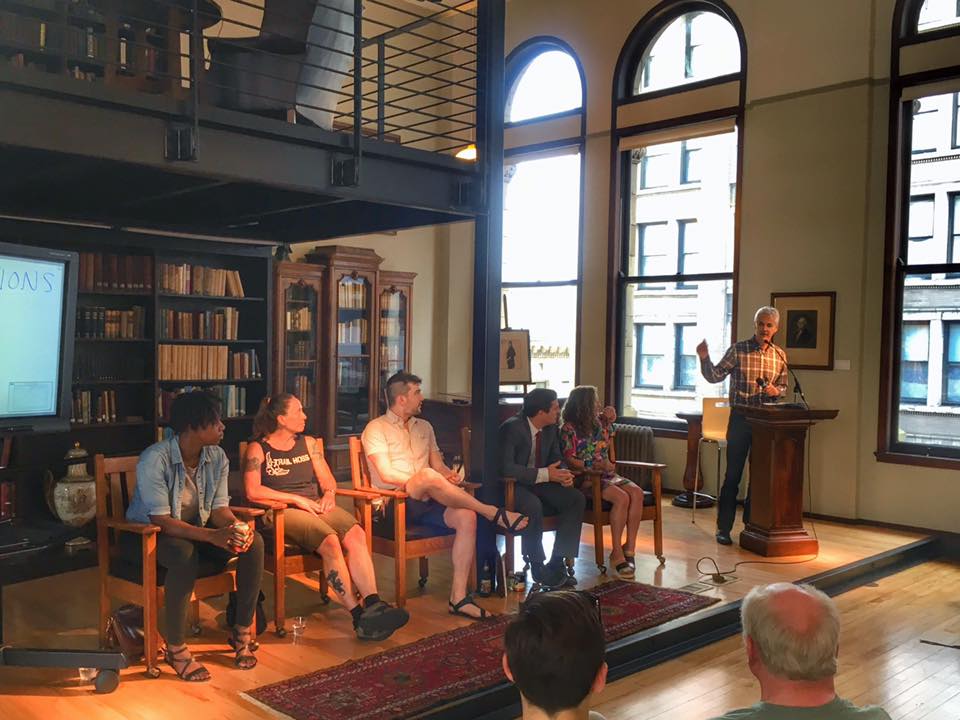
Last night at the Mercantile Library dozens crowded the venue to hear a panel discussion and engage in discussion about the current and future state of Cincinnati’s bike network. Organized by Queen City Bike and other area advocacy groups, the event served as an opportunity for people to constructively discuss the good and bad about the city’s bike infrastructure.

First adopted in June 2010, Cincinnati’s Bicycle Transportation Plan has served as the official document meant to guide policy decisions at City Hall. Since its adoption, however, the planning document has largely sat on the shelf, with targets for the development of bike lanes and other infrastructure falling behind schedule.

Mayor John Cranley’s administration has made it very clear that they are not interested in the development of on-street bike lanes, particularly those that are physically protected from automobile traffic. In lieu of pursuing those targets, the Cranley administration has instead focused on off-street bike trails; while also providing the critical upfront investment to launch Red Bike.

“Under our public-private relationships and support of council and a very vibrant cyclist community, in my opinion, we’re going to be the most bike-friendly city in America in four years,” Mayor Cranley told Aaron Renn in 2014. “We have three major bike trails that can be connected on abandoned train tracks into downtown; and, candidly, we intend to get all three of them build in the next four years. There’s just nothing like it in any city.”

National studies have found that protected on-street bike lanes not only provide the greatest level of safety for both bicyclists and motorists, but also encourage a greater range of demographics to bike. According to the American Journal of Public Health, this is largely attributable to the fact that streets with protected bike lanes saw 90% fewer cyclist injuries per mile than those without.

When it opened in July 2014, the Central Parkway protected bike lane was the first of its kind in Ohio. Since then other cities around the state have developed their own protected bike lanes, but Cincinnati has gone back to discussing the merits of the project after a handful of motorists complained that it made the roadway more dangerous and confusing to navigate.

Those suggestions were refuted in a report issued earlier this month that found conflicts along the 2.2-mile stretch of Central Parkway with the protected bike lane are no different, or even safer, than on other comparable streets around the city; but that further experience and education is needed for motorists.

“The Cincinnati Police Department and DOTE both believe that as drivers, cyclists, and pedestrians become more familiar with the area and with the rules for the bike lane operations, there should be fewer conflicts,” the report concluded. “DOTE will continue to monitor conditions, and improvements may be made in the future as best practices evolve.”

Whether the future of Cincinnati’s bike infrastructure continues to focus on off-street bike trails, or shifts to a more balanced approach is yet to be seen. Queen City Bike is hoping last night’s event, and others to come in the future, will help grow the number of people advocating for a more robust bike network, but also refine the vision based around what it is the community wants to see pursued.

The Cranley administration has put forth a proposed budget that increases spending on bicycle infrastructure, but the overwhelming majority of that money has been tagged for off-street trails, not protected bike lanes or other sorts of infrastructure improvements.

City Council has until the end of June to review, make proposed changes and approve next year’s budget. This will give the growing bike advocacy community a strong opportunity to make their voices heard.

Categories
News Transportation

City Officials Gathering Public Feedback On $718,000 Westwood Trail Extension

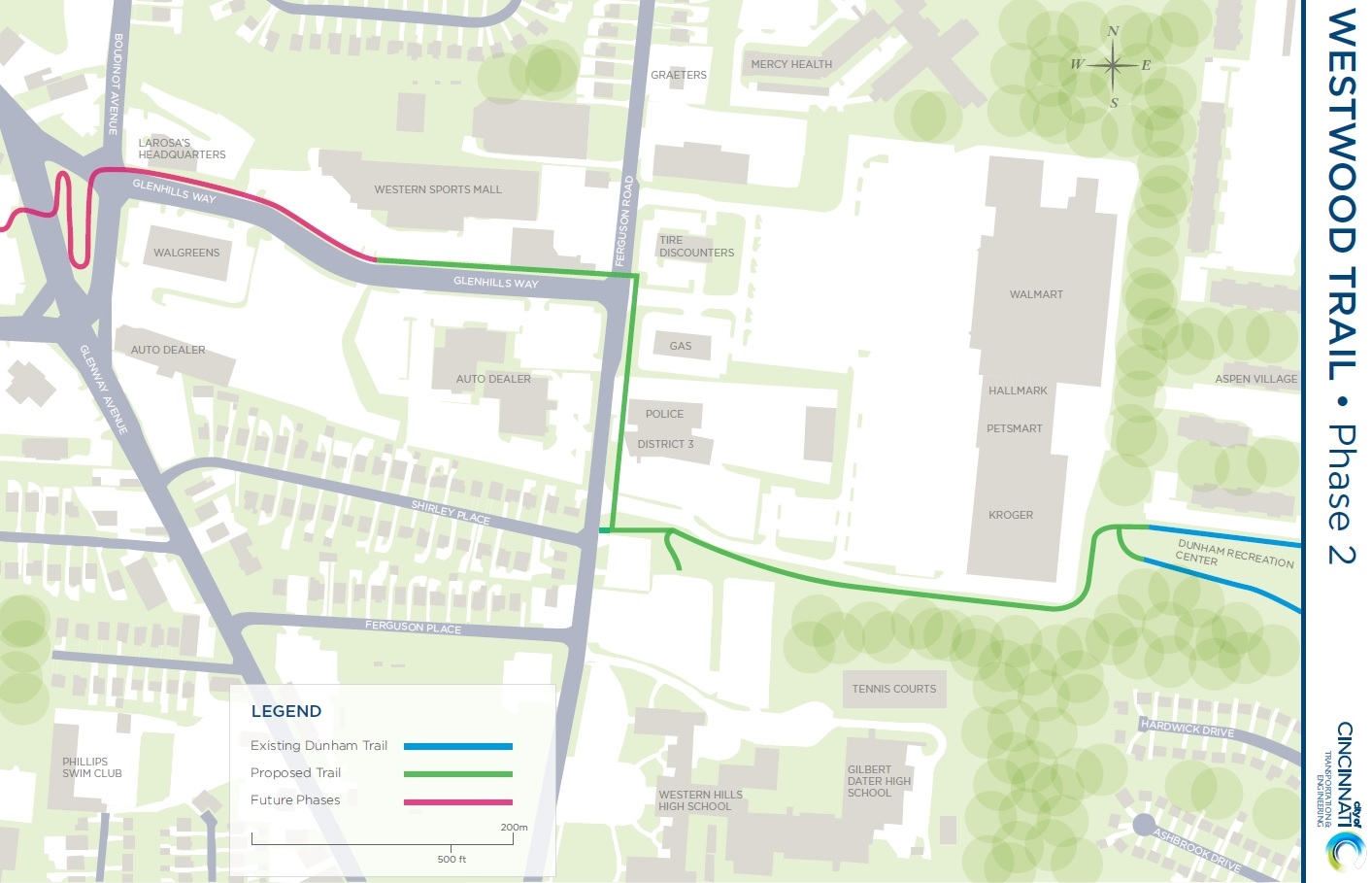
The Cincinnati Department of Transportation & Engineering is taking public input on the proposed second phase of Westwood Trail. A public meeting was held last Wednesday, at the recently christened District 3 Police Headquarters on Ferguson Road, at which the proposed route was presented.

At that time it was explained that things are moving forward thanks to a $500,000 Federal Transportation Alternatives grant for the $718,000 project. The remainder of the budget, officials say, will come out of Cincinnati’s capital budget.

The new half-mile extension is proposed to connect to the existing loop trail at Dunham Recreation Center; and run approximately 1,200 feet between the Kroger parking lot and the Gilbert Dater/Western Hills High School sports facilities to the south. Engineers and planners with the City say that a cross slope on this portion of the route presents a challenge, so the path is to be cut into the slope, with a new 8-foot high, 355-foot long retaining wall.

Along Ferguson Avenue, the sidewalk in front of the newly constructed District 3 Police HQ was built as shared use path, and has a width sufficient to accommodate people walking and biking. The trail will then continue north on Ferguson, and west on Glenhills Way to Western Sports Mall.

City officials say that the existing sidewalks to the north and west of the police substation are not the width required for a shared use path and will need to be rebuilt. This may be, in part, due to the fact that the Bicycle Transportation Plan adopted in June 2010 called for on-street bike lanes along Glenhills Way, not a shared use off-road trail like what is now being proposed.

City Hall has not currently identified the funding to build the next extension of the trail to the west of the Western Sports Mall, but officials say that the intent is for it to eventually extend northwest to the Green Township Trail, and east to the Lick Run Greenway.

These extensions would incorporate the Westwood Trail into a larger regional trail network, including the Mill Creek Greenway. The work also fits into the Cranley Administration’s aim of prioritizing trails over on-street bike facilities.

DOTE officials say that they will be taking public feedback on the proposed trail alignment, and connections to local community institutions, until Wednesday, December 2. Those that were unable to attend last week’s meeting can submit their feedback online at: http://www.cincinnati-oh.gov/bikes/bike-projects/westwood-trail-phase-2/.

Construction is projected to begin in the spring of 2017.

Categories
News Transportation

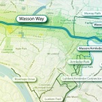
City Planners Recommend Transportation Overlay District for Wasson Railroad Corridor

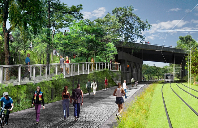
Following the guidance of City Council, Cincinnati’s Department of City Planning & Buildings has completed its land use study for the Wasson Railroad Corridor. The study’s findings and recommendations offer the clearest guidance to-date as to how to proceed with redeveloping the abandoned freight rail corridor, following the issuance of preliminary designs in July 2014.

City planners took a comprehensive look at the history of the corridor, its current conditions and the best path forward that respects the desires of the city and the impacted neighborhoods.

In that analysis City staff revealed seven studies and plans that recommend the corridor either be used for rail transit, or a combined multi-modal network that accommodates rail transit, bicycles and pedestrians. Some of the most notable of these include the 2002 MetroMoves regional transit plan, 2010 Bicycle Transportation Plan, 2012 comprehensive Plan Cincinnati, and the 2013 Railroad Safety Improvement Plan – all of which either specifically call for the corridor to be used for rail transit, or a multi-modal corridor.

The history is important as it influenced the study’s recommendation as to how to proceed with acquiring and preserving the corridor. As of now, the 5.7-mile Wasson Railroad Corridor is still owned by Norfolk Southern, but the City of Cincinnati has stated that they are in the process of acquiring the property from them.

“With this corridor being so crucial to the future development of multi-modal transportation in the City, the threat of potential development within the railroad right-of-way would significantly slow down, if not completely hinder, those possible public transportation opportunities from occurring,” city planners wrote in the 32-page land use study released earlier this month.

Of course, this fact has been known by policy makers at City Hall for years. As a result, City Council has, on several occasions, approved interim development controls to protect the corridor from being built upon. These controls, however, are just temporary and city officials must now decide how they would like to move forward.

In the study city planners examined the pros and cons of three potential options for accomplishing this.

The first option examined the idea of rezoning the property to a Parks and Recreation classification. This would offer the corridor significant protections, but it would also severely restrict the City from being able to implement rail transit in the future due to federal regulations that prohibit the use of public parks or wildlife refuges for transit corridors.

A second option studied looked at simply dedicating the land as City right-of-way. This too would offer significant protections, but is not possible until the City acquires the land from Norfolk Southern.

The third option, and the one recommended by city staff, is enacting a Transportation Overlay District over the corridor. While planners admit that crafting the language for such legislation may be complicated, they also stated that it would be most aligned with the preferences of neighborhood residents and publicly adopted planning documents.

In order to address the complexity of the legislation required for such an overlay district, city planners recommended looking at the Atlanta BeltLine Overlay District that was implemented to protect a 22-mile abandoned freight rail corridor. In Atlanta civic leaders are currently in the process of converting the corridor into a similarly envisioned multi-modal network with rail transit, bikeways, parks and pedestrian paths.

“While all options present advantages and disadvantages, the Transportation Overlay District is seen as the best solution for preservation of the Wasson Railroad Corridor,” city planners wrote. “This tool, while it may take a bit longer to craft the ordinance language, will provide more flexibility and also protect the contiguous nature of the corridor.”

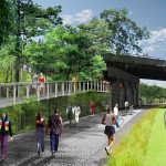
City officials say that this solution will allow for the development of the Wasson Way Trail to move forward in the near term, while affirming the City’s intentions to develop the corridor as a multi-modal transportation facility that includes rail transit in the future.

The solution crafted by the Department of City Planning & Buildings appears to be a perfect compromise between the two constituencies looking to use the corridor. Bicycle advocacy groups can see the right-of-way acquired and preserved so that they can move forward with their plans for a bike and pedestrian trail, while transit advocates can rest assure that those immediate efforts are not being done in conflict with ongoing planning and design work for a future light rail line.

With the Wasson Railroad Corridor Land Use Study now complete, it will go before the city’s Planning Commission. Should it be approved by Planning Commission, it will then go back to city staffers so that draft overlay district language can be crafted and recommended to City Council. From there, it would go before City Council for approval.

It is a standard process and one that advocates hope can be completed in the coming months.

Categories
News Opinion Politics

EDITORIAL: What Cranley’s Clever Budget Means for Urbanists

As has been widely reported thus far, the budget proposed by Mayor Cranley’s Administration is not as bad as many had expected it would be. That is, the administration’s proposal that is predicated on a massive reduction in required pension contributions is not that bad.

Should the proposed reduction to 14% in pension contributions not be accepted by a federal court, then all bets are off as to where this budget will actually go, since the vast majority of its balancing comes from that assumption. This is a major assumption, and one that will not be clarified until later this summer.

One of Cranley’s interesting moves relates to the Focus 52 program, established under Mayor Mallory’s Administration, that targeted funds for economic development projects throughout every city neighborhood. The fund relied, in part, on $3,000,000 in casino revenues to pay for its capital projects, which oddly enough were included in the Operating Budget in prior years.

The proposed budget shifts these Focus 52 projects from the Operating Budget to the Capital Budget, but the $3,000,000 in funding does not move along with them. As a result, the $3,000,000 is being used to help balance the Operating Budget, thus eliminating funding for all Focus 52 capital projects, or requiring cuts elsewhere in the Capital Budget to cover the costs.

The clever ledger shift allows Cranley to essentially eliminate the Focus 52 program without a special hearing process, and thus free up $3,000,000 annually for the Operating Budget that would have otherwise gone to support these neighborhood economic development projects.

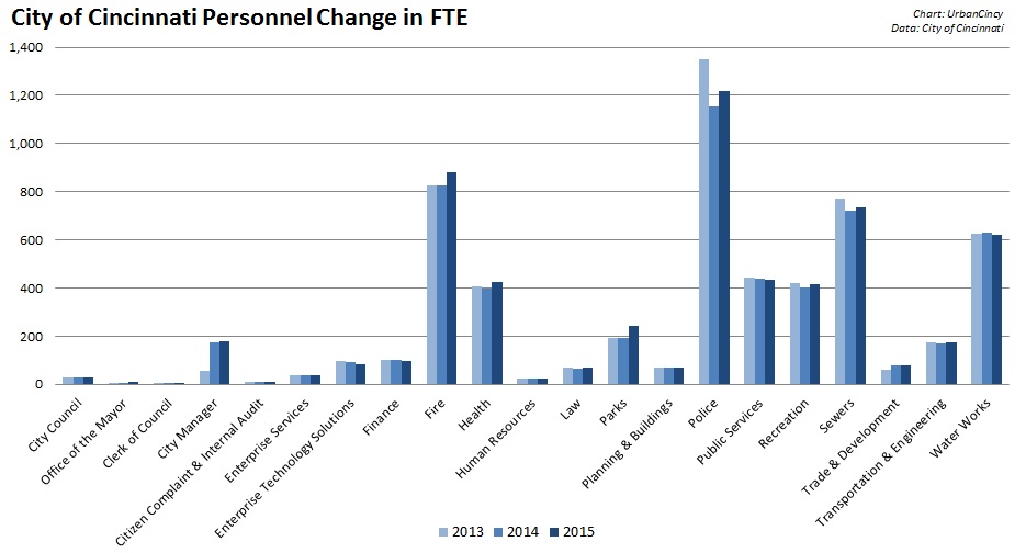
City of Cincinnati Personnel Changes Since 2013

The City will have its first public hearings on the budget proposal starting tomorrow. For those of you who care about urbanism, UrbanCincy’s editorial team has gone through every page of Cranley’s budget proposal and identified the following major items of concern:

  1. Public Safety (police and fire) would consume 65.8% of the Operating Budget. While consuming two-thirds of the Operating Budget, only one-third of the City’s overall staffing would be made up of Public Safety personnel.
  2. Since the year 2000, Public Safety will have seen its personnel levels decrease by 4% (87 FTE), while all other departments will have collectively seen their personnel decrease by 17.7% (803 FTE).
  3. The City of Cincinnati would not repay $2,000,000 in Tax Increment Financing (TIF) dollars to Cincinnati Public Schools as previously agreed.
  4. The Cincinnati Area Geographic Information System (CAGIS), which is a shared technology and mapping service between the City of Cincinnati and Hamilton County, would see its funding reduced by $335,560, bringing its total funding down to $4,448,000.
  5. An additional $279,100 would be allocated to repair an estimated 8,000 potholes. This money would come at the expense of $154,100 in funding previously programmed for solar trash receptacles/compactors and $125,000 for a customs house at Lunken Airfield.
  6. Even though the Department of Planning & Buildings generates more in revenues than it has in expenses, and has won national accolades the last two years, it would see its Neighborhood Studies fund completed eliminated ($81,700).
  7. The Bicycle Transportation Program would be completely modified to only include funding and staff time for off-road trails, and eliminate all funding and staff resources for the development of any bike lanes, sharrows, bike racks or other on-street bike facilities.
  8. The Office of Environment & Sustainability would have $77,500 cut from its budget; while the Urban Forestry (street tree) Program would see its funding increase $46,650.
  9. A whopping 1,954 vehicles out of the City’s total 2,419 vehicles are out of life cycle because they have exceeded the established standards for maximum mileage, age or maintenance costs.
  10. The Port of Greater Cincinnati Development Authority would continue to receive $700,000 for operations, but would receive no money for capital projects as had been anticipated following the cancellation of the Parking Modernization & Lease Agreement that would have otherwise provided the Port Authority with a funding stream for capital projects.

While this budget proposal may technically be “structurally balanced”, it does so by craftily moving budget items around from one ledger to the other, defunding programs that either generate or save money over the long-term, and overly relying on what could be considered this year’s one-time budget fix – a reduction to 14% pension contribution that would equate to $7,100,000 in savings annually.

The City should fulfill its payment obligations to Cincinnati Public Schools, fully fund all aspects of its revenue generating Department of Planning & Buildings, renew the Bicycle Transportation Program to its originally intended goals established through an extensive public engagement process, restore funding to CAGIS and the Office of Environment & Sustainability, return the funds programmed for solar trash receptacles/compactors, and shift the funding associated with Focus 52 capital projects to the Capital Budget along with the projects.

Outside of this budget process, the City should also move forward with a comprehensive effort to fix its outdated fleet of vehicles, provide a stable and substantial revenue stream for the Port Authority and balance its budget in a way that does not create a police state.

The clever maneuvers demonstrated in Cranley’s first budget proposal show ingenuity, but UrbanCincy would prefer seeing that ingenuity being used to solve the actual problems present instead of relying on financing tricks.