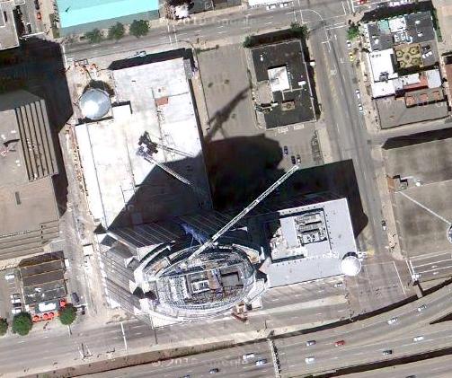
Google has updated its aerial imagery for several major cities throughout the United States including Portland, Washington, D.C., and Cincinnati. The new imagery appears to have been taken over the summer. Observers in the nation’s capital have been able to narrow it down to as precise as Sunday, August 29 between 1:00pm and 1:35pm.
Like many other cities around the country, the new aerial imagery for Cincinnati illustrates much of what has changed over recent years. New construction projects are visibly taking place while others have been completed or are nearing completion in their aerials. In addition to capturing the changing urban landscape in Cincinnati, the new imagery is also much crisper than previous versions.
Below is a sampling of 20 sites around the city that illustrate the aforementioned changes. Enjoy!
