Categories
News Transportation

How to Reimagine Our Streets Around the Concept of Shared Space

CNU22 featured speakers from all over the world, from Bogotá to Toronto to Brighton. One plenary speaker from Bristol moved the audience with an idea called Shared Space that was beautifully simple and innovative, yet entirely new to most of the crowd.

Ben Hamilton-Baillie is a British urban designer, “recovering” architect and self-taught in the area of transportation planning. His presentation focused on explaining Shared Space as an urban design technique that can alleviate the frequently problematic interface between pedestrians, cyclists, automobiles and the public realm.

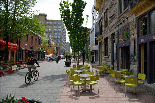
As the name would suggest, Shared Space advances the idea that streets themselves can be a seamless part of public space that is shared by all users. The method came from the Netherlands, where Hamilton-Baillie studied under transportation engineer Hans Monderman and Joost Váhl, who developed the Dutch woonerfs where pedestrians and cyclists have priority on roadways.

The concept also integrates a thoughtful assessment of human psychology as it relates to driving. “It’s essential to understand the changing view of the nature of risk,” Hamilton-Baillie explained. “Hazards keep us aware of our environment and allow us to adapt our behavior.”

This seems counter-intuitive, but it was effectively explained through an example of two cities in the Tel Aviv region of Israel.

Bnei-Brak, located east of Tel Aviv, is composed of largely low-income, ultra-conservative Jews. Ramat-Gan, also located east of Tel Aviv, is home to a more moderate, middle-income Jewish population. Hamilton-Baillie explained that the people of Bnei-Brak are known throughout the region as being unruly pedestrians. Adults and children cross streets with disregard for traffic. Locals know that they must be vigilant when driving there.

Conversely, the residents of Ramat-Gan respect pedestrian rules, crosswalks, and jaywalk less frequently. Drivers are more at ease in Ramat-Gan.

Perhaps counter-intuitively, there is a higher instance of pedestrian fatality in Ramat-Gan. Drivers in Bnei-Brak tend to cautiously drive at lower speeds, aware that there is a greater risk of a pedestrian appearing in the road. One can see in this example that increased risk makes for more attentive drivers.

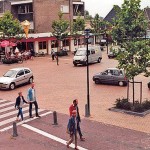
Shared Space utilizes risk in the form of mixing cyclists, pedestrians and motorists on streets, and relies on the idea that removing lines and signaling allows for social protocols to take over more strongly than signs. This, Hamilton-Baillie said, is called “friction”, or natural cues that guide a driver’s speed. There is already an increasing awareness in North America that things like narrow streets, street trees and buildings built to the right-of-way naturally induce drivers to reduce speed without a speed-limit.

One might think that this friction would create delays, but evidence from project implementation has found the opposite, as did Hans Monderman’s projects in the Netherlands. And post-project evaluations, like in Poynton, UK, have confirmed the efficacy of Shared Space designs.

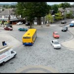
Poynton is a city southeast of Manchester. It is a throughway for traffic between the two larger cities of Macclesfield and Stockport. In this instance, vehicles were found to be passing on the main thoroughfare at a rate of 26,000 per day, many of which were trucks. The initial approach to relieve congestion was the construction of additional lanes of traffic.

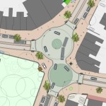
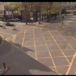
Shared Space, however, was applied as part of a regeneration scheme in Poynton. The first task for Hamilton-Baillie’s consultancy was to “remove every trace of traffic engineering.”

Three lanes of cars were reduced to one, signaling was removed, additional on-street parking was introduced, and sidewalks were widened. There was increased edge friction through vertical elements within the driver’s line of vision.

Even after the removal of two lanes and signals, traffic flow stayed the same and pedestrian traffic increased five-fold. Before the project, 16 of 32 shops in town were boarded up; but within one to two years after project completion, all shop spaces in the business district were occupied.

Streets were able to concurrently be part of Poynton public space and serve through traffic – the change in aesthetics was remarkable.

It is certain that freight and car movement is critical to the healthy functioning of any economy. This fact is not contested. But since civilizations started building cities, they have been venues for people to roam – sometimes at odds with our economic necessity to move people and goods through them quickly.

Fast big things and slow small things do not mix well.

Shared Space demonstrates that these seemingly incompatible users actually function better when mixed within the city fabric – cars move more fluidly when drivers are forced to react to their surroundings instead of their actions being dictated to them. People are safer, too.

The outcome is that streets become a different kind of public space, where mobility means interacting with one’s surroundings.

When asked if he thought famously impatient North American drivers could adapt to the concept, he paused for a moment and said, “Everywhere Shared Space has been applied, I was told that the drivers in the locale couldn’t adapt. In every case they did.”
Categories
Business Development News

CNU22: Cincinnati Wins National Planning Award for Form-Based Code

The City of Cincinnati’s Department of Planning & Buildings has been on a roll lately. This past weekend in Buffalo, at the Congress for the New Urbanism (CNU) national conference, the city won its third national award of the year for its new form-based code.

CNU’s grand prize for the Best Planning Tool or Process was actually a tie and thus jointly awarded to Cincinnati for its form-based code (FBC) and Station Center, a transit-oriented development in Union City, California.

As first reported by UrbanCincy, the Department of Planning & Buildings was honored with the Daniel Burnham Award for a Comprehensive Plan at the American Planning Association’s (APA) national conference in Atlanta.  Additionally, in late 2013, the Department won the Ohio APA’s award for Comprehensive Planning for a Large Jurisdiction.

In 2012, city leaders were also awarded with the Frank F. Ferris II Community Planning Award from the Hamilton County Regional Planning Commission.

In addition to city staff and thousands of Cincinnatians, those involved in developing Cincinnati’s award-winning FBC included Opticos Design, Hall Planning & Engineering, Urban Design Associates, glaserworks, Wise Economy Workshop, and Urban Fast Forward.

“It is an honor for us to have our code recognized by an organization that is on the cutting edge of best practices with regard to planning tools and good urbanism,” said Alex Peppers, senior city planner for Cincinnati. “We put a lot of work into developing a code that would fit our context and assets.”

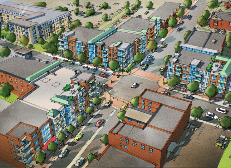
What makes Cincinnati’s FBC unique is that it is a voluntary tool for neighborhoods who seek to preserve the character of their centers of activity and historic business districts. Thus far, it has been adopted in College Hill, Madisonville, Walnut Hills and Westwood.

Jurors noted that they were particularly impressed by the code’s extensive photo documentation and mapping analysis that calibrated the code’s application, and reinforced the unique characteristics of Cincinnati’s urban neighborhoods.

“The Cincinnati code is an excellent example of that advancement in the deployment of SmartCode, with particular attention paid to public process, neighborhood structure and graphic presentation,” explained Elizabeth Plater-Zyberk, one of CNU’s award jurors. “It reinforces Cincinnati’s historic urban patterns with guidance for appropriate infill and predictable redevelopment building.”

The final draft of Cincinnati’s form-based code is available online and can be accessed here.

On the twelfth official episode of The UrbanCincy Podcast, we were joined by Roxanne Qualls to discuss Cincinnati’s development and implementation of form-based codes. You can subscribe to The UrbanCincy Podcast on iTunes for free.

Categories
Development News

OKI Looking for Additional Feedback About How Region Should Grow

The Ohio, Kentucky, Indiana Regional Council of Governments (OKI) is looking for more feedback for its ongoing update of their Strategic Regional Policy Plan.

Once complete, the plan will include 32 strategic policy recommendations for the Cincinnati region in the areas of housing, transportation, land use, public facilities and services, natural systems and economic development.

The original plan was completed in 2005 but due to an evolving context in the wake of the Great Recession, and in the midst of significant demographic changes, the organization is updating the document.

OKI officials say that the planning process will address the same four questions as the original 2005 Plan: Where are we as a region? Where are we going given current trends? Where do we want to go? How do we get there?

Specifically, the core and supplemental questions are looking to see where the 2.2-million-person region stands in terms of its preferences for various transportation, land use and economic development policies.

OKI, the region’s federally mandated metropolitan planning organization, has revised the 32 policy recommendations over the last year-and-a-half; and a draft is now ready for public viewing and comment.

It is hoped that the sleek, attractive and user-friendly website can be easily navigated by anyone interested in giving feedback. OKI is also utilizing a variety of social media tools to bolster participation, including several videos that have been uploaded to YouTube to help disseminate information and inspire people to get involved.

“We are focusing on presenting information in a more accessible way through the website,” said OKI planner Thomas DiBello, “People will be able to review the information whether they are at their computer or on a smartphone.”

This viewing format contrasts traditional multi-page documents that are increasingly being seen as dated ways to engage with a more tech-savvy public.. The website is interactive and input can be given with a series of clicks through short questionnaires.

The change in approach comes after OKI had an initial public input campaign with more than 2,400 individuals responding in the fall of 2012. The online format proved successful beyond the organization’s expectation, and will now be the vehicle for encouraging people to take a look at the draft and express their opinions as they move into the finalization of the plan in coming months.

In addition to standard questions, the online portal where those giving their feedback can also share their thoughts in more open-ended comments.

OKI officials say the comment period will remain open through the end of June. You can view the plan and give input through the How Do We Grow websiteThose who prefer to read through the material on paper can do so by downloading the information from the website as well.

Categories
Arts & Entertainment News

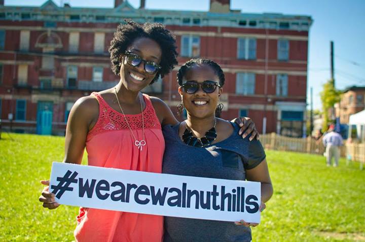
Inaugural We Are Walnut Hills Festival to Take Place This Saturday at Firehouse Row

Those engaged in what is happening in the city are undoubtedly familiar with the positive energy that abounds at the numerous Walnut Hills community events. Community Council meetings are packed with a diverse, engaged group of residents on a regular basis.

This is exactly what the upcoming We Are Walnut Hills Festival on May 17 will celebrate. Event organizers say it will be an opportunity to harness the energy of anyone who lives, works or worships in Walnut Hills for a celebration of community.

Recent events there have drawn attendees from the entire city, including, most notably, the Walnut Hills Street Food Festival, which is now planning for its third year. Last year it was estimated to have attracted more than 5,000 people.

Walnut Hills Redevelopment Foundation (WHRF) community engagement specialist, DJ Greene, says that the We Are Walnut Hills Festival will seek to look inward toward the neighborhood’s roughly 6,500 Walnut Hills residents.

“The festival is really an opportunity for neighborhood people to learn about each other and engage each other,” Greene explained.

The event will take place this Saturday at Firehouse Row, the open green space in the 700 block of McMillan Street, and Five Points Alley, where there will be special activities for kids, art, games and a grill out. And Greene says that local businesses and organizations will be allowed to set up booths for free.

The festival’s location will help show off Five Points Alley’s remarkable transformation. Through the efforts of volunteers, the junction of urban alleyways was turned from a derelict, litter-strewn area into a community gathering space and home to the popular Five Points Pop-Up Biergarten. Building on last year’s inaugural success, beer garden socials will become weekend-long events on the third weekend of every month.

The We Are Walnut Hills Festival will take place from 12pm to 4pm on Saturday, May 17. Anyone interested in volunteering should contact Sarah Dotter at SarahDotter@walnuthillsrf.org. And, of course, you can track all things happening in the neighborhood on social media at #WeAreWalnutHills.

Categories
News Opinion Transportation

APA14: Transportation Set the Mood at This Year’s National Planning Conference in Atlanta

This year the American Planning Association (APA) National Conference was held in Atlanta from April 26 to 30 at the Georgia World Conference Center. For those who have never been, it is five days packed full of urban-focused sessions, workshops, tours, meetings, happy hours and an awards ceremony, with approximately 5,000 in conference attendees.

Cincinnati’s Department of Planning & Buildings received the prestigious Daniel Burnham Award for for Plan Cincinnati. Last year in Chicago, Cincinnati took home this same award for the execution of its Central Riverfront Plan. Plus, UrbanCincy was recognized by Planetizen immediately following the five-day event as being one of the “top influencers” at the conference. Needless to say, the mood was especially festive for the few dozen attendees from the Cincinnati region.

Attendees and experts are also able to submit ideas for presentations, and put on a session of their own. For presenters, it is a lot like show and tell. Professionals get to share lessons, valuable knowledge gained on the job or show off a successful or interesting planning project to the world.

This year’s conference program was particularly transportation-heavy, and with good reason.

Many presenters remarked on the increasing evidence that people are trading in their car for a transit pass, a bicycle or walking shoes. Teenagers, in particular, have less interest in acquiring driver’s licenses. The rate at which this is happening is significant enough that it has been covered by nearly every major news source in the United States, according to Greg Hughes from the Utah Transit Authority in a session about transit and competitiveness.

Bloomberg Business Week reported that from 2001 to 2009, 16- to 34-year-olds took 24%more bike trips and were 16% more likely to walk to their destinations. Meanwhile, from 2000 to 2010, the share of 14- to 34-year-olds without drivers’ licenses increased from 21% to 26%.

National Geographic reported in December that this trend was acknowledged in “dramatically altered projections” for transportation energy use over the next 25 years by U.S. government forecasters.

If anyone feels that Cincinnati is bucking the trend, we could take our temperature on the invisible hand.

Zipcar, Uber, Lyft and Cincy Bike Share have all moved past the market analysis phase and are providing, or will soon provide, private-automobile alternatives within the city. In addition, bus ridership in Cincinnati grew by 3.5% last year, significantly more than the 1% seen nationally, according to the American Public Transportation Association.

This same APTA report showed the highest U.S. transit ridership in 57 years. It seems that we could be entering into a new Golden Age of transit.

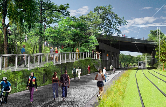
Atlanta had a few transportation projects of its own to showcase. One of the favorite activities for conference attendees was exploring the Atlanta BeltLine – a 25-year project that will transform old railway and industrial sites into 22 miles of multi-modal trail right in the heart of the city. It connects multiple parks and green spaces, and given that it is woven so seamlessly into the city fabric, is a viable transportation alternative to city streets.

Atlanta boasts the largest public transit system in the southern United States, and carries roughly 500,000 passengers on weekdays.

MARTA rail services were well-used by conference attendees, and some attendees even made a point to get hotels outside of downtown and utilize the subway to get to the conference venue and back. Although not yet operational, Atlanta is also in the process of finalizing its 2.7-mile streetcar project running from Centennial Olympic Park downtown to the historic Old Fourth Ward neighborhood to the east.

Atlanta’s pedestrian-oriented Midtown neighborhood became a favorite after-conference hangout, and the restaurant and pub scene in Little Five Points was both eclectic and funky. Next year’s conference will be held in Seattle.