Categories
Development News

Proposed Tax Would Provide Dedicated Parks Funding Stream, $85M in Improvements

A campaign to improve Cincinnati’s parks by raising the City’s property tax by 1 mill will “change the city for the better,” according to Cincinnati Mayor John Cranley (D).

Cranley made his remarks during the official launch of the Citizens for Cincinnati Parks levy campaign on Saturday morning at New Prospect Baptist Church in Roselawn.

The charter amendment would raise the City’s property tax rate to 13.1 mills and would bring in approximately $5.3 million a year. The move would require City Council to fund the Parks Department’s capital budget at its 2016 budget level, and approve bonds for capital improvements using levy revenue.

Proponents say that 75% of the levy revenue will be available for the City to borrow against in order to fund 13 designated capital projects selected by the mayor and city manager. The remaining 25% will go to system-wide maintenance and operating costs.

“We’re asking to voters to pass a very small property tax that we believe, for that small amount of money – $35 a year per $100,000 value – will increase property values and increase the quality of life for all Cincinnatians as we take the wonderful park system and we bring it to the neighborhoods,” Cranley said.

The group needs to collect approximately 6,000 signatures by August 15 to make it on to the November 3 ballot. Cincinnati Parks has not placed a levy on the ballot since 1927.

“We have decided that the only fair way to do this, if we’re going to be asking the taxpayers to pay more money, is to ask the citizens first to even let us put it on the ballot,” Cranley said. “At the end of the day, we’re putting this decision in the hands of the voters, and we believe the value proposition is there. We believe that this will build a better city.”

Vision needs funding
Board of Park Commissioners President Otto M. Budig, Jr. said that his organization has been charged with creating the best parks system in the country, but despite generous City funding and donor contributions, it continually finds itself short on money for major initiatives.

“We have had some difficulty in developing major projects that have long been needed,” he said. “I went to the mayor and I said, ‘We need these funds to bring about a new vision. You give us a vision, we’ll take care of the details.’ The mayor has given us the vision.”

While many of the projects are only in the conceptual stage at current time, the Citizens for Cincinnati Parks website says that they were chosen due to being the most shovel-ready, with the ability to be completed quickly.

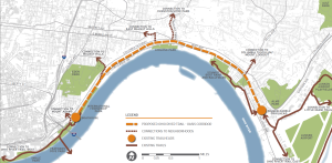
Multipurpose recreational trails are a major component of the plan, including the Oasis River Trail ($8 million), Wasson Way ($12 million), Mill Creek Greenway Trail ($5 million), and the Ohio River West Trail ($6 million). The City also plans to work with the Cincinnati Off-Road Alliance to develop more than 20 miles of off-road trails in Mount Airy Forest ($11 million).

“The bike system that will be created as a result of this levy, off-road, which is a big thing for me – I think off-road is a much safer, dedicated path that doesn’t have as many accidents – the most extensive, bicycle urban path in America,” Cranley said.

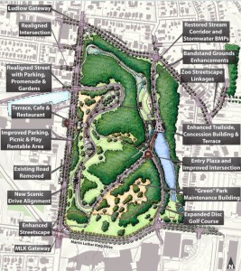
The plan would also raise $10 million for a joint venture between the City, the University of Cincinnati, and Clifton Town Meeting to create a new master plan for Burnet Woods.

“As I often say, Burnet Woods – even more so that Washington Park – could be the Central Park of Cincinnati,” Cranley said. “If you think about Corryville, CUF, Clifton, Avondale…all surround this park. It’s the densest part of the city and it’s right across the street from 30,000 students. We can have the same impact with that park as we did with Washington Park.”

Other projects include:

  • Developing part of the 20-acre New Prospect Baptist Church grounds into a communal programming center, athletic fields, and an urban camp site that would cost $8 million;
  • A public-private partnership with Western & Southern Financial Group that would provide $5 million to renovate and reprogram Lytle Park;
  • $5 million for the redevelopment of a portion of the former Mercy Hospital complex in Westwood into athletic fields and green space for an expanded Oskamp Park;
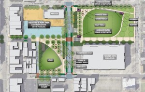
  • A $5 million redesign of Ziegler Park in Over-the-Rhine/Pendleton, in conjunction with the Cincinnati Center City Development Corporation (3CDC);
  • $4 million for streetscape and roadway improvements surrounding Christ Hospital and improvements to Inwood Park in Mount Auburn;
  • $2 million for the preservation of the historic King Studios site and development of a small café/museum in Evanston;
  • $2 million for upgrades around Westwood Town Hall and Epworth Avenue; and
  • $1.8 million for a new boat dock/marina at Smale Riverfront Park.

“Now we have this new vision,” said Parks Director Willie Carden, who already has overseen the amazing transformations at Smale Riverfront Park and Washington Park, among others. “The vision brings ‘parkonomics’, partnerships to the neighborhoods. We can do this. We can make this a safer, healthier community, but we need your help.”
Categories
Development News

Pendleton Offers Support For $24M Alumni Lofts, Pending Green Space Protection

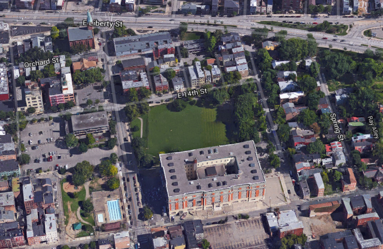
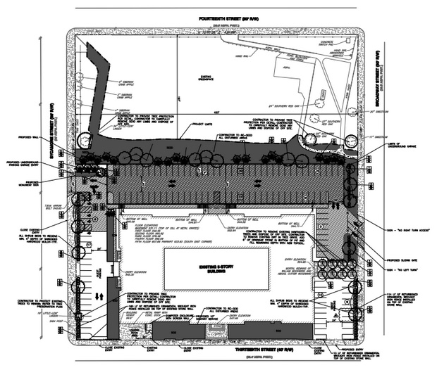
On Monday evening, the Pendleton Neighborhood Council voted unanimously to support Core Redevelopment’s $24 million Alumni Lofts project, provided the green space north of the former Woodward School/School for Creative and Performing Arts building remain undeveloped and available for public use.

The council’s letter of support asks that any development agreement between the City and the Indianapolis-based developer, or any future owners or assigns, include provisions that the Cutter Playground property be donated to a nonprofit or governmental entity and that development restrictions, such as a conservation easement, be included in the contract.

The developer’s current plans call for a two-level parking structure on part of the nearly three-acre site, leaving between 80-85% of the original green space intact.

Developer Michael Cox with Core said that he’s unsure whether the green space will be managed by his company or donated, but said that his company is committed to the community’s goals.

“We don’t know which one yet, simply because we haven’t worked through all of the deal structure and the timing of all of that,” he said. “It’s a pretty complicated project that we’re doing, but we are committing to the City in our project agreement with the City that we will do one of those things with the green space and it will be a green space in perpetuity.”
Alumni Lofts will consist of 142 market-rate apartments, ranging from 480 to 2,000 square feet and leasing for between $699 and $1,400 a month.

Still undergoing demolition and prep work, construction on the new units has been bid and is ready for permitting pending Council approval. A leasing office is planned to open in January or February, and Core expects to welcome its first tenants by July 1, 2016, Cox said.

The development agreement will be presented to City Council’s Budget & Finance Committee on June 8.

Under terms of the agreement, the project would receive indirect City assistance through a 30-year tax increment financing (TIF) rebate program, which Senior Community Development Analyst Adam Sickmiller said is “completely unique” for the region.
“From the developer’s perspective, it’s effectively a net 67.5% tax rebate,” he said.  “So the developer will pay their taxes. Twenty-five percent will go to the schools, and 7.5% will go to the streetcar operating fund.”

The remainder would be returned to the developer, which will allow Core to receive a bigger bank loan to construct the parking structure, Sickmiller said.

“If the project performs better than expected, there will be a sharing of that revenue between the developer and the City,” he said. “Where specifically this money is going – and one of the reasons that we’re pretty excited about this – is that it’s going into an account that will specifically be used for public improvements, urban redevelopment, and public infrastructure, parks and the like.”

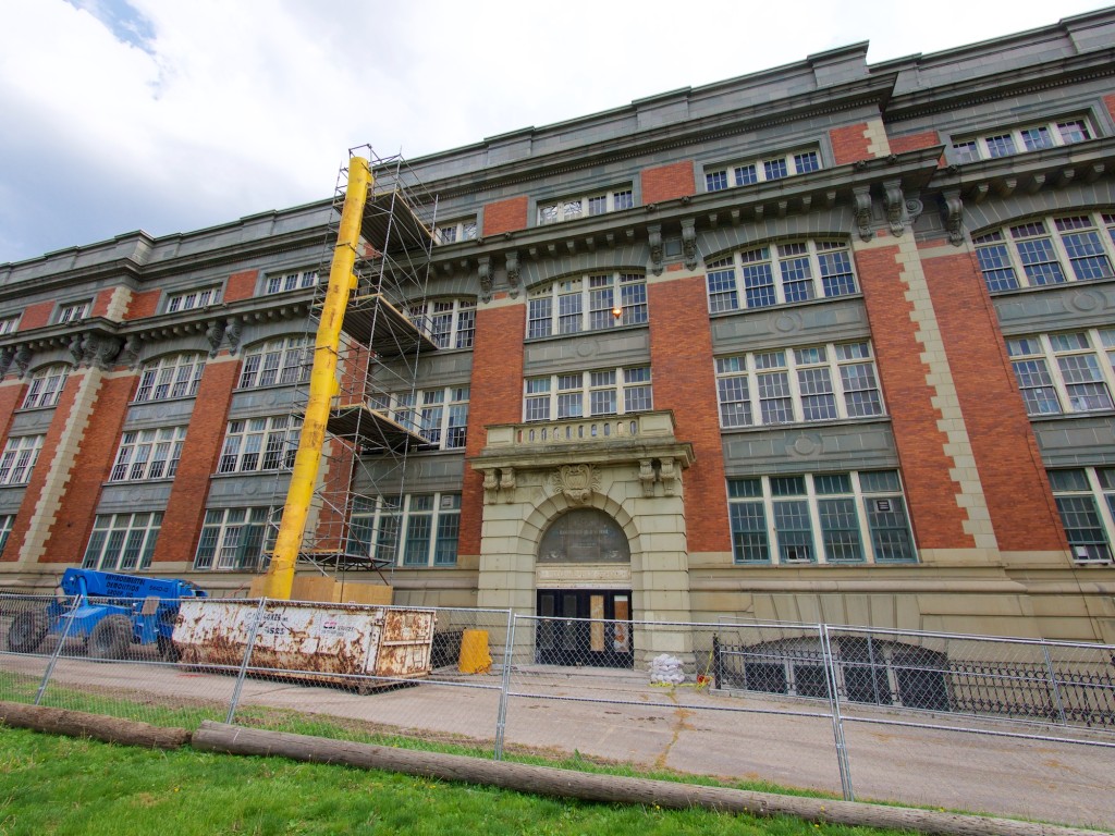
Opened in 1910 as the second Woodward High School, the 225,000-square-foot building has been vacant since 2010, when SCPA moved to its new $72 million building on Central Parkway.

Core bought the school for $1.3 million in late 2012 at an auction of vacant Cincinnati Public Schools properties.

Categories
Development News Transportation

Cincinnati Reaches Agreement With Norfolk Southern on Purchase of Wasson Railroad Corridor

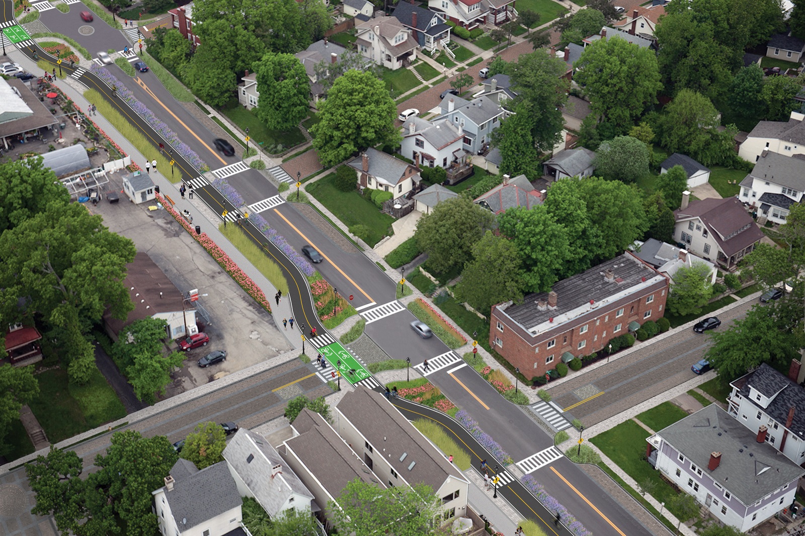
Cincinnati City Council’s Neighborhoods Committee gave a unanimous okay to an ordinance that would solidify an agreement to purchase 4.1 miles of railroad right-of-way from Norfolk Southern for $11.8 million, providing a key piece of the 7.6-mile Wasson Way recreational trail.

The agreement would give the City a two-year purchase option for the property, which extends between the Montgomery-Dana intersection along the Norwood/Evanston line to the intersection of Red Bank and Wooster roads in Columbia Township.

The ordinance was a last minute by-leave item on the committee calendar, made necessary due to a TIGER grant application that is due on Friday. Project backers are seeking $17 million of the $20 million project cost, and City support makes their application much more attractive.

The trail has been in the works since 2011, and a group of nearly 20 volunteers with the Wasson Way nonprofit got a big boost when Mayor John Cranley (D), City Manager Harry Black, and City staff assisted with the negotiations.

“We started looking at the TIGER grant application,” said Mel McVay, senior planner at Cincinnati’s Department of Transportation & Engineering. “They really talk about ‘ladders of opportunity’, increasing mobility and accessibility for folks throughout the region, and so we saw an opportunity between the property we could purchase and some property we already had, and some existing trails.”

Director of Department of Trade and Development Oscar Bedolla spelled out the project’s urgency.

“One of the statutory requirements associated with the scoring for TIGER is related to readiness,” he said. “And so, the more that we can do to show that the project is potentially shovel-ready enhances our ability to acquire or be selected for TIGER funding.”

Bedolla added that under the terms of the agreement, the City would pay nothing in the first year if it does not proceed with the purchase. If the purchase is pursued within the second year, there would be a 5% fee added to the price.

The City’s matching funding of between $3 million and $4 million for construction costs could be made up of a combination of state and federal grants, plus funds raised by Wasson Way, he said.

Still up in the air is approximately two miles or the corridor between the Columbia Township end point and Newtown, where it could connect with the Little Miami Scenic Trail.

“We’re working on it,” McVay said. “Unfortunately, the railroad was not open to selling any additional property east of that point. We’re investigating three or four ways that we can get farther east to the existing Little Miami Trail. We’re very confident we can get there.”

David Dawson, a resident of Mt. Lookout and realtor with Sibcy Cline, expressed concern about how a long-envisioned light rail line could be brought to the corridor once its freight rail designation is abandoned – a legal process that is handled by the U.S. Surface Transportation Board.

“It just can’t be said enough, in my view, that the City will now become the steward of a very valuable asset,” Dawson said. “This is a regional corridor that, in this day and age, cannot really be duplicated. If we lose that ability to eventually have transit, rail transit, or some sort of transit in the future, we won’t be able to put it back.

Dawson and other rail advocates are calling for the corridor to be railbanked, so that the addition of light rail transit remains an option in the future.

“This doesn’t just connect our neighborhoods, but in the future it has the potential to connect the entire region out to Clermont County,” Dawson said.

The use of this corridor has long been eyed for light rail transit, including in the 2002 MetroMoves regional transit plan. A 2014 study by KZF Design recommended a design solution that would preserve the ability to develop both light rail transit and a trail; and estimated that such an approach would bring the cost of developing the trail to approximately $11.2 million.

Andrea Yang, senior assistant City solicitor, said that the purchase agreement would give the City some time to work out those issues.

“The way that the abandonment process is structured, there is a time period which we could utilize to further investigate other options,” Yang said. “Had we chosen to railbank the property and attempt to preserve it, it would actually follow the same process for abandonment, so there’s definitely time to look into that if that is what Council’s interested in seeing.”

In April, Cincinnati’s Planning Commission voted to place an Interim Development Control Overlay District on this corridor in order to give the city more time to allow plans to progress without new development creating new conflicts.

Categories
News Opinion

CNU23: Unsure About Expectations, Dallas an Unexpected Delight

I saw my first cowboy hat within my first five steps off of my Frontier Airlines flight into Dallas/Fort Worth International Airport.

The truth is, I didn’t really know what to expect from Dallas – hell, I’d never even been to Texas. What I found during last week’s visit was a clean, cosmopolitan city filled with music, art, and a personable populace that exceeded my expectations.

Things didn’t get off to the best start. I had to spend a couple of hours at the airport waiting for my girlfriend’s flight to arrive. Leaving Terminal E for the train at Terminal A, the Terminal Link bus felt, indeed, terminal, as it would its way through an unintelligible maze of ramps and roadways.

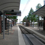
We then faced another hour on Dallas Area Rapid Transit‘s (DART) Orange Line to our accommodations, the historic Hotel Lawrence in the West End of Dallas. I would not recommend this hotel unless you’re looking for something cheap and you’re not planning on being there much, because it’s currently under a heavy renovation to rebrand it as a LaQuinta Inn & Suites and won’t be completed until early next year. But it is served by several bus lines, is across the street from Dallas Union Station, and is a short walk from Dealey Plaza and the Sixth Floor Museum, which is located in the building from which President Kennedy was shot. Oh, and the 561-foot Reunion Tower (1978), where for $16 you can access the GeO-Deck. (I declined.)

(Tip: Buy a 7-day DART pass for $25 and enjoy unlimited rides on all trains and buses!)

I was in town for CNU23, which was being held downtown at the beautiful Hotel Adolphus (1912) on Commerce Street. The first two days were spent getting to know writers from other Streetsblog affiliate sites and brainstorming ways to build better stories, better sites, and a better national network. We also traveled to the adjacent Deep Ellum neighborhood, which, with its restaurants and bars, would be considered the city’s hipster enclave. While there, we heard a presentation on tactical urbanism and took part in a project to build seating out of reclaimed wood pallets for a street festival.

The rest of the conference – which was extremely well-run, by the way – was focused heavily on transportation and designing around transit. Called “Meeting the Demand For Walkable Places”, the conference featured speakers presenting on topics ranging from in-depth to broad, tours of place making initiatives that are working, and meet-ups.

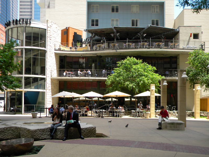
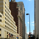
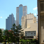
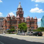
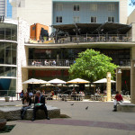
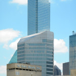
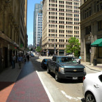
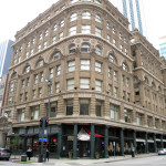
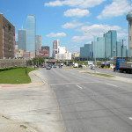
I will say that the architecture in Dallas left me a bit wanting. Many of the downtown buildings are constructed in the modern/brutalist and postmodern styles, indicative of the postwar boom that saw the city grow from a population of under 300,000 in 1940 to an estimated 1.3 million today. But there are pockets of “old” Dallas here and there, and numerous public plazas from which to enjoy them.

(Note: Yes, there is a McDonald’s with a drive-thru in downtown Dallas!)

On the way back to the airport on Friday, I was able to get a good look at some transit-oriented development near the Orange Line’s Victory station (near the American Airlines Center) and the massive planned community of Las Colinas in neighboring Irving.

The airport was no better the next day.

I would definitely recommend Dallas. The people were fantastic, the food was great, and the positive vibe was palpable. It may have just been the great minds that were in town for the conference, but, if it’s even half as nice on a daily basis, I’d still enjoy it. And the “CVB” weather made it all the more enjoyable.

CNU24 will take place June 8-11, 2016 in Detroit. I’ve been to Detroit several times, but not for a few years. Perhaps it will be time to visit again.

Categories
Development News

Developer Seeking Support for Six-Unit Columbia Tusculum Townhome Project

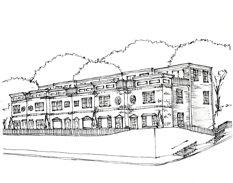
The developer responsible for building “Cottage Hill” along Columbia Tusculum’s Strafer Street is now seeking the community’s approval for a six-unit townhome project.

On Monday, Gary Osterfeld presented to the community council what he called “very preliminary” sketches for the attached buildings at the bottom of Strafer Street – along Columbia Parkway – which would likely be around 1,900 square feet apiece and could be either apartments or for-sale homes.

The site is currently undeveloped and is used as a small community gardening space. If he pursues the project, Osterfeld will be seeking a zoning variance from its current zoning classification of community commercial-mixed to residential mixed, as it would have no commercial component.

“The commercial market in Columbia Tusculum is not real good, despite what people may think,” he said. “The problem is, relative to the number of people, there’s more retail than there is need for it. There’s already more retail than there is people; so in order for businesses to come in there and be enough demand and for the businesses to be profitable, we need more people.”

Osterfeld also told the community council that Al. Neyer’s Columbia Square, which is located directly across Columbia Parkway from his proposed building site, took five years to fill with tenants. He also said that he’s been trying to market his site for about the same amount of time but “hasn’t had a single serious call”.

The site is also challenging because of its steep slope and six-foot retaining wall, which Osterfeld said the City would likely want to keep in place.

“The idea of the zoning in place – what they would like to see – is they would like to see retail on the street level, so that people can walk in the shops like Hyde Park Square or Oakley Square – or like most squares – and the upstairs is residential,” he said. “The problem with that is you don’t see hills in Hyde Park, Mount Lookout, Oakley. The other neighborhoods you don’t see built on a hill like this. So the topography does not lend itself well to what the City’s insisting be there.”

The earliest the project could begin is this fall. Price points are expected to start in the mid-$300,000s, based upon what Osterfeld has seen of the local market.

“My guess is that it’s probably going to be a younger, more transient market,” he said. “There’s going to be a lot of steps, the price point’s not going to be like [the Cottage Hill development on] Strafer. I think that Strafer started out in the upper 3’s [$300,000s] and ended up in the upper 6’s [$600,000s]. I don’t see that happening. But we’re designing it to try to accommodate anybody. We’re going to be as flexible in our design as we can.”

Osterfeld said he plans to keep the neighborhood notified as the proposal navigates the maze of design, variances and permits.

“The City would like to have neighborhood support and neighborhood cooperation, as would I,” he said. “Your interest is what’s good for the community. So, I’m trying to help with that.”