Categories
Development News

Columbus is not the biggest city in Ohio, and Indy’s not bigger than Boston

Following the release of the U.S. Census Bureau’s updated population numbers for American cities, much has been made about the urban rise of the west. Even the Census Bureau itself touted the growing number of cities with more than 1 million people – the vast majority of which are located west of the Mississippi River.

These numbers can be misleading, and often don’t even pass the smell test.

Is Jacksonville, for example, really a bigger city than Detroit, Washington DC, Atlanta and Boston? Or out west, would most people actually consider Phoenix to be a larger city than San Francisco, Seattle, Denver or San Diego? Of course not.

In both scenarios, however, that is precisely the case. That is because the municipal boundaries for Jacksonville (885 square miles) and Phoenix (517 square miles) are disproportionately large compared to the population of their city. Closer to home the same is true for Columbus (223 square miles), Indianapolis (368 square miles) and Charlotte (298 square miles) – all of which skew the average population density for cities east of the Mississippi downward due to their huge municipal footprints.

If you were to simply pick-up a daily newspaper and read the listing of America’s most populated cities, you would not get this full perspective and perhaps be misled to think that Columbus is the biggest city in Ohio, or that Indianapolis is the fifth largest city east of the Mississippi River.

Using this same practice, some might consider Cincinnati to be a small city that doesn’t even crack the top 30 in the United States.

Of course, we know all of this is skewed by all sorts of factors. Some cities sit on state or county lines, others follow historical boundaries from hundreds of years ago that have never changed, while other are granted more liberal annexation capabilities. In short, it’s politics.

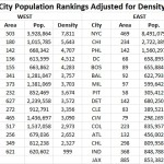
Now if we were to look at America’s 30 most populous cities again, but rank them by population density instead of overall population, the picture would change rather dramatically. Most cities in the west fall considerably, while older cities in the east would rise. The outliers that have artificially inflated their boundaries over the years also fall into a more normalized position on the chart.

While Cincinnati is not in the top 30 in terms of population, we considered it anyways since this is UrbanCincy after all. After adjusting for population density, Cincinnati would vault all the way to the 16th “biggest” city in America, just behind Denver and ahead of Dallas. This is also more in line with Cincinnati’s metropolitan population ranking that falls within the top 30 in America.

Those cities in this analysis that are in the east have an average population density, outliers included, of 6,579 people per square mile, while those in the west, come in at 3,804 people per square mile.

If outliers like Jacksonville actually were as large as they project, and followed the average population density for the region, it would need to add close to 5 million people. Likewise, Indianapolis would need to add around 1.6 million people and Charlotte 1.1 million. Local politics and market conditions in each of these cities will never allow for this many new people to move within city limits.

The Washington Post is correct in that the west is getting more populated and urbanizing at a fast pace, but let’s not get ahead of ourselves. The most populated cities in the west would only be average, at best, in the east if they were judged by population density instead.

Now, factoring for population-weighted density would be an entirely different ballgame.

Categories
Development News

As Construction Nears Completion, Apartment Leasing to Begin at The Gantry

Construction work has progressed quickly on the $13 million Gantry development since ground was broken in June 2014; and developers expect to start leasing apartments in the near future.

Located in the heart of Northside, the project has transformed what had long sat as an empty and vacated rail yard. It is also the site of what had long stood as a controversial proposal to develop a suburban-style Walgreen’s on the site, which was adamantly fought by Northside residents in the early aughts.

After the success in fighting off what was seen as a damaging Walgreen’s proposal, and the success of the American Can Lofts just behind this site, which opened in 2011, the location has only become that much more desirable.

“Their [Bloomfield & Schon] work for American Can, getting that project through – I know it was a grueling process – really paved the way for Gantry to happen, and enables us to thrive in this great neighborhood,” explained Jake Dietrich at Milhaus, at the groundbreaking last year.

“Some might say that we’re taking a chance on Northside, but in a way Northside kind of took a chance on us, because this kind of project doesn’t happen more times than once. So the fact that Northside was willing to let an out-of-town developer come in and work with them so closely just goes to show just how much this neighborhood cares and how much potential this neighborhood has.

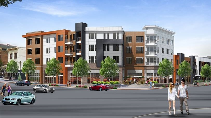
Located at the northeast corner of Blue Rock and Hamilton Avenue, the Gantry was designed by CR architecture + design and is being developed by Milhaus. It includes three new buildings with 131 apartments and approximately 8,000 square feet of street-level retail space.

Wire & Twine was one of the first businesses to sign on for space at Gantry, and will open this fall.

While the new retail will fill in an important gap for the business district, it is the influx of new housing that has many in the historic neighborhood excited.

According to Gregory Martin, Vice President of Development at Milhaus, most of the framing is now finished inside the buildings, and that leasing on the studio, one-, and two-bedroom apartments will begin in July, with the first residents moving in this September.

Those interested in getting on the waiting list now can do so by signing up on the Gantry’s website.

The project has been designed to achieve LEED Silver certification from the U.S. Green Building Council. In addition to its green building features, the development will also take advantage of being located in the walkable Northside business district, and being directly across the street from one of Cincy Red Bike’s newest stations at Jacob Hoffner Park, as well as Metro’s new Northside Transit Center.

“Northside is a community, that if you haven’t noticed, is a community that is very, very much on the upswing,” said Vice Mayor David Mann (D).

Categories
News Opinion Transportation

Here’s How to Improve Access Between Ohio and Kentucky’s East/West Neighborhoods

When discussing regional transportation issues, the topic seems to always be about congestion. In reality, outside of a few limited periods, the Cincinnati region has relatively good traffic flow with little actual congestion. So instead of trying to solve a problem that does not exist, we should be instead focusing our resources on maintaining our current system and improving mobility within the overall region.

As is the case in any city, the natural environment often serves as a chokepoint and barrier to regional mobility. This is true for Cincinnati with its hills and rivers.

With the region’s population largely centered along the Ohio River, it is natural that this is where the most choke points exist. Outside of the center city, however, there are very few river crossings. In fact, there are only two Ohio River crossings outside of the center city, and both of those are for I-275.

One such area that makes sense for a new local road bridge is around Cincinnati’s Columbia Tusculum neighborhood and Dayton, KY near where the $400 million Manhattan Harbour project is planned.

An increasing amount of development continues to occur on the northern bank of the river in Columbia Tusculum and East End. Further up the hill sits prosperous neighborhoods like Mt. Lookout, Hyde Park, and Oakley; and just around the bend lies Lunken Airfield.

Conversely, on the south side of the river in Kentucky, large-scale development projects have long been envisioned, but are often derailed due to poor access via existing roadway networks. This remains true for Manhattan Harbour where concerns exist about the traffic burden that would be placed on the narrow KY 8 running through historic Bellevue’s quaint business district.

A local road bridge that is one lane in each direction with space for pedestrian and bicycle paths would be an ideal fit for this area of the region. It would improve mobility and access to two difficult-to-access areas. It would also offer a highway alternative for those looking to cross between the two states.

A second location where a local bridge of this nature would make sense is near where the Anderson Ferry currently operates today on the city’s west side.

While little development has occurred in this area for some time, this may soon change. The Ohio River Trail West will soon make its way toward this area, and several developers have been eyeing the western riverfront for major projects.

The Cincinnati-Northern Kentucky International Airport sits on the southern side of the river where this bridge would land. This area continues to be bolstered by warehouses, distribution facilities and other airport-related services, and could be further bolstered with better access. What’s more, Cincinnati’s western neighborhoods that have long had to deal with excessive airplane noise, yet long treks to the airport, could at least resolve one of those injustices with a new local access bridge.

The Taylor-Southgate Bridge is the most recent span that has been constructed over the Ohio River. It was completed in 1995 and cost $56 million at that time – approximately $85 million when adjusted for inflation. Both of these new bridges would need to span an approximate 1,700-foot-wide width, which is about 300 feet more than the Taylor-Southgate Bridge river width.

One of the main differences, however, is that the Taylor-Southgate Bridge includes two lanes of traffic in each direction, plus sidewalks. The need for only one lane of traffic on these bridges would allow them to have a deck width of around just 30 to 35 feet.

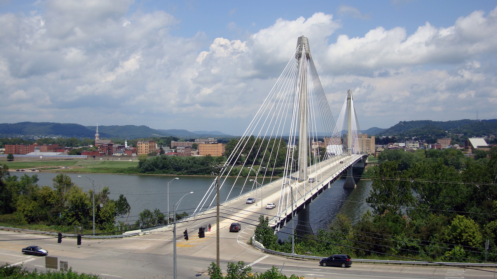
Another good nearby comparison is the U.S. Grant Bridge in Portsmouth, OH. That cable-stayed bridge was completed by the Ohio Department of Transportation in 2006 for approximately $30 million – or about $35 million in today’s dollars.

In addition to access and mobility improvements for motorists, a new bridge in both of these locations would also be a boon for cyclists. Those riding along the Little Miami Scenic Trail and the Ohio River Trail would now also be able to continue on to Northern Kentucky’s Riverfront Commons Trail, which will eventually stretch 11.5 miles from Ludlow to Ft. Thomas.

The Cincinnati region does not need multi-billion dollar solutions for a traffic congestion issues that largely do not exist. Reasonable and affordable projects that aim to increase mobility and access, along with maintaining our existing assets, should be the priority.

New local bridges connecting the region’s east and west side neighborhoods would open up land for new development, improve access between both states, enhance mobility for pedestrians and cyclists, and would do so at a price tag we can afford.

Categories
News Transportation

Local Transportation Organizations Partnering To Offer Streetcar-Bicycle Training

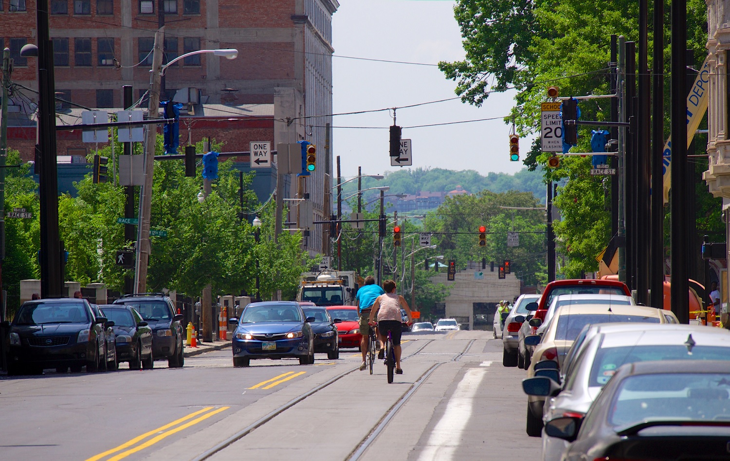
Area cyclists have long been aware of the risks with riding over certain sewer grates due their design that can allow for tires to get caught, thus causing an accident for the person riding the bike. With track work nearly complete, the same is true for cyclists navigating streets with train tracks on them.

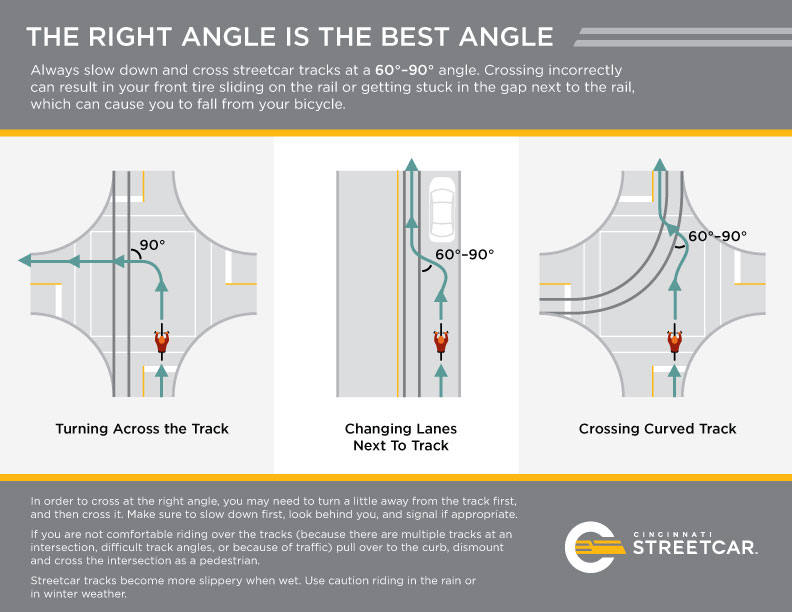
While the risks posed by such an arrangement are minimal and easily avoided, local transportation officials are working to make sure that there are no problems. As a result, SORTA and Queen City Bike have put together some recommendations for people riding bikes on streets where the streetcar operates.

They suggest to look and listen for trains, and to never cross in front of a moving train as it is approaching; be aware that rails can be slippery when wet; cross tracks at a 90-degree angle; and to just generally practice safe riding techniques and maintain awareness.

“Cincinnati is becoming increasingly bike-friendly and we want to ensure that riders are aware of these simple safety tips that can help them avoid potential falls or damage to their bikes when riding along the streetcar route,” said Metro’s System Safety Director T.J. Thorn.

Queen City Bike is also working with Cincy Red Bike to offer free streetcar safety clinics every second Saturday of the month at 10am in Washington Park. Organizers say that the free clinics will run through October, which is just after the scheduled arrival of Cincinnati’s first streetcar vehicles. At these clinics bicyclists will learn how to safely ride adjacent to the streetcar tracks, and how to properly cross over the tracks.

Streetcar Bike Safety

Categories
Development News

VIDEO: Latest Phase of Work at Smale Riverfront Park Virtually Complete

Cincinnati Park officials have celebrated a string of openings at Smale Riverfront Park over the past month. While a few more openings remain, the vast majority of work in the latest major phase of the $120 million park is now essentially complete.

In the latest video update from project manager Dave Prather, he explains what all has taken place and what remains before work slows down considerably. At this point, Prather said, attention will turn to raising funds for the next wave of work, including the boat dock and western reaches of the 45-acre park.

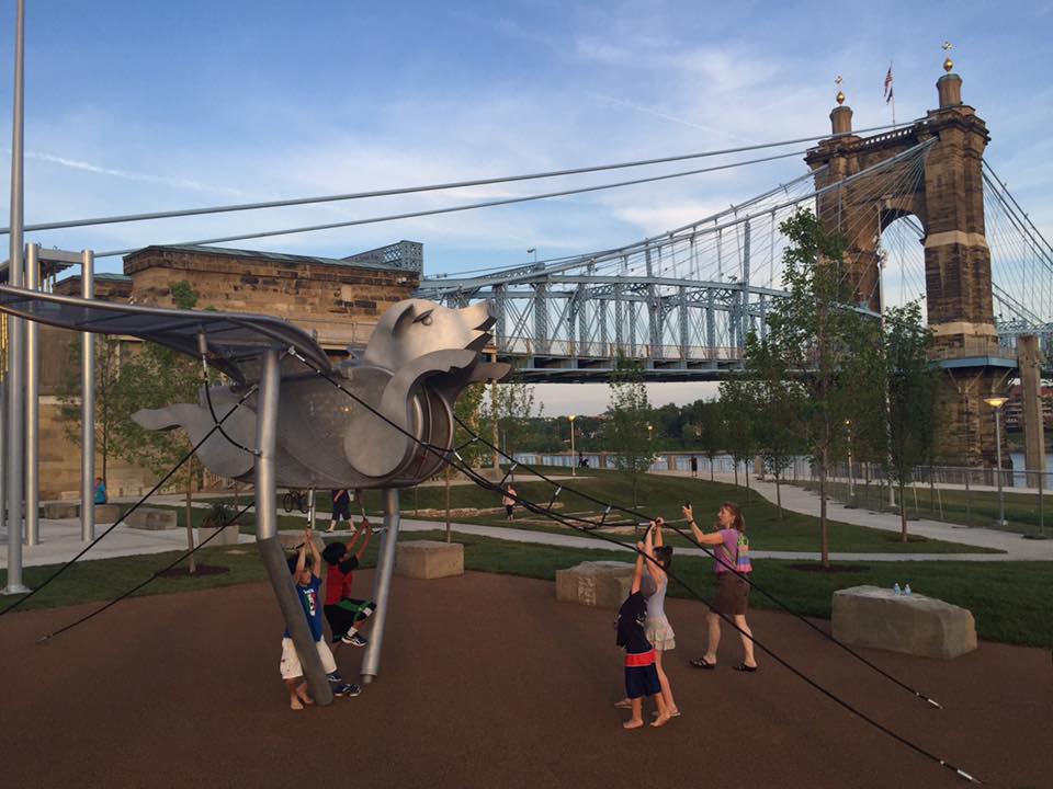
The latest additions to the central riverfront park are more active than what has been developed so far. There are more of the popular family swings overlooking the river, an interactive foot piano, a flying pig playset, water pumps and channels, Carol Ann’s Carousel, and the P&G go Vibrantscape. Where railyards once existed, there are now even movable picnic tables sat atop rail ties.

Two of the larger features of the latest expansion are actually passive spaces. The Great Lawn is now nearly complete and the “beach” is in its early stages of formation. Once complete, visitors will be able to walk all the way down to the water’s edge, although this “beach” will not be made of sand due to the risk of erosion.

Two unique historical features are also part of this latest work. The first is a cornerstone marker in the middle of the Great Lawn that shows where the first addressed building in Cincinnati was situated. The second is a collection of foundation walls that were uncovered during the park’s excavation. These foundations, historians say, remain from 19th century buildings developed along the Ohio River.

This is expected to be the last video update from the Smale Riverfront Park development team for some time. As development at The Banks catches up, the park will soon be able to continue its westward expansion.