Randy is an award-winning urban planner who founded UrbanCincy in May 2007. He grew up on Cincinnati’s west side in Covedale, and graduated from the University of Cincinnati’s nationally acclaimed School of Planning in June 2009. In addition to maintaining ownership and serving as the managing editor for UrbanCincy, Randy has worked professionally as a planning consultant throughout the United States, Korea and the Middle East. After brief stints in Atlanta and Chicago, he currently lives in the Daechi neighborhood of Seoul’s Gangnam district.
Level of Service. Chances are, unless you’re in a field related to transportation planning or engineering, or are a total geek, you probably have not heard of this term before. LOS, however, has come to define how we design and build or roadways. Almost by its structure, LOS favors cars over the function or safety of any other mode of transportation. So what would happen if we took the same approach for other modes, like walking? More from Urban Kchoze:
The point of a traffic engineer in most studies is to keep level of service as low as possible to avoid delays for drivers, helping them drive faster and have to wait less for other traffic. Now then, some of you may ask “well, what about pedestrians and cyclists? How is level of service measured for them?” Well, the answer to that is that the default method says: F#!% ’em.
So let’s suppose that we calculate a level of service for pedestrians based on the same basis as for vehicles. Pedestrians can stop and accelerate to regular walking speed almost instantaneously and so we don’t have to calculate delay caused by lower than desired speeds during acceleration and deceleration. So delay is limited essentially only to the wait time before they can go ahead and cross (supposing car drivers respect pedestrian priority).
…crosswalks with medians and stop signs should be preferred to traffic lights for areas with a focus on pedestrians. It also means that the habit of channeling all the traffic on a few wide arterials, forcing each intersection to have multiple turn lanes and many through lanes, is absolutely terrible for pedestrians. A street grid with densely packed streets would do a better job of responding to all users, as it would dilute traffic on many streets, all these streets could be narrow, with 3 or 4 lanes only (1 per direction plus a shared left-turn lane or 2 per direction). Ideally, I believe there should not be any width of pavement greater than 12 meters (40 feet) in a city, any pavement wider than that should be broken in two with a median wide enough to use as a pedestrian refuge.
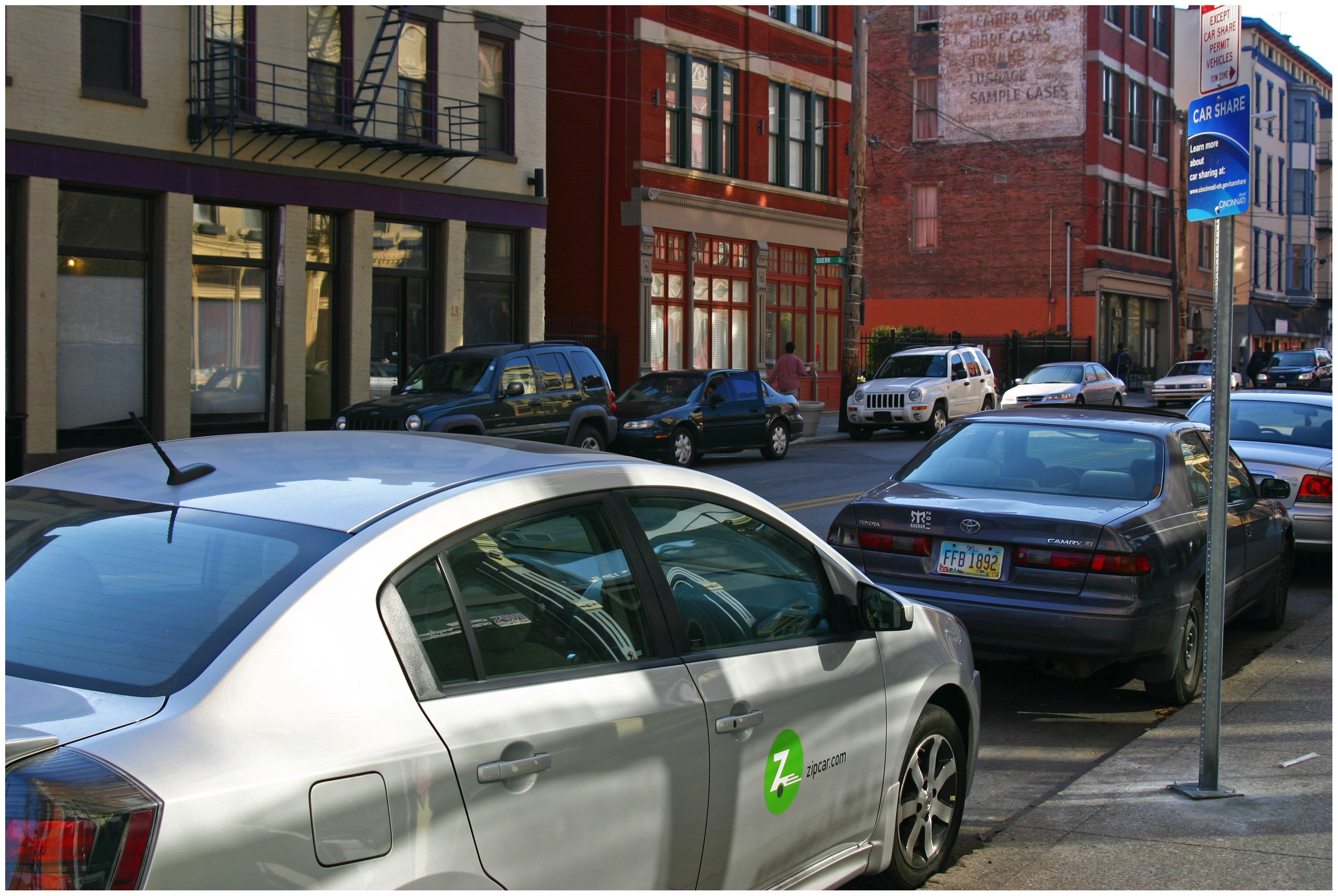
Since that time, however, peer-to-peer driving services, like Uber and Lyft, have emerged and begun challenging the more established business model of companies like Zipcar, which was acquired by Avis in January 2013 and boasts a global membership of more than 900,000.
In the case of Zipcar, the user is the driver, and must return the car to its starting point – a requirement limiting potential growth of Zipcar and other car sharing services. In order to stay competitive, Zipcar has recently launched new one-way services in its hometown of Boston.
Zipcar in Over-the-Rhine [Randy Simes]
“We are currently beta testing the service in Boston with our Boston members,” Jennifer Mathews, Public Relations Manager at Zipcar, told UrbanCincy. “Our plan is to roll out the service to additional markets once it’s ready.”
While one-way car sharing travel may soon be a reality in Boston, it appears to be further off for smaller markets like Cincinnati, as does the availability of cargo vans, which are presently available in a limited number of markets, but not Cincinnati. The desire for such vans, industry experts say, is so that they can be used for more utilitarian purposes like moving. For now, those participating in Cincinnati’s car sharing economy will continue to need to either use a traditional rental company, or borrow a friend’s truck for such purposes.
Since its debut in 2011, however, Zipcar officials say that they have made changes to their operations and 11-car fleet in Cincinnati in order to stay relevant.
“While the number of cars has remained somewhat consistent over the years, we have moved locations and updated our vehicles throughout the program,” Mathews explained. “Zipcar strives to place cars where our members want them. As we see pockets of members pop up in certain areas or neighborhoods we will move cars around to make sure that they are convenient as possible.”
Of course, Cincinnati’s Zipcar network is substantially smaller than other cities, thus reducing its usefulness to more than a small collection of users.
While there are no immediate plans for expansion, Mathews does say that the company will continue to monitor their two programs – University of Cincinnati and City of Cincinnati – over the course of 2015 to determine whether additional changes or expanded offerings are needed.
Those with memberships are able to use those in any of the hundreds of markets where Zipcar operates worldwide. Cincinnati’s 11 vehicles can be found at the northwest corner of Race Street and Garfield Place, Court Street in between Vine and Walnut, the southeast corner of Twelfth and Vine Streets; and on the University of Cincinnati’s main campus on McMicken Circle and just north of Daniels Residence Tower.
It is always fascinating to study what exactly led to the collapse of previous civilizations and the cities they built and inhabited. Often we study what it is we can learn in order to maintain the civilizations we have built, but not our cities. A team of University of Cincinnati researchers have been looking at exactly that in the former Mayan city of Tikal. More from Next City:
When Lentz and a group of colleagues looked, they were able to piece together a picture of how Tikal survived as an urban center. For hundreds of years, they found, the Maya managed their resources sustainably. But that wasn’t enough to keep the city from collapsing in the face of climatic change; the changes Tikal’s residents made to the land may even have made them more vulnerable.
“They expanded to the carrying capacity of their landscape, leaving no resilience where something bad came along,” Lentz said. “When you make changes to your environment, sometimes things happens that you don’t expect. When the droughts came, because they had exploited the environment to the full extent of their technological capabilities, they just were not able to respond.”
The last monument went up around 869 A.D. By the end of the century, the city was likely largely abandoned.
New parking rates and hours of operation went into effect for the Central Business District and Over-the-Rhine on Friday. The changes come after Cincinnati City Council approved the matter in November 2014.
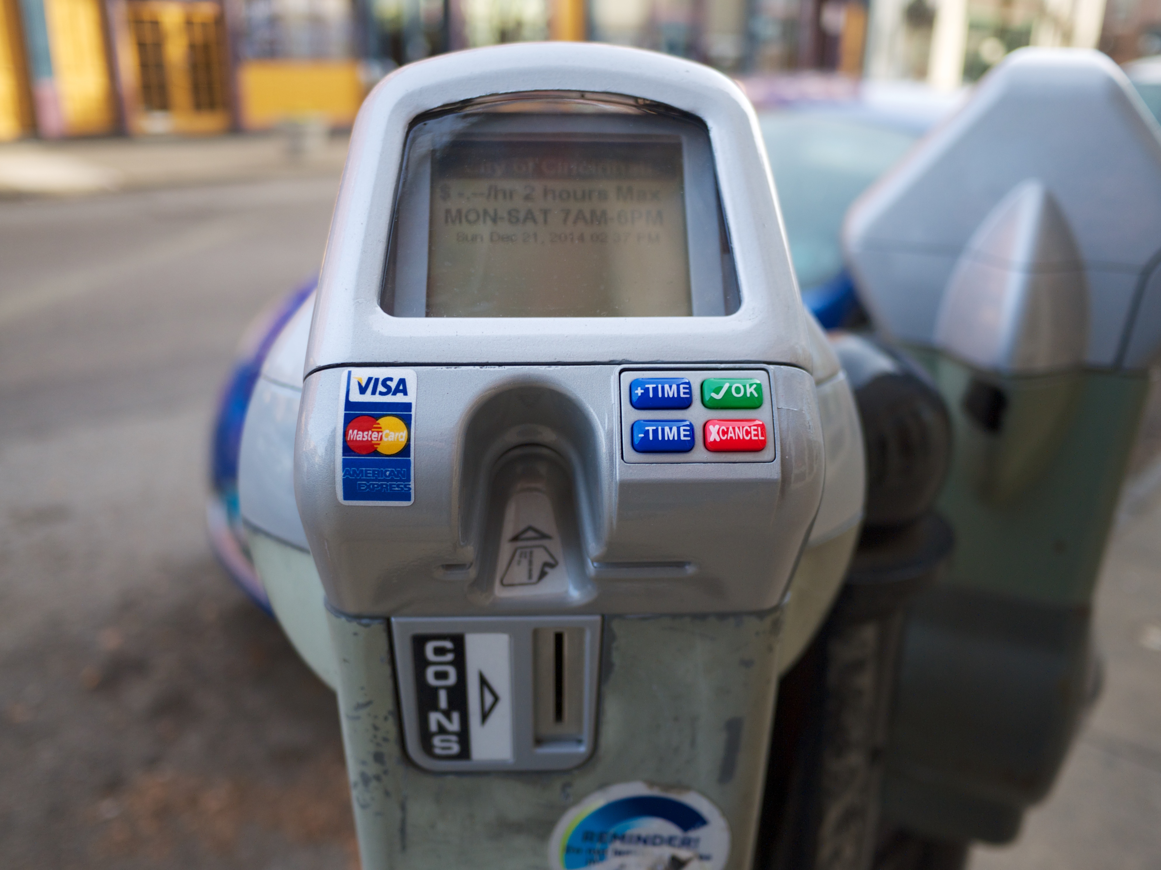
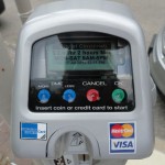
Under the arrangement, 500 new electronic parking meters have been installed throughout Over-the-Rhine to complement the existing set already in place in the Central Business District. Over the coming weeks, the City of Cincinnati will also be installing 1,000 additional electronic meters throughout the Clifton, Hyde Park, Mt. Lookout, Northside, O’Bryonville, Oakley, and Pleasant Ridge neighborhood business districts, as well as key locations throughout Uptown.
The electronic meters, officials say, are meant to replace the old ones with newer models that accept credit card payments and are compatible with future plans for pay-by-phone technology and dynamic pricing structures. Pay-by-phone capabilities are expected to be operational by the middle of 2015.
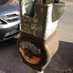
Vandalized Parking Meter in OTR
New Parking Meter
While nearly a dozen neighborhoods will benefit from the new technology, only Over-the-Rhine will see its on-street parking policies change across the board. As part of the new policy, parking rates in Over-the-Rhine will double to $1/hour; while rates will remain set at $.50/hour and $2/hour in the other neighborhoods and in the Central Business District, respectively.
As of today, parking meters in the Central Business District and Over-the-Rhine will now also be in effect from 9am to 9pm Monday through Saturday, and 2pm to 9pm on Sundays. Parking hours of enforcement in the remaining 50 neighborhoods, meanwhile, will remain unchanged.
The sweeping changes are meant to help improve the performance of the City’s broken parking system. While many small business owners in Over-the-Rhine have expressed their support for the changes, especially in light of ongoing vandalism of meters in Over-the-Rhine, some believe they have been singled out following the cancellation of a previous agreement that would have raised rates and increased enforcement city-wide.
“I’m not opposed to longer meter hours and higher rates, but what upsets me, as an OTR resident and business owner, is the fact that our neighborhood has been singled out,” Jean-Francois Flechet, owner of Taste of Belgium, wrote in a Facebook post. “The same hours and rates should apply to other neighborhoods.”
The original Parking Lease & Modernization Plan approved in early 2013 was, of course, cancelled by Mayor John Cranley (D) almost immediately upon his arrival at City Hall at the end of 2013. While the mayor and many members of City Council bemoaned the previous plan, a similar plan appears to be taking shape, but in a piece-by-piece approach.
As like the original plan, new electronic meters are being installed that accept credit card payments and utilize dynamic pricing models, meters are being upgraded city-wide, and a contract has been signed with Xerox.
The Cranley Administration has not yet commented on plans for new hours or rates in the city’s remaining neighborhood business districts, where on-street parking meters exist, but they do say that they intend to systematically create multi-space parking that will “produce more aesthetically clean public right-of-way areas in Over-the-Rhine.”
This means that the newly retrofitted parking meters in the historic neighborhood will eventually be removed to make way for multi-space equipment, similar to what has been used in the Central Business District in the past. The upgraded parking meters from Over-the-Rhine will then be shifted to other neighborhoods throughout the city. This process, officials say, could begin as soon as this spring.
In addition to the specific focus on center city neighborhoods, the new parking policy differs from the previously approved plan by creating Sunday hours of enforcement. While the new Sunday hours of enforcement are only in effect for the Central Business District and Over-the-Rhine, it crosses what was considered a red line in the previous public debate over proposed parking changes.
All of the changes are expected to bring confusion to those parking in the affected areas, including a large group of people who drove to Christ Church Cathedral for the Boar’s Head & Yule Log Festival on Sunday. According to Michelle Dillingham, Director of Education at the Greater Cincinnati Coalition for the Homeless, parking enforcement officers ticketed many cars parked on the street during the event.
“I walked out of the Boar’s Head event that was barely an hour long and almost every car had a parking ticket on their windshield…on a Sunday and in front of a church celebrating 75 years of a Cincinnati tradition,” Dillingham wrote. “I don’t know, but it just rubbed me wrong.”
The former Cincinnati City Council candidate went on to say that she had two separate conversations with people, who lived outside of the center city, that were very upset by the situation and would reconsider visiting downtown again due to the aggressive parking enforcement.
City officials acknowledge that there will be a bit of a learning curve, and say they are working to improve awareness of the new rates and hours of enforcement by distributing flyers and working with groups like Downtown Cincinnati Inc. and the Over-the-Rhine Chamber of Commerce to inform drivers of the changes.
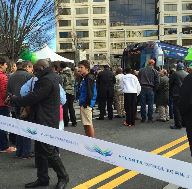
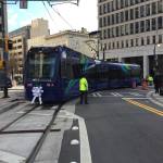
Atlanta’s initial modern streetcar line went into service yesterday. It marks the first time for streetcar operations in Georgia’s capital city since service was phased out in 1949.
The $90 million project, which relied upon $47 million from TIGER II funding, has a similar system design as Cincinnati’s system, but utilizes different rolling stock. In Atlanta, transit officials opted to award a $17.2 million contract for four vehicles to Siemens. Like Cincinnati, however, the vehicles are capable of expanded capacity more akin to light rail trains in use around North America.
Inaugural Run [Paige Malott]
Ribbon Cutting Ceremony [Paige Malott]
Opening Ceremony [Paige Malott]
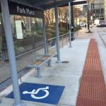
ADA Station Accessibility [Paige Malott]
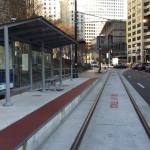
Streetcar Tracks [Paige Malott]
Siemens S70 Interior [Paige Malott]
Opening Ceremony [Paige Malott]
Park Place Station [Paige Malott]
Cincinnati Representing in Atlanta [Paige Malott]
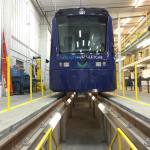
Maintenance Facility [Paige Malott]
Celebratory Confetti in Tracks [Paige Malott]
Ridership at Capacity [Paige Malott]
Streetcar at SkyView Atlanta [Paige Malott]
The reason for such planning is that this streetcar segment is seen as the first part of a much larger network that folds into the comprehensive Atlanta BeltLine project. As part of that, planners anticipate building a 63-mile network of modern streetcars throughout the heart of the 448,000-person city.
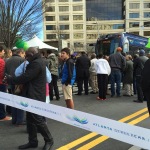
City leaders, civic boosters and transit officials gathered in downtown Atlanta yesterday to celebrate the occasion. Paige Malott, an UrbanCincy contributor, was there to capture the scene and reported capacity crowds on the initial trains in operation.
“First ride inside the Atlanta Streetcar, and it is standing room only,” Malott wrote. “It is at capacity with 150 riders; super smooth ride!”
The 2.7-mile route is notably smaller than Cincinnati’s initial $148 million segment, which is 3.6 miles and features 17 stations, and is planned to average 15-minute headways.
Starting at Centennial Olympic Park and ending in the King Historic District, the initial features 12 stations and is envisioned to connect people to a slew of attractions spread throughout the center city, while also spurring redevelopment on the southeast edge of the central business district.
Like Cincinnati, the City of Atlanta is the owner of the project while MARTA oversees its operations. The Atlanta Downtown Improvement District is also a part-owner.