Categories
Business News Transportation

Ridership, Revenue Continue to Grow for Resurgent Amtrak

The growth of intercity passenger rail and bus continues. According to newly released data, the National Railroad Passenger Corporation (Amtrak) recorded a record breaking year in terms of both ridership and revenue.

The data is for FY13, and showed that the oft-criticized passenger rail agency carried 31.6 million passengers and collected $2.1 billion in ticket revenue. Amtrak officials say that the ridership figure represented a 1% increase while revenue was 4.2% higher than the previous year.

In addition to the ridership and revenue growth, Amtrak also broke several records over the past year including total ridership in one month (March; July), ridership records on 20 of the agency’s 45 routes and the number of passengers using state-supported routes (15.4 million) in a single year.

When compared with other modes of transportation, Amtrak now has more than double the ridership of Greyhound, and if it were a commercial airline it would be the fifth largest domestic carrier.

Queensgate Railyard
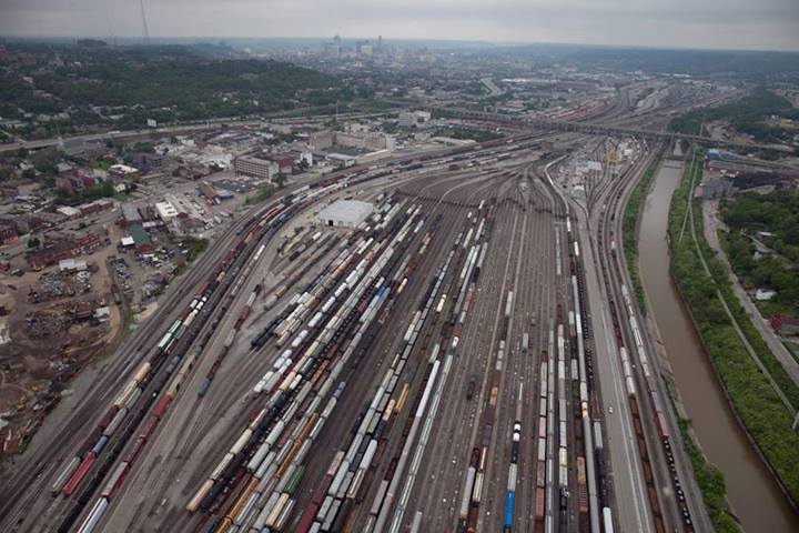
Cincinnati has largely been on the outside looking in when it comes to Amtrak ridership growth, but unclogging the Midwest’s second busiest railyard will need to come first. Photograph by Jake Mecklenborg for UrbanCincy.

“In ten of the last 11years, we have marked new ridership records, and since ridership has risen by 50% since FY2000,” Amtrak’s President and CEO, Joe Boardman, told employees through an internal memo. “This great accomplishment is not solely ours, but was made possible through strong, collaborative relationships with our state partners and the federal government.”

Boardman went on to say that through these relationships, Amtrak will pursue the resources needed to rebuild and enhance passenger rail service throughout the country, and work toward building infrastructure to support high-speed rail.

As a result of these partnerships and ridership growth, Amtrak now recovers approximately 85% of its annual operating expenses from user fees.

“I believe that all of these records point to our success in creating and marketing a product desired by the traveling public,” Boardman explained. “In growing metropolitan areas, passenger rail is clearly a viable alternative to crowded roads and skies, while in many rural areas, Amtrak often is the only means of regularly scheduled, public intercity transportation.”

While Amtrak’s success has been felt nationwide, very little has been felt here at home in Ohio due to limited service in the nation’s seventh most populated state. The reason, passenger rail advocates say, is because of a lack of support from the State of Ohio.

“We are on the outside looking in. Ohio isn’t on the outside due to a lack of travel, as USDOT says travel on Ohio’s stretch of I-71 (Cleveland-Cincinnati) ranked 22nd in the country with nearly 5.5 billion vehicle-miles traveled in 2011,” noted Ken Prendergast, Executive Director, All Aboard Ohio. “In the Midwest, only I-94 through Michigan (Detroit-Chicago) saw more traffic in 2011.”

Prendergast went on to note that the stretch of I-94 through Michigan is currently being upgraded to 110mph service by the Michigan Department of Transportation (MDOT), with some stretches operating at that speed already.

The situation in Ohio has been bad for a long time, but got significantly worse following the election of Governor John Kasich (R) in 2010. Almost immediately after taking office, Kasich gave away $400 million from the federal government that was intended to establish passenger rail along the 3C Corridor. The stretch between Cincinnati, Columbus and Cleveland is seen as the most densely populated corridor in North America without any passenger rail service.

Not all hope for Ohio, however, is lost. On National Train Day this past May, Cincinnati Mayor Mark Mallory (D) commended the work being done by Amtrak and called for enhanced service and operations out of Cincinnati’s Union Terminal.

“Passenger rail has to be part of a balanced multi-modal transportation system that I believe the federal government needs to play a huge role in in addition to states and local governments,” Mallory stated at Cincinnati’s National Train Day event on May 11. “Indiana has made a lot of progress as it relates to Amtrak…wouldn’t it be great to be able to jump on a train in Cincinnati, run to Indianapolis and then on to Chicago? I want Cincinnati to be a part of that line.”
Categories
Business Development News

VIDEO: Next Phases of 45-Acre Smale Riverfront Park Taking Shape

Hopefully you are ready to learn all about support structures and geothermal, because the latest video update for the $120 million Smale Riverfront Park goes into great detail about both topics. It also reveals some new information about upcoming features at the park.

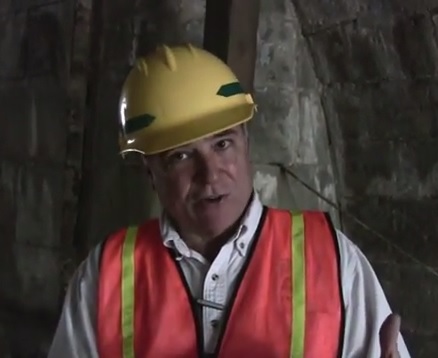
The first half of the 13:30 video focuses on the intricate details involved with some of the most mundane work taking place at the site. Project manager Dave Prather does a good job, however, at illustrating just how important that work is.

The more intriguing pieces of information are saved for the second half of the video. During that portion, Prather reveals details about the fog feature at the Heekin/PNC Grow Up Great Adventure Playground, which is scheduled to open to the public in spring 2014.

Prather also discusses that the Cincinnati Park Board has control of the anchorage under the John A. Roebling Suspension Bridge. Dating back to the Civil War, the inner structure, he says, will be opened to the public in some way. Details have not yet been finalized for how they will utilize the area, which is in the flood plane, but Prather expects to be able to make an announcement in time for the next video update.

City and park officials aim to complete the 45-acre central riverfront park by mid-2017, assuming all remaining financing falls into place.

Categories
Business News Politics

UVA Demographer’s Map Illustrates Cincinnati’s Racial Segregation

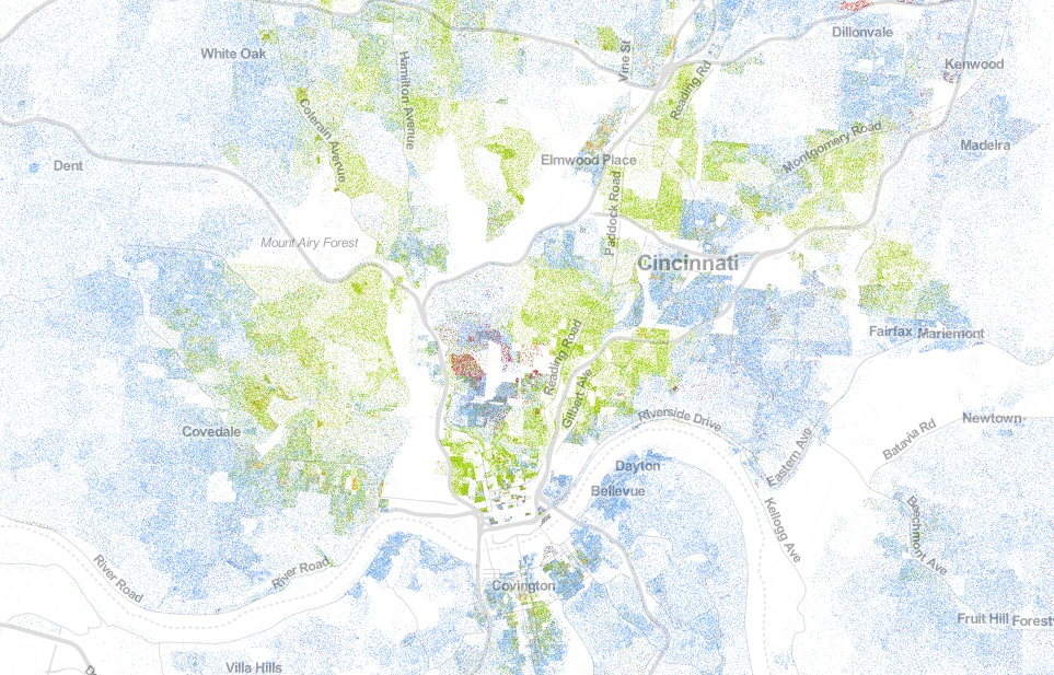
Dustin Cable, a demographic researcher at the University of Virginia’s Weldon Cooper Center for Public Service, recently published a map of the United States that shows an individual dot for each of the nation’s 308,745,538 people.

On their map each dot was assigned one of five colors based on the racial and ethnic affiliation. Whites are blue; African-Americans, green; Asians, red; Hispanics, orange; and all other racial categories are coded as brown. Cable used publicly available 2010 data from the U.S. Census Bureau.

When viewed in its entirety from afar, the map makes cities look like integrated places with a merging of all the colors to create a purple shade. This, however, is not the most accurate portrait of the racial segregation found throughout American cities.

When viewing Cincinnati at a more detailed level, for example, one can see the clear separation of White, Black, Hispanic and Asian populations.

The dots are evenly distributed throughout their assigned Census Block, so some dots (or people) appear to be living in areas where they cannot (i.e. parks, water, streets).

The specific areas of interest inside Cincinnati city limits are several Uptown neighborhoods where a dense cluster of Asian individuals live, and the Lower Price Hill and East Price Hill area where a small concentration of Hispanic individuals call home.

When looking elsewhere around the region it is also interesting to observe the Hispanic population cluster in Butler County near in and around the City of Hamilton.

Categories
Arts & Entertainment Business News

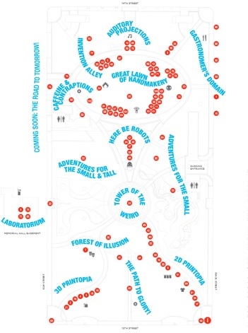
Cincinnati Maker Faire to Showcase Work of 90+ Inventors at Washington Park

Cincinnati Maker FaireA family-friendly showcase of invention, creativity and resourcefulness will take place this weekend at Washington Park in historic Over-the-Rhine.

Cincinnati Maker Faire, inspired by the national Maker Faire by MAKE Magazine, will exhibit over 90 inventors and their trades. Scientists, engineers, artists, performers and crafters are among those showcased in the event.

Event organizers tout that the event will include a drum set that shoots fireballs, one-man concert played entirely on Nintendo Gameboys, power tool drag race, working robots and R2D2s, and a hands-on workshop with an international team of plush artists.

Organizers also say that there will be an exhibit on the Cincinnati Streetcar, which recently had its first steel tracks laid on the adjacent block of Elm Street.

Part science fair, part county fair, Cincinnati Maker Faire is anticipated to be the greatest show (and tell) on Earth. The free event will take place this Saturday, October 19 and will run from 12pm to 10pm.

Categories
Business News Politics Transportation

Ludlow Avenue: The Case for a Pedestrian Streets Ordinance

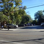
The stretch of Ludlow Avenue from Whitfield Avenue to the west to Ormond Avenue to the east has a decidedly suburban form different from the rest of the gaslight district between Ormond Avenue and Clifton Avenue. This western stretch is part of a two-block commercial main street that is arguably the “most complete neighborhood commercial district in the city,” according to Aaron Renn.

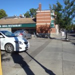
Just being a commercial main street, however, has not been enough to preserve the pedestrian-oriented nature of the street for the entire western half of the district on the south side of Ludlow, and a key gap on the north side of Ludlow at Ormond.

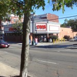
The southern stretch could be described as the Clifton financial district. Between Whitfield and the CVS are three banks – US Bank, PNC and Columbia Savings Bank – all with their own independent access and parking lots surrounding the buildings.

The oddity is not that banks have their own access and parking, but that you have auto-oriented suburban development on a historic commercial main street. This is not a unique problem, but a pedestrian streets ordinance, perhaps modeled after Chicago’s, could help correct faulty land use decisions like this one.

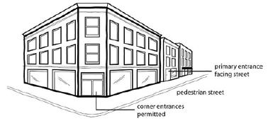
The theory behind such an ordinance is that you have an A and B street hierarchy, with A streets having a high standard of spatial definition and pedestrian interest in a continuous network, and B streets having lower standards for parking lots, drive-thru’s, muffler shops, etc.

This is a neoliberal approach typical of New Urbanism, It compromises for many areas and gives businesses a design choice based on location: a pedestrian main street (A), or an auto-oriented B street.

Chicago’s pedestrian streets ordinance seeks “to preserve and enhance the character of streets and intersections that are widely recognized as Chicago’s best examples of pedestrian-oriented shopping districts. The regulations are intended to promote transit, economic vitality and pedestrian safety and comfort.”

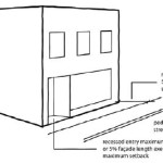
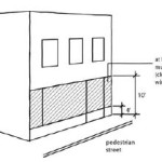
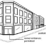
The ordinance then sets the criteria for the pedestrian street designation, lists all street segments within the city that have been deemed pedestrian streets subject to the ordinance, and sets standards for build-to lines, transparency and pedestrian access.

Of particular importance is what it says about parking and driveways:

Parking Location. All off-street parking spaces must be enclosed or located to the rear of the principal building and not be visible from the right-of-way of a pedestrian street.

Driveways and Vehicle Access. Vehicle access to lots located along pedestrian streets must come from an alley. No curb cuts or driveways are allowed from a pedestrian street.

If this the stretch of Ludlow Avenue had a pedestrian streets ordinance, at such time these banks wish to make improvements or redevelopment, these standards would then kick in and require the banks to reconsider their vehicular access, possibly to the point of eliminating driveways and consolidating parking and access off Whitfield.

More realistically, however, the ordinance would help guard other commercial main streets from the auto-oriented nature of drug stores, banks and restaurants without the need for a short-term Interim Development Controls (IDC) district or historic district protections.