Categories
News Transportation

Bogota’s TransMilenio serves as model for Cincinnati’s planned BRT

Cincinnati is exploring the idea of implementing bus rapid transit (BRT) lines to create better transit access from the city’s inner-ring suburbs to the employment centers of downtown and uptown. The success of BRT is often determined before the first passenger ever boards. Design, routing and operation planning often determines the level of success experienced. As a result, UrbanCincy traveled to Bogota, Colombia to see how one of the world’s most famous, and successful bus rapid transit systems works.

Bogota’s TransMilenio system first opened in December 2000. The investment was made in lieu of a much more expensive, and invasive, highway building project to relieve congestion in Colombia’s largest city. Since that time, the TransMilenio’s reach has grown along with its popularity, now serving 1.5 million riders each day along its nine lines totaling 54 miles.
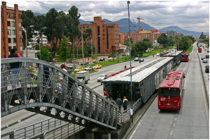

TransMilenio Peppe Sierra Estacion on Bogota’s north side. Photograph by Randy A. Simes.

Design
The TransMilenio operates in the center of major thoroughfares throughout Bogota. Riders often access the stations by crossing steel walkways that extend over the wide streets below. The stations also use similar steel framework and include glass doors that open when buses pull up to the platform.

The simple design helped to keep initial costs low ($9.6M per mile), but is showing signs of significant wear and tear. The open air stations also suffer from the extreme pollution from vehicle, truck and bus exhaust along the busy roadways.

The buses themselves are typically single-articulated red buses that are easily recognizable from the city’s plethora of private buses operating as circulators throughout the rest of the city. To accommodate more passengers, new double-articulated buses are now being integrated into the overall system as station design permits.

Routing
It is important to note that the TransMilenio only operates along major thoroughfares and functions much like an above-ground rapid transit system. The buses do not reach into neighborhoods and instead focus on moving people long distances along specific corridors. Other trips are better made by using the small, private buses operating on local streets.

The original TransMilenio lines were routed much like those being planned for Cincinnati. Lines focused on moving people from heavily populated residential areas to the downtown business district, surrounding university and government buildings, and tourist attractions. New lines are extending into secondary job centers including the city’s international airport.
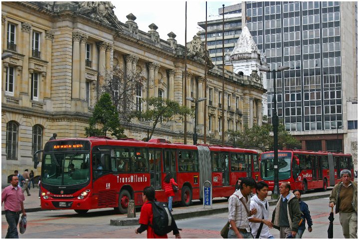
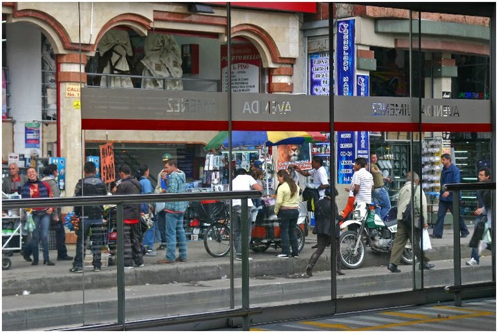
TransMilenio BRT service in downtown Bogota along Calle 13 [LEFT]. Service doors at Avenida Jimeniz TransMilenio Estacion in downtown Bogota [RIGHT]. Photographs by Randy A. Simes.

Operations
The TransMilenio may be one of the most sophisticated BRT systems in the world. During peak travel times, buses operate at extreme frequencies with buses arriving at station platforms virtually non-stop. The buses also receive traffic light priority. They are not timed with lights due to the unpredictability of station length stops as passengers try to cram on the bus.

The system operates from 5am to 11pm and uses an electronic fare payment system. This payment system is different from others systems around the world. Riders purchase a specific number of trips from a person staffing each location. This creates backups during heavy travel times as many people attempt to purchase trip cards. These cards are then used until the last trip when the card is inserted into the turnstile and recycled for later use.

Fares have risen steadily since the system began operation in late 2000, and now costs 1,700 Colombian Pesos per trip (about $1). The huge ridership numbers clearly allow for fares to be kept low, but the rising cost of oil is sure to impact a system that relies solely on diesel fuel.

The buses are all managed at a central dispatch center which tracks average travel speeds, stacking at stations and other schematics. This system tracking allows operators to determine how future improvements should be made, and how operation changes can improve service.

Conclusion
Cincinnati should learn from Bogota’s experience. The TransMilenio offers superior service, but also suffers from problems that could be solved with a greater upfront investment.

When operating lots of big buses at high frequencies, it is no wonder that heavy pollution comes with it. Bus rapid transit in Cincinnati should utilize electric overhead wires, or some sort of clean fuel technology to prevent such pollution from proliferating along the lines.

When designing bus rapid transit lines and stations for Cincinnati, city leaders and transit officials should not view BRT as a cheap transit alternative. In the case of BRT, like many things, you get what you pay for. The TransMilenio has robust stations and huge amounts of right-of-way clearly separated from other traffic. BRT systems that do not invest in superior station designs and separated right-of-way, will suffer lower ridership due to the lack of improved travel times and overall perception problems.

Bus rapid transit should also not be viewed as a transit solution to be done instead of rail investments. This has been seen in Bogota, and city leaders there are now working on a new subway and a massive light rail system that will compliment the TransMilenio which will eventually cover 241 miles.

Categories
News Transportation

Local transit map exceeds expectations

In less than six months, Nate Wessel has helped bring change to Cincinnati’s transit system. After debuting his bus-riding basics map on UrbanCincy earlier this year, Wessel launched the project on crowdfunding site Kickstarter in April. People from Cincinnati and around the world responded to the design, and in 30 days the initiative had raised twice its initial goal of $1,000.

In five days, the Transit Guide raised over $1,200. By the deadline, over one hundred donors had given $2,105 to help print and distribute the pocket guide to bus riders all over Cincinnati.

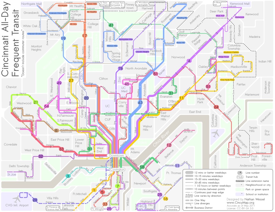
Wessel also had an opportunity to interface with donors and solicit feedback on the map’s design during the fundraising period, and the updated version is better than ever. Described as a diagrammatic illustration of the Greater Cincinnati area’s transit system, the guide shows conceptually where, when, and how one can travel by bus.

It’s nearer to New York City’s Subway Map or that of London’s Tube in design than to the more literal and more difficult to read maps of most Midwestern cities like Akron or Cincinnati.

Like the New York map, his new map for Cincinnati highlights the important frequent and convenient transit lines over services that are infrequent, specialized or too complex to readily apprehend. Lines are spaced for easier reading, and line thickness indicates how long one can expect to wait for the next bus. The most frequent lines have buses that come every ten minutes in each direction for most of the day. The thinnest lines have service every 1 hour or slightly better.

The map does not include routes that only run during rush hours to serve commuters, since these have a relatively limited application. The back of the map will answer some common questions for people who have never been on the bus before, point out peculiarities of specific lines and highlight major routes and bus stops in Downtown.

The funds from the project will be used to print and distribute more than 30,000 pocket-sized copies of the map and several hundred posters to organizations and businesses in the area.

“I particularly hope to get maps in the hands of students, young professionals and recent immigrants and visitors to Cincinnati,” said Wessel. “As it is, people who are new to the city, or just unfamiliar with the transit system face an enormous hurdle in trying transit for the first time.”

He believes many in the city would utilize the bus service if they understood it better – where and when the buses go. The local transit authorities have tried, but not completely succeeded in making their maps user-friendly.

Wessel admits the current transit system is not perfect, but it is pretty good. “My goal is to allow people to see what good service exists, and where it can take them,” he explained. “This way users can better understand the system that serves them and to begin to see public transit as a realistic transportation option.”

Nate will be giving a talk at the Contemporary Arts Center on May 23rd to further explain the project.

Updated Cincinnati Transit Guide map provided for UrbanCincy by Nate Wessel.

Categories
Development News Politics Transportation

Cincinnati to break ground on smaller streetcar starter route this fall

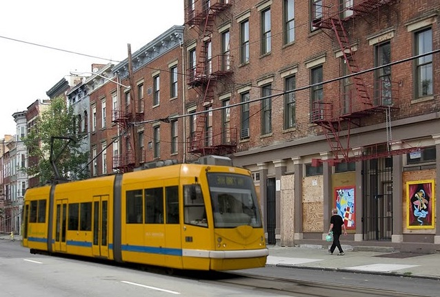
Today Cincinnati Mayor Mark Mallory and City Manager Milton Dohoney announced that the city will push forward with its modern streetcar project even with recent setbacks. The announcement included the debut of a new shortened phase one routing that will run from Fifth Street in the Central Business District to Henry Street in Over-the-Rhine just north of Findlay Market.

The 3.1-mile route will cost $95 million to build and $2.5 million annually to operate. City leaders currently have a total of $99.5 million to build the line, and have conservatively identified $4.1 million to operate the line annually. City leaders say that this will mean no money will be needed from the City’s General Fund for operations.

While some supporters have expressed discontent over the shortened Cincinnati Streetcar route, Mayor Mallory emphasized that the long-term vision has not changed.

“The vision for the project remains the same. We are going to build a streetcar that connected Downtown to Uptown, and then we are going to build out into the neighborhoods,” explained Mallory. “We are going to get started with the funding that we have in hand, but we must move forward in order to attract jobs and residents to our region.”

Project officials say that the shortened line will operate 18 hours a day, seven days a week and will utilize five streetcars instead of the original seven planned for the longer route. The shortened route, city leaders say, was chosen based on its unique ability to maximize economic investment.

“Over-the-Rhine and portions of the downtown area have some 500 vacant buildings, and it is where you have the bulk of the 95 acres of what today is surface parking,” City Manager Dohoney told the audience. “The explosiveness of the development potential rests in the area that we’re covering.”

City officials also announced that they are exploring the idea of running the streetcars on battery power instead of electricity. This technology is currently being examined for Washington D.C.’s modern streetcar system where concerns have come up over the use of overhead electric wires. Cincinnati officials believe that such a move would also reduce costs upfront and long-term.

The city says that it expects to break ground on the modern streetcar system this fall, and will simultaneously work to raise additional funds to build the system’s extension to uptown, and reconnect with The Banks to the south which in and of itself costs an additional $9 million.

“Clearly there is a need to expand the tax base. No one wants to pay more taxes, so we must find a proactive step to take to expand the existing tax base,” City Manager Dohoney explained. “A streetcar is one such tool to do that. There are people that have issues with this project, and there are folks that are responsible for moving this city forward. We are unapologetic advocates.”

Categories
News Politics Transportation

Cincinnati approves transition to solar-powered parking meters

Yesterday, Cincinnati’s city council unanimously approved legislation that will replace and upgrade parking meters throughout the city.

The legislation approves the City to move forward with a $1.7 million purchase of 1,400 individual solar-powered meters, and 50 multiple-space meters. The new electronic parking meters allow users to pay with credit card, while existing meters require users to pay with coins.


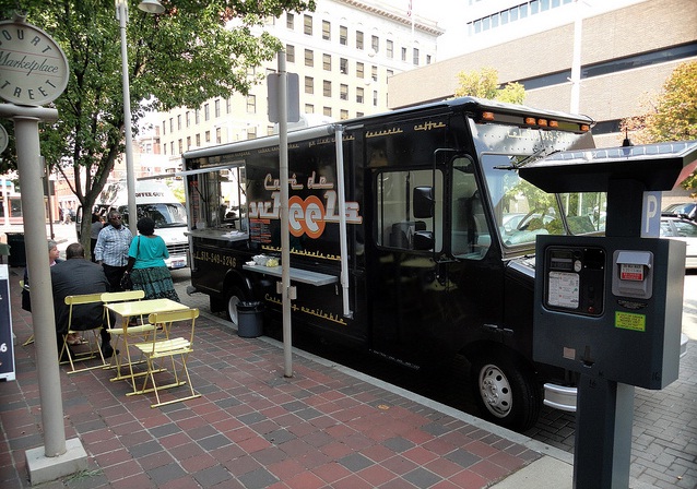
Solar-powered parking pay station on Court Street

The new meters will upgrade approximately 25 percent of the City’s 5,600 parking meters city-wide and 100 percent of the parking meters downtown where parking rates are now $2 per hour.

Vice Mayor Roxanne Qualls’ office says that the new parking meters are expected to increase revenues and parking turnover. They say the increased revenue will come, in part, because a lot of people will now use credit cards to pay for the full two hour maximum, and because users will no longer be able to piggy-back off of previous time paid for at the meters.

Qualls’ office also believes the new meters will result in fewer people plugging the meters all day, and thus increase turnover.

The multi-space meters will function similarly to those currently found on Court Street and Second Street where users pay at a single pay station per block, then display a ticket on their dash board. City leaders envision that these pay stations will eventually be able to be used for issuing tickets for the Cincinnati Streetcar.

The investment is being funded through a parking revenue surplus, and was one of the recommendations to come from a 2009 study by Walker Parking Consultants that detailed actions the City could take to improve its parking infrastructure while also increasing parking revenues.

Court Street parking pay station photograph by Thadd Fiala for UrbanCincy.

Categories
Arts & Entertainment News Transportation

CPA to lead walking tour of Cincinnati Streetcar route this Saturday

At one point in Cincinnati’s history, the city had the largest electrified transit network of any city its size in North America. A good deal of that network consisted of 220 miles of streetcars running all throughout the city, and now city leaders are working to introduce a modern streetcar system in Cincinnati.

The Cincinnati Preservation Association (CPA) would like to show off the proposed modern streetcar route to those interested, and discuss the positive impacts such a system would have on the city’s historic building stock.

“The city’s core neighborhoods developed along transit lines,” said Margo Warminski, Preservation Director, CPA. “They have the urbanity and great buildings people are looking for in cities today.”


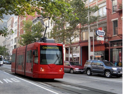
Artist rendition of modern streetcar on Race Street in Over-the-Rhine.

Warminski says that at the recently held Cincinnati Neighborhood Summit speaker after speaker said the same thing about the important value of walkability and access to transit to improve neighborhoods. And the CPA believes that projects like the Cincinnati Streetcar help to promote that vision, while also presenting exciting revitalization opportunities.

“Over-the-Rhine has seen a lot of new investment in recent years, but it still has hundreds of vacant, condemned and blighted buildings at-risk of demolition,” Warminski explained. “While no one project can transform a neighborhood, people are already buying buildings and opening businesses along the proposed streetcar route.”

Those interested in participating in CPA’s Walk the Streetcar Route, can do so on Saturday, April 30 from 9:30am to 12pm. Margo Warminski will lead the walking tour, which will meet at Vine Street and Central Parkway (map), and show off the development opportunities present along the Cincinnati Streetcar route through Over-the-Rhine.

A $5 donation is appreciated, and go towards supporting CPA’s advocacy and outreach efforts that include the Gamble House, Our Lady of Perpetual Help, Oakley Train Station, Village of Greenhills, monthly educational programs and other projects.