A team of New York-based developers have purchased a number of properties in the West End, and a recent tax credit from the State of Ohio may spark the first major redevelopment investment in the historic district in decades.
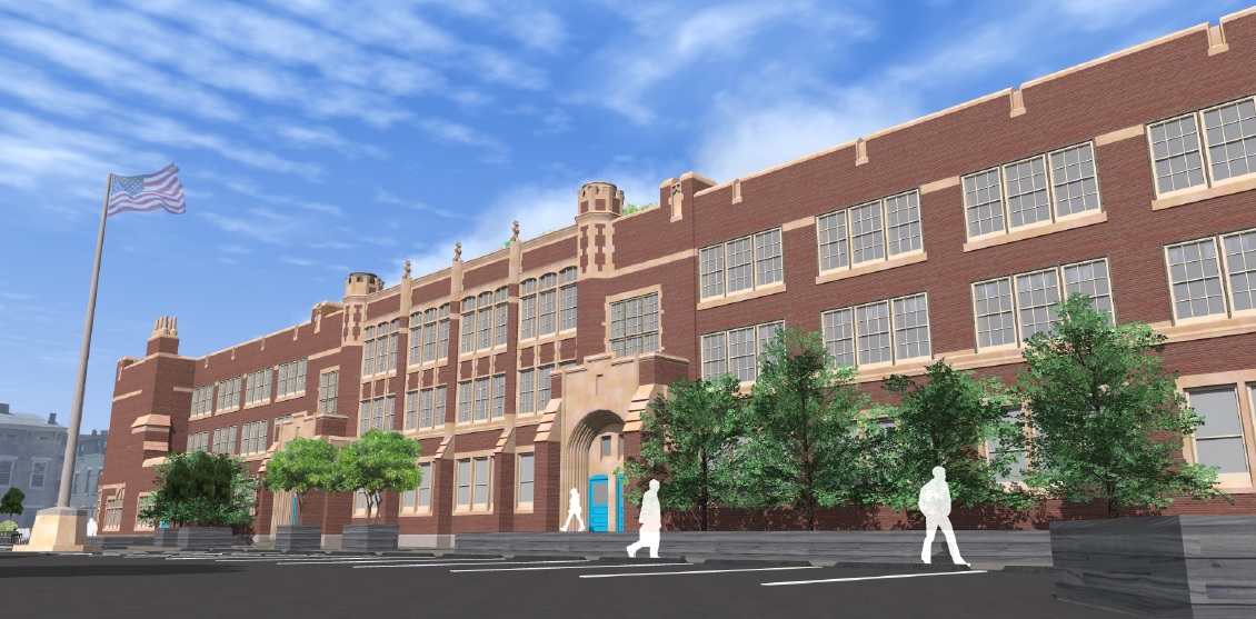
The development team told UrbanCincy that they intend to begin construction on the 86-year-old Heberle School in February, thanks to a $1.8 million Ohio Historic Preservation Tax Credit – the biggest award in the recent round of funding in Southwest Ohio aside from Music Hall’s $25 million catalytic project award. It is due to the neighborhood’s proud history that the developers decided to enter the Cincinnati market and take on their first project here.
Northwestern view of Heberle Lofts [Provided]
Southwestern view of Heberle Lofts [Provided]
“This area has been abandoned for some time, which prompted us to collaborate with the Dayton Street Neighborhood Association in order to revive a community rich in history and architecture,” explained Golan Marom from Zada Development Group.
The $11.2 million Heberle Lofts project, meanwhile, is seen as phase one of the team’s efforts. The second phase will focus on the 100-year-old Lafayette Bloom Middle School on Baymiller Street. There, developers anticipate a project similar in scope to what will be done at Heberle, which is planned to include 59 market-rate apartments and 5,000 to 6,000 square feet of street-level commercial space.
A striking similarity at both school properties is the large open space in front of their main entrances. In both cases, Marom says that the plan is to maintain some of it as parking for the development, while also creating new public and green space for the community.
While redevelopment has been moving northward from Over-the-Rhine’s Gateway Quarter, all the way up to the Brewery District surrounding Findlay Market, it has yet to spread west into the West End or its Brighton District. An injection of activity like this, however, could improve the neighborhood’s ability to support service retail and restaurants, which so far have proved difficult to attract within the Brighton District or along Linn Street at the nearby City West development.
The development team says they are still working to secure some additional financing, but are optimistic they will be able to get started in the coming months. Should everything go according to plan, the Heberle Lofts project is expected to be completed approximately two years after construction work begins.
Level of Service. Chances are, unless you’re in a field related to transportation planning or engineering, or are a total geek, you probably have not heard of this term before. LOS, however, has come to define how we design and build or roadways. Almost by its structure, LOS favors cars over the function or safety of any other mode of transportation. So what would happen if we took the same approach for other modes, like walking? More from Urban Kchoze:
The point of a traffic engineer in most studies is to keep level of service as low as possible to avoid delays for drivers, helping them drive faster and have to wait less for other traffic. Now then, some of you may ask “well, what about pedestrians and cyclists? How is level of service measured for them?” Well, the answer to that is that the default method says: F#!% ’em.
So let’s suppose that we calculate a level of service for pedestrians based on the same basis as for vehicles. Pedestrians can stop and accelerate to regular walking speed almost instantaneously and so we don’t have to calculate delay caused by lower than desired speeds during acceleration and deceleration. So delay is limited essentially only to the wait time before they can go ahead and cross (supposing car drivers respect pedestrian priority).
…crosswalks with medians and stop signs should be preferred to traffic lights for areas with a focus on pedestrians. It also means that the habit of channeling all the traffic on a few wide arterials, forcing each intersection to have multiple turn lanes and many through lanes, is absolutely terrible for pedestrians. A street grid with densely packed streets would do a better job of responding to all users, as it would dilute traffic on many streets, all these streets could be narrow, with 3 or 4 lanes only (1 per direction plus a shared left-turn lane or 2 per direction). Ideally, I believe there should not be any width of pavement greater than 12 meters (40 feet) in a city, any pavement wider than that should be broken in two with a median wide enough to use as a pedestrian refuge.
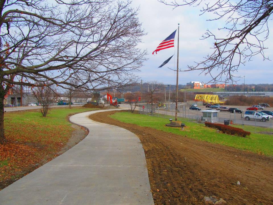
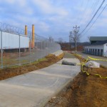
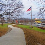
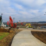
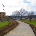
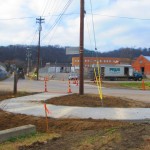
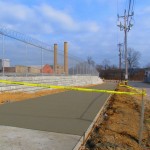
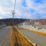
Construction is nearly complete on the fourth phase of work on the Mill Creek Greenway. As part of that work, a new 0.7-mile trail stretches along the border of South Cumminsville and Milvale, from the Millcreek Road Bridge to the intersection of Fricke Road and Beekman Street near Ethel Taylor Academy.
Once this work is complete, project planners say, the stretch will include additional accommodations for the trail to safely cross the creek on the existing roadway bridge, along with traffic calming measures for a safe crossing at Beekman Street near the school.
This latest phase of work is part of the much larger Mill Creek Greenway project that is being spearheaded by Groundwork Cincinnati – Mill Creek. The non-profit organization is celebrating its 20th anniversary this year, and is hoping that the planned 15-mile green corridor, which starts at the Hamilton County Fairgrounds in Carthage and will eventually reach the Ohio River Trail in Lower Price Hill, will help clean up one of the region’s most notoriously polluted corridors.
Phase 4 Construction [Provided]
Phase 4 Construction [Provided]
Phase 4 Construction [Provided]
Phase 4 Construction [Provided]
“We have done 33 ecological restoration projects as part of the greenway program,” Robin Corathers, Executive Director of Groundwork Cincinnati – Mill Creek, told UrbanCincy. “That includes bank stabilization, stream bed stabilization, wetland restoration, wildlife habitat restoration.”
In addition to that, Corathers says that edible forest gardens have been planted along the trail, with seven layers of vegetation that mimic a natural forest ecosystem. Improving the health of the ecosystem is a key component of Groundwork’s strategy, and more work is planned to help revitalize and heal damage to the natural resources within the Mill Creek Valley – one of the city’s oldest industrial corridors.
This latest phase of work was funded through a $245,000 grant from the Clean Ohio Trail Fund, $80,000 grant from the Interact for Health Foundation, $30,000 grant from the Greater Cincinnati Foundation, and $191,000 from the City of Cincinnati that was provided through its annual capital budget. Corathers also notes that the C.W. Wood Company donated a strip of land along Fricke Street for the trail.
The project, however, is not just about new trails and habitat restoration. Groundwork leadership also says that they are focused on capacity building, community involvement, and environmental education programming for 4,000 fourth through twelfth grade students each year.
“Phase four is really important to us for several reasons” explained Corathers. “As a ground work trust we are committed to working in economically distressed and historically under-served communities and neighborhoods; and in this case it’s the neighborhoods in the lower Mill Creek watershed.”
Millcreek Road Bridge [Google]
To this end, Corathers says that community leaders and neighborhood residents have been excited about the project and the process by which it is being implemented. She says that neighborhood councils become involved in the planning and design work of each phase of the trail, which leads to moments like this past November 12 when they celebrated the groundbreaking for the latest phase of work with about 85 area residents and business owners.
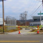
While there has been a good deal of neighborhood support, there are still challenges that exist for project leaders. One of those challenges is the Millcreek Road Bridge, which is envisioned as a crossing for the trail, but is currently only one lane in each direction for automobile traffic.
To tackle this issue, Groundwork Cincinnati has been working closely with Cincinnati’s Department of Transportation & Engineering (DOTE) to address safety issues with the narrow bridge. City officials say that the aging Mill Creek crossing is not considered a priority bridge and is not scheduled for replacement.
As a result, transportation engineers have come up with a solution that will retrofit the lightly used span to have one lane for shared two-way traffic flow, and one lane dedicated to the trail. The DOTE says that new signals will be installed, in February, at either end of the bridge to control alternating movements of vehicles across the Mill Creek Bridge.
“It’s a great investment. The bridge will be so much safer for people, for bikes, and also for vehicles,” Corathers said when emphasizing the importance of the trails connection. “The trail provides opportunities for outdoor exercise and recreation, active living, and active transportation for people in the Mill Creek corridor and nearby.”
Phase 4 Construction [Provided]
Phase 4 Construction [Provided]
Phase 4 Construction [Provided]
Phase 4 Construction [Provided]
Crossing the Mill Creek at this location is critical in the project’s overall goal of eventually reaching the Ohio River to the south. Once getting past this location, project planners say that a former CSX rail corridor can be used to take the trail all the way to its envisioned terminus.
The former freight rail right-of-way is considered to be wide enough to accommodate the Mill Creek Greenway Trail, as well as tracks for a future transit line. The use of this corridor, Corathers says, will also allow the Mill Creek Greenway Trail to tap into the planned $192 million Lick Run project, which will include another corridor of green space and trails.
Ultimately, the ongoing efforts could produce what would become a large network of interconnected trails through the heart of the city, including the Ohio River Trail, Little Miami Scenic Trail, Mill Creek Greenway, Lick Run, and West Fork Mill Creek Trail in Carthage.
The next 2.9-mile phase of work on the Mill Creek Greenway is estimated to cost $860,000, and project officials say they have already secured $500,000 of that from the State of Ohio, $50,000 from Interact for Health, and $10,000 from Duke Energy. The hope is that the remaining funds can come from City Hall. Should the final funding fall into place, Groundwork Cincinnati believes phase five work could be completed next year – creating a continuous eight-mile stretch of trails.
An attempt has been made all along to keep the trail close to the Mill Creek, but in some places, such as along Este Avenue, project planners say that it has not possible. But in locations where restoration and stabilization work has been performed along the creek, recovery of the ecosystems is easily visible.
“We now have great blue heron that fish in Mill Creek. We’ve got turtles, lizards, salamanders, beavers, birds, and all kinds of wildlife” Corathers exclaimed. “What we’re doing is breathing life back into this corridor. The trail allows users and visitors to experience an urban river that is coming back.”
In addition to Groundwork Cincinnati and the DOTE, Queen City Bike, Human Nature, IBI Group, Kolar Design, and Prus Construction have contributed to the development of the Mill Creek Greenway over the past six years.
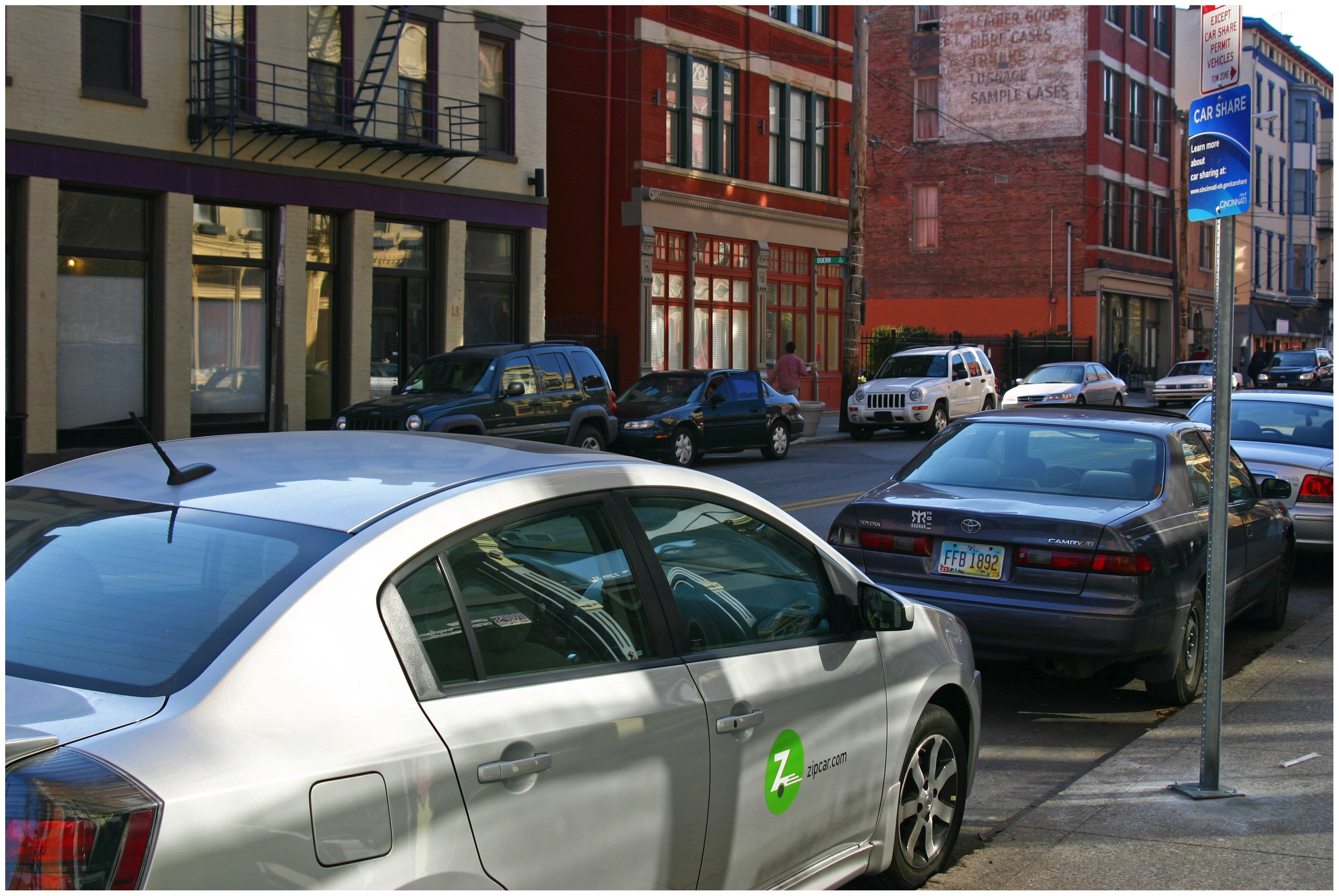
Since that time, however, peer-to-peer driving services, like Uber and Lyft, have emerged and begun challenging the more established business model of companies like Zipcar, which was acquired by Avis in January 2013 and boasts a global membership of more than 900,000.
In the case of Zipcar, the user is the driver, and must return the car to its starting point – a requirement limiting potential growth of Zipcar and other car sharing services. In order to stay competitive, Zipcar has recently launched new one-way services in its hometown of Boston.
Zipcar in Over-the-Rhine [Randy Simes]
“We are currently beta testing the service in Boston with our Boston members,” Jennifer Mathews, Public Relations Manager at Zipcar, told UrbanCincy. “Our plan is to roll out the service to additional markets once it’s ready.”
While one-way car sharing travel may soon be a reality in Boston, it appears to be further off for smaller markets like Cincinnati, as does the availability of cargo vans, which are presently available in a limited number of markets, but not Cincinnati. The desire for such vans, industry experts say, is so that they can be used for more utilitarian purposes like moving. For now, those participating in Cincinnati’s car sharing economy will continue to need to either use a traditional rental company, or borrow a friend’s truck for such purposes.
Since its debut in 2011, however, Zipcar officials say that they have made changes to their operations and 11-car fleet in Cincinnati in order to stay relevant.
“While the number of cars has remained somewhat consistent over the years, we have moved locations and updated our vehicles throughout the program,” Mathews explained. “Zipcar strives to place cars where our members want them. As we see pockets of members pop up in certain areas or neighborhoods we will move cars around to make sure that they are convenient as possible.”
Of course, Cincinnati’s Zipcar network is substantially smaller than other cities, thus reducing its usefulness to more than a small collection of users.
While there are no immediate plans for expansion, Mathews does say that the company will continue to monitor their two programs – University of Cincinnati and City of Cincinnati – over the course of 2015 to determine whether additional changes or expanded offerings are needed.
Those with memberships are able to use those in any of the hundreds of markets where Zipcar operates worldwide. Cincinnati’s 11 vehicles can be found at the northwest corner of Race Street and Garfield Place, Court Street in between Vine and Walnut, the southeast corner of Twelfth and Vine Streets; and on the University of Cincinnati’s main campus on McMicken Circle and just north of Daniels Residence Tower.
It is always fascinating to study what exactly led to the collapse of previous civilizations and the cities they built and inhabited. Often we study what it is we can learn in order to maintain the civilizations we have built, but not our cities. A team of University of Cincinnati researchers have been looking at exactly that in the former Mayan city of Tikal. More from Next City:
When Lentz and a group of colleagues looked, they were able to piece together a picture of how Tikal survived as an urban center. For hundreds of years, they found, the Maya managed their resources sustainably. But that wasn’t enough to keep the city from collapsing in the face of climatic change; the changes Tikal’s residents made to the land may even have made them more vulnerable.
“They expanded to the carrying capacity of their landscape, leaving no resilience where something bad came along,” Lentz said. “When you make changes to your environment, sometimes things happens that you don’t expect. When the droughts came, because they had exploited the environment to the full extent of their technological capabilities, they just were not able to respond.”
The last monument went up around 869 A.D. By the end of the century, the city was likely largely abandoned.