The Columbus-based business opened its first “barcade” to overflowing crowds late last summer and added a Cleveland-area bar in Lakewood earlier this year.
It’s the kind of place that is perfect for those that want to cherish their memories of the late 1980s. Not only do the arcade games date back to that time, but the cocktails served at 16-Bit Bar+Arcade also take their names from the icons of that era.
Pinball Games at 16-Bit Bar+Arcade Cbus [Sam Howzit]
Ohio Love at 16-Bit Bar+Arcade Cbus [Sam Howzit]
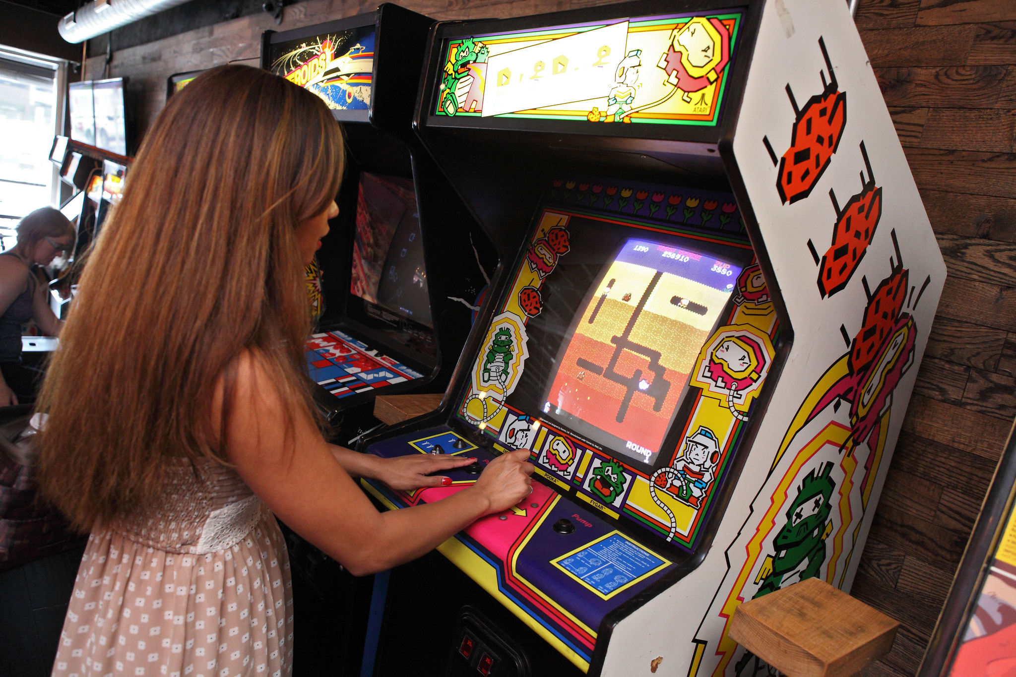
Video Games at 16-Bit Bar+Arcade Cbus [Sam Howzit]
Video Games at 16-Bit Bar+Arcade Cbus [Sam Howzit]
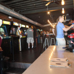
16-Bit Bar+Arcade Cbus Interior [Sam Howzit]
While there is no food provided, Allen says that customers are always able to bring food in from neighboring restaurants. That means that you can hang out, eat and drink inside while playing throwback arcade games and enjoying music and television from the ‘80s and ‘90s.
“It’s a throwback concept; when you step inside, you’re really immersing yourself in the ’80s and early ’90s,” Allen explained. “It’s next to impossible not to smile about something.”
The barcade would have opened in Over-the-Rhine even sooner had 3CDC had its way, but the owners were not quite ready for expansion a year ago. Allen did say, however, that they have been looking at spaces in Over-the-Rhine for the past year; and that he’s happy to finally have the paperwork signed.
Occupying 4,300 square feet at Mercer Commons, the Cincinnati location will be the largest 16-Bit to-date. Allen says that it will have almost the same style as their locations in Columbus and Cleveland; and that they will have the same amount of arcade games, but with a bit more room to move around. Located at the corner of Walnut and Mercer Streets, the location will also have garage doors that open up along Mercer.
“We are dedicated to giving everyone that walks through our door a killer experience while exceeding their expectations,” Allen said. “We truly appreciate the feedback and input, we will continue to evolve and refine the business to meet as many expectations as possible.”
Once open, 16-Bit Bar+Arcade will be open Monday through Friday from 4pm to 2:30am, and Saturday to Sunday from 12pm to 2:30am. The owners are aiming to open up sometime in the first quarter of 2015.
EDITORIAL NOTE: All five photos were taken by Flickr user Sam Howzit in July 2014.
The new one-day, unlimited ride passes are part of Metro’s ongoing fare payment overhaul that began back in 2011 with the introduction of new electronic fare boxes.
The new day passes will be able to be purchased directly on any Metro bus as you board. Jill Dunne, Public Affairs Manager at Metro, says that all the purchaser will need to do is notify the driver before paying their fares. The pass is then activated upon its first use and will be valid for unlimited rides until 3am the next day.
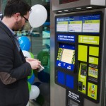
Government Square Ticketing Kiosk [Travis Estell]
The passes cost $4.50 for Zone 1, which is anything within city limits, and $6.30 for Zone 2. A pass purchased for either zone accounts for all necessary transfer fees.
Since these day passes will be ideal for visitors, you can also purchase them in advance at the sales office on Government Square. The passes can then be distributed to friends or family members and used at their convenience, only being activated upon their first use.
“Riders have been asking for day passes for several years,” Dunne explained to UrbanCincy. “They are great for visitors, occasional riders and anyone who plans to ride Metro frequently throughout the day without worrying about exact change or transfers.”
In many cities around the world, however, the idea of buying day or month passes is a thing of the past thanks to the advent of smart card payment technology. If Metro were to switch over to a system like this, which their new electronic fare boxes are capable of handling, it would allow for riders to use enabled bank cards or loadable fare cards.
“We are looking at all options for fares to make it convenient for our riders,” Dunne emphasized. “We have been working on ‘smart cards’ for a while and I hope we’d be able to roll them out in the future.”
Another new feature riders can soon expect, and has been rumored for some time, is a regional stored-value card that works on transit services offered by Metro and the Transit Authority of Northern Kentucky (TANK). Metro officials say they are optimistic that will be available within the next few months.
Those interested in getting their hands on the new day passes can do so by attending a ceremony Metro will hold at Government Square on Monday, November 3 at 10am. To celebrate the moment, Metro employees and SORTA board members will be giving out 500 free day passes on a first-come, first-serve basis.
During his first State of the City address, Cincinnati Mayor John Cranley (D) made a point to discuss the city’s food desert’s and how he intends to address one of them with a new full-service grocery store in Avondale. Meanwhile in Denver, city officials there are taking a slightly different approach. More from The Denver Post:
This colorful corner store, painted orange and lime green, sits at the intersection of East 30th Avenue and Downing Street in the Whittier neighborhood, which is considered a food desert, far from a full-service grocer. It’s one of five corner stores in a pilot program called the Healthy Corner Store Initiative, started in August by the city and county of Denver’s Department of Environmental Health, and funded by a grant of more than $327,000 from the Colorado Health Foundation.
The plan is to implement the economic-development model in 50 corner stores throughout these neighborhoods over the next three years, helping the small-business owners by providing technical assistance to help carry more healthy products while promoting positive messages about nutritious foods in their stores. Other organizations in the neighborhood also offer classes in nutrition and healthy cooking.
Many of us were sad to see the demolition of the historic mansion that housed the Christy’s & Lenhardt’s restaurant in Clifton Heights. At the time, a new six-story, mixed-use development was envisioned for the site, which would have included 210 student apartments, street-level retail, and a 245-space parking structure. However, the Business Courier reports that the development has now been downsized by its developers, although the size of the parking structure has curiously been increased:
The developer is now looking to build a mixed-use building on the 1.65-acre site with about 190 apartment units, according to materials filed with the City Planning Commission. The building will have two levels of underground parking with 380 spaces. A row of six, three-story townhouses with separate entrances will face Lyon Street. Finally, a separated commercial space of up to 9,000 square feet will be at the corner Clifton and West McMillan streets. […]
At this point, the proposed schedule for the project includes zoning in the third and fourth quarters of 2014, permitting in the first quarter of 2015, construction starting in the second quarter of 2015, completion in July 2016 and occupancy in August 2016.
Overpass at North Highland Avenue [Atlanta BeltLine]
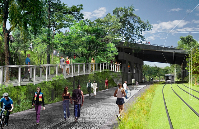
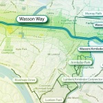
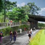
Following the guidance of City Council, Cincinnati’s Department of City Planning & Buildings has completed its land use study for the Wasson Railroad Corridor. The study’s findings and recommendations offer the clearest guidance to-date as to how to proceed with redeveloping the abandoned freight rail corridor, following the issuance of preliminary designs in July 2014.
City planners took a comprehensive look at the history of the corridor, its current conditions and the best path forward that respects the desires of the city and the impacted neighborhoods.
In that analysis City staff revealed seven studies and plans that recommend the corridor either be used for rail transit, or a combined multi-modal network that accommodates rail transit, bicycles and pedestrians. Some of the most notable of these include the 2002 MetroMoves regional transit plan, 2010 Bicycle Transportation Plan, 2012 comprehensive Plan Cincinnati, and the 2013 Railroad Safety Improvement Plan – all of which either specifically call for the corridor to be used for rail transit, or a multi-modal corridor.
Wasson Way Trail [Provided]
The history is important as it influenced the study’s recommendation as to how to proceed with acquiring and preserving the corridor. As of now, the 5.7-mile Wasson Railroad Corridor is still owned by Norfolk Southern, but the City of Cincinnati has stated that they are in the process of acquiring the property from them.
“With this corridor being so crucial to the future development of multi-modal transportation in the City, the threat of potential development within the railroad right-of-way would significantly slow down, if not completely hinder, those possible public transportation opportunities from occurring,” city planners wrote in the 32-page land use study released earlier this month.
Of course, this fact has been known by policy makers at City Hall for years. As a result, City Council has, on several occasions, approved interim development controls to protect the corridor from being built upon. These controls, however, are just temporary and city officials must now decide how they would like to move forward.
In the study city planners examined the pros and cons of three potential options for accomplishing this.
The first option examined the idea of rezoning the property to a Parks and Recreation classification. This would offer the corridor significant protections, but it would also severely restrict the City from being able to implement rail transit in the future due to federal regulations that prohibit the use of public parks or wildlife refuges for transit corridors.
A second option studied looked at simply dedicating the land as City right-of-way. This too would offer significant protections, but is not possible until the City acquires the land from Norfolk Southern.
The third option, and the one recommended by city staff, is enacting a Transportation Overlay District over the corridor. While planners admit that crafting the language for such legislation may be complicated, they also stated that it would be most aligned with the preferences of neighborhood residents and publicly adopted planning documents.
In order to address the complexity of the legislation required for such an overlay district, city planners recommended looking at the Atlanta BeltLine Overlay District that was implemented to protect a 22-mile abandoned freight rail corridor. In Atlanta civic leaders are currently in the process of converting the corridor into a similarly envisioned multi-modal network with rail transit, bikeways, parks and pedestrian paths.
The Square at Ford Factory Lofts [Atlanta BeltLine]
Overpass at North Highland Avenue [Atlanta BeltLine]
Irwin Promenade [Atlanta BeltLine]
“While all options present advantages and disadvantages, the Transportation Overlay District is seen as the best solution for preservation of the Wasson Railroad Corridor,” city planners wrote. “This tool, while it may take a bit longer to craft the ordinance language, will provide more flexibility and also protect the contiguous nature of the corridor.”
City officials say that this solution will allow for the development of the Wasson Way Trail to move forward in the near term, while affirming the City’s intentions to develop the corridor as a multi-modal transportation facility that includes rail transit in the future.
The solution crafted by the Department of City Planning & Buildings appears to be a perfect compromise between the two constituencies looking to use the corridor. Bicycle advocacy groups can see the right-of-way acquired and preserved so that they can move forward with their plans for a bike and pedestrian trail, while transit advocates can rest assure that those immediate efforts are not being done in conflict with ongoing planning and design work for a future light rail line.
With the Wasson Railroad Corridor Land Use Study now complete, it will go before the city’s Planning Commission. Should it be approved by Planning Commission, it will then go back to city staffers so that draft overlay district language can be crafted and recommended to City Council. From there, it would go before City Council for approval.
It is a standard process and one that advocates hope can be completed in the coming months.