Categories
News Transportation

New programs, technology driving ridership surge for Cincinnati’s largest transit provider

The Southwest Ohio Regional Transit Authority (SORTA) saw ridership on Metro bus service increase by approximately 200,000 riders in 2012.

SORTA officials say that the 4.2% increase is due in large part to a greater number of students from the University of Cincinnati and Cincinnati State taking advantage of a new student pass program instituted by Metro last year. Metro officials say that there was a 24% increase in ridership at the University of Cincinnati, and a 19% increase at Cincinnati State when compared to their previous years.

As a result, the regional transit agency provided nearly 17.6 million rides and outpaced the 2.6% ridership increase experienced elsewhere throughout the United States, according to the American Public Transportation Association (APTA).

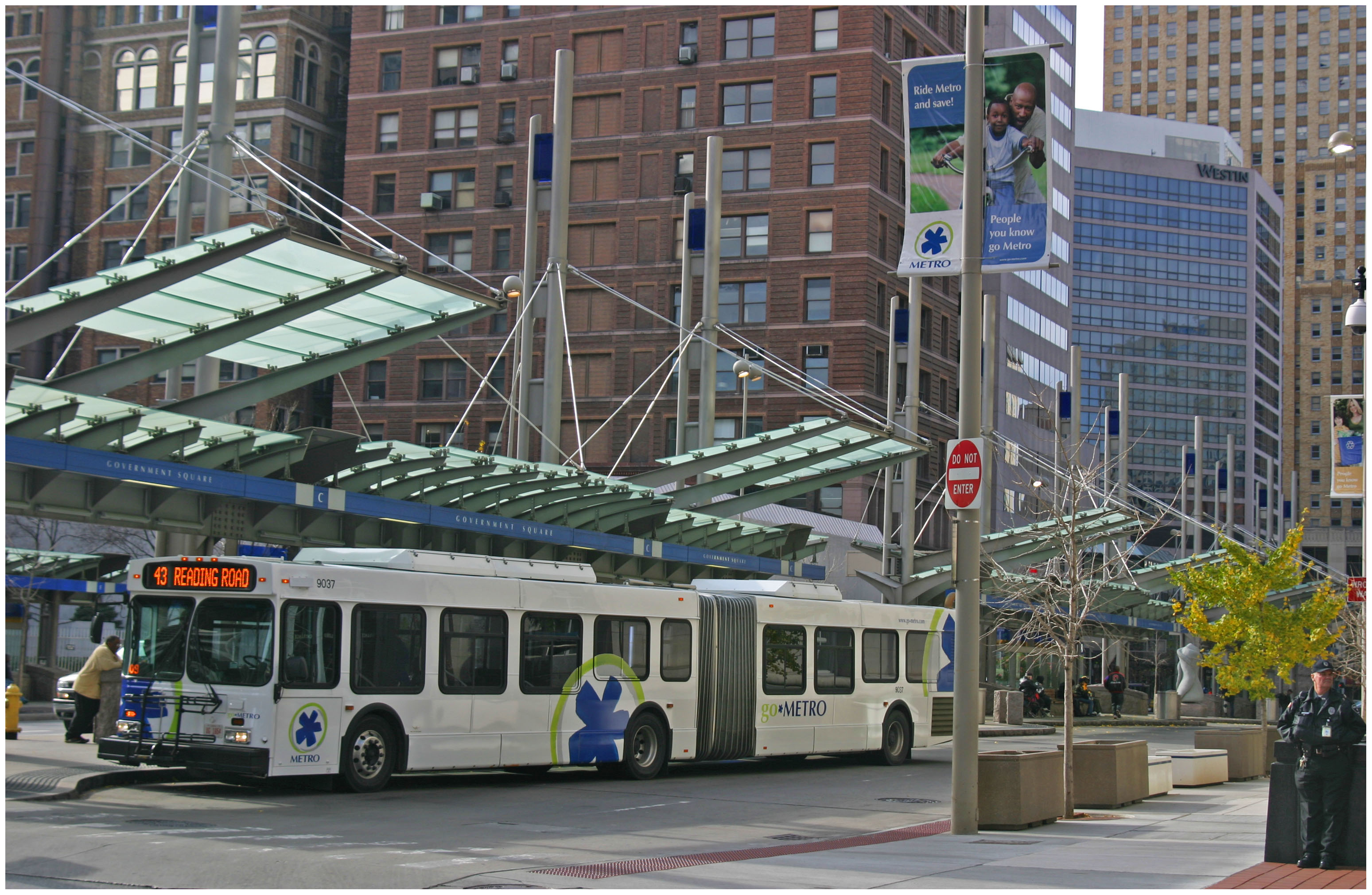
Cincinnati Metro Bus

Metro had provided around 20 million rides annually in the early 2000s until large-scale service reductions took effect when the national economy struggled.

“We’re focused on providing a great customer experience and are seeing positive results from improvements we’ve been making for our customers,” Metro’s CEO Terry Garcia Crews stated in a prepared release.

Metro also saw ridership gains along the 38X route running from the new Glenway Crossing Transit Hub to Uptown. This route experienced an 18% ridership increase when comparing data from December 2012 to December 2011 when the new west side transit hub opened.

“We expect the number of 38X riders to continue to climb,” explained Jill Dunne, Metro’s public affairs manager. “As more routes go through the Glenway Crossing Transit Hub, it will become easier to transfer to different routes, and that should help ridership continue to grow.”

One of the new additions riders can expect at the Glenway Crossing Transit Hub in 2013 is expanded crosstown service via Route 41. Metro officials say the service modification will be included in a new system plan to be released this spring, and will extend the existing Route 41 to North Bend Road to the new Mercy West Hospital, and connect through Cheviot and Westwood to the west side transit center.

Dunne also says that Metro*Plus limited stop service, previously discussed as Cincinnati’s version of bus rapid transit, will begin operating between Downtown, Uptown and Kenwood via Montgomery Road.

In addition to the physical improvements to the region’s bus system, Metro officials also believe that the agency’s new electronic fare payment system is making the system more attractive to new and existing riders. One of the new options riders might be able to expect in 2013 is a smart card that allows for stored values, in addition to the 30-day rolling pass and 10-ride ticket.

“We’ve upgraded our bus fleet, introduced new fare options, added real-time information at Government Square, improved our website and customer information, and that’s just the beginning,” Crews continued. “In 2013, we’re continuing to make Metro easier to ride to better meet the community’s needs for transit.”

Perhaps one of the most welcome pieces of news for existing Metro riders, however, is that SORTA does not anticipate any service reductions or fare increases in 2013.

We discussed bus rapid transit on episode one of The UrbanCincy Podcast with a city planner from Bogota, Colombia, and on episode two we discussed the problem of transportation poverty in the Cincinnati region, including the lack of service to the new Mercy West Hospital. You can stream our podcasts online or subscribe to our bi-weekly podcast on iTunes for free.
Categories
Up To Speed

The rise of downtowns and resurgence of inter-city bus travel

The rise of downtowns and resurgence of inter-city bus travel.

The resurgence of center cities and urban living has been well-documented. When combined with the inability of the United States to significantly invest in inter-city passenger rail, it appears to be only natural that inter-city bus travel has boomed. More from Chicago Magazine:

“In 1960, there were 454 daily arrivals and departures by bus in and out of Chicago. In 1980, 290; in 2002, 147 (O’Hare has about 2,400 flights every day). From 2002-2006, intercity bus service across the country declined eight percent. Then it turned around…With the resurgence of central-business districts, travelers too young to remember the stigma associated with bus travel, especially those living on college campuses and in large cities, are turning to motor coaches in especially large numbers.”

Categories
Up To Speed

More than $64.3B to be invested in North American rail transit in 2013

More than $64.3B to be invested in North American rail transit in 2013.

As the migration of people from the suburbs back to cities continues, so does the investment in urban forms of transport. A modern streetcar route is currently under construction in Cincinnati, and bus rapid transit, light rail and commuter rail is all being studied for the area. Nationally, more than $64.3 billion is being invested to expand rail transit. More from The Transport Politic (including map):

What is evident is that certain cities are investing far more than others. Among American cities, Denver, Honolulu, Houston, Los Angeles, New York, San Francisco, Seattle, and Washington stand out as regions that are currently investing particularly dramatically. Toronto has the biggest investments under way in Canada. These metropolitan areas have invested billions of local dollars in interconnected transit projects that will aid in the creation of more livable, multi-modal environments. Dynamic, growing cities require continuous investment in their transit systems.

Categories
Business News Transportation

Nate Wessel aiming to change the way Cincinnati does maps

Maps are used in our everyday lives to help us navigate our cities, perform research, and visualize spatial data, but Nate Wessel has attempted to change the way Cincinnatians view such information.

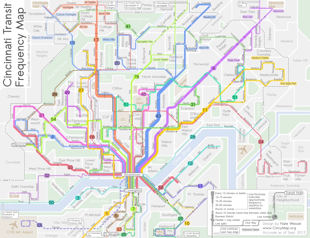
In June 2011, Wessel started a modest Kickstarter campaign that would raise money to print a transit frequency map he had developed. Instead of using the typical approach to developing a bus system map, Wessel adjusted colors and line weights according to the frequency of service along each bus route.


Cincinnati Frequent Transit Map (Day Time). Image provided by Nate Wessel.

While he simplified the system map, he also added critical wayfinding information such as neighborhood business districts, parks, neighborhoods and natural landscape features.

“The maps used currently will put the 38X on the same visual level as the 17, but one runs three times a day in each direction, and the other runs almost 100 times a day in each direction,” Wessel explained. “In no way does the map indicate any more value for one over the other, but my map gives people an approximate idea of how long you’ll need to wait, in addition to how frequent the buses come and where they go.”

Wessel grew up in Northeast Ohio and said that his first experience with transit was biking a mile to an unmarked bus stop in Canton. Since then he has studied urban planning at the University of Cincinnati (UC) and worked with the U.S. Department of Transportation, Bureau of Transportation Statistics.

It was during his time at UC, when he realized something needed to change with the way transit information is visually presented.

“A friend of mine from China was basically saying that he felt trapped in his apartment, and didn’t know anything beyond campus and thought you could take transit, but didn’t know where it went,” recalled Wessel. “He lived in a transit-rich area, but many people like him didn’t know the correct routes to take to the right places, even easily accessible places like downtown.”


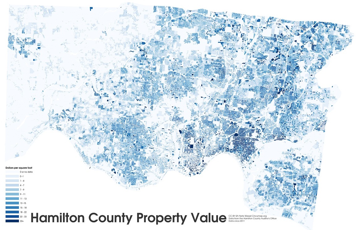
Hamilton County property values by square foot. Image provided by Nate Wessel.

The initial Kickstarter campaign raised far more money that Wessel was anticipated, and he was able to print and distribute 30,000 copies of his Cincinnati Transit Frequency Map. The map is now also featured on Southwest Ohio Regional Transit Authority’s (SORTA) website, but beyond that has not made significant inroads with regional transportation agencies.

Six months after Wessel distributed his new map, SORTA released a new regional transit map, for which they paid $20,000, that lacked the intuitive display and added information presented on the Cincinnati Transit Frequency Map.

While both SORTA and the Transit Authority of Northern Kentucky (TANK) were originally cooperative, and even contributed financially to the Kickstarter campaign, the follow-up, Wessel says, has been a bit disappointing.

Since the original release and distribution of the frequency map, Wessel has continued to improve upon it while also developing a separate night-time map, and one that focuses on center city transit service. To support those efforts, he launched a second Kickstarter campaign which funded the production of 20,000 additional maps in September 2012.

Wessel, however, has not limited himself solely to transit maps. He has released a number of maps this year that have highlighted property value data in Hamilton County, provided an exhaustive analysis of SORTA’s new transit plan, explained the theory of bus bunching, and is in the midst of an eight-part series critiquing the Cincinnati Streetcar project.

In the future he hopes to do a comprehensive map for bicycling to replace the existing one produced by the OKI Regional Council of Governments (OKI).

“In some way it’s a common interest in Cincinnati that I share with a lot of people that see the city not doing things as awesome as compared to other places, so I kind of want to do that with information about transit and cartography,” Wessel explained. “I also want people to make informed decisions about transit and planning in general, and I think that putting as much information out there in an attractive and useful manner helps.”

Nate Wessel was the winner of UrbanCincy’s first featured profile contest at the September 2012 URBANexchange. If you have a great idea we should know about, please contact the us at urbancincy@gmail.com. URBANexchange events are held on the first Wednesday of every month at the Moerlein Lager House.

Categories
Up To Speed

New iPhone will expose Cincinnati’s lack of open data

New iPhone will expose Cincinnati’s lack of open data.

With the imminent introduction of the next generation iPhone from Apple, the new phone and iOS interface is poised to eliminate Google Maps in favor of Apple’s own mapping software package. The move, which will come by fall of this year, provides driving directions but relies on third-party applications to provide transit directions. The Southwest Ohio Regional Transit Authority (SORTA) is one of the top ten agencies that does not provide the necessary open data necessary to create a transit app to replace Google Maps. More from The Atlantic:

The strategy relies on a pretty big assumption, and third-party developers need open data to build these tools…Many cities still aren’t sharing their data, including big ones like Atlanta, Phoenix, and Detroit. Along with hundreds of other metros, these cities do provide their transit data directly to Google for use in Google Maps, using a standardized format Google developed known as the General Transit Feed Specification (or GTFS). Giving data to Google is not, however, what developers mean when they talk about “open data.”