Categories
Opinion Transportation

Opinion: A Boulevard for Brent Spence Bridge Exit

Covington is in the midst of a redevelopment wave. A number of prominent historic buildings have recently been rehabbed and several large new mixed-use buildings are in the planning stages or under construction.

Two of the new projects, “Riverhaus” at 501 Main Street, and the John R. Green Lofts at 411 West 6th Street are scheduled to bring 369 new apartments into the Main Strasse neighborhood.  Census tract 603 covers most of the Main Strasse neighborhood and it shows 1,491 residents living there in 2015. Those two new projects will add a significant increase in the local residential population density.  Their ongoing progress reflects the demand for residential development in pedestrian-friendly urban spaces.

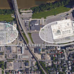
Part of Covington’s urban core that hasn’t seen any new residential development is the area north of 4th street between Madison Ave. and I-75.  Dubbed “Hamburger Heaven” in the city’s recent City Center Action plan, it contains multiple fast food restaurants, the sprawling one-story IRS center, and a sea of parking lots. Part of the reason the area hasn’t seen any development is that Covington’s 4th Street delivers 27,000+ cars per day to I-75. That much traffic is incompatible with pedestrian-friendly urban space.  

The City Center Action Plan makes redevelopment of the Hamburger Heaven and IRS sites a priority but it does not address the area’s inhospitable traffic. It’s a problem: How do you connect new development north of 4th street to the existing pedestrian-friendly urban fabric while maintaining all the traffic to the interstate?

The imminent closure of the IRS site presents an opportunity to address the problem. The 23-acre site covers 3-1/2 blocks of frontage on 4th street. Most of the remaining space adjacent to 4th street between the IRS site and I-75 consists of parking lots.

Once the IRS site is closed, the city of Covington should widen 4th street and convert it into a multiway boulevard.

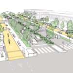
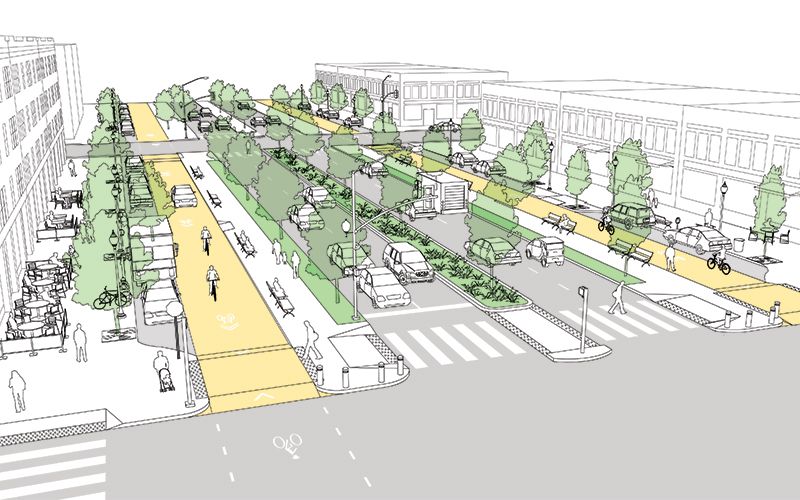
A multiway boulevard consists of a series of central lanes to move through-traffic, side lanes with on-street parking to serve local vehicles and bicycles, and broad sidewalks to serve pedestrians. Tree-lined medians separate the local traffic from through-traffic, and trees on the sidewalk further separate pedestrians from traffic. Think of it as a “mixed-use street.” Because the street supports a different mix of uses – people, bicycles, transit, through traffic – it can more readily support mixed-use buildings at its edges. Mixed-use buildings add the density and diversity of uses that support pedestrian-friendly urban space.

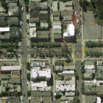
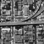
San Francisco recently took an existing street and converted a portion of it into a new multiway boulevard. The creation of Octavia Boulevard was possible because an earthquake damaged a freeway and made it unusable. Instead of rebuilding the freeway, San Francisco added its right-of-way to a four-block stretch of Octavia Street, which became Octavia Boulevard.

Today, Octavia Boulevard moves 45,000 cars per day in two directions, it has side streets and broad sidewalks to serve local residents, and the creation of the street spurred new development on its edges. Octavia Boulevard sets a clear precedent for converting underutilized auto-oriented development into more productive mixed-use urban development. Octavia Boulevard is aesthetically pleasing, practical at moving traffic, and successful at promoting economic development.

To implement Covington’s “4th Street Boulevard Project” the street’s existing 50-foot right-of-way would be widened to the north to create a 100+ foot wide right-of-way.

The expanded right-of-way will accommodate the multiway boulevard’s additional lanes, medians, and sidewalks. Expanding the right-of-way will require part of the IRS parcel, a number of parking lots, and the demolition of a fast food chain restaurant.

Different design options could include making 4th street’s through lanes either one-way or two-way. A dedicated transit lane could be accommodated. Bicycles can share the local lanes with local vehicular traffic.  

Implementing the 4th Street Boulevard Project would have multiple effects that support the ongoing urban renaissance. The medians and parked cars provide protection for people to walk, eat, drink, and socialize outside. Trees also protect pedestrians and provide a canopy for shade and cooling. Bicycle use will be safe and easy. Converting 4th street from a single use – channeling cars to I-75 – into a multiway boulevard will facilitate the development of dense mixed-use buildings.

There’s a historic opportunity here. The IRS site was born out of federal urban renewal projects in the 1950s. Its time is now at an end.  The trend of the future is to live, work, and play in the urban core. The current traffic on 4th street is a barrier to urban development. Converting 4th street into a multi-way boulevard will support the traffic flow but mitigate its negative impacts. Recent examples provide good evidence.

If the ongoing urban development is to be sustained and space north of 4th street – just blocks away from the Ohio River – is to be put to its highest and best use, then the traffic along 4th street must be addressed. Converting 4th street into a multiway boulevard will do just that.


This is a guest editorial by Chris Meyer that originally appeared in the CNU Midwest blog. CNU and CNU Midwest are content partners with UrbanCincy.

If you would like to have your thoughts and opinions published on UrbanCincy, simply contact us at editors@urbancincy.com.
Categories
News Transportation

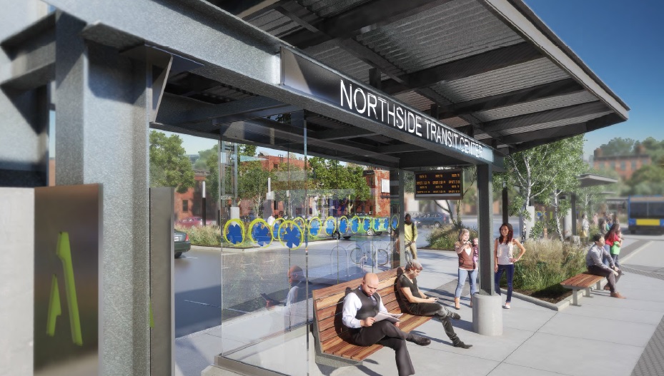
Final Designs Revealed for Long-Envisioned Northside Transit Center

One of Cincinnati’s most popular neighborhoods will soon get its very own transit hub.

With more than 13,000 people boarding or exiting buses every day, Northside has long been one of the region’s busiest transit hubs. This is partially due to the neighborhood’s high population and business density, but also because of the numerous transfers from the eight bus routes there (15x, 16, 17, 19, 20, 23x, 27, 51).

This high transit ridership also creates an odd conversion of buses from all over the city. In an effort to clean up the operation of these bus routes, the Southwest Ohio Regional Transit Authority has long been trying to streamline and enhance operations at Knowlton’s Corner.

After years of work, that vision is finally becoming reality with the $320,000 Northside Transit Center.

“Northside has been working to improve bus traffic through the neighborhood for most of two decades, and the pieces are finally falling into place,” said Ollie Kroner, President of the Northside Community Council.

“Metro presented preliminary plans to the community in July. I would say we are a hard group to impress, but their drawings really exceeded expectations,” Kroner continued. “This should be good for commuters, and also good for our business district.”

Its location is further complimented by the nearly location of a large Cincy Red Bike Station at Hoffner Park.

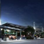
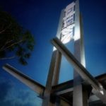
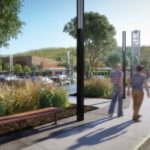
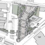
Cincinnati-based MSA Architects has completed its designs for the new transit hub in the heart of the Northside business district immediately south of the recently completed $15 million Gantry Apartments development. The new facility will boast dedicated bus lanes, boarding platforms, passenger shelters, bike racks and lockers, and real-time arrival technology.

The plan also calls for a significant upgrade and expansion of an adjacent parking lot, which SORTA officials envision as also serving as a miniature park-and-ride facility with 18 allocated spaces.

Project officials say that the Northside Transit Center project is expected to be completed by late 2017.

Larger Implications
Northside has become the center point for the city as hit-and-runs with people walking and biking have increased. In September, this even led to the community organizing public demonstrations urging City Hall to reduce the speed limit through the business district, while also committing to other safety improvements city-wide.

The implementation of the Northside Transit Center will significantly help consolidate bus traffic through the popular business district, while also create a safe and hospitable place for people to wait for their transit connections.

“We have the second busiest transit hub in the city after Government Square, in a neighborhood that was built before we had cars,” Kroner told UrbanCincy. “The transit hub should make riding the bus easier, more comfortable, and safer in Northside.”

While the City of Cincinnati has not committed to a Vision Zero campaign, or an official Complete Streets policy, residents continue to call for such measures.

Meanwhile, the move also comes as Metro attempts to reinvent its region-wide bus system in order to better connect people with jobs. Historically, many bus systems relied on what is called a spoke-and-hub system that ran all routes to a central downtown transit center. This train of thought has changed as cities have become increasingly more mixed-use and diverse.

Metro officials plan to unveil a new regional transit plan in early 2017, and may possibly put a transit tax increase before votes next November to help implement the recommendations laid out in that plan.

Categories
News Transportation

Ohio Maintains Position As Nation’s 16th Best State for Bicyclists

Bicycle Friendly State Ranking 2015Ohio has maintained its ranking as the 16th best state for bicycling in 2015, according to the League of American Bicyclists. The Buckeye state was previously ranked 16th in 2014, after a big jump from 32nd the previous year. This position places the state as the fourth best in the Midwest, behind just Minnesota, Wisconsin and Illinois.

The ranking is issued after compiling the results of a Bicycle Friendly State questionnaire that is answered by a coordinator in each state, and is based on five criteria: Legislation and Enforcement, Policies and Programs, Infrastructure and Funding, Education and Encouragement, and Evaluation and Planning.

The state scored a total of 45.3 points out of a possible 100, and fared best in terms of its Education and Outreach, but scored lowest in its Evaluation and Planning.

“I’m excited about where Ohio is,” Frank Henson, President of Queen City Bike, told UrbanCincy. He said that he felt that even though Ohio gained in its scoring of points, the reason it did not move higher in the ranking is due to the investments being made elsewhere around the country.

“While Ohio continued to do a lot of great things, especially here in Cincinnati and neighboring communities, other states were ramping up,” Henson said.

Leadership at Queen City Bike believes that Ohio has the potential to move up in next year’s ranking with the possible passage of House Bill 154.

Chuck Smith, Chairman of the Ohio Bicycle Federation, agreed and said that the top two suggestions from the League of American Bicyclists to improve the state’s ranking are both addressed in the bill. The first is a statewide requirement for vehicles to provide three feet of clearance when passing bikes, which is already an ordinance in Cincinnati. The second is a “dead red” law, which would allow all vehicles, including bicycles, to proceed through an intersection if they are not detected by traffic control devices.

“It’s important for cyclists to be legal, but bikes are sometimes outside of the system” Smith said in reference to many traffic control devices that are unable to detect the presence of people riding bikes.

One of the other major items recommended by the League of American Bicyclists is the adoption of a statewide Complete Streets policy – something both state and local officials continue to struggle with all over Ohio.

Julie Walcoff, Bicycle and Pedestrian Program Manager of the Ohio Department of Transportation, said there are several other actions being taken at the state level that could further bolster the state’s national ranking.

“We’re putting together a safety coalition that will encompass advocates, communities around the state, and other organizations that are interested in bicycle and pedestrian safety,” Walcoff told UrbanCincy. “We’ll be using that group to help develop a statewide educational campaign that focuses on road users of all types and on law enforcement.”

In addition, ODOT recently kicked off an initiative to designate proposed US and state bike routes throughout the Ohio, connecting the 17 largest cities in the state. ODOT officials say that these routes will use roads that already have an acceptable level of safety, along with existing paths.

While many have described ODOT as an agency almost entirely focused on highway building, Walcoff says they pride themselves on their working relationships with bicycle advocacy organizations throughout the state. This, she says, can help not only maintain Ohio’s current ranking but help it get even better in the future.

In Columbus, advocacy group Yay Bikes! is working with the city to increase the focus on design and engineering of the street infrastructure. Executive Director Catherine Girves says that to help improve the current situation, they are having engineers budget time each week to ride the streets with their group in order to better understand the needs of those people riding bikes.

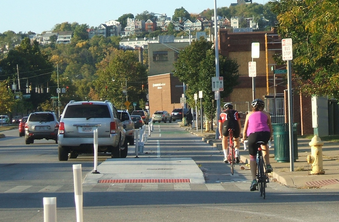
Back in Cincinnati, Henson noted the addition of Cincy Red Bike and the Central Parkway protected bike lane – the first of its kind in Ohio – as two key developments over the past year that have helped state’s ranking. Following the Cincinnati’s lead, both Cleveland and Columbus are now planning protected bike lanes of their own.

While much of the focus has been on core cities, Queen City Bike is also working with the Connecting Active Communities Coalition, which is comprised of representatives from nine communities in Cincinnati’s northern suburbs: Blue Ash, Evendale, Glendale, Lockland, Montgomery, Reading, Sharonville, Woodlawn and Wyoming. As of now, this group is working to develop a coordinated network for bicycling and other non-motorized modes of transportation on a multi-jurisdictional level.

Kentucky, meanwhile, ranked as the second worst state in the nation with just 18.3 points. This represented a 0.8 point drop from the previous year.

Categories
Up To Speed

Complete Streets are more equitable, safer and improve economic outcomes

Complete Streets are more equitable, safer and improve economic outcomes.

Over the past several years the idea of taking a new approach toward designing our public streets has been gaining traction. For many decades roads were built almost exclusively for people driving cars. But historically speaking, streets have always been much more egalitarian – accommodating all modes of transportation of the time.

While the idea of designing streets for all users has gained attention, it has not always gained supporters. This includes Cincinnati where a Complete Streets policy has yet to be realized. More from Streetsblog USA:

Redesigning streets to make room for people is a no brainer. “Complete streets” projects that calm traffic and provide safe space for walking and biking save money, reduce crashes and injuries, and improve economic outcomes. Need further convincing? Smart Growth America has done some number crunching, looking at the impact of 37 complete streets projects from communities across the country. 

Categories
News Transportation

Designs for Two-Way Street Conversion in East Walnut Hills Nearly Complete

Over the past four months, city planners and engineers have been working away on concepts that would transform William Howard Taft Road and E. McMillan Street into streets with two-way travel. During that time public feedback has been gathered and designs have been revised.

The actual work began much earlier than that when the City of Cincinnati converted portions of those same two streets through the Walnut Hills neighborhood back in 2012. There was some trepidation at the time in East Walnut Hills, but those have seemingly faded away following the successful conversion of those streets to the west.

“This two-way conversion will make the two neighborhoods much more connected, and make the distance between DeSales Corner and Peeble’s Corner more walkable,” explained Kevin Wright, Executive Director of Walnut Hills Redevelopment Foundation. “Our goal is to make the two districts more connected, and this is one of many changes that will be put in place to make that area more walkable.”

Some of those other changes include the redevelopment of historic buildings throughout the business district, establishment of new public gathering spaces, and potential upgrades to the district’s bus service.

Since the last round of public meetings, staff from Cincinnati’s Department of Transportation & Engineering (DOTE) have prepared updated alternatives for traffic flow and streetscape enhancements. These alternatives were presented at a public meeting on February 25, 2015, which included many residents and business owners from the East Walnut Hills neighborhood.

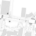
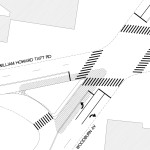
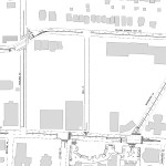
The modifications include the addition of off-peak parking on the north side of William Howard Taft Road between Woodburn Avenue and Ashland Avenue, the addition of left turn lanes from E. McMillan Street to Victory Parkway, and the addition of a landscaped island on the east leg of the Woodburn Avenue and E. McMillan Street intersection.

Project officials say there will be another round of public feedback on these changes, and members of the public are encouraged to share their feedback with Greg Koehler [greg.koehler@cincinnati-oh.gov] or Curtis Hines [curtis.hines@cincinnati-oh.gov] by Wednesday, March 11.