Categories
Arts & Entertainment News Transportation

UrbanCincy Partners with Cincinnati to Organize Two Unique Bike Month Events

In celebration of Bike Month, UrbanCincy has partnered with the City of Cincinnati to bring you two unique events. The first will take place on Saturday, May 14 and take bicyclists on a pedal-powered pub crawl through the city’s urban core. The second event will take place on Sunday, May 22 and give riders a glimpse into what bicycle commuting will be like along the Ohio River Trail.

Bikes+Brews is back by popular demand. Last year UrbanCincy organized this event and made five stops throughout Downtown and Over-the-Rhine. Roughly 50 people participated over various segments of the ride which began and terminated at Findlay Market. This year’s event will also begin and end at Findlay Market, but will include a total of nine stops throughout Over-the-Rhine, West End, Downtown, Newport and Covington. The ride will be led by Cincinnati brewer, and UrbanCincy contributor, Bryon Martin.

Bikes+Brews will begin at 1pm and will roughly last until 6:30pm. The event is free and open to the public, and interested participants are encouraged to join the ride for any duration and segment. The ride is approximately seven miles from start to finish (map), includes slight elevation change and two bridge crossings.

The Ohio River Trail Tour is new this year. The event will begin at Lunken Airport and take bicyclists for a ride along the partially completed Ohio River Trail. The ride will terminate in downtown Cincinnati at the Bike & Mobility Center currently under construction at the Cincinnati Riverfront Park.

Those participating in the Ohio River Trail Tour will be able to get information about future phases of the Ohio River Trail, which will link Cincinnati’s eastern suburbs with downtown, and how to successfully commute by bicycle by utilizing lockers, showers, repair facilities and bicycle parking at the new Bike & Mobility Center.

The Ohio River Trail Tour will begin at 10am in the parking lot across from Lunken Airport’s terminal building. The ride is approximately six miles (map) and contains very few changes in elevation.

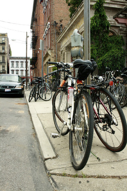
2010 Bikes+Brews photograph by Jenny Kessler for UrbanCincy.

Categories
Development News Politics

NKAPC study reveals strong passion for area hillsides

Cincinnati’s urban form has long been defined by its two most significant natural landscape features – the Ohio River and its many hills. Early in the city’s history, the hills served as a boundary to further expansion. Then, as technology improved, people began to move up the hillsides and build there as well.

Over time some hillsides were developed and remain developed, while others were never developed to begin with or have been returned to nature over time. This scenario has created a situation where Cincinnatians debate the best use for the city’s hillsides. To develop or not develop, that is the question.

In Northern Kentucky this issue has been particularly relevant over recent years as hillsides have been built upon for residences that boast city views. To determine where in fact the residents of the area stand, the Northern Kentucky Area Planning Commission (NKAPC) conducted a Hillside Survey.

The results of the 273 respondents are striking. While one-third of the respondents indicated that they would prefer full preservation of the hillsides, nearly 64 percent said that they would like to see a mixture of developed and preserved hillsides in Kenton County.

The common thread throughout the survey was that Kenton County residents view the area’s hillsides as a defining characteristic and one that should be carefully considered in future and ongoing policy decisions.

In June 2010 UrbanCincy discussed this same topic. What should be done with the region’s unique urban hillsides? I contended that a unique development opportunity was being left on the table that has been capitalized on in other cities in Greece and the United States. So what do you think? Should the region’s hillsides be built upon, left undeveloped, or be comprised on some mixture of both?

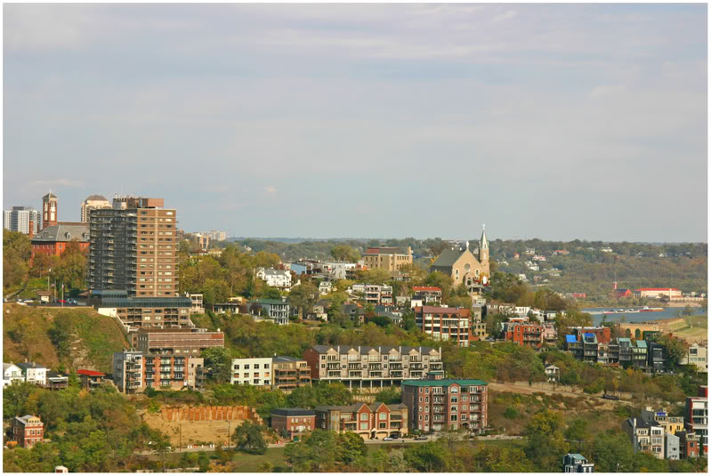
Mt. Adams photograph by Randy Simes; ‘The Views’ photograph by Kevin LeMaster.

Categories
Business Development News Transportation

Kenton County Planning Commission votes to adopt Roebling Point Plan

Last week, the Kenton County Planning Commission voted 11-5 in favor of adopting Covington’s Roebling Point Plan into the county’s comprehensive plan. Roebling Point, located at the foot of the historic Roebling Suspension Bridge, is home to such local favorites as Molly Malone’s and Keystone Bar & Grill.

Given that most view the comprehensive plan as a guide for the region, the vote was seen as a big step forward for the City of Covington as it hopes to redevelop one of its most important gateways into a more pedestrian friendly and generally more livable bar/restaurant district.

“Incorporating the plan will allow for a smoother zoning transition when new commercial moves in, streamlining zoning decisions to quicken the process for developers,” explained Covington Assistant City Manager Larisa Sims.

If the land use recommendations in the plan are followed, the new commercial development will consist of mixed-use design that complements, but does not copy the existing historic infrastructure. Sims points out that Roebling Point’s geography is unique in that it has the possibility of bringing together a variety of aesthetics.
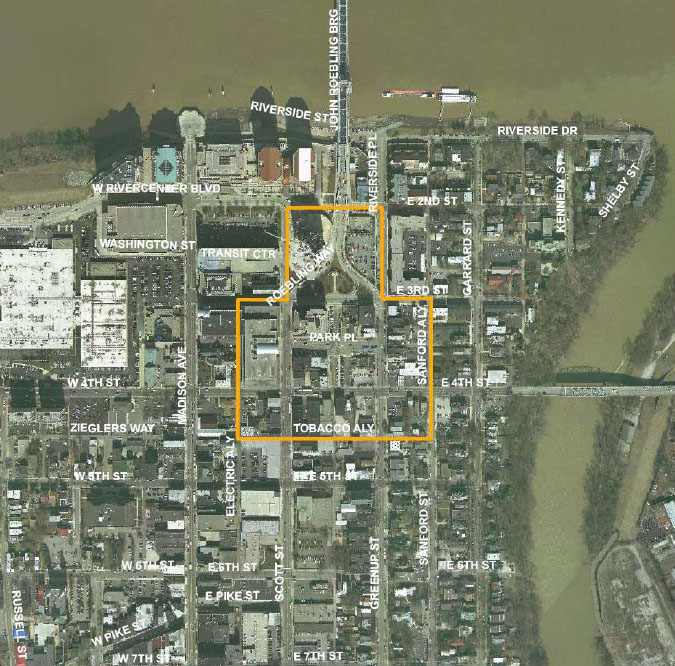
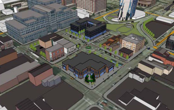
“The area is on the verge of success,” Sims says. “It’s located between high density office use to the west and the historic Licking Riverside District to the east. The area highlights the importance of, and creates a balance between, new mixed-use development and historic preservation.”

Last week planners also outlined the specific elements of the Roebling Point Plan for four key areas:

  1. West side of Scott Street between 3rd and 4th (Gateway Building): No significant change is proposed for the Gateway Building. The plan states that the structure is an appropriate size and it incorporates well designed features for pedestrian scale. Uses encouraged in this building are retail or office on the ground floor, with office above.
  2. Southwest corner of Scott and 4th Street: This block is part of the Times Star Commons Public Space Plan. The plan focuses on the preservation of the existing historic buildings, specifically the Times Star Building. The plan also calls for the redevelopment of the J&R auto repair that is on the corner of E. 4th Street and Electric Alley.
  3. 4th Street, Tobacco Alley, and Scott to Greenup Street: The plan calls for general reinvestment and rehabilitation in this section of the study area.
  4. East side of Greenup Street, from 3rd to Tobacco Alley: The plan indicates that the mix and scale of the development here is generally appropriate.

Land Use, growth, and redevelopment
While there are many land use recommendations within the district plan, the possible reuse or demolition of the county offices and county jail at 303 Court Street is one of the most intriguing. Currently, the County is discussing whether this building will be needed once the new jail is fully functional. If the offices are also eventually moved out of this building, the plan would recommend two alternatives.

First, if the building is not demolished, the plan would prefer changes be made to the facade of the building, and that the addition on the west side of the building be removed to create more pedestrian friendly space. The recommended use of this building would be residential or office.

Second, if the building were to be razed, the design of the building should be creative, and incorporate opportunities for open spaces and pedestrian amenities mid-block. The recommended use of this building is residential, or office, with retail opportunities on the first floor.

Transportation & Urban Design
One of the main transportation recommendations in the plan involves an area called ‘The Yoke’ which is a small green space with a police memorial located next to The Ascent. Currently there are two traffic ramps that separate two small islands of green space from the police memorial. The plan recommends the elimination of these ramps in order to provide safer access to this underutilized public amenity.

The plan also recommends, among other things, to identify locations and preferred methods for streetscape enhancements and pedestrian amenities. It specifically suggests making use of the local alleys in the surrounding neighborhoods for walking, biking, and safe vehicular traffic. The plan also outlines identifying areas for new public spaces and utilizing urban design methods for enhancing safety and cleanliness.

The plan’s architectural design objectives include protecting the community’s historic architecture, while allowing flexibility for appropriate new development. In order to accomplish this, the plan lists two main specific recommendations.

  1. Keep the Historic Preservation Overlay zone in place in order to facilitate historically appropriate and compatible design.
  2. Update and amend the Historic Covington Design Guidelines to codify flexibility and consistent interpretation.

The first implementation committee meeting for the plan will be held November 15th at 6pm, the public is welcome. The meeting will outline and give a more detailed prioritization of the action items within the plan. Initial plans are already underway to meet with the owner of the Keystone Bar & Grill to discuss sidewalk expansion along Park and Greenup. These sidewalk improvements are scheduled to begin in the spring.

Additionally, funds are currently being raised for the improvements to the Yoke/Police Memorial and changes to the Yoke parking lot have already been made to try to increase usage. Additional recommendations in the plan will continue to be evaluated.

“Long term implementation will largely depend on the interest and activity from property owners and developers specifically related to land use and redevelopment of each block,” Sims stated. “The City will continue to promote its incentives and work as a facilitator to make this vision a reality.”
Categories
Business News Transportation

Pedicab service gets rolling in Cincinnati’s center city neighborhoods

As you walk around downtown Cincinnati, Newport, or even Bellevue these days you may see new pedicabs moving about. Pedicabs have become increasingly popular in other major urban areas throughout the United States including Austin, New York City, Boston, and San Francisco.

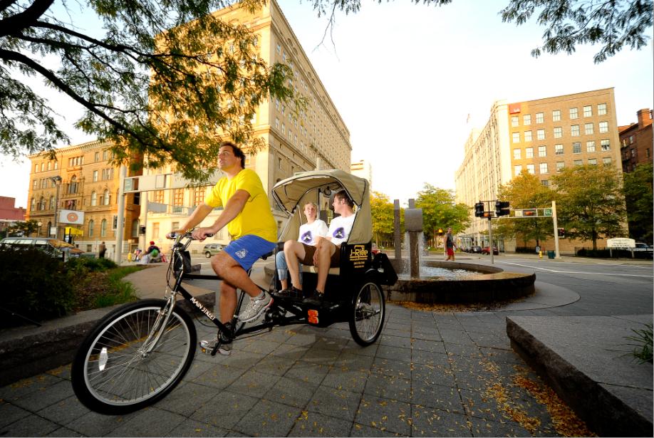
Newport-based J-Rides has begun operating within Cincinnati’s center city and, like many start-ups, was born from a moment of seeing a need and realizing that nobody else was providing it.

Residents of downtown Cincinnati, J-Rides’ owners Beatrice Terekhov and Jared Poweski say that they were out running errands one day when they realized that there was no quick and easy way to get from the Ohio side of the river to the Kentucky side without jumping in a car. A few days later they were getting started on a business plan to start J-Rides.

The bike taxis take revelers and residents alike between the different areas of the river basin for little or no charge. The drivers, who work mostly for tips, work under contract to operate a J-Rides pedicab and receive training and licensing.

“Servicing almost the entire urban area, the pedicabs can easily be flagged down for a ride or can be booked for a tour,” Beatrice told UrbanCincy. “Our pedicabs travel on the streets just like any other vehicle, but they are allowed on the Purple People Bridge which makes for a great ride.”

While pedicab service thrives in other urban settings, the owners of J-Rides say that they are still working to dispel myths about their service.

“We are all weather, can carry two to three passengers, and are absolutely safe,” Beatrice explained when asked about what hurdles they have to overcome. “Only severe weather like an ice storm or heavy snow will keep us off the road this winter.”

According to Beatrice, the pedicabs are also inspected by each city in which they operate, include seat belts, and have a canopy for cold and rainy weather.

Aside from moving people throughout the center city, J-Rides is also hoping to help create a thriving urban area in Cincinnati. This support, Beatrice says, may come through advertising for local establishments or by putting more eyes on the street. After one of J-Rides’ drivers recently helped apprehend a pickpocket in Newport, Beatrice says that their service is helping to make the urban environment both better and safer.

The company will also be assisting with upcoming walks and races by offering rides to people who might otherwise not be able to participate, and Beatrice hopes to host a fundraiser of their own later this year that will support the Society for the Prevention of Cruelty to Animals (SPCA).

J-Rides pedicabs can be reserved by calling (513) 702-7656 or emailing info@j-rides.com. The pedicab service can also be used for longer rides including tours of the area with rates starting at $25 for 30 minutes. Look for the pedicabs throughout Bellevue, Newport, Cincinnati, and hopefully Covington once the Roebling Suspension Bridge reopens in about a month.

Categories
Business Development News

Google updates aerial imagery of Cincinnati region

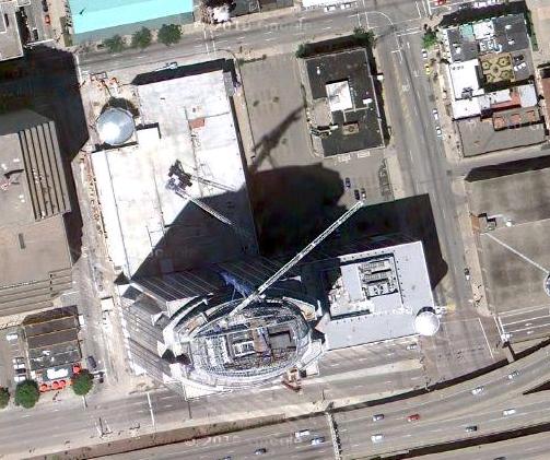
Google has updated its aerial imagery for several major cities throughout the United States including Portland, Washington, D.C., and Cincinnati.  The new imagery appears to have been taken over the summer.  Observers in the nation’s capital have been able to narrow it down to as precise as Sunday, August 29 between 1:00pm and 1:35pm.

Like many other cities around the country, the new aerial imagery for Cincinnati illustrates much of what has changed over recent years.  New construction projects are visibly taking place while others have been completed or are nearing completion in their aerials.  In addition to capturing the changing urban landscape in Cincinnati, the new imagery is also much crisper than previous versions.

Below is a sampling of 20 sites around the city that illustrate the aforementioned changes.  Enjoy!