Categories
Business Development News

Officials celebrate completion of nation’s largest green renovation of affordable housing

Photograph by Alexis Barnes.

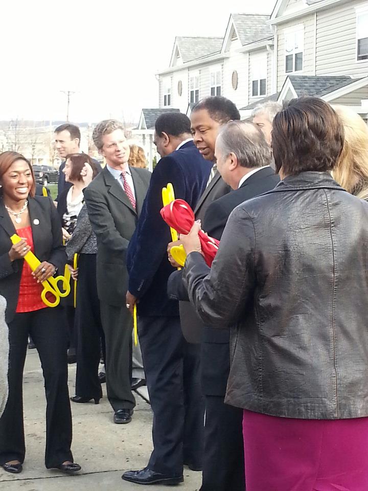
The Secretary of Housing and Urban Development (HUD), Shaun Donovan, is in Cincinnati today to celebrate the completion of the newly redeveloped housing project called the Villages at Roll Hill. The project, which was once known as Fay Apartments, is being heralded as the largest green renovation, affordable housing project in the country.

Developers Wallick-Hendy state that they intend to apply to the U.S. Green Building Council (USGBC) to obtain LEED certification on the project.

Redevelopment of the long-stalled neighborhood had begun in earnest in 2010 after years of setbacks and delays. As disclosed by UrbanCincy in 2010, developers were able to tap a variety of funding sources to get the project off the ground including a $32 million loan from HUD and a $3.2 grant from City HOME. The City of Cincinnati also granted an eight-year tax abatement on the renovated units.

The rehabilitation included the demolition of 17 buildings on site and reduced the number of housing units to 703. The upgrades also include landscaping, security, tree installation, a new playground and other improvements.

The Villages of Roll Hill is located along Baltimore Avenue on the west side of Cincinnati. The housing development debuted in 1962 as a promising new city neighborhood with over 1,025 market rate apartments. The development was owned and operated by HUD but was bought by the City in 1982.

By 1986, the City sold the struggling development to Stern-Hendy due to promises to invest millions in rehabilitating and repairing the complex. By 2005, however, there were only 112 market rate apartments left, 650 were rented to Housing Choice Voucher recipients (Section 8) and 128 were rehabilitative housing operated by Cincinnati Metropolitan Housing Authority (CMHA).

Categories
News Transportation

Cincinnati Moves Forward With Land Use Study of Wasson Railroad Corridor

On November 14, Cincinnati’s Department of City Planning & Buildings held a public hearing on its upcoming land use study for the disused Wasson Road Railroad and adjacent properties.

Norfolk-Southern Railroad ended service on the line in 2009, and in 2010 the City of Cincinnati’s Department of Transportation & Engineering (DOTE) identified the right-of-way as a future off-road bicycle path in its planned 400-plus-mile network of bike lanes and trails.

Local bicycle advocates have since built public support for construction of a paved rails-to-trails bicycle path between Xavier University and Fairfax as part of a project called the Wasson Way Trail.
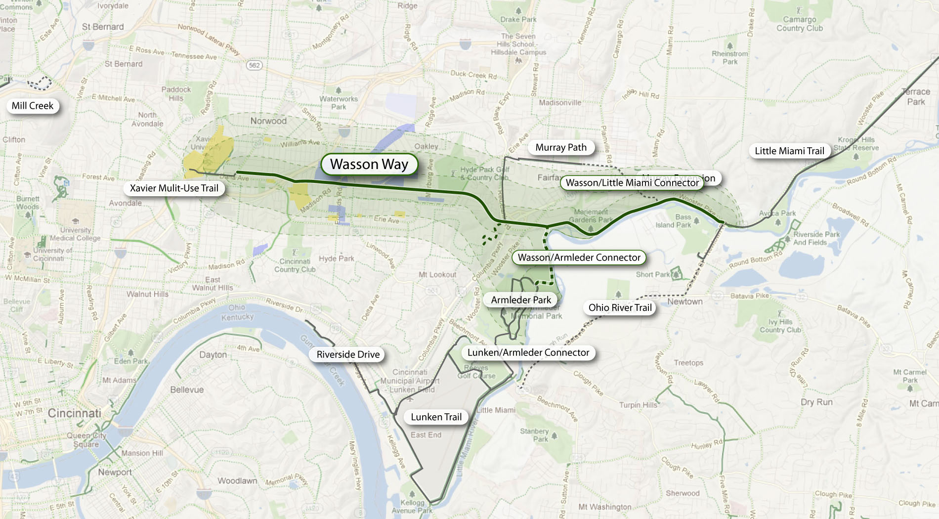

The proposed Wasson Way Trail would use the Norfolk Southern Railroad right-of-way to create a bike trail from the Little Miami Trail to Xavier University. Image provided.

On Wednesday, however, city officials were quick to mention that the upcoming land use study is just that – a determination of how the Norfolk Southern property and its surroundings might be rezoned in order to protect the right-of-way up until and after the right-of-way is purchased by Cincinnati – not a determination of what should be built in its place.

Already, Norfolk Southern has leased some of its railroad property for other uses. In 2011, a shopping center at Wasson Road and Edwards Road created a gravel parking lot on the disused tracks and another business near Paxton Road is looking to do the same.

Although Federal regulations prohibit railroads from subdividing their disused properties until they complete an “abandonment” process, Wasson Way Trail advocates are concerned that revenue from additional leases might discourage Norfolk Southern from selling the right-of-way to the City of Cincinnati at a future date.

Michael Moore, Director of the City of Cincinnati’s DOTE, stated that appraisals of the Norfolk Southern property fall close to $2.5 million. He cautioned, though, that this appraisal should not be thought of as a sale price, as the terms of the City’s purchase of the property cannot be known at this time.

Multi-Modal Use of the Corridor
At the November 14 meeting, city officials also made a point of stating that the title of the upcoming land use study has not been determined but that it will make no explicit mention of bicycle paths, light rail transit, or multi-modal use of the corridor.
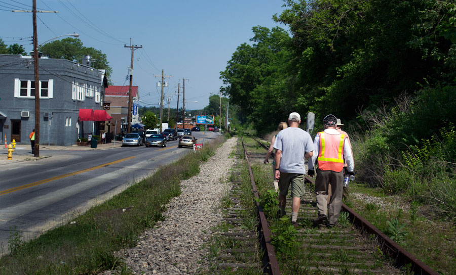

Members of Queen City Bike joined Cincinnati City Councilmember Laure Quinlivan (D) and former MetroMoves chairman John Schneider for a walk along the Wasson Railroad Corridor in May 2012. Photograph by Jake Mecklenborg for UrbanCincy.

Construction of a double track light rail transit line in the right-of-way was first identified by the OKI Regional Council of Governments in the late 1970s. Then in 2002, the Southwest Ohio Regional Transit Authority (SORTA) planned to build a light rail line in place of the Wasson Road freight railroad as part of its MetroMoves plan and failed sales tax referendum. If the ballot issue had passed, construction of a light rail line would have almost certainly commenced soon after Norfolk Southern ceased freight service in 2009.

The width of the Norfolk Southern right-of-way varies wildly as it travels between Xavier University and Hyde Park. It is typically at least 30 feet wide, but in a few places widens close to 100 feet.

In May 2012 members of Queen City Bike walked the right-of-way with John Schneider, who had previously chaired the MetroMoves campaign. At that time, the groups agreed that conflicts between the proposed bike path and light rail line can be avoided if the two are planned as a unified project.

Further complicating the issue is that small sections of the Norfolk Southern property fall under the jurisdiction of the City of Norwood. These sections are all north of the line’s main tracks, for example the railroad’s former yard tracks near Montgomery Road. As Norwood is not involved in Cincinnati’s upcoming land use study, and Cincinnati of course has no influence in its affairs, whatever zoning changes Cincinnati applies will not affect bordering Norwood properties.

The Department of Planning & Buildings will complete its land use study in summer 2013, but with no immediate plans to enter into negotiations with Norfolk Southern, there is no timeline for construction of the Wasson Way Trail.

Categories
Development News

$450,000 donation from Duke Energy to advance construction at Smale Riverfront Park

Thanks to a $450,000 donation from Duke Energy, the Cincinnati Park Board will be able to move forward more quickly with the development of what was previously called the Main Street Garden at the Smale Riverfront Park.

The area is located immediately south of Great American Ball Park, and is now called the Duke Energy Garden. The narrow piece of park space is expected to be completed by spring 2013, and will connect the Smale Riverfront Park with additional riverfront parkland to the east (Sawyer Point, Bicentennial Commons, Theordore M. Berry International Friendship Park).


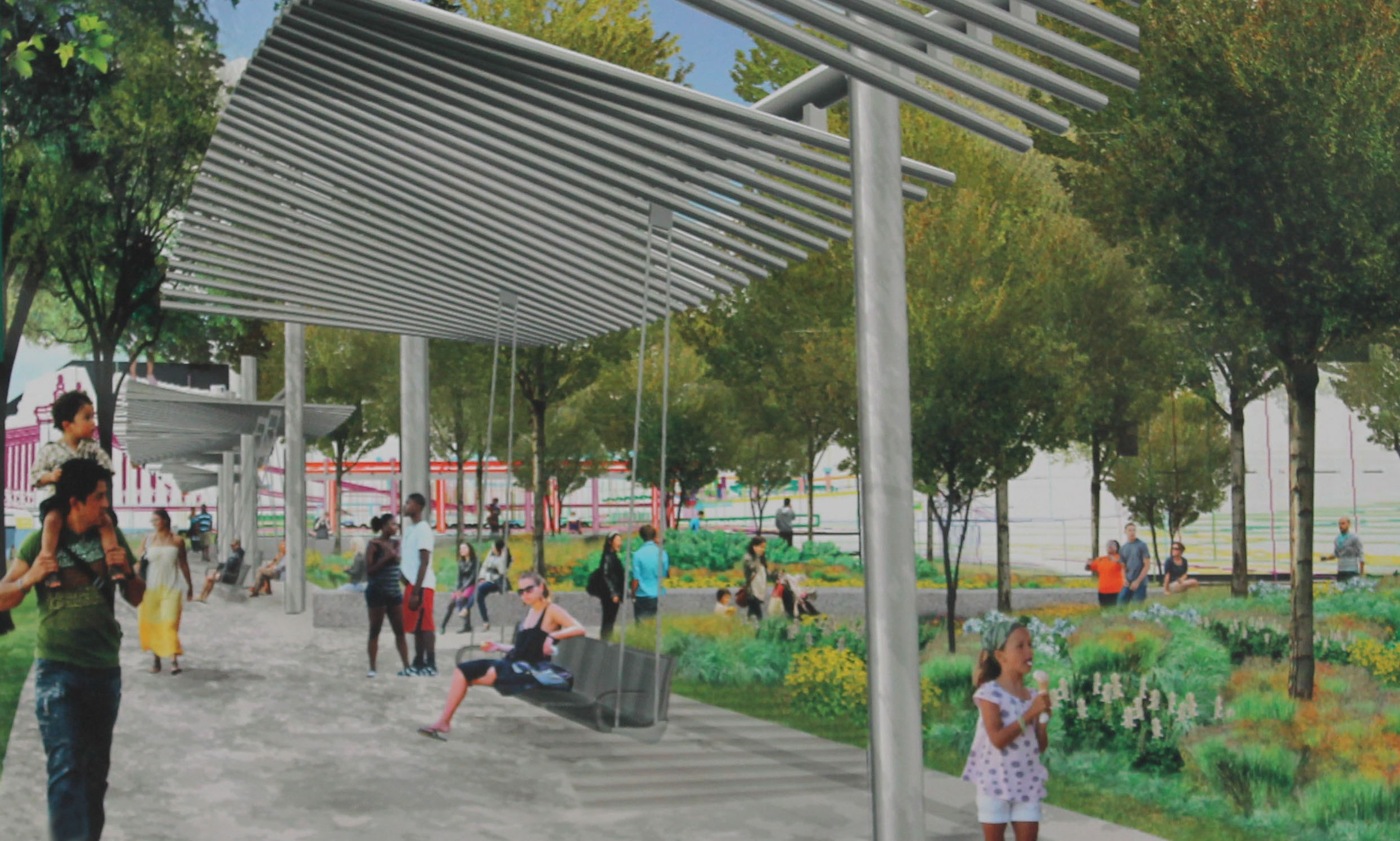
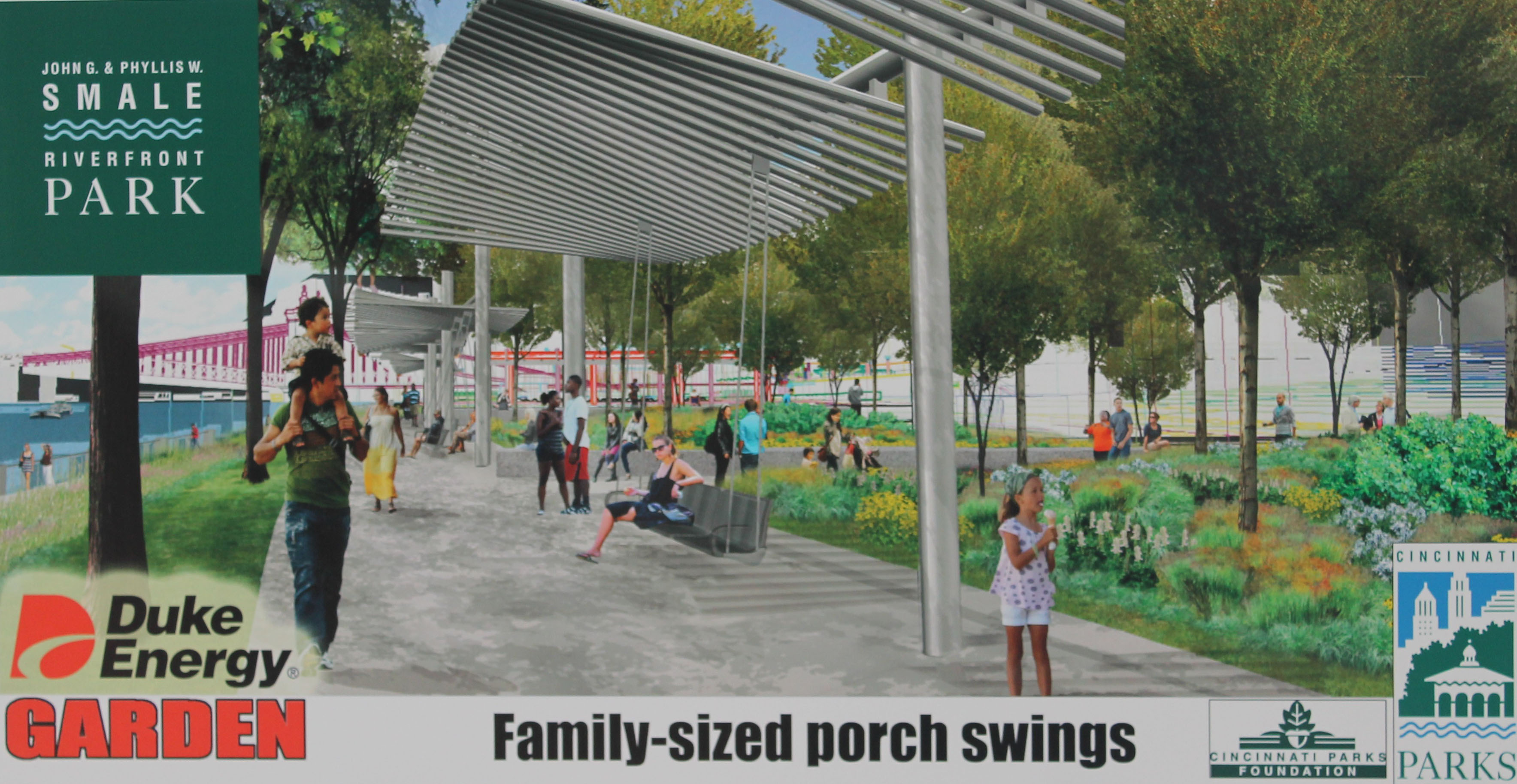
The Duke Energy Garden will include 12 “family-sized” porch swings, walking paths, and will help connect the Smale Riverfront Park with additional riverfront parks to the east. Rendering provided.

According to Cincinnati Park Board officials, this connection will be further established with the completion of the Ohio River Trail to Paddlewheel Park in fall 2013.

“The Cincinnati riverfront is more than just an entryway into our community,” Julie Janson, President of Duke Energy Ohio/Kentucky, stated at a Monday morning press conference. “It serves as the front porch to Ohio. That’s why Duke Energy, through our foundation, is happy to be able to support the creation of the Duke Energy Garden in the new Smale Riverfront Park.”

According to park officials, the Duke Energy Garden will include 87 trees, thousands of smaller plantings, walking paths, a 150-foot granite seat wall, and 12 “family-sized” porch swings.

The porch swings will be suspended from “undulating” pergolas that will also offer park-users a bit of shade and protection from the elements while enjoying the swings, which have long been anticipated at the park due to their popularity elsewhere throughout the country.


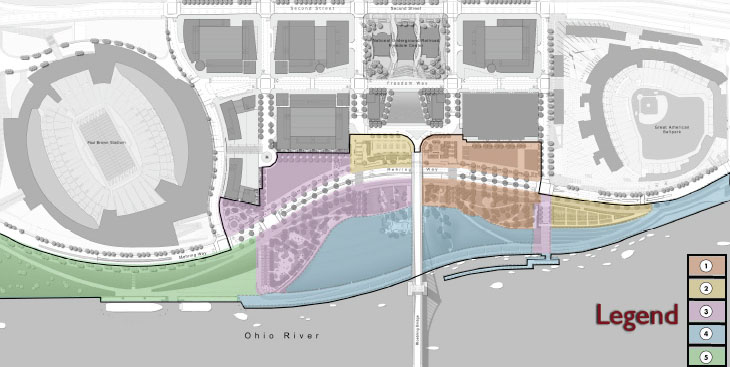
Three additional phases of work are planned to follow the completion of the Duke Energy Garden at Smale Riverfront Park. Image provided.

“Duke Energy’s commitment to the vitality of this region has been demonstrated again and again by the company’s substantial investments in economic development, education, environmental and energy efficiency efforts throughout the region,” said Willie F. Carden, Jr., Director of Cincinnati Parks. “The establishment of the Duke Energy Garden in Smale Riverfront Park is another such gift that will provide a stunning new public greenspace in Greater Cincinnati’s grand new front yard.”

The majority of phase one work at the Smale Riverfront Park was completed in May 2012, but several features of phase one have yet to be funded or built, in addition to future phases of park construction to the west. Some of those features include a transient boat dock, playgrounds, additional gardens and tree groves, a carousel, and more promenades and fountains connecting the central riverfront park with the Ohio River.

Three additional phases of construction work will take place following the completion of the Duke Energy Garden, and it is expected that once fully built out that Smale Riverfront Park will attract approximately 1.1 million visitors annually.

Categories
Development Opinion

Horseshoe Casino Cincinnati requesting 80-foot sign

On Wednesday, the City of Cincinnati’s Zoning Hearings Examiner will hear a request from the owners of the new Horseshoe Casino asking for the city to grant several variances to the city’s sign ordinance for signage at the casino site. Casino representatives are asking for more signage and larger signs than the current ordinance allows.

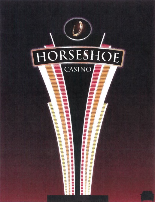
A variety of signs are included in the package including three signs that will display a real-time count of available parking spaces in the casino garage, and a monument sign that will located along Gilbert Avenue and rise 80 feet in height.

The sign, which is 943 square feet in size, exceeds the maximum allowed signage by 678 square feet in total area and 64 feet in height. According to the plans, the sign will be illuminated and visible along I-71 and up Gilbert Avenue into Walnut Hills, as well as parts of Mount Auburn and Mount Adams. For reference, the sign will be taller than the six-story building currently housing casino construction offices at Broadway Street and Eggleston Avenue, and will dominate the skyline view looking south from I-71 like a peculiar star above the Greyhound bus terminal.

In requesting for the sign variance, casino officials argued that they need the site to be visible to drivers along I-71. Once erected, the sign will tower above the casino complex and adjacent highway as a beacon of hope and good fortune to gamblers, and serve as a landmark to those traveling through downtown Cincinnati.

Residents living along Reading Road and in Mount Adams will also be able to bask in the comforting warm neon glow emanating from the sign at night. In fact, some may never need a night light again!

Some neighborhood leaders have raised concerns that the meeting is being held without enough notice for neighborhood councils; however, it seems to be in the city’s interest to get this sign up as soon as possible so suburbanites have plenty of lead time to know exactly where the casino is and how many parking spaces are free in its breathtakingly massive parking garage.

Already, out-of-towners are looking to flock to the casino but are unsure of its exact location.

“I was approached by a woman at the airport the other day and she asked me where the casino was being built,” disclosed UrbanCincy Chief Technologist Travis Estell. Thankfully, the woman will now know where the casino is with this gargantuan sign!

Springboro resident Chris Cousins also shared his enthusiasm for the proposed sign saying, “I’m really looking forward to dining at the casino’s buffet and this sign will point me in the right direction.”

The meeting will take place Wednesday, October 24 at 9am in the Permit Center located at 3300 Central Parkway (map). This facility is served by Metro’s #20 bus route.

Categories
Up To Speed

Cincinnati a changed city since Reds’ last playoff run

Cincinnati a changed city since Reds’ last playoff run.

Those who haven’t been living under a rock for the past five years know that a lot has happened in Cincinnati’s center city during that time frame. On Sunday TBS’ announcers spoke highly of the transformation that has occurred in downtown Cincinnati since the Reds last playoff appearance in 2010, and with the eyes of the baseball world focused squarely on the city this evening, it seems as though the nation will get a front row seat to that progress. More from the Associated Press:

Less than two years ago, little more than a giant parking lot occupied the half-mile between the stadiums of the Cincinnati Reds and Bengals along the Ohio River.

After more than $600 million in new development between the two stadiums, there are now six distinct bars and restaurants, a popular riverfront park and high-end apartments that are touted as being “Cincinnati’s premier live-work-play destination” and charge rent in the thousands…A few blocks over is a new $322 million, 41-story office tower that’s the tallest building in the city, and a 20-minute walk away is the trendy Over-the-Rhine historic district that used to be best known as a haven for crime and the site of the city’s 2001 race riots. Now dozens of bedraggled buildings in the district have been renovated into popular bars and restaurants and a once crime-prone park has undergone a $48 million makeover to become one of the city’s best venues for concerts, outdoor movie viewings and flea markets.