Categories
Development News Politics Transportation

Plan Cincinnati aims to guide city back towards its urban roots

After a three-year planning process, Cincinnati’s first comprehensive plan in 32 years will be shared with the city’s Planning Commission. The hearing marks a ceremonious occasion for city employees that have worked tirelessly on the plan since Mayor Mark Mallory (D) tasked them to work with the community on putting together an updated plan for the Queen City.

The City of Cincinnati Planning Department will share the 228-page document with the Planning Commission at 6pm today at City Hall (map). From there the document will move on to City Council’s Livable Communities Committee, and then the full City Council for approval where officials do not expect much, if any, pushback from the nine-member elected body. After formal approval from City Council, the document will become Cincinnati’s policy guide for everything from financial to environmental decisions, and beyond.
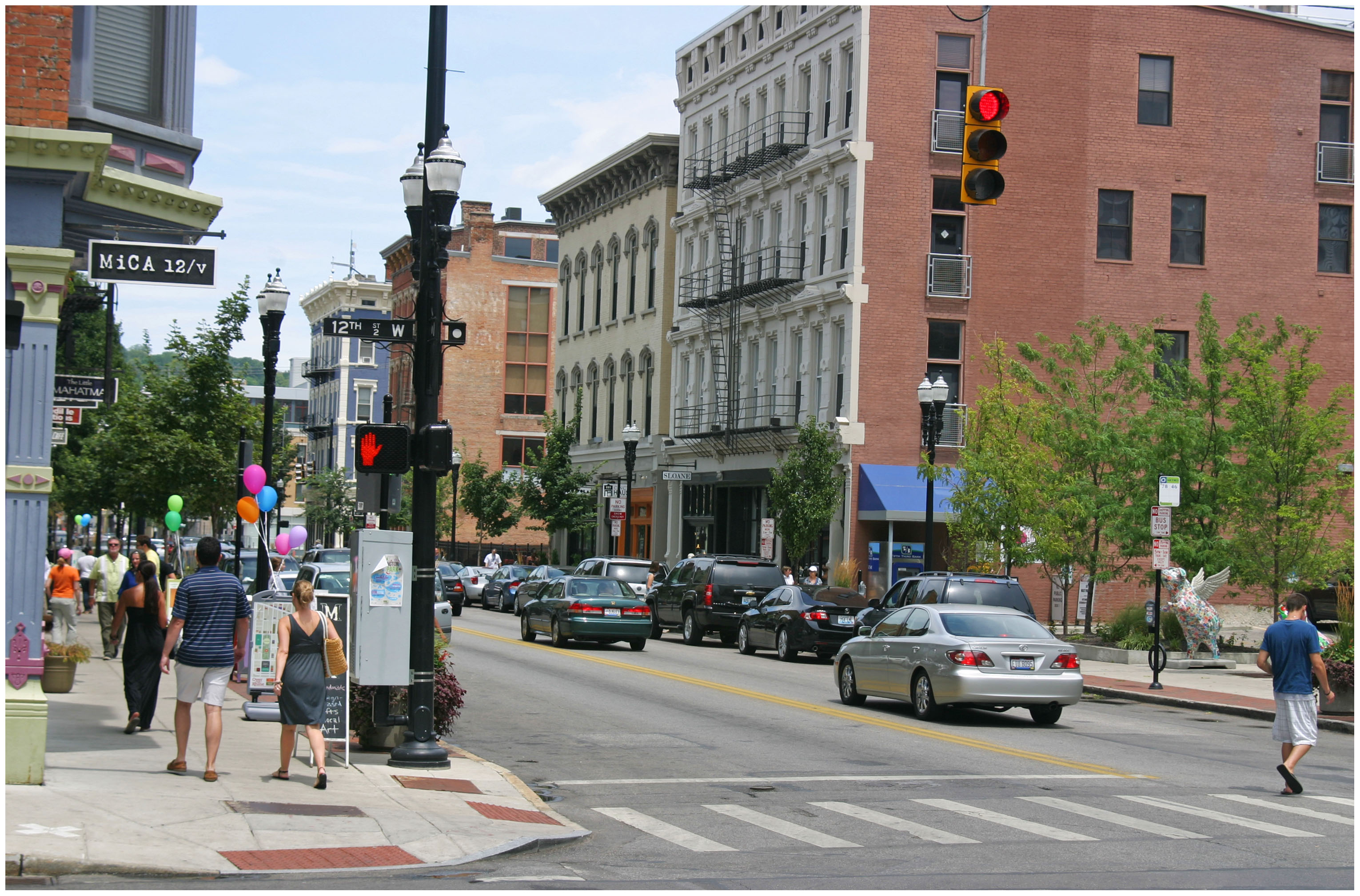

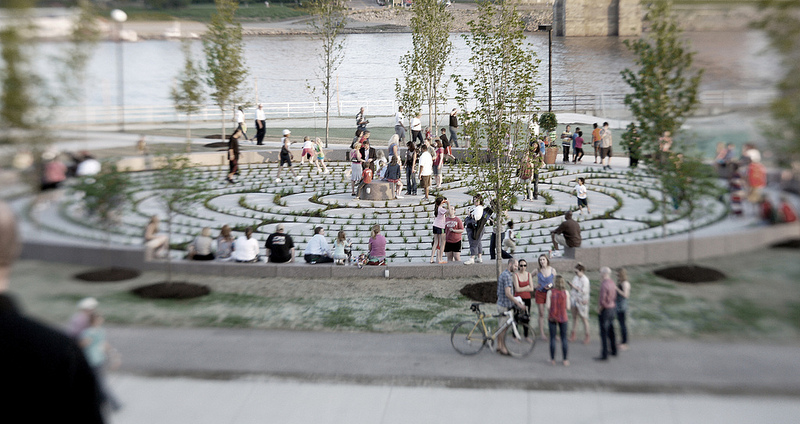
The city’s new comprehensive plan, Plan Cincinnati, places a strong focus on creating and building upon walkable neighborhood centers. Photograph by Randy A. Simes for UrbanCincy.

The tone for the city’s new vision is set early and often throughout the document stating, “The vision for the future of Cincinnati is focused on an unapologetic drive to create and sustain a thriving inclusive urban community, where engaged people and memorable places are paramount, where creativity and innovation thrive, and where local pride and confidence are contagious.”

The focus on a comprehensive urban approach is a bold diversion from Mayor Charlie Luken’s (D) administration which ultimately left the city without a Planning Department after a heated debate over whether to allow Vandercar Holdings to build a suburban-style development at what is now the Center of Cincinnati big-box development.

In the early 2000s, Vandercar had agreed to go along with Cincinnati’s Planning Department and build a mixed-use development on the site. Disagreements over the project led to a change of heart by the development team, and a strong reaction by both Mayor Luken and then City Manager Valerie Lemmie to dismantle the city’s planning department.

The renewed focus on urbanism in the Plan Cincinnati document establishes 11 goals that range from growing the city’s population, to becoming more aggressive with economic development, to developing a culture of health. One of the key goals set out by Plan Cincinnati calls on leadership to build on the city’s existing assets. To that end, the plan identified 40 Neighborhood Centers that should serve as the diverse, walkable centers of activity throughout the city.

Of those 40 nodes, approximately 28 percent are recognized as “urban” neighborhood centers while the remainder are identified as “traditional” neighborhood centers.
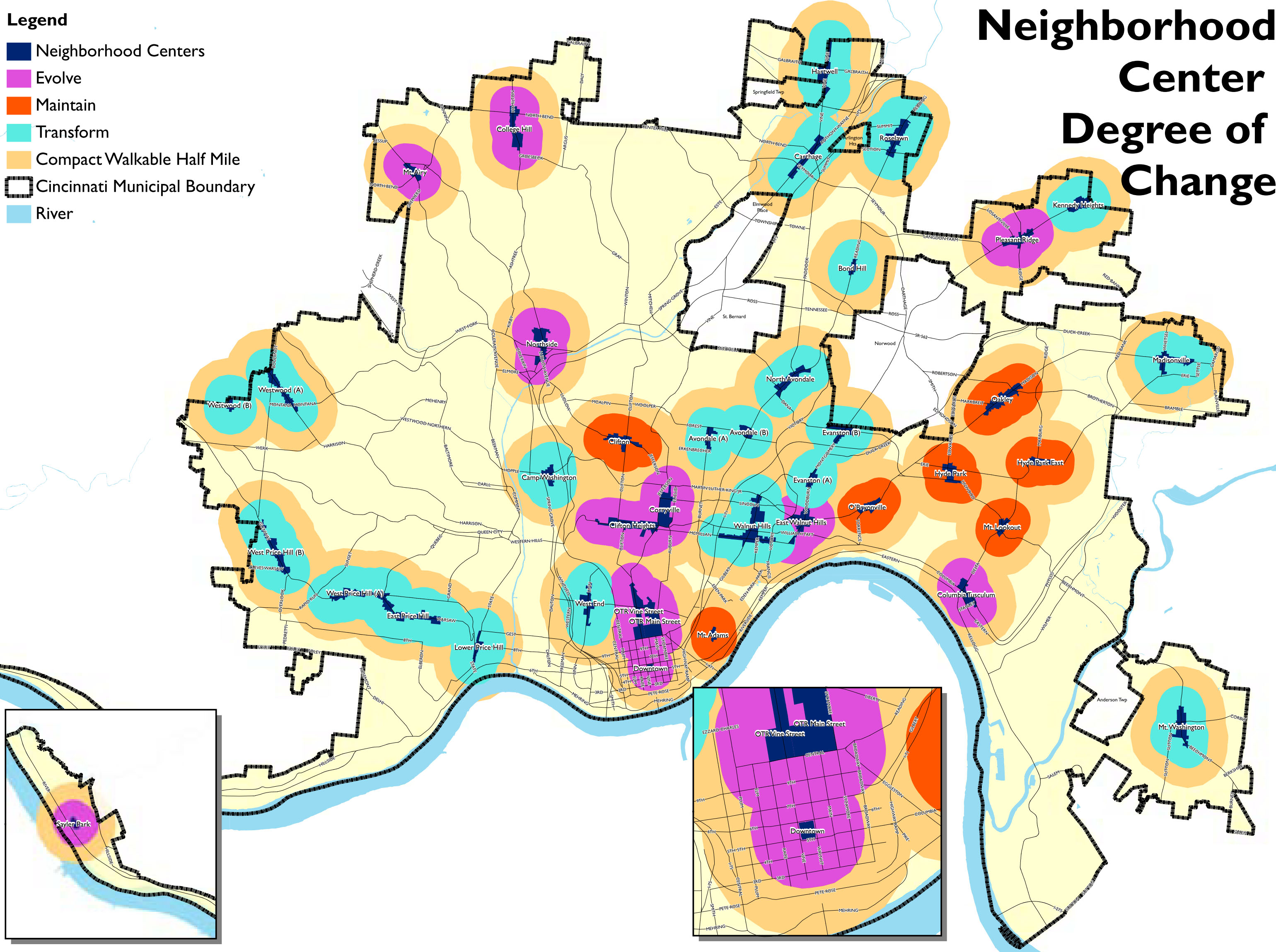
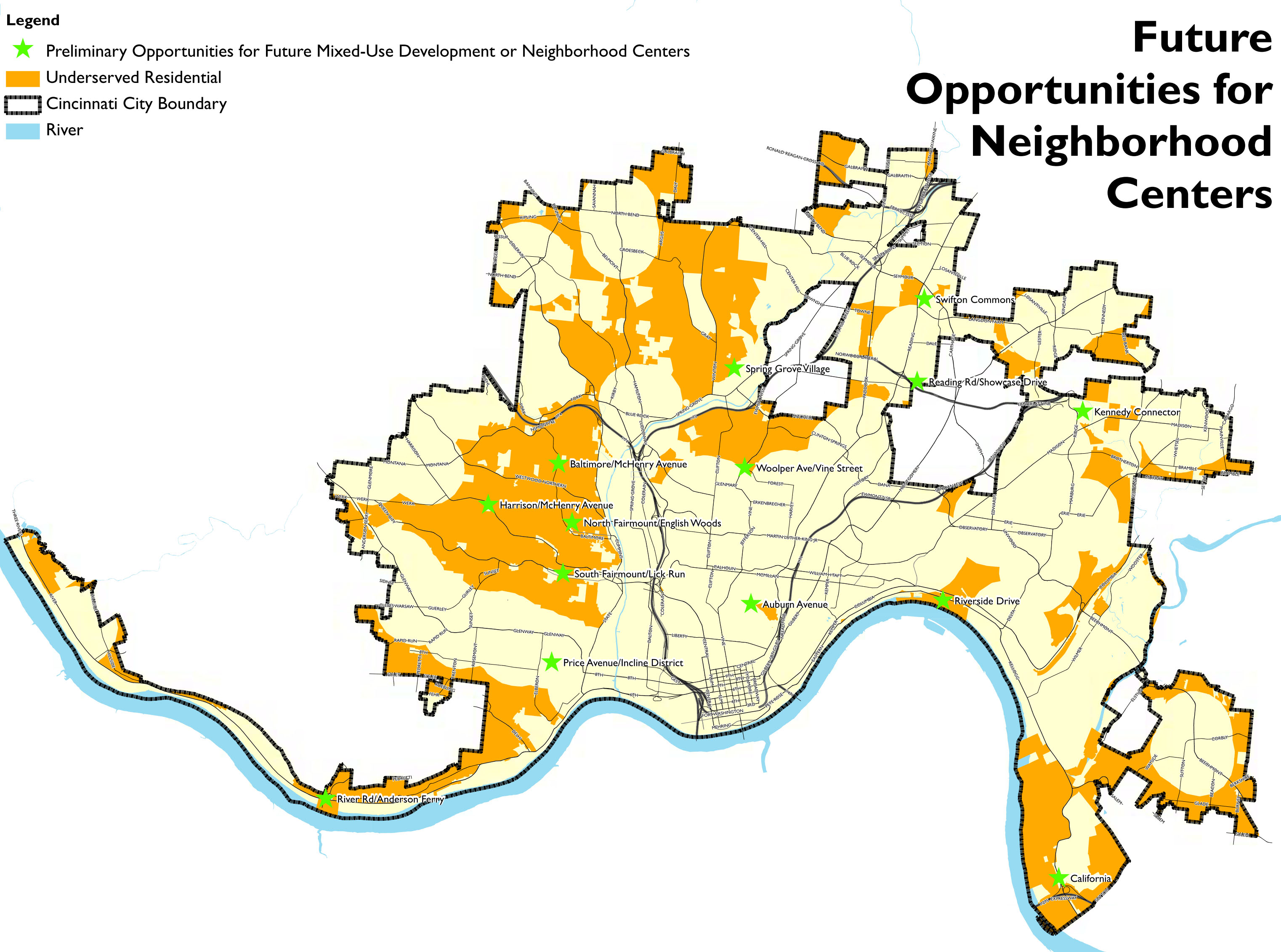
       
Plan Cincinnati recognized 40 Neighborhood Centers throughout the city [LEFT], and identified 14 preliminary areas to examine for future investments that could lead to new Neighborhood Centers [RIGHT]. Maps provided.

“Our neighborhoods are structured around centers of activity that contain all of the amenities that we need to go about our daily life,” the Plan Cincinnati document states. “We will focus our development on these centers of activity, and strategically select areas for new growth.”

From there the plan recognizes which of those neighborhood centers are doing a good job at serving as diverse, walkable centers. Seven are seen as well off and simply needing maintenance; 12 are identified as areas that need to evolve and become more walkable, and the remaining 21 are called on to be transformed with large-scale changes such as infill, redevelopment, and public improvements.

“We will permeate our neighborhoods with compact, walkable mixed-use development, bikable streets and trails, and transit of all types (such as bus, light rail, bus rapid transit, light rail transit, streetcar/circulator vehicles, and passenger rail),” declares the Plan Cincinnati document. “The development of a Complete Streets policy and adoption of a form-based code are tools that will help reach this goal.”

A sobering fact, presented within the plan, is that roughly 22 percent of all Cincinnati households have no automobile, while only a percentage of those households have safe and easy access to the jobs, goods and services they need.
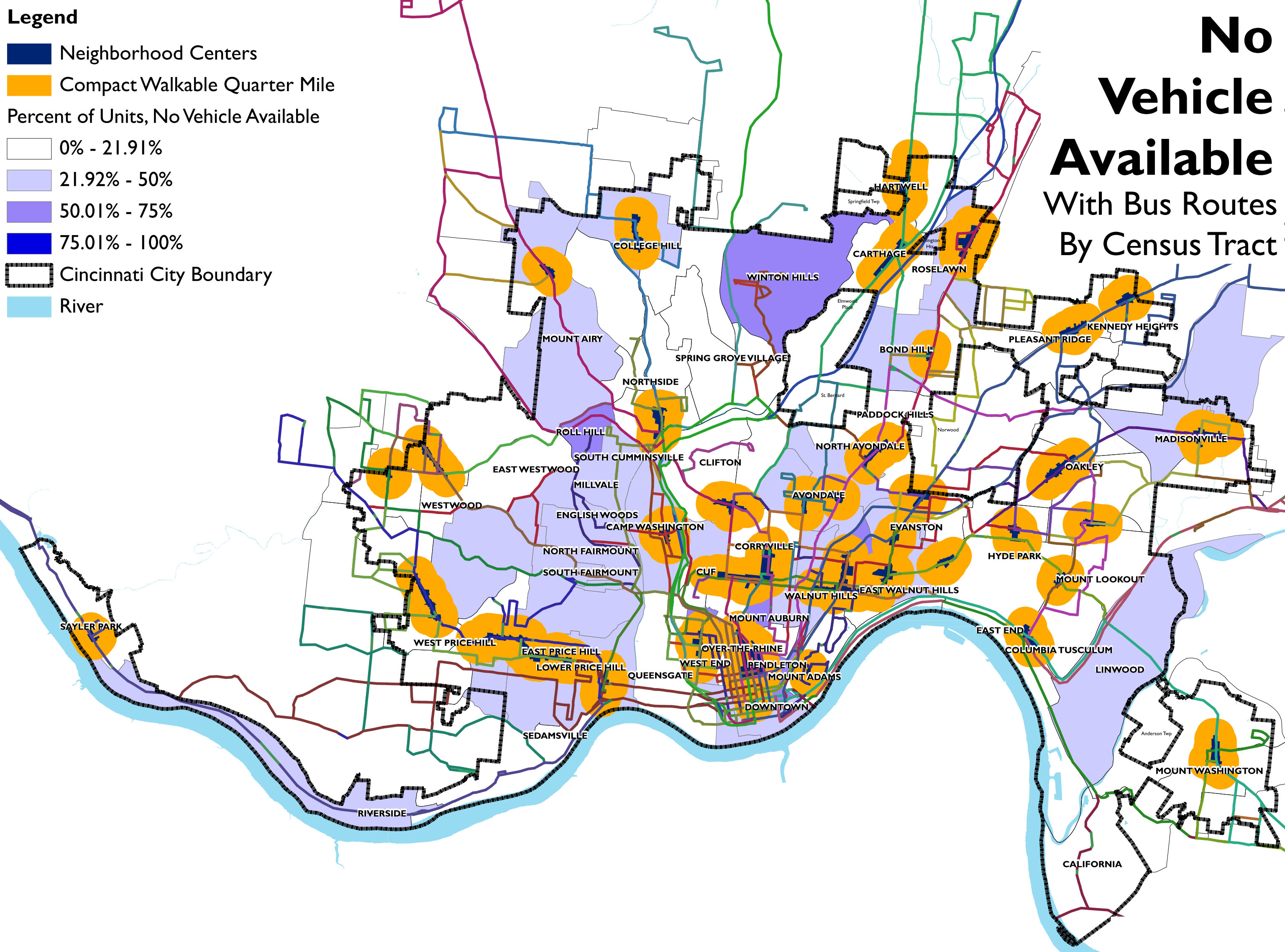

Approximately 22% of Cincinnati households do not own a car, and are not within easy access to the goods and services they need. Map provided.

To help solve that issue, city planners hope to build upon the goal of creating a healthy, sustainable community by eliminating food deserts and providing fresh produce within a half-mile, or 15-minute walk or transit ride, from all residential areas.

City planners acknowledge, however, that building upon existing assets will not be enough in order to create the envisioned outcomes identified within PLAN Cincinnati. As a result, the document identifies 14 preliminary opportunities (see second map) for future mixed-use development that can eventually serve as new neighborhood centers where they are currently lacking.

While the visioning document looks to be unapologetic about its urbanist movement, it also looks to firmly establish Cincinnati as the unapologetic leader within the larger region, stating that consolidation of government services and municipal boundaries will be efforts led by the City of Cincinnati.

PLAN Cincinnati goes into much greater depth on many more topics. Those interested in learning more can download the entire document online, or attend tonight’s Planning Commission meeting where staff will be on hand to answer questions afterwards.

Categories
Arts & Entertainment News

2012 Ohio River Way Paddlefest [VIDEO]

The 11th annual Ohio River Way Paddlefest took place June 21 through 23 at Coney Island, and culminated with more than 2,200 paddlers took to the Ohio River. The paddling event has become the largest of its kind in the Midwest, and according to event organizers, has positioned Cincinnati as “the paddling capital of the United States.”

Paddlefest celebrates the region’s picturesque Ohio River and surrounding hills, and puts a critical mass of recreational users out on what is typically a commercial waterway through the heart of North America.

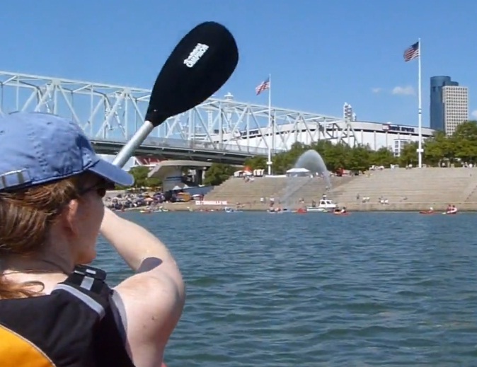
A new video highlights the 8.2-mile journey from the perspective of a kayaker participating in the 2012 Paddlefest. The one-minute video was produced by Vimeo user Brent B. and features scenes of the Ohio River’s natural scenery, the I-471 Daniel Carter Beard Bridge, Serpentine Wall, and Cincinnati’s central riverfront.

Categories
Arts & Entertainment Development News

Cincinnati’s new riverfront park immediately exceeding expectations

If you have yet to visit the first phase of the Smale Riverfront Park, then you need to do yourself a favor and go visit the beautiful new park. From a personal perspective, out of all of the new developments along the central riverfront, the new park is by far the best product and is a true civic asset for Cincinnati.

In the latest video update from project manager Dave Prather, he takes viewers on a tour of the now completed features of the Smale Riverfront Park that are open to the public. Prather also gives some insight into the elements that are soon to come including the continuation of the tree grove, Women’s Committee Garden, Adventure Playground, construction of the river’s edge and the transient boat dock.

“We’re proceeding with design and grant application for the transient boat dock, which will be aligned with the Main Street Fountain,” Prather explained in the project video. “That grant application is due the end of July, and award will be announced around early March next year. So we’re planning on next May to present the completed portion of the tree grove and break ground on the boat dock.”

In addition to the boat dock, Prather says that plans call for construction to begin on the Vine Street Steps next May as well, and would complete the framing of the Roebling Suspension Bridge.

One of the attractions of the first phase of the park is the new Cincinnati Bike Center which is now open to bicycle commuters 24 hours a day, and boasts a retail shop that includes merchandise and allows for people to rent various types of bicycles and Segways.

Reports from various media outlets and first-hand accounts highlight the immediate popularity of the park. One problem, according to Prather, has been that visitors want to play in the dramatic water curtain along Mehring Way which was not designed for interaction.

The early summer project update is nearly 13 minutes in length, and is the first video of the series to highlight a finished product.

Categories
News Transportation

Living car-free can help you save money, live healthier

The American Public Transportation Association (APTA), in partnership with The Sierra Club, The Natural Resources Defense Council (NRDC), and public transportation systems across the country will celebrate the 7th annual National Dump the Pump Day tomorrow.

The event is meant to encourage people take public transit instead of driving a car in an attempt to save money. But ditching the personal automobile can not only save you money, it can help you enjoy a healthier lifestyle.

UrbanCincy was recently contacted by creators of an infographic that breaks down the health issues related to driving. It should be something to consider before you hop into that vehicle of yours tomorrow morning, and every morning thereafter.

Killer Commute

Categories
Business News Politics

Cincinnati’s hillside overlooks profiled in new brochures

The Queen City has long been defined by the Ohio River and its surrounding hills which reminded early German settlers of the Rhine River Valley, but the hills have also provided natural corridors through the city along with valuable real estate for homes and businesses.

In order to help celebrate and promote this unique natural asset, The Hillside Trust is in the process of distributing 50,000 brochures highlighting Cincinnati’s dynamic views from places like Eden Park, Mt. Echo and Bellevue Park.

“These overlooks represent an iconic part of Cincinnati’s landscape and livability,” exclaimed Eric Russo, Executive Director of The Hillside Trust.

Eastern view from Wilson Commons Overlook in East Price Hill [TOP], and Jackson Hill Park Overlook looking southwest from Mt. Auburn [TOP]. Photographs provided by The Hillside Trust.

Russo went on to say that Cincinnati’s numerous overlooks are an asset that can be used to market and promote the city as a unique place to live and work.

The 18 overlooks profiled in the brochures cover the city’s western, central and eastern hillsides. Each of the overlooks were also identified as “high priority” for protection in the 2007 Cincinnati Scenic View Study produced by The Hillside Trust for the City of Cincinnati.

The brochures were funded through $15,000 provided by two family foundations, and are currently being distributed to regional convention and visitor bureaus, the Cincinnati USA Regional Chamber, and libraries and parks throughout the city for free distribution to the public.

The family foundations wanted to see the brochures used in a way to attract attention and encourage the public to visit the prominent overlooks. In addition to photographs of the views from each location, the brochures also include unique facts, features and history about the sites.

“These overlooks originate from park lands, dead end streets, roadways and public staircases,” explained Russo. “All offer unique and spectacular viewing experiences.”

The brochures were designed by Cincinnati-based Linserpelle Creative, and include locator maps so that they may be used for self-guided tours. The brochures can also be downloaded for free on The Hillside Trust’s website.