Categories
News Transportation

New Cincinnati Bike Map Aims to Change the Way New, Old Cyclists View the City

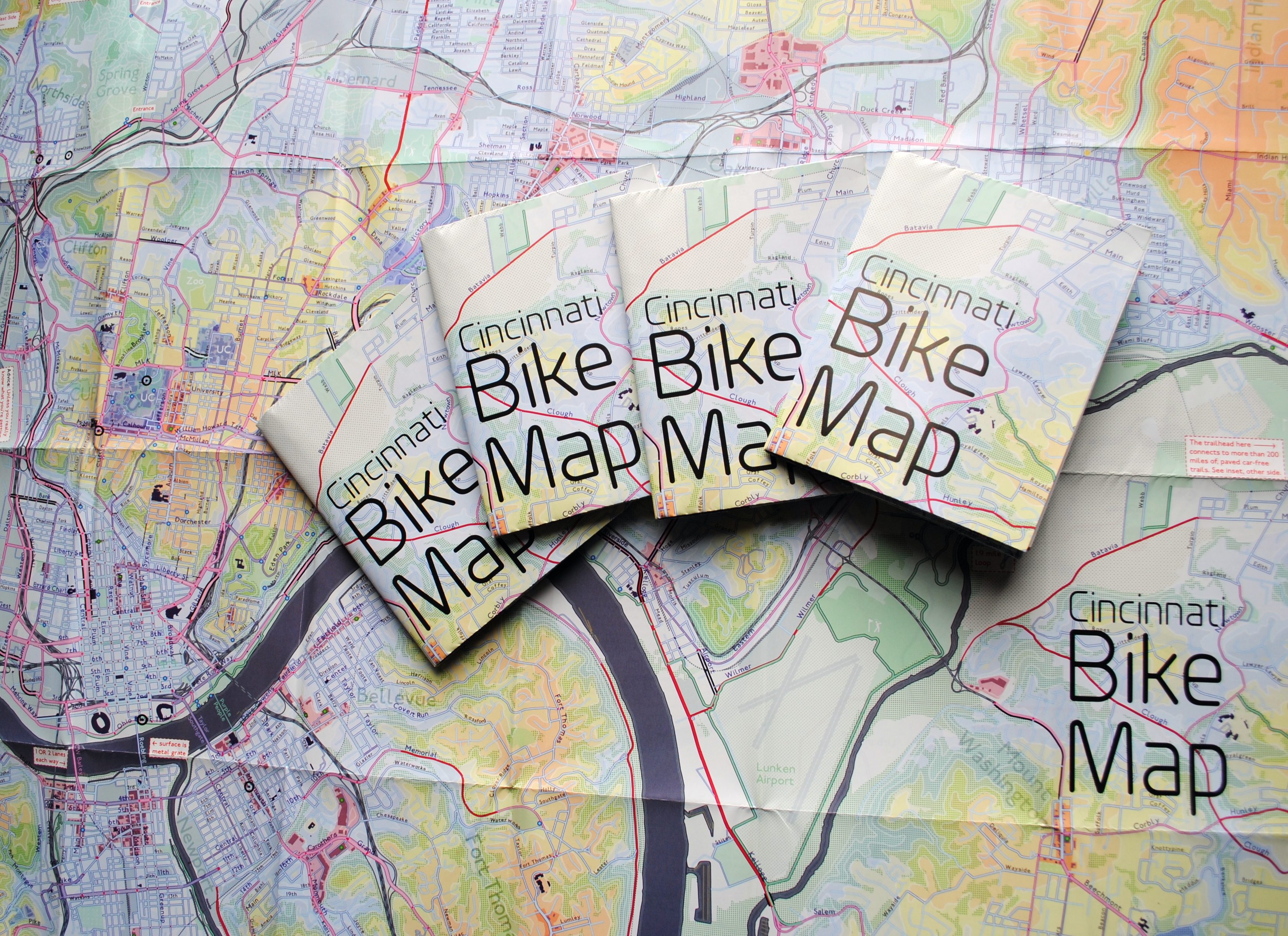
In 2011 Nate Wessel sought out to change the way Cincinnati mapped its transit. In a region with multiple transit operators that all use traditional bus mapping visuals, it was quite the daunting task. But after successfully raising more than $2,000 on Kickstarter, Wessel was able to fund his effort to print tens of thousands of his newly designed maps that ultimately received national praise.

Since that time he has continued his quest to improve the visual nature of map-making in Cincinnati, including serving as UrbanCincy’s official contributing cartographer, but he also embarked on another major endeavor. Instead of a transit map with bus frequencies, Wessel this time focused his energies on creating a new regional bike network map.

“Imagine someone kept taking, and reproducing and sharing, very unflattering photos of you or someone you loved. If you’re like me, you’d probably let the first one slide,” Wessel stated. “Maybe it was an accident, but by the fifth or sixth one, you’d start noticing a pattern and you’d start getting kind of miffed about it.”

This is the feeling the twenty-something urban planner, cartographer and fashion designer felt about the region’s existing bike maps, and he wanted to take control of the situation and improve it.

“This is a subtle visual game and words won’t do,” Wessel explained. “You need to make your own photo that shows the beauty you see in what you love; and then get other people to see what you see.”

One of the ways to accomplish that, he says, is to get the maps into people’s hands – digital maps are not enough. While the physical presence of a printed map gives it a sense of permanency and seriousness, producing a hard copy map also comes with its challenges.

After finishing the design for the Cincinnati Bike Map, Wessel said that he received feedback from the binder recommending a redesign to better accommodate the way the paper would fold, but that it was too late in the process. As a result, he wishes the maps folded a bit better, but that he is otherwise quite pleased with the final product. Perhaps leading to that feeling of satisfaction, however, is the fact that no compromise was needed since the project was entirely self-funded.

“Both times I’ve raised money for these projects it was in advance of having a real demonstrable product,” said Wessel. “In neither project have I ever had to check anything with a sponsor, supervisor or co-designer. The maps were totally my own in both cases, held to my own standards alone and uncompromised. That is very unusual for print maps.”

While quite unusual, it was a situation he preferred. In fact, Wessel says that a local organization very generously offered to fully fund the printing of Cincinnati Bike Map should he work with their graphic designer. A generous offer indeed, but one that came with risks that the final product not turn out as originally envisioned.

The release of the new regional bike map last month comes at a time when Cincinnati is in the national spotlight for its dramatic gains in bike ridership and development of new bike infrastructure.

Now that the project is complete, the goal now shifts to distributing the stack of Cincinnati Bike Maps that now exist. In addition to distributing the maps to local bike shops and organizations, Wessel is also mailing out copies of the map. His hope is that new or unfamiliar riders feel empowered by the maps, and that experienced riders use them to explore new routes throughout the region.

“Regular cyclists have found their favorite routes and will probably stick with what they know,” said Wessel. “Though, I totally discovered Fort Thomas through this map. Every map I’d seen made it look like a pretty crappy, suburban place to ride and I always avoided it; but the streets are beautifully wooded and very slow with 25mph speed limits.

Of course, all of this would not have been possible without access to the treasure trove of data on-hand at Cincinnati City Hall, and with the OKI Regional Council of Governments.

Those who would like to get a free copy of the Cincinnati Bike Map can do so by emailing Nate Wessel at bike756@gmail.com and informing him of your name, how many copies you want, and the address to which he can ship them.
Categories
Business Development News

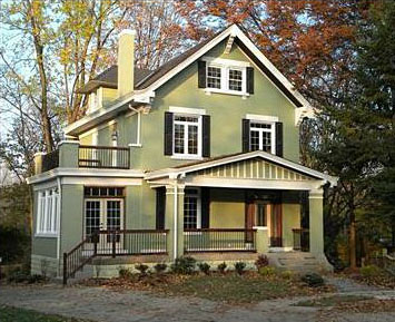
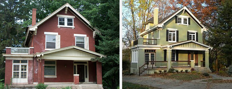
Home ReStart partnering with Neyer Properties to renovate, sell historic Cincinnati homes

Since the inception of Neyer Properties in 1995, the company has developed hundreds of projects totaling over $1 billion in both construction and development in the Cincinnati region.  While the company has typically focused on commercial development, they have begun investing in a new real-estate company called Home Restart. The relatively new endeavor specializes in buying distressed homes, making renovations, and re-selling the properties.

Over the past year, the company has purchased, renovated, and prepared seven houses for re-sale. In that time, they have intentionally focused their efforts in more desirable urban neighborhoods like Hyde Park, Oakley, Edgewood and Fort Thomas.  According to the company’s leadership, this was done to help make the projects successful in an otherwise difficult market.

“The housing market has taken a hit throughout the Greater Cincinnati area, but neighborhoods such as Hyde Park and Fort Thomas always have a relatively active market,” explained Anne Pond, Vice President of ReStart. “By focusing on these areas, we can decrease the number of days that our houses sit on the market.”

According to Pond, the large stock of historic homes in these neighborhoods is another key selling point, as they have a charm that cannot be replicated in new construction.

“Over the years, many older homes have fallen into disrepair and have been converted into two-family homes,” Pond continued. “We work very hard to maintain the charm and character of historic homes, while bringing them up-to-date for modern living.”

Pond says that ReStart typically purchases homes from anywhere between $50,000 and $200,000.  After the initial purchase, ReStart then renovates and sells the properties for prices ranging between $130,000 and $350,000. Following this work, ReStart then turns to Neyer Properties for its expertise in purchase approval, renovations, and finance management.

Of the seven homes purchased and renovated through the program thus far, five have been sold and another is currently under contract.

Categories
Development News Transportation

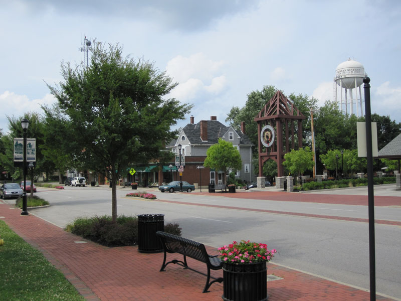
Streetscape projects helping transform Fort Thomas business district

The bedroom suburb of Fort Thomas, Kentucky is perhaps best known for its streets of tidy, well-kept houses and its nationally-ranked public schools. Located along a ridge overlooking the Ohio River and downtown Cincinnati, Fort Thomas is an attractive destination for those seeking the relative peace and quiet of a suburban lifestyle, combined with convenient access to downtown Cincinnati along with walkable streets and plenty of historic character.

In recent years, Fort Thomas has become one of several Northern Kentucky cities seeking to enhance its appeal by revitalizing its historic retail district and rediscovering the benefits of pedestrian-scaled, transit-friendly urban development. Fort Thomas’s neighbor to the north, Bellevue, has received recognition for its ongoing historic preservation work, and Bellevue and Covington have both made strides in implementing form-based codes that could ultimately serve as a model for zoning code changes in Cincinnati.

Over the past few years, Fort Thomas has undertaken a number of projects to enhance the city’s role as an attractive community within Cincinnati’s urban core. These projects include new buildings for Highlands Middle School and Woodfill Elementary School, a new amphitheater and bike trails in Tower Park, and the restoration of the city’s iconic 100-foot-tall stone water tower at the entrance to Tower Park. Perhaps most visibly, though, the city of Fort Thomas has recently completed major streetscaping improvements to its primary business district centered around the intersection of Highland and Fort Thomas Avenues and its secondary business district — the so-called Midway district — located adjacent to the site of the former Army post.

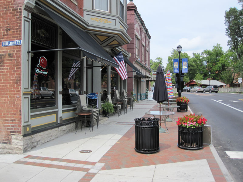
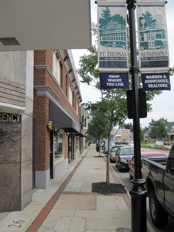
Aspects of the two streetscaping projects included burying overhead utility lines, the reconstruction of sidewalks and crosswalks to include brick accents and other decorative elements, the addition of street trees and thoughtful landscaping, installation of pedestrian-scaled light fixtures and signage, as well as the introduction of benches and other outdoor seating. The first phase to be completed was the primary downtown district at Highland Avenue and Fort Thomas Avenue.

Now complete for a couple of years, the trees and plantings in downtown Fort Thomas have begun to nicely mature. Of particular interest is the focus on the former Green Line streetcar, which provided transit access to the Army post and served as a catalyst for much of the subsequent development in the city from the 1890’s through the 1950’s. Fort Thomas is the classic “streetcar suburb”, and today’s TANK bus route through town still carries the Green Line’s old #11 route number.

Following the completion of streetscaping improvements to the downtown district of Fort Thomas, the second phase involved similar improvements to the so-called Midway district, a secondary business district on South Fort Thomas Avenue that grew up adjacent to the former Army post and was named after the carnival midway at the 1893 World Columbian Exposition in Chicago. The site of the Army post — originally built to replace the flood-prone Newport Barracks — is now home to Tower Park, a large Veterans Administration nursing home, and an Army reserve center.

The streetscaping improvements recently completed in the Midway district are similar in nature to those performed in downtown Fort Thomas. Included in the Midway improvements were the reconfiguration of the River Road intersection, which now provides a small civic space that can be used for outdoor concerts or a farmer’s market, and the addition of sidewalk seating for neighborhood establishments such as the Olde Fort Pub and the Midway Cafe.

There are still a number of vacant storefronts in the Midway district, but it is hoped that the now-completed streetscaping improvements along with other measures, such as the restoration of long-vacant officers’ housing nearby and marketing efforts by the newly-formed Renaissance District, will see the addition of new retail tenants to the Midway district.