Categories
Business News Transportation

Car-Sharing Could Reduce Costs, Improve Efficiency of Cincinnati’s Vehicle Fleet

When a brother and sister are fighting over the same toy, a parent quickly steps in and teaches the children to take turns and share.

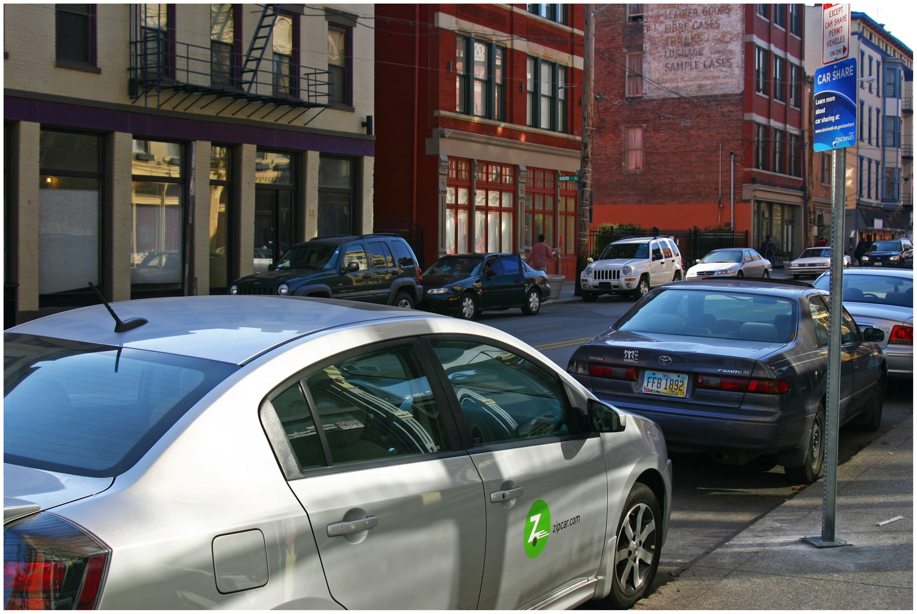
Now that Over-the-Rhine parking is at a premium, and the residential permit plan has been vetoed, the residents of OTR are going to have to find a way to share parking, or risk losing more of the historic neighborhood to parking lots and garages. Sharing also presents an opportunity when it comes to modernizing the City of Cincinnati’s fleet of 2,149 vehicles.

Mayor John Cranley (D) received unanimous support for this year’s budget, which includes $110 million to make much-needed upgrades to the City’s fleet and roadways over the next six years. While some vehicles, like those for police and fire, cannot be shared, others certainly can; and by implementing a program like Zipcar’s FastFleet program, Cincinnati would benefit from significant savings and operating efficiencies.

In 2012, an internal audit of the Fleet Services Division found that fleet management has been “unwieldy” and mentioned that a knowledgeable and empowered staff is needed to properly manage the system. This has proven difficult over the past decade due to a severe cut in funding for the department in 2003.

“Almost the entire management team left the department near the end of 2007 and was not replaced,” the internal audit noted. “While the staff operates to the best of their abilities, they are undermanned without the resources to correct the inertia of the department.”

The Fleet Services Division operates under the Public Services Department, and controls and maintains 2,149 motorized vehicles for various departments at City Hall. These departments pay $63 an hour for maintenance and repair of the vehicles and are allocated a portion of the capital budget based on their proportion of need with regards to their percentage of obsolete fleet.

In 2011 Fleet Services was allocated $4,301,900 in capital dollars and $5,240,600 was allocated for 2012. These numbers are expected to rise as soon as the approved budget is published on July 1, but more money for new vehicles is only part of the solution. The 2012 audit also recommended reducing the size of the fleet, evaluating underutilized equipment, and examining the cost of leasing sedans and light trucks.

With services like FastFleet, City Hall could optimize its fleet without degrading operations, thus lowering maintenance and administrative costs.

FastFleet works by tracking vehicle usage by employees through GPS monitoring systems. This enables the service to produce real-time data, with recommendations on synergy and optimization. Once this data is analyzed, car assignments can be reorganized to allow for sharing of each vehicle by city employees, ultimately allowing for more efficient usage of vehicles.

In Washington D.C., city officials there were able to benefit from $6 million in savings over a five-year period by eliminating more than 200 administrative vehicles from their fleet. While Cincinnati’s fleet is smaller than the nation’s capital, proportional savings are safe to be assumed.

With City Hall poised to invest millions into its fleet operations, now is the perfect time to look into a solution such as this that could potentially reduce the City’s fleet, while also improving its performance.

A program could even be put in place to allow for public use of the vehicles, akin to the city’s existing Zipcar system, when city employees are not in need of the fleet. The revenue collected from these services could then be used to offset the public’s cost of maintaining the city’s fleet, while also expanding car-sharing services to other neighborhoods outside of the city center.

As it stands now, the City of Cincinnati does not even know what the optimal size is for its vehicle fleet. Tracking the performance of the fleet and analyzing the data will help bring clarity to the matter, and allow for the fleet to perform more efficiently.

Implementing a vehicle sharing program for Cincinnati’s municipal fleet would help save additional taxpayer dollars, improve operations and bolster car-sharing throughout the city.

EDITORIAL NOTE: Chad Schaser contributed to this article.
Categories
Development News

What Does Anthem’s Relocation to Oakley Mean for East Walnut Hills?

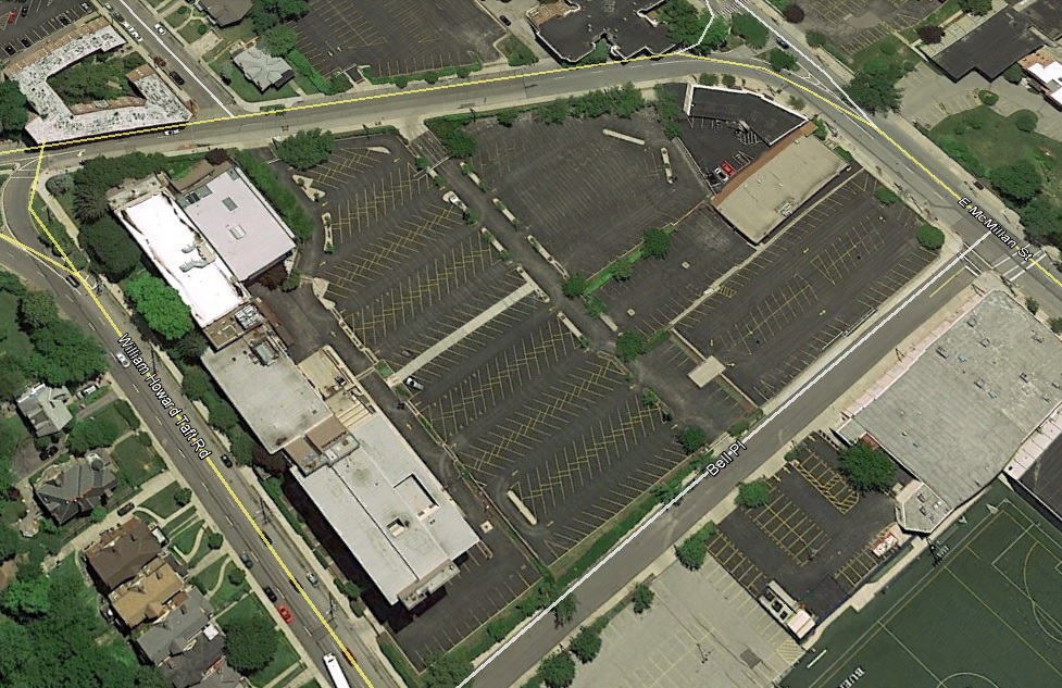
After having been located in East Walnut Hills along William Howard Taft Road for many years, Anthem Blue Cross and Blue Shield recently announced that they would move to Oakley into a new $13 million, 80,000-square-foot office building at Oakley Station.

Shortly after the announcement, Mayor John Cranley (D) said that the insurer was prepared to move its 400 jobs outside of the city, should the economic incentive deal not have been struck.

“We’ve got to keep these jobs in the city,” Cranley told the Business Courier on June 25. “The infrastructure that we’re building – the public garage – is not going to just support Anthem but the entire Oakley Station development.”

There is a lot of truth to what Mayor Cranley said, considering the City of Cincinnati generates the majority of its revenues from income tax collections. This means the preservation and growth of jobs – particularly high-paying ones like these – is of the utmost importance for leadership at City Hall.

But this move does a lot more than maintain 400 high-paying jobs; it also will open up a key piece of property in one of the city’s up-and-coming neighborhoods.

Walnut Hills is booming so much that it will create a really exciting development pad,” Cranley continued. “I’ve heard people think they can reuse it as office. People say that they want to tear it down and use it for market-rate housing. In concert with the neighborhood, either one of those can make a lot of sense. It will see new life quickly.”

While the loss of that many jobs is rarely welcome news for a neighborhood, leadership at the Walnut Hills Redevelopment Foundation says that they have been prepared for it.

“We have known about Anthem for a few months and have been brainstorming,” Kevin Wright, Executive Director of the WHRF, told UrbanCincy. “We haven’t been involved in anything specific, but there is a great opportunity to do something with this site that further connects the McMillan and Woodburn commercial corridors.”

Wright went on to say that the neighborhood is focused on enhancing the walkability of the area. One such effort to do that is the conversion of surrounding streets from one-way to two-way traffic.

Located on the eastern end of the McMillan business corridor, the Anthem site occupies 6.3 acres of land, with nearly 70% used as surface parking lots. A redevelopment of the site, which is one of the largest of its kind in this part of the city, could free up enough land to develop hundreds of housing units, along with thousands of square feet of commercial space.

“There’s momentum in Walnut Hills, both east and west of Gilbert, as well as in East Walnut Hills,” said Blake Bartley, a commercial real estate agent with Urban Fast Forward who is working on several projects in the neighborhood. “This site could be the catalyst for bridging the gap between development in both neighborhoods. Plus, you don’t often find a redevelopment site of that caliber located so close to the urban core.”

While neighborhood and city leaders see great potential for the site, it is not yet known what will happen to the site when it is sold. The hope is that Anthem, through its subsidiary Community Insurance Co., will do something in coordination with neighborhood leaders to ensure that it is redeveloped in a manner that fits with the community’s vision for it.

Preliminary construction work has already taken place at the sprawling, 74-acre Oakley Station site, and it is expected that Anthem will be able to move into the new office building as early as summer 2016.

Categories
Development News

Proposed Tax Would Provide Dedicated Parks Funding Stream, $85M in Improvements

A campaign to improve Cincinnati’s parks by raising the City’s property tax by 1 mill will “change the city for the better,” according to Cincinnati Mayor John Cranley (D).

Cranley made his remarks during the official launch of the Citizens for Cincinnati Parks levy campaign on Saturday morning at New Prospect Baptist Church in Roselawn.

The charter amendment would raise the City’s property tax rate to 13.1 mills and would bring in approximately $5.3 million a year. The move would require City Council to fund the Parks Department’s capital budget at its 2016 budget level, and approve bonds for capital improvements using levy revenue.

Proponents say that 75% of the levy revenue will be available for the City to borrow against in order to fund 13 designated capital projects selected by the mayor and city manager. The remaining 25% will go to system-wide maintenance and operating costs.

“We’re asking to voters to pass a very small property tax that we believe, for that small amount of money – $35 a year per $100,000 value – will increase property values and increase the quality of life for all Cincinnatians as we take the wonderful park system and we bring it to the neighborhoods,” Cranley said.

The group needs to collect approximately 6,000 signatures by August 15 to make it on to the November 3 ballot. Cincinnati Parks has not placed a levy on the ballot since 1927.

“We have decided that the only fair way to do this, if we’re going to be asking the taxpayers to pay more money, is to ask the citizens first to even let us put it on the ballot,” Cranley said. “At the end of the day, we’re putting this decision in the hands of the voters, and we believe the value proposition is there. We believe that this will build a better city.”

Vision needs funding
Board of Park Commissioners President Otto M. Budig, Jr. said that his organization has been charged with creating the best parks system in the country, but despite generous City funding and donor contributions, it continually finds itself short on money for major initiatives.

“We have had some difficulty in developing major projects that have long been needed,” he said. “I went to the mayor and I said, ‘We need these funds to bring about a new vision. You give us a vision, we’ll take care of the details.’ The mayor has given us the vision.”

While many of the projects are only in the conceptual stage at current time, the Citizens for Cincinnati Parks website says that they were chosen due to being the most shovel-ready, with the ability to be completed quickly.

Multipurpose recreational trails are a major component of the plan, including the Oasis River Trail ($8 million), Wasson Way ($12 million), Mill Creek Greenway Trail ($5 million), and the Ohio River West Trail ($6 million). The City also plans to work with the Cincinnati Off-Road Alliance to develop more than 20 miles of off-road trails in Mount Airy Forest ($11 million).

“The bike system that will be created as a result of this levy, off-road, which is a big thing for me – I think off-road is a much safer, dedicated path that doesn’t have as many accidents – the most extensive, bicycle urban path in America,” Cranley said.

The plan would also raise $10 million for a joint venture between the City, the University of Cincinnati, and Clifton Town Meeting to create a new master plan for Burnet Woods.

“As I often say, Burnet Woods – even more so that Washington Park – could be the Central Park of Cincinnati,” Cranley said. “If you think about Corryville, CUF, Clifton, Avondale…all surround this park. It’s the densest part of the city and it’s right across the street from 30,000 students. We can have the same impact with that park as we did with Washington Park.”

Other projects include:

  • Developing part of the 20-acre New Prospect Baptist Church grounds into a communal programming center, athletic fields, and an urban camp site that would cost $8 million;
  • A public-private partnership with Western & Southern Financial Group that would provide $5 million to renovate and reprogram Lytle Park;
  • $5 million for the redevelopment of a portion of the former Mercy Hospital complex in Westwood into athletic fields and green space for an expanded Oskamp Park;
  • A $5 million redesign of Ziegler Park in Over-the-Rhine/Pendleton, in conjunction with the Cincinnati Center City Development Corporation (3CDC);
  • $4 million for streetscape and roadway improvements surrounding Christ Hospital and improvements to Inwood Park in Mount Auburn;
  • $2 million for the preservation of the historic King Studios site and development of a small café/museum in Evanston;
  • $2 million for upgrades around Westwood Town Hall and Epworth Avenue; and
  • $1.8 million for a new boat dock/marina at Smale Riverfront Park.

“Now we have this new vision,” said Parks Director Willie Carden, who already has overseen the amazing transformations at Smale Riverfront Park and Washington Park, among others. “The vision brings ‘parkonomics’, partnerships to the neighborhoods. We can do this. We can make this a safer, healthier community, but we need your help.”

Categories
News Transportation

Everything You Need to Know About the Proposed Elmore Street Viaduct

In the mid-2000s, ODOT designed a $1 billion reconstruction of I-75 between the Ohio River and I-275 that attracted little attention from the Cincinnati media. Who would win and who would lose as access points were shifted, added, or permanently closed?

Aside from a successful effort in 2006 by OKI to retain access at Galbraith Road over ODOT’s objections, virtually no public objections were made as multi-million dollar contracts were let; and work commenced in 2011 on a mega-project that will shape Cincinnati’s traffic patterns and property values for the next fifty years.

ODOT’s design strategy for the Mill Creek Expressway (Western Hills viaduct to Paddock Rd.) and Thru the Valley (Paddock Rd. to I-275) projects aimed to improve capacity and safety by reducing points of access and mitigating complex merging movements. This means most of I-75’s left-side ramps will be rebuilt as right-side ramps, and odd partial interchanges, such as the Towne Street ramps in Elmwood Place and the famous southbound “canyon” ramps in Lockland, will be permanently removed.

ODOT has already closed a lightly-used ramp providing access to I-75 southbound from Spring Grove Avenue, and another exiting I-74 westbound at Powers Street in Northside.

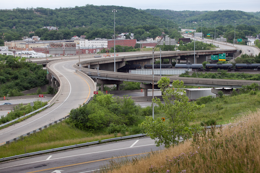
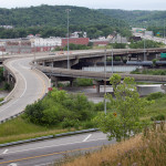
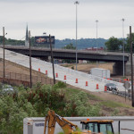
In 2016, ODOT plans to permanently close two ramps near Cincinnati State Technical and Community College. One provides access to I-75 northbound from Central Parkway, while the other provides access to Central Parkway from I-74. The planned closure of this final ramp – an unremarkable 250-foot deck girder overpass spanning I-75 near the Ludlow Viaduct – has been public knowledge for nearly a decade, but only recently has its closure generated opposition.

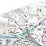
Evidence suggests that replacement of Central Parkway access from I-74 was discussed in the mid-2000s via an aerial structure approximately 10 times longer than the current 250-foot overpass. A drawing from February 2007 illustrates that the flyover ramp would have diverged from I-74 near the Colerain and Beekman Street interchange, bridged Elmore Street, then deposited traffic onto Central Parkway very close to the location of the current ramp.

Despite an effort led by Cincinnati State and then Vice Mayor Roxanne Qualls (D) several years ago, ODOT has not capitulated to recent pleas by Cincinnati State and the City of Cincinnati to reestablish the access provided by the existing 250-foot exit ramp with a similar ramp forking from the planned I-74 east to I-75 north ramp.

Such a ramp would not comply with current Federal Highway Administration guidelines, which discourage local access ramps built in close proximity to “system” interchanges, and local access ramps that diverge or join system interchange ramps. In fact, construction of a new ramp similar to what currently exists would violate Section 6.2.11 and Section 6.2 of FHWA code.

ODOT’s refusal to permit reconstruction of the I-74 ramp to Central Parkway, however, is inconsistent with its recent activities elsewhere in the state.

As part of the $200+ million reconstruction of the I-71/I-670 interchange in Columbus, an exit ramp to Leonard Avenue, a local residential street, was built in the middle of a “system” interchange. No reciprocal access to I-71 south was built, meaning this new ramp violates two sections of the FHWA’s guidelines and created a new situation identical on paper to the one ODOT seeks to eliminate in Cincinnati.

Access to Cincinnati State Community College from I-74 after 2017
In 2015, the City of Cincinnati, with the endorsement of Mayor John Cranley (D), outlined plans for an entirely new 2,500-foot viaduct connecting Elmore Street in South Cumminsville with Central Parkway at Cincinnati State. Ostensibly the proposed viaduct will restore the easy access from I-74 that Cincinnati State will lose in 2017; and, according to Cincinnati State President O’Dell Owens, help attract and retain students who commute from the city’s western suburbs.

To be sure, the proposed viaduct will improve access to I-74 westbound, as no direct access currently exists. But inbound travel will be significantly slower than what presently exists, and not much faster than what would exist if it weren’t built at all.

Perhaps the Elmore Street Viaduct, or something similar to it, could have been better integrated with the I-74 Beekman Street ramps if access to Central Parkway had been deemed a priority 10 years ago – instead ODOT completed a significant rebuilt of the interchange in 2014 with no provision for a new viaduct to Central Parkway.

Access to Cincinnati State Community College from I-75 after 2017
Missing from the Elmore Street Viaduct conversation, however, is the character of Cincinnati’s access from I-75. Currently, commuters from city’s northern neighborhoods must pass Cincinnati State on southbound I-75, exit at Hopple Street, then backtrack one mile north along Central Parkway. Commuters using I-75 north must exit a mile south of the college, traverse the new jug handle connection between Martin Lurther King Drive and Central Parkway, then drive one mile north.

If the current circuitous path I-75 commuters use to reach Cincinnati State isn’t discouraging attendance by prospective students from those neighborhoods, why does President Owens contend that use of the very same Hopple Street exit ramp will discourage I-74 commuters?

Why No Ludlow Avenue Interchange?
Missing from I-75’s initial 1950s construction, and its current reconstruction, is a full interchange at Ludlow Avenue. A new diamond interchange on the Ludlow Viaduct would have created ideal access to Cincinnati State, a new alternative route to the University of Cincinnati and the hospitals, and significantly increased property values in Northside.

Construction of a new interchange at Ludlow Avenue does not appear to have entered into ODOT’s conversations a decade ago, nor did construction of an interchange at Vine Street in St. Bernard.

MetroMoves and the Future of the Rapid Transit Right-of-Way
In 2002, Hamilton County voters defeated MetroMoves, a half-cent sales tax that would have funded improved countywide bus service and construction of various modern streetcar and light rail lines. The initiative planned for the convergence of two light rail lines above the I-75/I-74 interchange that would have provided direct access to Cincinnati State via a station located on the west face of its hill above Central Parkway.

The convergence of two lines just north of the property promised frequent train service for the community college, even during off-peak hours; however, no call for improved public transportation has been heard from those currently pushing for the Elmore Street Viaduct.

What’s more, there has been no call to incorporate a provision for rail transit on the proposed Elmore Street Viaduct. When looking at ODOT’s 2007 drawing, it is plain to see how the proposed structure could be integrated into the light rail network, thus eliminating the high expense of a dedicated light rail viaduct over the I-75/74 interchange in the future.

Meanwhile, ODOT’s reconstruction of I-75 will leave the old Rapid Transit Loop right-of-way mostly intact between the subway portals and Cincinnati State – meaning only a 100-foot bridge over Marshall Avenue will be necessary to construct a fully grade-separated surface line between the subway portals and Cincinnati State.

EDITORIAL NOTE: After this article was published, Mayor John Cranley’s office, through spokesperson Kevin Osborne, contacted UrbanCincy and provided additional information regarding the efforts of then Vice Mayor Roxanne Qualls to piece together funding for a smaller, yet similar project years ago. This article has been updated to reflect that reality.

Categories
Development News Transportation

Cincinnati Reaches Agreement With Norfolk Southern on Purchase of Wasson Railroad Corridor

Cincinnati City Council’s Neighborhoods Committee gave a unanimous okay to an ordinance that would solidify an agreement to purchase 4.1 miles of railroad right-of-way from Norfolk Southern for $11.8 million, providing a key piece of the 7.6-mile Wasson Way recreational trail.

The agreement would give the City a two-year purchase option for the property, which extends between the Montgomery-Dana intersection along the Norwood/Evanston line to the intersection of Red Bank and Wooster roads in Columbia Township.

The ordinance was a last minute by-leave item on the committee calendar, made necessary due to a TIGER grant application that is due on Friday. Project backers are seeking $17 million of the $20 million project cost, and City support makes their application much more attractive.

The trail has been in the works since 2011, and a group of nearly 20 volunteers with the Wasson Way nonprofit got a big boost when Mayor John Cranley (D), City Manager Harry Black, and City staff assisted with the negotiations.

“We started looking at the TIGER grant application,” said Mel McVay, senior planner at Cincinnati’s Department of Transportation & Engineering. “They really talk about ‘ladders of opportunity’, increasing mobility and accessibility for folks throughout the region, and so we saw an opportunity between the property we could purchase and some property we already had, and some existing trails.”

Director of Department of Trade and Development Oscar Bedolla spelled out the project’s urgency.

“One of the statutory requirements associated with the scoring for TIGER is related to readiness,” he said. “And so, the more that we can do to show that the project is potentially shovel-ready enhances our ability to acquire or be selected for TIGER funding.”

Bedolla added that under the terms of the agreement, the City would pay nothing in the first year if it does not proceed with the purchase. If the purchase is pursued within the second year, there would be a 5% fee added to the price.

The City’s matching funding of between $3 million and $4 million for construction costs could be made up of a combination of state and federal grants, plus funds raised by Wasson Way, he said.

Still up in the air is approximately two miles or the corridor between the Columbia Township end point and Newtown, where it could connect with the Little Miami Scenic Trail.

“We’re working on it,” McVay said. “Unfortunately, the railroad was not open to selling any additional property east of that point. We’re investigating three or four ways that we can get farther east to the existing Little Miami Trail. We’re very confident we can get there.”

David Dawson, a resident of Mt. Lookout and realtor with Sibcy Cline, expressed concern about how a long-envisioned light rail line could be brought to the corridor once its freight rail designation is abandoned – a legal process that is handled by the U.S. Surface Transportation Board.

“It just can’t be said enough, in my view, that the City will now become the steward of a very valuable asset,” Dawson said. “This is a regional corridor that, in this day and age, cannot really be duplicated. If we lose that ability to eventually have transit, rail transit, or some sort of transit in the future, we won’t be able to put it back.

Dawson and other rail advocates are calling for the corridor to be railbanked, so that the addition of light rail transit remains an option in the future.

“This doesn’t just connect our neighborhoods, but in the future it has the potential to connect the entire region out to Clermont County,” Dawson said.

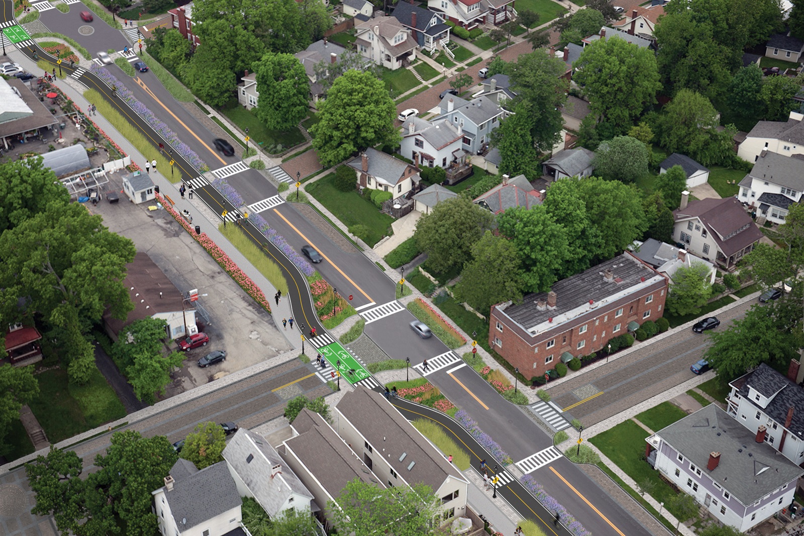
The use of this corridor has long been eyed for light rail transit, including in the 2002 MetroMoves regional transit plan. A 2014 study by KZF Design recommended a design solution that would preserve the ability to develop both light rail transit and a trail; and estimated that such an approach would bring the cost of developing the trail to approximately $11.2 million.

Andrea Yang, senior assistant City solicitor, said that the purchase agreement would give the City some time to work out those issues.

“The way that the abandonment process is structured, there is a time period which we could utilize to further investigate other options,” Yang said. “Had we chosen to railbank the property and attempt to preserve it, it would actually follow the same process for abandonment, so there’s definitely time to look into that if that is what Council’s interested in seeing.”

In April, Cincinnati’s Planning Commission voted to place an Interim Development Control Overlay District on this corridor in order to give the city more time to allow plans to progress without new development creating new conflicts.