Categories
Opinion Transportation

Opinion: A Boulevard for Brent Spence Bridge Exit

Covington is in the midst of a redevelopment wave. A number of prominent historic buildings have recently been rehabbed and several large new mixed-use buildings are in the planning stages or under construction.

Two of the new projects, “Riverhaus” at 501 Main Street, and the John R. Green Lofts at 411 West 6th Street are scheduled to bring 369 new apartments into the Main Strasse neighborhood.  Census tract 603 covers most of the Main Strasse neighborhood and it shows 1,491 residents living there in 2015. Those two new projects will add a significant increase in the local residential population density.  Their ongoing progress reflects the demand for residential development in pedestrian-friendly urban spaces.

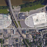
Part of Covington’s urban core that hasn’t seen any new residential development is the area north of 4th street between Madison Ave. and I-75.  Dubbed “Hamburger Heaven” in the city’s recent City Center Action plan, it contains multiple fast food restaurants, the sprawling one-story IRS center, and a sea of parking lots. Part of the reason the area hasn’t seen any development is that Covington’s 4th Street delivers 27,000+ cars per day to I-75. That much traffic is incompatible with pedestrian-friendly urban space.  

The City Center Action Plan makes redevelopment of the Hamburger Heaven and IRS sites a priority but it does not address the area’s inhospitable traffic. It’s a problem: How do you connect new development north of 4th street to the existing pedestrian-friendly urban fabric while maintaining all the traffic to the interstate?

The imminent closure of the IRS site presents an opportunity to address the problem. The 23-acre site covers 3-1/2 blocks of frontage on 4th street. Most of the remaining space adjacent to 4th street between the IRS site and I-75 consists of parking lots.

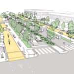
Once the IRS site is closed, the city of Covington should widen 4th street and convert it into a multiway boulevard.

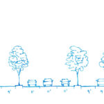
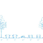
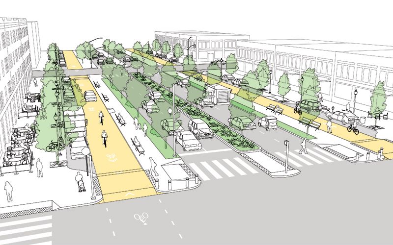
A multiway boulevard consists of a series of central lanes to move through-traffic, side lanes with on-street parking to serve local vehicles and bicycles, and broad sidewalks to serve pedestrians. Tree-lined medians separate the local traffic from through-traffic, and trees on the sidewalk further separate pedestrians from traffic. Think of it as a “mixed-use street.” Because the street supports a different mix of uses – people, bicycles, transit, through traffic – it can more readily support mixed-use buildings at its edges. Mixed-use buildings add the density and diversity of uses that support pedestrian-friendly urban space.

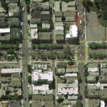
San Francisco recently took an existing street and converted a portion of it into a new multiway boulevard. The creation of Octavia Boulevard was possible because an earthquake damaged a freeway and made it unusable. Instead of rebuilding the freeway, San Francisco added its right-of-way to a four-block stretch of Octavia Street, which became Octavia Boulevard.

Today, Octavia Boulevard moves 45,000 cars per day in two directions, it has side streets and broad sidewalks to serve local residents, and the creation of the street spurred new development on its edges. Octavia Boulevard sets a clear precedent for converting underutilized auto-oriented development into more productive mixed-use urban development. Octavia Boulevard is aesthetically pleasing, practical at moving traffic, and successful at promoting economic development.

To implement Covington’s “4th Street Boulevard Project” the street’s existing 50-foot right-of-way would be widened to the north to create a 100+ foot wide right-of-way.

The expanded right-of-way will accommodate the multiway boulevard’s additional lanes, medians, and sidewalks. Expanding the right-of-way will require part of the IRS parcel, a number of parking lots, and the demolition of a fast food chain restaurant.

Different design options could include making 4th street’s through lanes either one-way or two-way. A dedicated transit lane could be accommodated. Bicycles can share the local lanes with local vehicular traffic.  

Implementing the 4th Street Boulevard Project would have multiple effects that support the ongoing urban renaissance. The medians and parked cars provide protection for people to walk, eat, drink, and socialize outside. Trees also protect pedestrians and provide a canopy for shade and cooling. Bicycle use will be safe and easy. Converting 4th street from a single use – channeling cars to I-75 – into a multiway boulevard will facilitate the development of dense mixed-use buildings.

There’s a historic opportunity here. The IRS site was born out of federal urban renewal projects in the 1950s. Its time is now at an end.  The trend of the future is to live, work, and play in the urban core. The current traffic on 4th street is a barrier to urban development. Converting 4th street into a multi-way boulevard will support the traffic flow but mitigate its negative impacts. Recent examples provide good evidence.

If the ongoing urban development is to be sustained and space north of 4th street – just blocks away from the Ohio River – is to be put to its highest and best use, then the traffic along 4th street must be addressed. Converting 4th street into a multiway boulevard will do just that.


This is a guest editorial by Chris Meyer that originally appeared in the CNU Midwest blog. CNU and CNU Midwest are content partners with UrbanCincy.

If you would like to have your thoughts and opinions published on UrbanCincy, simply contact us at editors@urbancincy.com.
Categories
Up To Speed

Region’s Demographics More Closely Resemble 1950s America Than Today’s

You often hear American politicians speak about “Normal America” in a reference to the country’s historical small town narrative – one that is also defined by a largely white, European-derived population. FiveThirtyEight actually dug into the data and found that Normal America is most often found in racially diverse metropolitan regions between 1-2 million people in size.

One of the outliers in their assessment, however, was Cincinnati, which ranked as one of the top ten places in America that are most similar with 1950s America. Indianapolis joined Cincinnati as one of two large regions in this status. What’s more is that Kentucky (#1), Indiana (#3) and Ohio (#7) all ranked within the top ten states that most resemble 1950s America, not the one of today. More from FiveThirtyEight:

We all, of course, have our own notions of what real America looks like. Those notions might be based on our own nostalgia or our hopes for the future. If your image of the real America is a small town, you might be thinking of an America that no longer exists. I used the same method to measure which places in America today are most similar demographically to America in 1950, when the country was much whiter, younger and less-educated than today.

Categories
Business News Transportation

Knight Foundation Announces Nearly 150 Finalists For Cities Challenge

The Knight Foundation will announce their list of finalists in the Knight Cities Challenge today. The finalists have been pulled from a collection of more than 4,500 ideas submitted through the challenge to help improve the vibrancy of cities throughout America.

The competition, as with all Knight Foundation grants, is limited to the 26 communities where the organization focuses its efforts. The nearest cities to Cincinnati include Akron and Lexington – both of which were places where the Knight brothers once owned newspapers.

“Through the challenge we want to find new voices and new ideas that capture the three key ingredients of city success—talent, opportunity and engagement,” said Carol Coletta, Knight Foundation vice president for community and national initiatives. “We see these as essential to the challenge and to building stronger futures for all of our cities.”

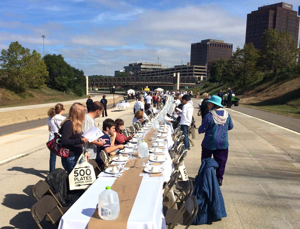
Akron has become a bit of a darling in the Knight Foundation group as many efforts originating their so tightly align with the non-profit’s core values. In fact, this past October Akron grabbed national headlines when it staged a 500-person dinner on an underutilized highway in the heart of the city – an effort the Knight Foundation supported financially.

The winners of this year’s challenge will be awarded grants to implement their ideas from a pool of $5 million. The target, program officials say, is to invest in civic innovators who help cities attract and keep talented people, expand economic opportunity and create a culture of engagement. Such a model is similar to what People’s Liberty has taken on here in Cincinnati.

Three projects that may prove of interest to leaders here in the Queen City include the Tree Debris to Opportunity project in Boulder, and the New Flavors Food Truck project in North Dakota.

In Boulder, city officials are looking to turn tree debris into an opportunity by training members of the community looking for new skills into collectors and artisans. Through the project, participants would work with the city to collect tree debris and turn it into furniture and art – thus improving the cleanliness of the city and providing the participants with new skills.

In Cincinnati, such a program could potentially help bolster Mayor John Cranley‘s Hand Up Initiative which is aiming to lift 4,000 Cincinnatians out of poverty, while also helping improve the cleanliness of city neighborhoods.

The proposal for the New Flavors Food Truck looks to capitalize on the continued popularity and low-cost of food trucks. In this effort, the organizers would use a generic food truck to provide opportunities to new immigrants to start new food service businesses or restaurants.

With Cincinnati placing a growing interest in embracing and growing its immigrant population, an idea akin to this might serve as a good building block to empower those individuals.

The Knight Foundation will select the winners from this pool of nearly 150 finalists later this spring.

Categories
News Transportation

How Do You Want OKI To Shape Future of Region’s Transport Network?

The OKI Regional Council of Governments is in the midst of updating its 2040 Regional Transportation Plan. In the early stages of developing this plan, they region’s designated metropolitan planning organization is looking for feedback regarding the types of transportation and land use policies it pursues over that time.

As of now, agency officials are looking for public feedback in the form of an online survey that takes less than five minutes to complete. It asks the public what kinds of transportation modes should be prioritized, where the region’s transportation network is lacking, whether maintenance or expansion should be prioritized, and how you currently and would like to get around for your daily needs.

Planners at OKI say that the results of this public input will help define what types of transportation improvement recommendations are made in June 2016. This is critically important since OKI serves as the regional authority in charge of administering federal transportation dollars.

Over the past four years this has included $86.3 million for 77 roadway projects, $22.9 million for 12 transit capital improvements, and $6.6 million for 15 bicycle and pedestrian projects.

As with any planning exercise, the OKI 2040 Regional Transportation Plan (2016 Update) is based on a number of factors to help guide decision-making.

One of the most important baseline factors is population growth and the distribution thereof. For this, OKI is using 2010 Census data, and its preceding decades, as the baseline for future forecasting.

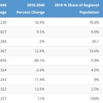
As a result, OKI is projecting that Hamilton County will lose 2% of its population between now and 2040, thus resulting in a loss of regional population share from its 40.1% today, to 35.4% in the future. In fact, based on those prior trends, OKI believes that Hamilton County’s population will stand at approximately 790,000 in 2020 – down from the 802,374 baseline in 2010.

The problem with using these historical trends is that Cincinnati has seen a dramatic turnaround over the past decade – one that has reversed Cincinnati and Hamilton County’s long population loss trend. This has been reflected in the latest population estimates from the U.S. Census Bureau, which say that Hamilton County has actually gained population since 2010, and now has approximately 806,000 residents. Meanwhile, growth in the region’s outlying counties has slowed down considerably based on historical trends.

This is important because leadership at OKI has consistently said that it needs to continue to accommodate growth in the region’s outlying counties, which means funds that could otherwise be directed toward mobility, safety and maintenance improvements are instead spent on capacity expansion.

While there may be an overstated importance placed on the need for capacity expansion, OKI planners do acknowledge the need to improve the mobility, safety and maintenance of the regional network. Of the plan’s eight stated goals, none of them include, with perhaps the partial exception of Economic Vitality, the need to add capacity.

“In addition to its economic impacts, transportation also plays an important role in the region’s quality of life,” the report states.

“Transportation improvements have an effect on development, travel patterns and opportunities for all the region’s citizens. The transportation system should be balanced so that no group or groups of people assume a disproportionate share of positive or negative impacts.

The survey will remain open until Friday, January 8. After that time OKI officials say that their staff will begin formulating a draft project list to recommend for funding. Once that list is completed, OKI will host five public involvement events in the spring to gather feedback on the recommended projects.

Now’s the time to speak up.

Categories
News Transportation

Ohio Maintains Position As Nation’s 16th Best State for Bicyclists

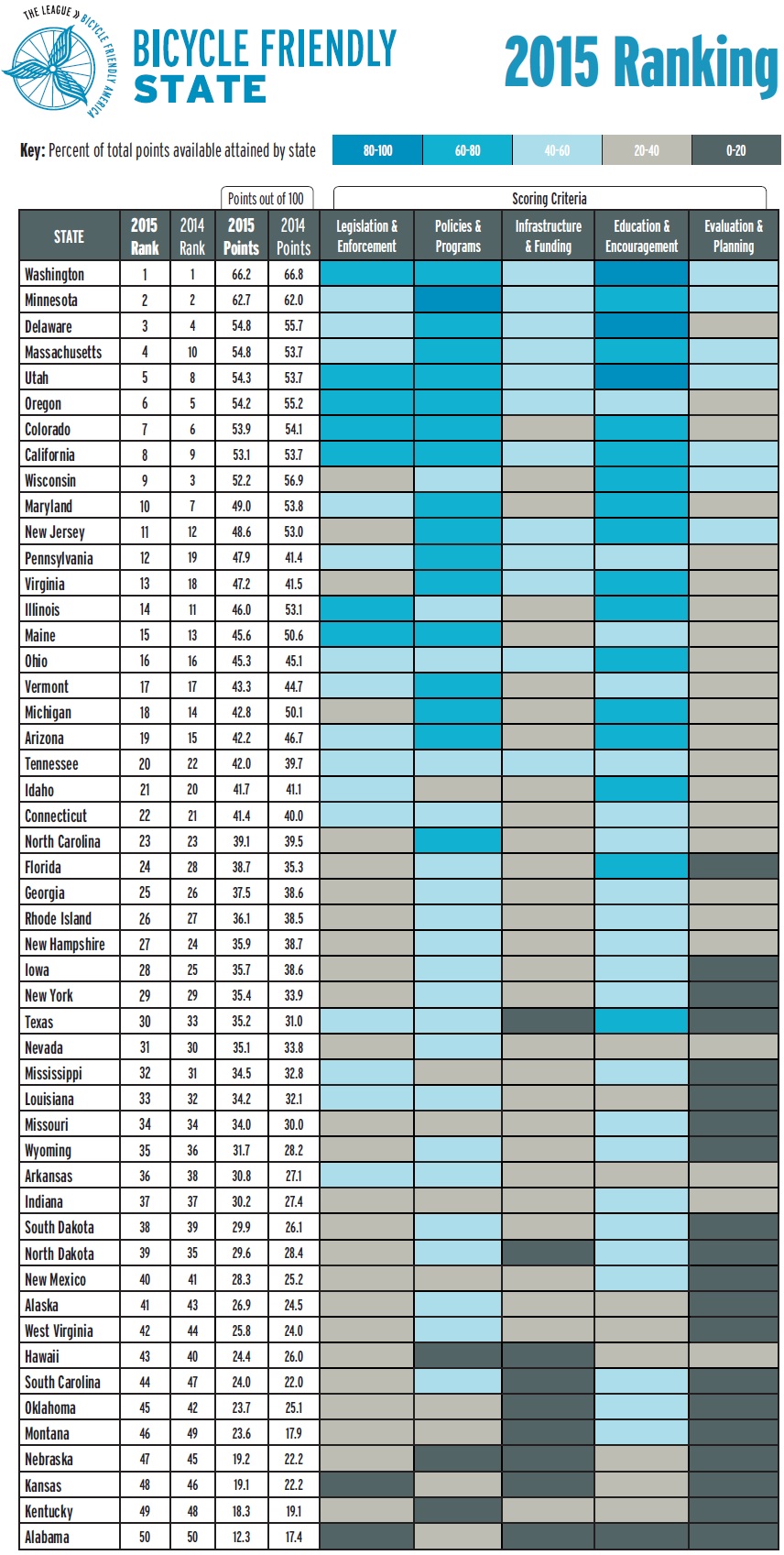
Bicycle Friendly State Ranking 2015Ohio has maintained its ranking as the 16th best state for bicycling in 2015, according to the League of American Bicyclists. The Buckeye state was previously ranked 16th in 2014, after a big jump from 32nd the previous year. This position places the state as the fourth best in the Midwest, behind just Minnesota, Wisconsin and Illinois.

The ranking is issued after compiling the results of a Bicycle Friendly State questionnaire that is answered by a coordinator in each state, and is based on five criteria: Legislation and Enforcement, Policies and Programs, Infrastructure and Funding, Education and Encouragement, and Evaluation and Planning.

The state scored a total of 45.3 points out of a possible 100, and fared best in terms of its Education and Outreach, but scored lowest in its Evaluation and Planning.

“I’m excited about where Ohio is,” Frank Henson, President of Queen City Bike, told UrbanCincy. He said that he felt that even though Ohio gained in its scoring of points, the reason it did not move higher in the ranking is due to the investments being made elsewhere around the country.

“While Ohio continued to do a lot of great things, especially here in Cincinnati and neighboring communities, other states were ramping up,” Henson said.

Leadership at Queen City Bike believes that Ohio has the potential to move up in next year’s ranking with the possible passage of House Bill 154.

Chuck Smith, Chairman of the Ohio Bicycle Federation, agreed and said that the top two suggestions from the League of American Bicyclists to improve the state’s ranking are both addressed in the bill. The first is a statewide requirement for vehicles to provide three feet of clearance when passing bikes, which is already an ordinance in Cincinnati. The second is a “dead red” law, which would allow all vehicles, including bicycles, to proceed through an intersection if they are not detected by traffic control devices.

“It’s important for cyclists to be legal, but bikes are sometimes outside of the system” Smith said in reference to many traffic control devices that are unable to detect the presence of people riding bikes.

One of the other major items recommended by the League of American Bicyclists is the adoption of a statewide Complete Streets policy – something both state and local officials continue to struggle with all over Ohio.

Julie Walcoff, Bicycle and Pedestrian Program Manager of the Ohio Department of Transportation, said there are several other actions being taken at the state level that could further bolster the state’s national ranking.

“We’re putting together a safety coalition that will encompass advocates, communities around the state, and other organizations that are interested in bicycle and pedestrian safety,” Walcoff told UrbanCincy. “We’ll be using that group to help develop a statewide educational campaign that focuses on road users of all types and on law enforcement.”

In addition, ODOT recently kicked off an initiative to designate proposed US and state bike routes throughout the Ohio, connecting the 17 largest cities in the state. ODOT officials say that these routes will use roads that already have an acceptable level of safety, along with existing paths.

While many have described ODOT as an agency almost entirely focused on highway building, Walcoff says they pride themselves on their working relationships with bicycle advocacy organizations throughout the state. This, she says, can help not only maintain Ohio’s current ranking but help it get even better in the future.

In Columbus, advocacy group Yay Bikes! is working with the city to increase the focus on design and engineering of the street infrastructure. Executive Director Catherine Girves says that to help improve the current situation, they are having engineers budget time each week to ride the streets with their group in order to better understand the needs of those people riding bikes.

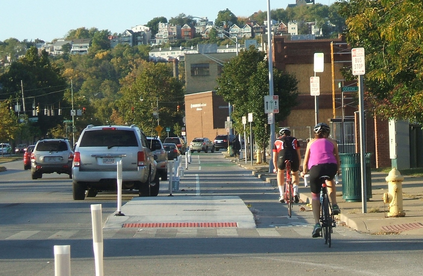
Back in Cincinnati, Henson noted the addition of Cincy Red Bike and the Central Parkway protected bike lane – the first of its kind in Ohio – as two key developments over the past year that have helped state’s ranking. Following the Cincinnati’s lead, both Cleveland and Columbus are now planning protected bike lanes of their own.

While much of the focus has been on core cities, Queen City Bike is also working with the Connecting Active Communities Coalition, which is comprised of representatives from nine communities in Cincinnati’s northern suburbs: Blue Ash, Evendale, Glendale, Lockland, Montgomery, Reading, Sharonville, Woodlawn and Wyoming. As of now, this group is working to develop a coordinated network for bicycling and other non-motorized modes of transportation on a multi-jurisdictional level.

Kentucky, meanwhile, ranked as the second worst state in the nation with just 18.3 points. This represented a 0.8 point drop from the previous year.