Categories
News Transportation

City Planners Recommend Transportation Overlay District for Wasson Railroad Corridor

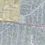
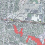
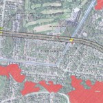
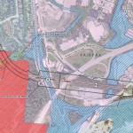
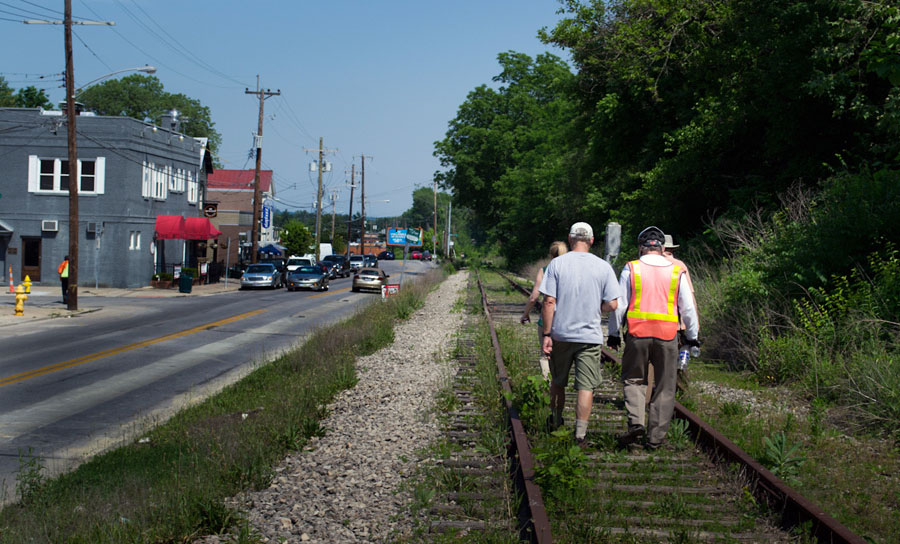
Following the guidance of City Council, Cincinnati’s Department of City Planning & Buildings has completed its land use study for the Wasson Railroad Corridor. The study’s findings and recommendations offer the clearest guidance to-date as to how to proceed with redeveloping the abandoned freight rail corridor, following the issuance of preliminary designs in July 2014.

City planners took a comprehensive look at the history of the corridor, its current conditions and the best path forward that respects the desires of the city and the impacted neighborhoods.

In that analysis City staff revealed seven studies and plans that recommend the corridor either be used for rail transit, or a combined multi-modal network that accommodates rail transit, bicycles and pedestrians. Some of the most notable of these include the 2002 MetroMoves regional transit plan, 2010 Bicycle Transportation Plan, 2012 comprehensive Plan Cincinnati, and the 2013 Railroad Safety Improvement Plan – all of which either specifically call for the corridor to be used for rail transit, or a multi-modal corridor.

The history is important as it influenced the study’s recommendation as to how to proceed with acquiring and preserving the corridor. As of now, the 5.7-mile Wasson Railroad Corridor is still owned by Norfolk Southern, but the City of Cincinnati has stated that they are in the process of acquiring the property from them.

“With this corridor being so crucial to the future development of multi-modal transportation in the City, the threat of potential development within the railroad right-of-way would significantly slow down, if not completely hinder, those possible public transportation opportunities from occurring,” city planners wrote in the 32-page land use study released earlier this month.

Of course, this fact has been known by policy makers at City Hall for years. As a result, City Council has, on several occasions, approved interim development controls to protect the corridor from being built upon. These controls, however, are just temporary and city officials must now decide how they would like to move forward.

In the study city planners examined the pros and cons of three potential options for accomplishing this.

The first option examined the idea of rezoning the property to a Parks and Recreation classification. This would offer the corridor significant protections, but it would also severely restrict the City from being able to implement rail transit in the future due to federal regulations that prohibit the use of public parks or wildlife refuges for transit corridors.

A second option studied looked at simply dedicating the land as City right-of-way. This too would offer significant protections, but is not possible until the City acquires the land from Norfolk Southern.

The third option, and the one recommended by city staff, is enacting a Transportation Overlay District over the corridor. While planners admit that crafting the language for such legislation may be complicated, they also stated that it would be most aligned with the preferences of neighborhood residents and publicly adopted planning documents.

In order to address the complexity of the legislation required for such an overlay district, city planners recommended looking at the Atlanta BeltLine Overlay District that was implemented to protect a 22-mile abandoned freight rail corridor. In Atlanta civic leaders are currently in the process of converting the corridor into a similarly envisioned multi-modal network with rail transit, bikeways, parks and pedestrian paths.

“While all options present advantages and disadvantages, the Transportation Overlay District is seen as the best solution for preservation of the Wasson Railroad Corridor,” city planners wrote. “This tool, while it may take a bit longer to craft the ordinance language, will provide more flexibility and also protect the contiguous nature of the corridor.”

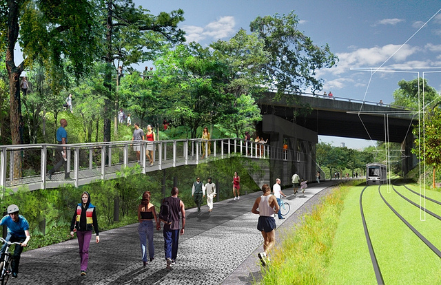
City officials say that this solution will allow for the development of the Wasson Way Trail to move forward in the near term, while affirming the City’s intentions to develop the corridor as a multi-modal transportation facility that includes rail transit in the future.

The solution crafted by the Department of City Planning & Buildings appears to be a perfect compromise between the two constituencies looking to use the corridor. Bicycle advocacy groups can see the right-of-way acquired and preserved so that they can move forward with their plans for a bike and pedestrian trail, while transit advocates can rest assure that those immediate efforts are not being done in conflict with ongoing planning and design work for a future light rail line.

With the Wasson Railroad Corridor Land Use Study now complete, it will go before the city’s Planning Commission. Should it be approved by Planning Commission, it will then go back to city staffers so that draft overlay district language can be crafted and recommended to City Council. From there, it would go before City Council for approval.

It is a standard process and one that advocates hope can be completed in the coming months.
Categories
Development News Transportation

KZF Releases Preliminary Designs, Cost Estimates for Wasson Way

A newly released feasibility study, produced by KZF Design, finds that construction of the 6.5-mile Wasson Way Trail would cost anywhere from $7.5 million for just a trail to $36 million for both a light rail line and trail totally separated from one another.

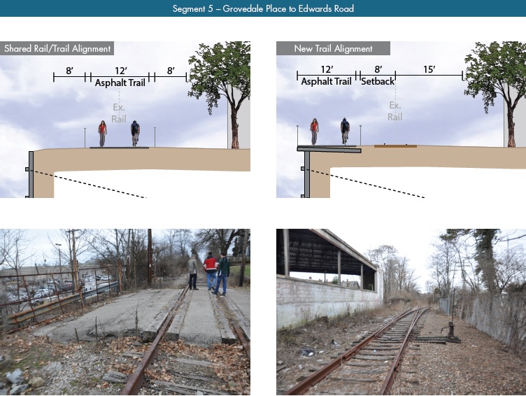
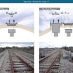
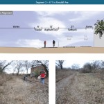
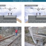
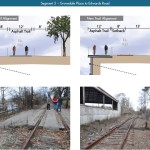
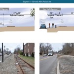
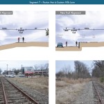
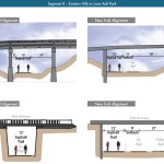
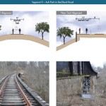
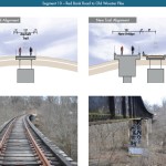
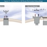
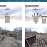
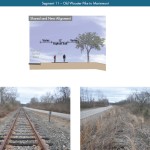
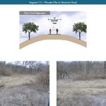
The cost estimates vary so much due to the three potential design options studied. The lowest cost alternative looked at placing a 12-foot-wide trail along the entire existing rail alignment. This, however, would make the inclusion of a future light rail line extremely difficult.

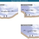
The most expensive alternative would construct an entire new trail alignment that does not interfere with any existing rail right-of-way. This would include the construction of several new bridges and completely preserve the ability to easily construct the long-planned light rail line adjacent to the new trail.

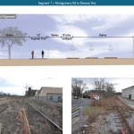
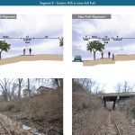
Alternative B, which was recommended by KZF and priced at $11.2 million, was a bit of a hybrid. It would include a 12-foot-wide trail offset from the existing rail alignment, but utilize existing rail right-of-way at pinch points along the corridor.

The 45-page study is the first detailed look at the corridor, which has been hotly debated and discussed over recent years. Much of the controversy has surrounded whether or not both light rail and a trail can be accommodated. KZF’s findings appear to show that much of the corridor could in fact accommodate both, but that some segments may prove to be difficult, albeit feasible.

If project supporters are able to advance the trail plan, KZF estimates that it would connect eight city neighborhoods and approximately 100,000 residents with an overall network of more than 100 miles of trail facilities.

“It is hard to build in the urban core, and to find an intact corridor ripe for development is a unique thing,” explained Eric Oberg, Manager at the Midwest Rails to Trails Conservancy. “If this is done right, this can be the best urban trail in the state of Ohio. I have no doubt.”

Some of the most difficult segments of the corridor are the nine existing bridges where the right-of-way is extremely limited. If both light rail and trail facilities are to traverse this corridor together, additional spans will be needed in order to have safe co-operation.

In addition to introducing what may become the region’s best urban trail and light rail corridor, some proponents also see it as an opportunity to fix other problems along the route. Most notably that includes the congested and confusing intersection of Madison, Edwards and Wasson Roads near Rookwood Pavilion.

While the newly released feasibility study offers the most detailed analysis of this corridor to date, the City of Cincinnati has yet to close on its purchase of the former freight rail line from Norfolk Southern.

City officials are reportedly in negotiations with Norfolk Southern now, and have made an initial offer of $2 million. In April, Mayor Cranley’s Administration also allocated $200,000 to the project.

Categories
Development News Transportation

VIDEO: UC Students, Transportation Experts Pitch Their Ideas for Wasson Corridor

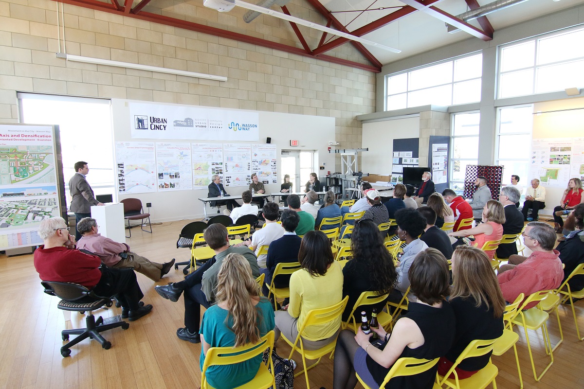
As part of UrbanCincy‘s ongoing partnership with the University of Cincinnati’s Community Design Center, we gathered interested members of the public at the Niehoff Studio in Corryville on April 17 to view the work of students studying the Wasson Corridor.

As with previous events we have hosted at the Niehoff Studio, a capacity crowd attended to not only view the student work, but also participate in a panel discussion with regional experts on the topic. At this event, UrbanCincy‘s Jake Mecklenborg moderated the discussion.

The topic of discussion and the proposals put forth by the interdisciplinary students carried even greater weight as the City of Cincinnati allocated $1.9 million for a variety of bike projects, including $200,000 for the Wasson Way Trail. The City has also recently made an offer to purchase the Wasson Corridor for $2 million from Norfolk Southern who abandoned the rail line years ago.

While the Wasson Way Trail envisions a recreational bicycle and pedestrian trail running along the Wasson Corridor, many now view it as a component of a multi-modal transportation corridor that includes a long-planned light rail line.

Mayor John Cranley’s (D) administration appears to be focused on investing in recreational bike/ped trails, which is good, but the development of the Wasson Corridor should include both the proposed recreational trail and room for light rail tracks.

Fortunately, what was once viewed as a project that pitted light rail advocates against biking advocates has changed drastically since UrbanCincy‘s controversial editorial on the matter in 2012. There now appears to be broad consensus from both sides that the corridor should be developed in a comprehensive, multi-modal fashion.

Categories
Development News Transportation

UrbanCincy, Niehoff Studio to Host Regional Discussion on Wasson Corridor

In May 2013, UrbanCincy partnered with the Niehoff Urban Studio to produce an event that highlighted the final work of engineering and urban planning students studying bus rapid transit and bikeways throughout the region. We then showcased their work and engaged the capacity crowd with a panel discussion between some of the region’s foremost experts on the subjects.

One of the hot topics at that event was the Wasson Corridor, which runs through the heart of Cincinnati’s eastern neighborhoods.

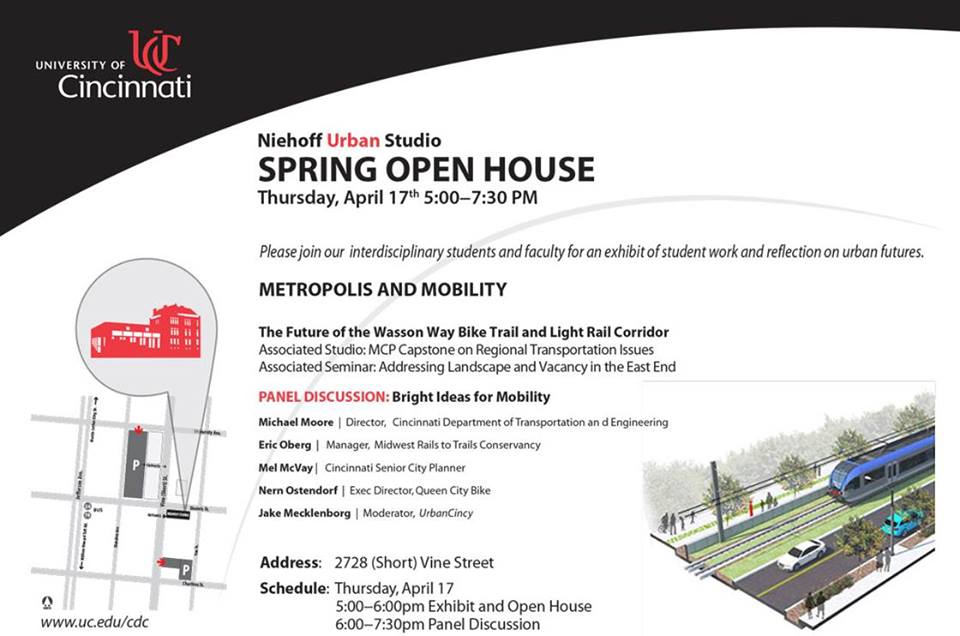
The Future of the Wasson Way Bike Trail and Light Rail Corridor

The corridor has long been in regional transit plans as the location for a light rail line, but recent advocacy efforts have been working to convert the abandoned freight rail right-of-way into a recreational trail for bicyclists and pedestrians.

Following UrbanCincy’s controversial editorial opposing the corridor’s conversion into a bike/ped trail, the conversation has shifted to one focused on creating a multi-modal corridor that accommodates the long-planned light rail and the newly envisioned recreational trail.

The next stage of that dialogue will occur this Thursday back at the Niehoff’s Community Design Center in Corryville.

Over the past semester, interdisciplinary students from the University of Cincinnati have been studying the Wasson Corridor and will be presenting their work at this event.

Following the open house where guests can view the final projects, UrbanCincy will then host a panel discussion with Michael Moore, Director of Cincinnati’s Department of Transportation & Engineering (DOTE); Eric Oberg, Manager of the Midwest Rails to Trails Conservancy; Mel McVay, Senior Planner at Cincinnati DOTE; Nern Ostendorf, Executive Director of Queen City Bike. The discussion will be moderated by UrbanCincy’s Jake Mecklenborg.

The event is free and open to the public. The open house portion of the evening will take place from 5pm to 6pm, and the panel discussion will follow immediately at 6pm and go until about 7:30pm.

Light food and refreshments will be provided and a cash bar will be available during the open house. The Niehoff’s Community Design Center can be accessed directly off of Short Vine at the southeast corner of Daniels and Vine Street.

Categories
Up To Speed

Streetcar opponents don’t just oppose streetcars, they oppose all transit investments

Streetcar opponents don’t just oppose streetcars, they oppose all transit investments.

We have heard it all before here in Cincinnati. In 2002 the problem COAST and others had with MetroMoves was that it was too big and too expensive. That county-wide transit tax lost at the polls and put regional rail and bus transit on the backburner. So what to do next? Well if that was too big, then let’s start smaller. So the City of Cincinnati decided to pursue a small component of that regional plan that could be implemented without raising taxes.

The problem opponents now cite is that the Cincinnati Streetcar is a “toy choo-choo train” that “doesn’t go anywhere.” Their alternative is to invest in Metro’s bus system and perhaps operate a center city, rubber tire trolley. While the regional bus improvements should be done regardless, the problem is that these opponents are not willing to commit to any funding for these improvements. They’re empty offers, and like Cincinnati, San Antonio is dealing with the same nonsense. More from The Atlantic:

The precise difference between streetcars and light rail may not be important to those opposing VIA’s plans. State Senator Campbell’s recent complaint to the attorney general reportedly stated that ATD funds should only be used “to improve San Antonio’s roads,” even though the law that created the ATD sales tax doesn’t impose that restriction. What’s being truly opposed here may just be rail projects in general, whatever their form. “For some folks, if it’s on a rail, it’s rail,” says Gonzalez.

Attorney General Abbott rejected VIA’s bond sales — a move that caught the agency by surprise, since Abbott had issued preliminary approval for them. The streetcar lawsuit was immediately dropped, with the opponents saying they got what they wanted.

Gonzalez says VIA is considering whether to use an alternative avenue through the court system to get approval for the bond sales. For now, he sees a situation rife with irony. For one thing, the streetcar opponents who claim to be fighting for taxpayers are actually costing the city money to deal with the lawsuits and the bond delay. Beyond that, the real losers at the moment are not streetcar advocates at all but the bus riders who use the transit centers.