Categories
News Transportation

Construction Nearing Completion for Latest $546k Phase of Mill Creek Greenway

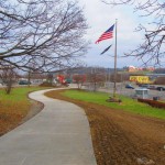
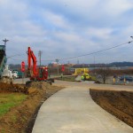
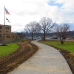
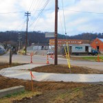
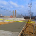
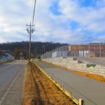
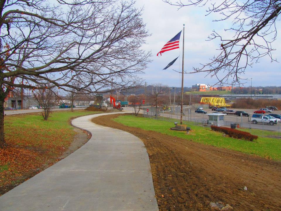
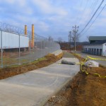
Construction is nearly complete on the fourth phase of work on the Mill Creek Greenway. As part of that work, a new 0.7-mile trail stretches along the border of South Cumminsville and Milvale, from the Millcreek Road Bridge to the intersection of Fricke Road and Beekman Street near Ethel Taylor Academy.

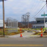
Once this work is complete, project planners say, the stretch will include additional accommodations for the trail to safely cross the creek on the existing roadway bridge, along with traffic calming measures for a safe crossing at Beekman Street near the school.

This latest phase of work is part of the much larger Mill Creek Greenway project that is being spearheaded by Groundwork Cincinnati – Mill Creek. The non-profit organization is celebrating its 20th anniversary this year, and is hoping that the planned 15-mile green corridor, which starts at the Hamilton County Fairgrounds in Carthage and will eventually reach the Ohio River Trail in Lower Price Hill, will help clean up one of the region’s most notoriously polluted corridors.

“We have done 33 ecological restoration projects as part of the greenway program,” Robin Corathers, Executive Director of Groundwork Cincinnati – Mill Creek, told UrbanCincy. “That includes bank stabilization, stream bed stabilization, wetland restoration, wildlife habitat restoration.”

In addition to that, Corathers says that edible forest gardens have been planted along the trail, with seven layers of vegetation that mimic a natural forest ecosystem. Improving the health of the ecosystem is a key component of Groundwork’s strategy, and more work is planned to help revitalize and heal damage to the natural resources within the Mill Creek Valley – one of the city’s oldest industrial corridors.

This latest phase of work was funded through a $245,000 grant from the Clean Ohio Trail Fund, $80,000 grant from the Interact for Health Foundation, $30,000 grant from the Greater Cincinnati Foundation, and $191,000 from the City of Cincinnati that was provided through its annual capital budget. Corathers also notes that the C.W. Wood Company donated a strip of land along Fricke Street for the trail.

The project, however, is not just about new trails and habitat restoration. Groundwork leadership also says that they are focused on capacity building, community involvement, and environmental education programming for 4,000 fourth through twelfth grade students each year.

“Phase four is really important to us for several reasons” explained Corathers. “As a ground work trust we are committed to working in economically distressed and historically under-served communities and neighborhoods; and in this case it’s the neighborhoods in the lower Mill Creek watershed.”

To this end, Corathers says that community leaders and neighborhood residents have been excited about the project and the process by which it is being implemented. She says that neighborhood councils become involved in the planning and design work of each phase of the trail, which leads to moments like this past November 12 when they celebrated the groundbreaking for the latest phase of work with about 85 area residents and business owners.

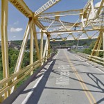
While there has been a good deal of neighborhood support, there are still challenges that exist for project leaders. One of those challenges is the Millcreek Road Bridge, which is envisioned as a crossing for the trail, but is currently only one lane in each direction for automobile traffic.

To tackle this issue, Groundwork Cincinnati has been working closely with Cincinnati’s Department of Transportation & Engineering (DOTE) to address safety issues with the narrow bridge. City officials say that the aging Mill Creek crossing is not considered a priority bridge and is not scheduled for replacement.

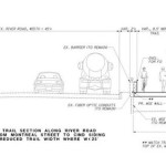
As a result, transportation engineers have come up with a solution that will retrofit the lightly used span to have one lane for shared two-way traffic flow, and one lane dedicated to the trail. The DOTE says that new signals will be installed, in February, at either end of the bridge to control alternating movements of vehicles across the Mill Creek Bridge.

“It’s a great investment. The bridge will be so much safer for people, for bikes, and also for vehicles,” Corathers said when emphasizing the importance of the trails connection. “The trail provides opportunities for outdoor exercise and recreation, active living, and active transportation for people in the Mill Creek corridor and nearby.”

Crossing the Mill Creek at this location is critical in the project’s overall goal of eventually reaching the Ohio River to the south. Once getting past this location, project planners say that a former CSX rail corridor can be used to take the trail all the way to its envisioned terminus.

The former freight rail right-of-way is considered to be wide enough to accommodate the Mill Creek Greenway Trail, as well as tracks for a future transit line. The use of this corridor, Corathers says, will also allow the Mill Creek Greenway Trail to tap into the planned $192 million Lick Run project, which will include another corridor of green space and trails.

Ultimately, the ongoing efforts could produce what would become a large network of interconnected trails through the heart of the city, including the Ohio River Trail, Little Miami Scenic Trail, Mill Creek Greenway, Lick Run, and West Fork Mill Creek Trail in Carthage.

The next 2.9-mile phase of work on the Mill Creek Greenway is estimated to cost $860,000, and project officials say they have already secured $500,000 of that from the State of Ohio, $50,000 from Interact for Health, and $10,000 from Duke Energy. The hope is that the remaining funds can come from City Hall. Should the final funding fall into place, Groundwork Cincinnati believes phase five work could be completed next year – creating a continuous eight-mile stretch of trails.

An attempt has been made all along to keep the trail close to the Mill Creek, but in some places, such as along Este Avenue, project planners say that it has not possible. But in locations where restoration and stabilization work has been performed along the creek, recovery of the ecosystems is easily visible.

“We now have great blue heron that fish in Mill Creek. We’ve got turtles, lizards, salamanders, beavers, birds, and all kinds of wildlife” Corathers exclaimed. “What we’re doing is breathing life back into this corridor. The trail allows users and visitors to experience an urban river that is coming back.”

In addition to Groundwork Cincinnati and the DOTE, Queen City Bike, Human Nature, IBI Group, Kolar Design, and Prus Construction have contributed to the development of the Mill Creek Greenway over the past six years.
Categories
Development News

West Side Leaders Land $46k for Long-Planned ‘Price Landing’ Park Along Riverfront

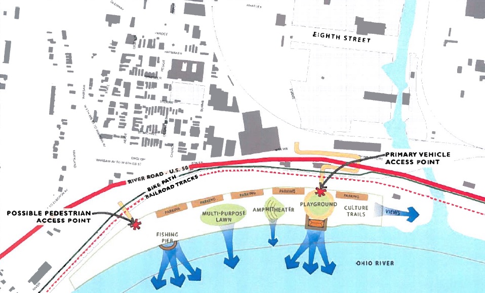
River West Working Group and Price Hill Will announced last month that they have received two grants to create a park framework plan for Price Landing, an integral piece of the overall western riverfront vision.

The first is a $30,000 grant from Interact for Health, and the second is a $16,000 grant from the Greater Cincinnati Foundation. The combination of the two will allow for the development of a vision and preliminary design for the park that would become the eastern bookend of the Ohio River Trail West.

Cincinnati’s western riverfront spans 22 miles from downtown to Shawnee Lookout, and Price Landing is seen as a critical step in reclaiming the riverfront ecosystem as a recreational and educational experience, rather than industrial.

Glaserworks and Human Nature have been hired to create the plan for the park, which will include major park features and a preliminary budget for the construction of the project. River West Working Group will manage the design process in coordination with both firms; and they say the goal of the process is to complete the park framework plan by the middle of 2015.

“This is a very exciting addition to the many positive developments driving the ongoing revitalization of our West Side neighborhoods,” said Tom Croft, Co-Chair of River West Working Group. “With the creation of Price Landing, and the expansion and renovation of the Cincinnati Recreation’s nearby Evans Fields, Lower Price Hill will be a true recreation destination.”

Having advocated for the park since 2007, River West Working Group says their mission is to foster communication among West Side neighborhoods about development and land use issues, and to promote proactive strategies to make Cincinnati an attractive place to live and work.

In fact, the group was founded during the debate over the approval of the controversial Queensgate Terminals project. That project, which is the same site as Price Landing, would have brought a modern rail-to-barge transfer facility to the area.

In 2009 Croft said the development of Queensgate Terminals would “consign Lower Price Hill, East Price Hill, Sedamsville and Riverside to permanent blight”, and would damage perceived recovery efforts taking place at the time.

“[This site] is located at key gateways to and from West Side neighborhoods,” Croft said at the time. “In accord with the Cincinnati Scenic View Study adopted by City Council last summer, it must be protected because of its position in the line of sight from Mt. Echo and the City.”

So far the group has been quite successful. In addition to the Queensgate Terminals project being scuttled, work has also progressed on the Ohio River Trail West, and Price Landing will permanently ensure that a critical piece of riverfront property will not be developed as an industrial use.

According to Dave Zelman, co-chair of River West Working Group, the progress is something to be celebrated, saying, “With planning well underway to link Lower Price Hill to the Gilday Recreation Complex in Riverside, this park will serve as a gateway to western Hamilton County, and be a positive addition to our region.”

Categories
Arts & Entertainment News

Cincinnati Dronescape is a Soundtrack of the City and the Sounds That Define It

Cincinnati has a rich history in music production, and recently it has become more of a hotbed for live performances. In addition to that, there are a number of well-known local or locally started musicians out there making the national rounds these days.

A new mashup project, however, is a bit of a change of pace from all of that.

Cincinnati Dronescape is the brainchild of Isaac Hand, and is a bit of an experiment involving art, music, technology and the city.

Hand worked with his friend Nick Denlinger to record what they thought were quintessential sounds from around the city. This included recordings from more than a dozen locations including the sound of the Western Hills Viaduct, Queensgate Railyard, Christian Moerlein Brewerythe hum of the University of Cincinnati Medical Center. From there, they then distributed the audio recordings to local musicians who them composed music to complement those sounds.

One of the interesting components of the project, aside from it recording background city sounds, is the fact that Hand and Denlinger recorded the sounds by using drones.

“The results are simultaneously a representation of the diversity of the Cincinnati music community, but also an aural portrait or sonic map of the city,” explained Hand.

Long-time readers of UrbanCincy may remember Hand from a project he helped champion in 2010 called Aural Grid, which was a “musical-spatial exploration” through Over-the-Rhine. Many of the artists involved with that project, Hand says, were also involved with Cincinnati Dronescape.

“Although I curated it, this really was a community endeavor,” Hand emphasized. “It took a whole bunch of people to make it possible.”

The community description is an apt one with roughly a dozen musicians contributing directly to the effort. In addition to that, Ian Gullett mixed everything into a cohesive recording, Arthur Brum produced the album artwork, and Micah Freeman composed the poem used for linear notes.

Nick Swartsell, who has grown increasingly fascinated by the history of the West End and its Kenyon Barr neighborhood, has even been working on a visual component to complement the track he contributed for the album.

It actuality, there are two albums available for streaming or purchase. The first, entitled Cincinnati Drones, is an album of the recorded sounds, while the second, entitled Cincinnati Dronescape, is the collection of artist remixes of those sounds.

Both albums can either be downloaded online for $7, or purchased in CD form for $10 on the project’s bandcamp webpage, Shake It Records, Everybody’s Records, Rock Paper Scissors and Torn Light.

Categories
Development News Transportation

Ohio River Trail Project Moving Westward from Center City

For those coming from the west side along the Ohio River, Cincinnati’s western riverfront serves as a bit of a welcome mat. However, after losing residents and jobs since mid-20th century, many in the area believe now is the time to rethink this historic area.

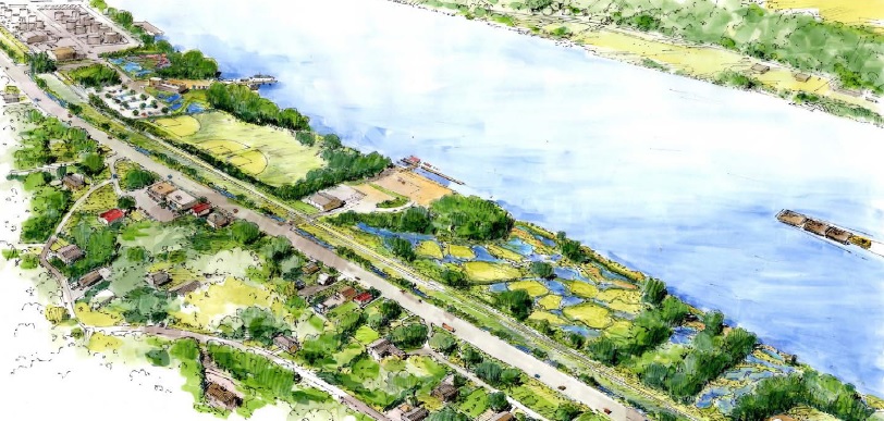
While oft-viewed as an industrial stretch, it is a little known fact that Cincinnati’s western riverfront is actually one of the region’s largest green corridors with riverfront parks and wooded hillsides. And just a few feet down from the busy streets and railways, there is a different Cincinnati – one community leaders believe has the potential to serve as a national example of environmental stewardship and urban recreation.

Perhaps the biggest asset this area boasts is the Ohio River with its views and access to unique amenities. The existing amenities offered by the river and surrounding hillsides, combined with potential amenities from a string of riverfront parks, have the ability to create a powerful attraction for new residents and jobs. It is because of this potential that community leaders see so much value in Ohio River Trail West, which is part of the city’s larger Western Riverfront Plan.

The proposed three-segment first phase of Ohio River Trail West. formerly known as the Western Riverwalk, ties together the reconstruction of the Waldvogel Viaduct, ongoing redevelopment in Lower Price Hill, and repurposing of the former Hilltop Concrete property into a park.

URS estimates that the first two segments within the first phase of work will cost approximately $1.3 million and build upon the much larger Ohio River Trail. This particular phase of trail would extend roughly 3.7 miles downriver to the Gilday Recreation Center.

The biggest of these three pieces of the puzzle is the $55 million reconstruction of the Waldvogel Viaduct. As part of the planning and engineering of the new viaduct, there will be improved views and access to the river from Lower Price Hill. Once the viaduct’s construction is complete, more than 16 acres of riverfront property will become accessible at the former Hilltop Concrete site, which had once been planned for a new rail-to-barge shipping facility, and will now become Price’s Landing.

The combination of all these ongoing efforts creates the possibility for a dramatically different future for the long-troubled Lower Price Hill neighborhood.

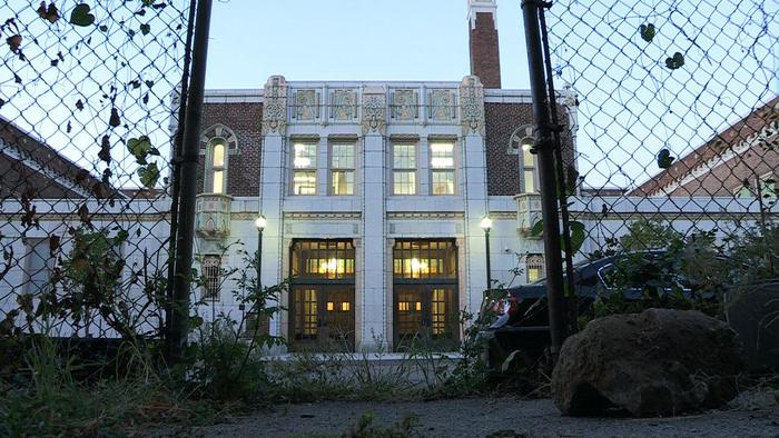
Olyer School – an architectural treasure and a foundation of the Lower Price Hill community– recently underwent a $21 million dollar renovation; and the reconstruction of the Waldvogel Viaduct will reconnect the neighborhood to the river for the first time in over 60 years.

Meanwhile, the western end of the first phase of Ohio River Trail West is the Gilday Recreation Center, which will support the trail through its current configuration and planned upgrades.

It is estimated that the stretch of properties between the former Hilltop Concrete site and Southside Avenue are controlled by no more than five entities, and project planners have already secured roughly 70% of the right-of-way needed for this first phase of work.

So while ownership and access are typically major hurdles for projects of this variety, proponents are particularly excited that all of the needed right-of-way required for the first phase of work is either controlled already, or is vacant and potentially available for the new trail. Furthermore, each endpoint is owned by the City and will be able to provide both access and parking for future users.

The efforts to make this plan a reality were given a boost by former Cincinnati Mayor Mark Mallory (D) when he delivered his final State of the City Address and made the western riverfront a key component of that speech.

“If you think about the proposed investment here…this could serve as a landmark development for the west side of Cincinnati,” Mallory stated.

The efforts were then given another jolt in April 2014 when current Cincinnati Mayor John Cranley (D) allocated $250,000 to the project for ongoing engineering work, and pledged to support the project going forward.

There is currently no timetable for phase one construction activities, but project proponents hope to finalize engineering work and secure construction funding for phase one over the next year or so.

Categories
Arts & Entertainment News

Award-Winning Filmmaker’s Latest Project Highlights Lower Price Hill’s Oyler School

Lower Price Hill is a neighborhood that has seen better days, but recent and ongoing efforts to turn things around in the largely Appalachian and Hispanic community have begun to prove successful.

Some of those efforts include the more recent co-op approach being employed by the Lower Price Hill Community School to help deliver services and offerings that are not currently available to residents of the historic neighborhood. But it is the $21 million renovation of Oyler School that is seen as the spark for the recent improvements.

“Roughly half of the children in U.S. public schools today come from low-income families, and a debate is raging over how to help more of them succeed,” write filmmakers for the new documentary entitled Oyler. “Oyler School’s approach—combining academic, health, and social services under one roof—is catching on around the country.”

Amy Scott, an independent documentary filmmaker and correspondent for public radio’s Marketplace show, says that she has spent a year reporting from Oyler, and believes the documentary tells a story that has become commonplace throughout America.

Oyler tells a gripping story of individuals fighting for change in a unique American community, but it also takes on one of our country’s most pressing challenges – the persistent achievement gap between low-income students and their more affluent peers,” wrote Scott on the project’s Kickstarter page.

The major underlying theme is about how Lower Price Hill is using its public school to transform itself and the lives of those who call it home. In a more direct message, the film also speaks to the nationally acclaimed community learning centers being employed by Cincinnati Public Schools.

While Scott’s team has already been successful at raising just over their initial goal of $25,000 for the film through Kickstarter, the campaign will remain open for one more week. The team says that the funds will be used to cover the costs associated with producing an original music score, sound mix and color correction, rights for commercial music and archival footage, and a professional website.

After the campaign closes next week, the team will get to work on finishing up the documentary and doing the requisite post-production work for a film of this nature. They say that there will be film screenings in Cincinnati and Baltimore next fall, at a minimum, and at other locations depending on those who provided more than $5,000 to the campaign.