Categories
News Politics Transportation

ODOT Looking For Public Feedback on Reworked Eastern Corridor Program

The Ohio Department of Transportation is looking for additional feedback related to transportation improvements for Cincinnati’s eastern neighborhoods and far reaching suburbs.

The survey comes after ODOT has said that they are backing away from original plans for the hotly debated Eastern Corridor project, which came under public scrutiny for its scope and potentially negative impact to established neighborhoods on the city’s east side.

While the project will most certainly not be moving forward as originally envisioned, public officials are still looking to get a grasp on what kinds of investments could be made to improve traffic congestion and mobility options.

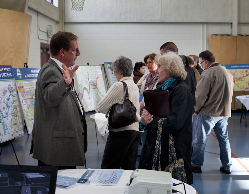
So far, ODOT has held public meetings in Newtown and Mariemont, and will hold meetings in Anderson Township, Mt. Lookout, Fairfax and Mt. Washington in the coming weeks – the next of which will occur this evening, from 6pm to 8pm, in Mt. Lookout at Christ The King Parish Center at 927 Ellison Avenue.

Those unable to attend that or the other upcoming meetings, are being encouraged to complete an interactive web-based survey. Taking approximately five to 10 minutes to complete, the survey asks respondents to rank the importance of the types of transportation improvements needed for the corridor, while also asking for specific location-based improvement suggestions.

The survey and public feedback for this effort is focused on what ODOT calls Segments II and III of the project, and is not limited to those who live or work in the study area, but rather open to anyone who finds themselves passing through the area.

Early results from the survey show that respondents want ODOT to focus investments on improving public transit, biking and walking options, and travel time through the corridor. While the travel time option could mean many different things, it may be connected to the other two top rankings for multi-modal transportation enhancements.

Projects not specifically mentioned in the survey include the Oasis Corridor commuter rail line, which also has been on the ropes lately, and the Wasson Corridor, which is still unclear how it will proceed with respects to a trail only, or a light rail and trail combination.

As UrbanCincy wrote in June 2015, a new local access bridge crossing the Ohio River, from Columbia Tusculum to Dayton, KY, could also greatly help solve access and congestion issues on the east side of the region.

ODOT officials say that the online survey will remain open until Wednesday, June 15. After this evening’s open house in Mt. Lookout, the next meetings to take place in Fairfax and Mt. Washington will occur on May 4 and May 5, respectively.
Categories
News Opinion Transportation

Here’s How to Improve Access Between Ohio and Kentucky’s East/West Neighborhoods

When discussing regional transportation issues, the topic seems to always be about congestion. In reality, outside of a few limited periods, the Cincinnati region has relatively good traffic flow with little actual congestion. So instead of trying to solve a problem that does not exist, we should be instead focusing our resources on maintaining our current system and improving mobility within the overall region.

As is the case in any city, the natural environment often serves as a chokepoint and barrier to regional mobility. This is true for Cincinnati with its hills and rivers.

With the region’s population largely centered along the Ohio River, it is natural that this is where the most choke points exist. Outside of the center city, however, there are very few river crossings. In fact, there are only two Ohio River crossings outside of the center city, and both of those are for I-275.

One such area that makes sense for a new local road bridge is around Cincinnati’s Columbia Tusculum neighborhood and Dayton, KY near where the $400 million Manhattan Harbour project is planned.

An increasing amount of development continues to occur on the northern bank of the river in Columbia Tusculum and East End. Further up the hill sits prosperous neighborhoods like Mt. Lookout, Hyde Park, and Oakley; and just around the bend lies Lunken Airfield.

Conversely, on the south side of the river in Kentucky, large-scale development projects have long been envisioned, but are often derailed due to poor access via existing roadway networks. This remains true for Manhattan Harbour where concerns exist about the traffic burden that would be placed on the narrow KY 8 running through historic Bellevue’s quaint business district.

A local road bridge that is one lane in each direction with space for pedestrian and bicycle paths would be an ideal fit for this area of the region. It would improve mobility and access to two difficult-to-access areas. It would also offer a highway alternative for those looking to cross between the two states.

A second location where a local bridge of this nature would make sense is near where the Anderson Ferry currently operates today on the city’s west side.

While little development has occurred in this area for some time, this may soon change. The Ohio River Trail West will soon make its way toward this area, and several developers have been eyeing the western riverfront for major projects.

The Cincinnati-Northern Kentucky International Airport sits on the southern side of the river where this bridge would land. This area continues to be bolstered by warehouses, distribution facilities and other airport-related services, and could be further bolstered with better access. What’s more, Cincinnati’s western neighborhoods that have long had to deal with excessive airplane noise, yet long treks to the airport, could at least resolve one of those injustices with a new local access bridge.

The Taylor-Southgate Bridge is the most recent span that has been constructed over the Ohio River. It was completed in 1995 and cost $56 million at that time – approximately $85 million when adjusted for inflation. Both of these new bridges would need to span an approximate 1,700-foot-wide width, which is about 300 feet more than the Taylor-Southgate Bridge river width.

One of the main differences, however, is that the Taylor-Southgate Bridge includes two lanes of traffic in each direction, plus sidewalks. The need for only one lane of traffic on these bridges would allow them to have a deck width of around just 30 to 35 feet.

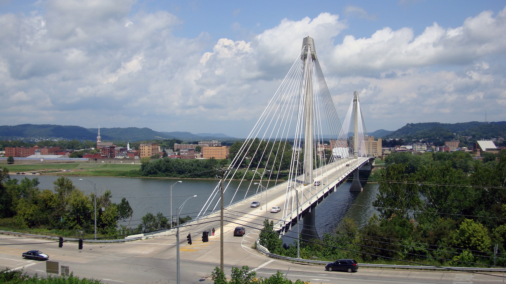
Another good nearby comparison is the U.S. Grant Bridge in Portsmouth, OH. That cable-stayed bridge was completed by the Ohio Department of Transportation in 2006 for approximately $30 million – or about $35 million in today’s dollars.

In addition to access and mobility improvements for motorists, a new bridge in both of these locations would also be a boon for cyclists. Those riding along the Little Miami Scenic Trail and the Ohio River Trail would now also be able to continue on to Northern Kentucky’s Riverfront Commons Trail, which will eventually stretch 11.5 miles from Ludlow to Ft. Thomas.

The Cincinnati region does not need multi-billion dollar solutions for a traffic congestion issues that largely do not exist. Reasonable and affordable projects that aim to increase mobility and access, along with maintaining our existing assets, should be the priority.

New local bridges connecting the region’s east and west side neighborhoods would open up land for new development, improve access between both states, enhance mobility for pedestrians and cyclists, and would do so at a price tag we can afford.

Categories
Development News Transportation

Cincinnati Aims to Break Ground on Next Phase of Ohio River Trail in June 2017

City officials are advancing the designs for the next phase of the Ohio River Trail. The 2.2-mile segment will run from Salem Road to Sutton Road in Cincinnati’s California neighborhood on its eastern riverfront.

Project and community leaders are excited about the work because it will fill in a gap in the Ohio River Trail that will eventually stretch 23 miles from Coney Island on the east to Sayler Park on the west. The project will also represent an approximate 50% increase in the number of completed miles of the Ohio River Trail.

While designs are still being finalized, city officials presented a conceptual design and the preferred alignment with the public at an open house held on March 25.

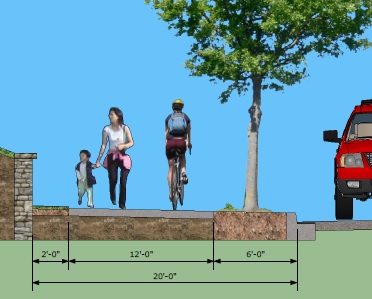
The designs call for a shared use, asphalt path for bicyclists and pedestrians that is 12 feet wide. There would be a six-foot setback from the road, and the path would essentially function as an extra wide sidewalk in order to avoid taking any right-of-way away from automobiles.

The preferred alignment for the shared trail would run along the eastern side of Kellogg Avenue and go through the California Woods Nature Preserve. The pathway would pass underneath I-275 at the foot of the Combs-Hehl Bridge.

Project officials say that they will take feedback given during the recent open house into consideration when developing final designs, and formulate construction cost estimates. The next public meeting will take place in October.

If all goes according to plan, detailed design work will be complete by October 2016 and construction will begin in June 2017.

Categories
News Transportation

Ohio River Trail Tour to explain bike commuter center basics this Sunday

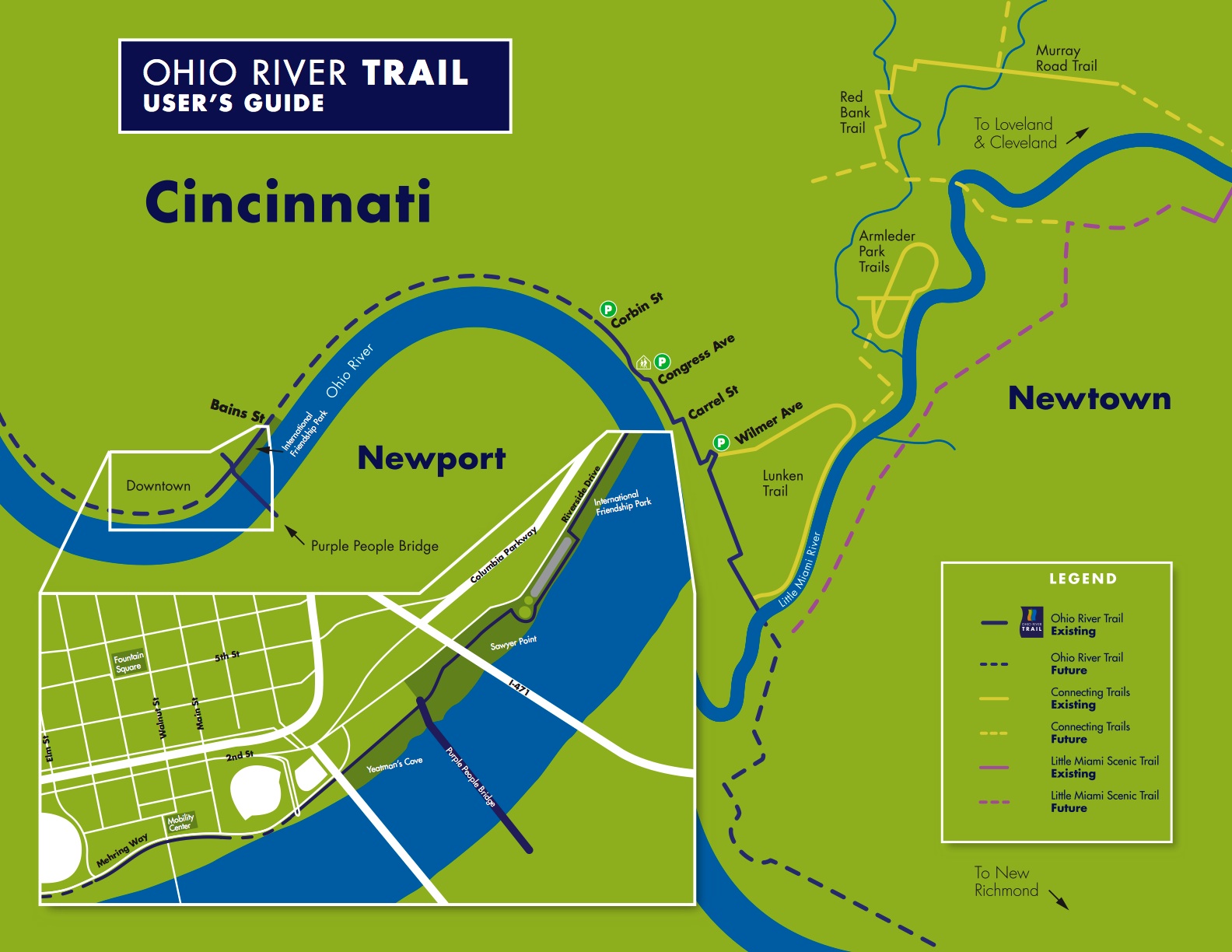
To wrap up the end of Bike Week (and Bike Month), UrbanCincy and the City of Cincinnati have teamed up to lead the Ohio River Trail bike ride on Sunday, May 22 at 10 am. The ride travels along the completed portion of the Ohio River Trail, and will also share information about the new Bike & Mobility Center at the Central Riverfront Park. This event will share information with those in attendance about future phases of the bike trail, as well as learn how to commute to Cincinnati’s urban core by bike.

Once both the Ohio River Trail and Bike & Mobility Center are completed, bicycle commuters will be able to easily commute from Cincinnati’s eastern suburbs to the region’s urban core. The Bike & Mobility Center will include bicycle parking, lockers, showers and a repair facility.

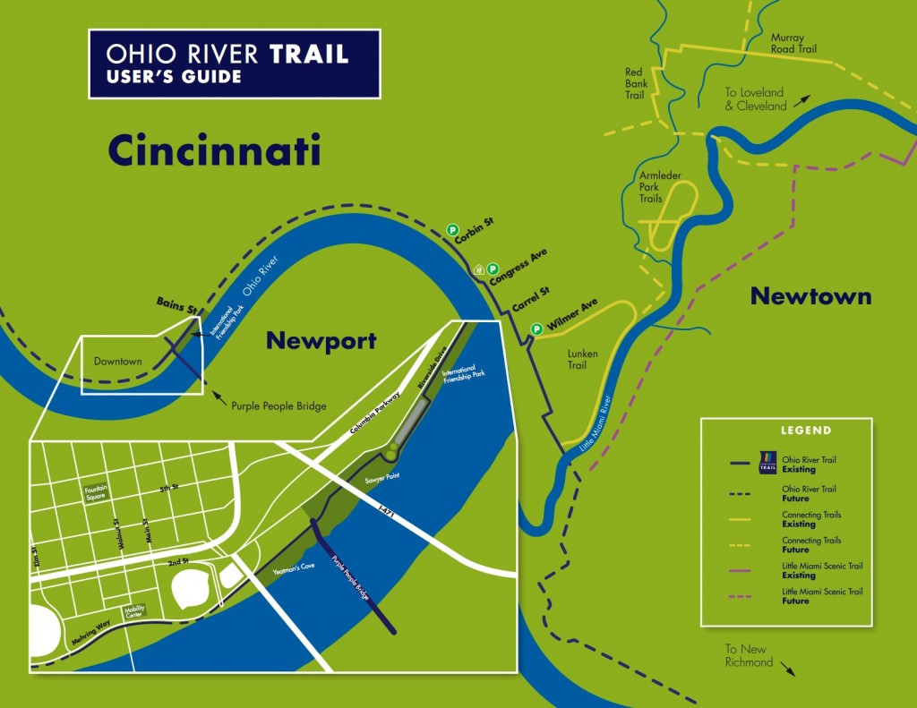
The event is free and open to the public, and is part of the City of Cincinnati’s official 2011 Bike Month activities. The ride is approximately six miles (one way). The map (below) details the route.

“I want this to be something that folks can use to come back to the trail by themselves, that will show them where they can park their cars, and where they need to get on and off the street because the trail is ending or beginning,” said Melissa McVay, with the City’s transportation office.

Steve Schuckman with the Parks department, will be along for the ride and will give a short talk at the termination of the trail to discuss the new mobility center and how residents and cyclists can take advantage of the showers, rental facilities and other amenities to make biking to work part of their routine.

The ride will begin at the parking lot across from the Lunken Airport at 2622 Wilmer Avenue at 10am on Sunday morning. The ride is approximately 6 miles (one way) and covers relatively flat terrain with little elevation change. Check the Facebook event page for more details.

Categories
Arts & Entertainment News Transportation

UrbanCincy Partners with Cincinnati to Organize Two Unique Bike Month Events

In celebration of Bike Month, UrbanCincy has partnered with the City of Cincinnati to bring you two unique events. The first will take place on Saturday, May 14 and take bicyclists on a pedal-powered pub crawl through the city’s urban core. The second event will take place on Sunday, May 22 and give riders a glimpse into what bicycle commuting will be like along the Ohio River Trail.

Bikes+Brews is back by popular demand. Last year UrbanCincy organized this event and made five stops throughout Downtown and Over-the-Rhine. Roughly 50 people participated over various segments of the ride which began and terminated at Findlay Market. This year’s event will also begin and end at Findlay Market, but will include a total of nine stops throughout Over-the-Rhine, West End, Downtown, Newport and Covington. The ride will be led by Cincinnati brewer, and UrbanCincy contributor, Bryon Martin.

Bikes+Brews will begin at 1pm and will roughly last until 6:30pm. The event is free and open to the public, and interested participants are encouraged to join the ride for any duration and segment. The ride is approximately seven miles from start to finish (map), includes slight elevation change and two bridge crossings.

The Ohio River Trail Tour is new this year. The event will begin at Lunken Airport and take bicyclists for a ride along the partially completed Ohio River Trail. The ride will terminate in downtown Cincinnati at the Bike & Mobility Center currently under construction at the Cincinnati Riverfront Park.

Those participating in the Ohio River Trail Tour will be able to get information about future phases of the Ohio River Trail, which will link Cincinnati’s eastern suburbs with downtown, and how to successfully commute by bicycle by utilizing lockers, showers, repair facilities and bicycle parking at the new Bike & Mobility Center.

The Ohio River Trail Tour will begin at 10am in the parking lot across from Lunken Airport’s terminal building. The ride is approximately six miles (map) and contains very few changes in elevation.

2010 Bikes+Brews photograph by Jenny Kessler for UrbanCincy.