Categories
Development News Transportation

VIDEO: UC Students, Transportation Experts Pitch Their Ideas for Wasson Corridor

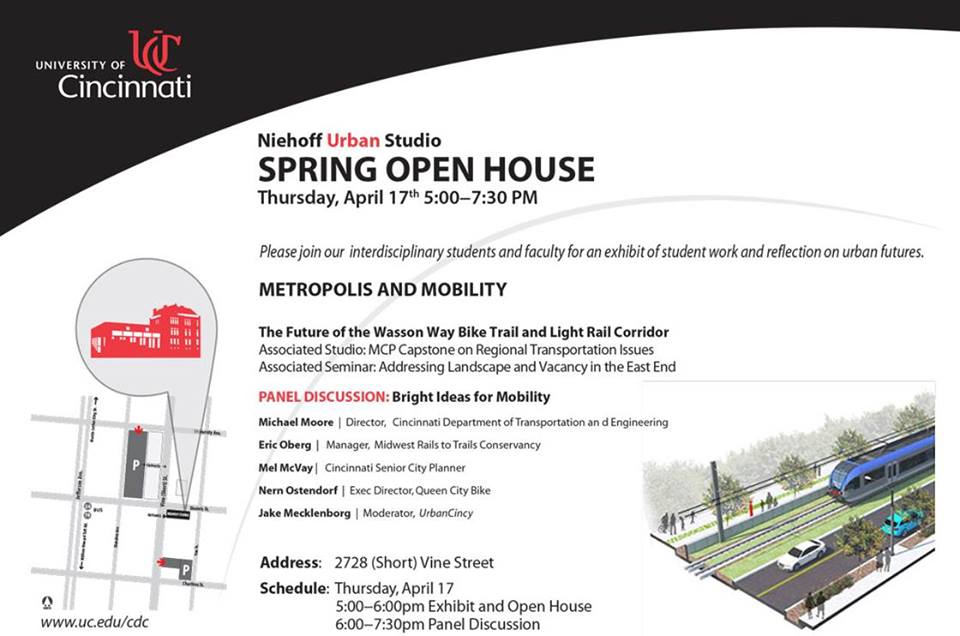
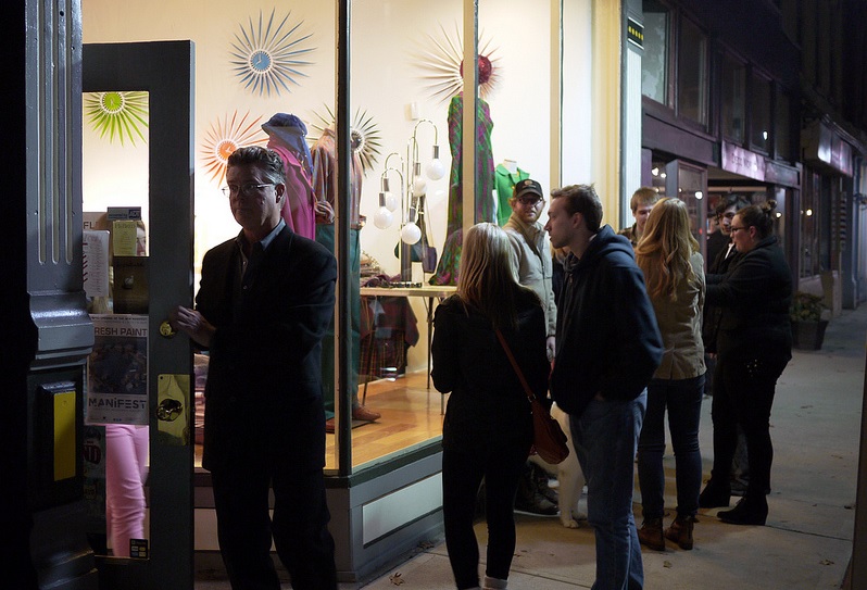
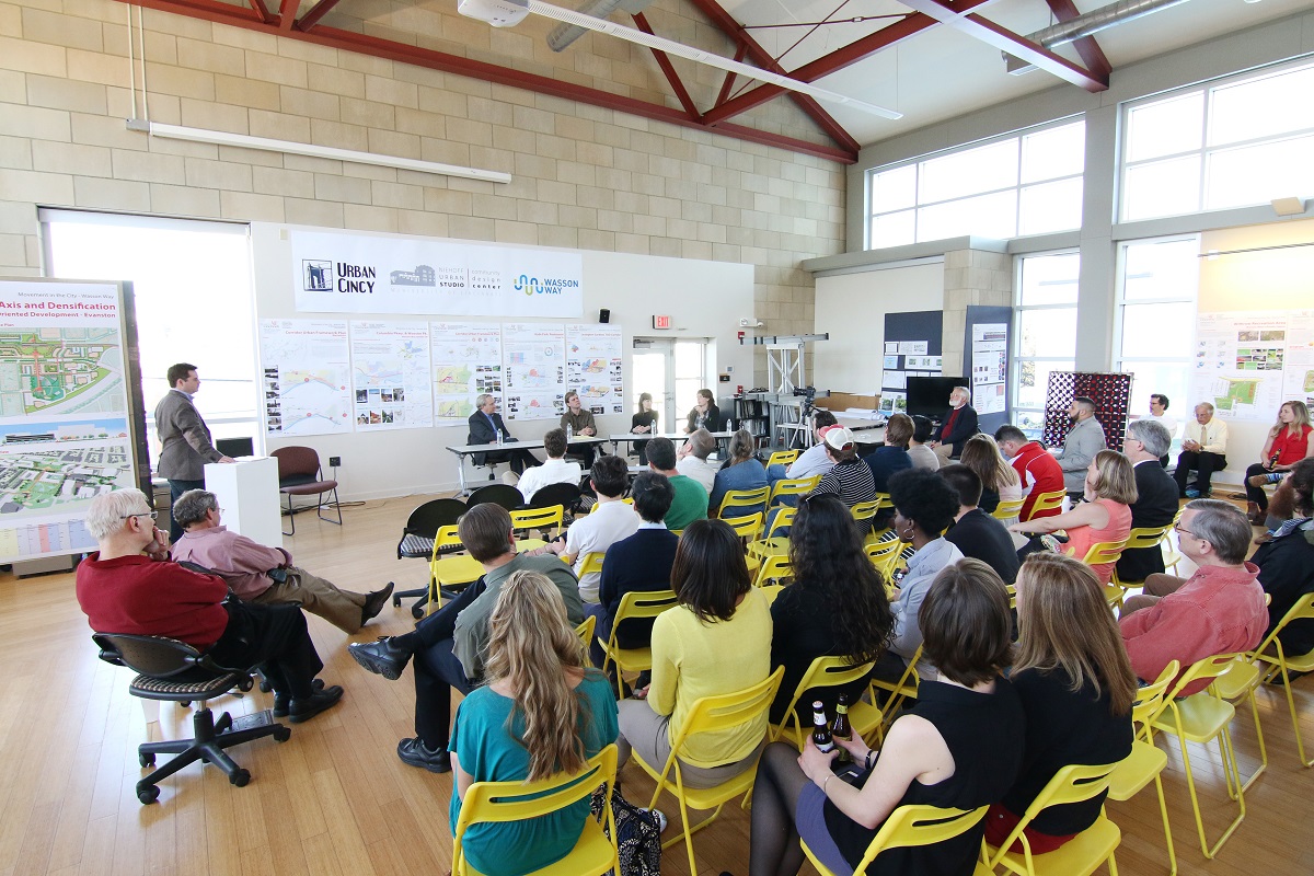
As part of UrbanCincy‘s ongoing partnership with the University of Cincinnati’s Community Design Center, we gathered interested members of the public at the Niehoff Studio in Corryville on April 17 to view the work of students studying the Wasson Corridor.

As with previous events we have hosted at the Niehoff Studio, a capacity crowd attended to not only view the student work, but also participate in a panel discussion with regional experts on the topic. At this event, UrbanCincy‘s Jake Mecklenborg moderated the discussion.

The topic of discussion and the proposals put forth by the interdisciplinary students carried even greater weight as the City of Cincinnati allocated $1.9 million for a variety of bike projects, including $200,000 for the Wasson Way Trail. The City has also recently made an offer to purchase the Wasson Corridor for $2 million from Norfolk Southern who abandoned the rail line years ago.

While the Wasson Way Trail envisions a recreational bicycle and pedestrian trail running along the Wasson Corridor, many now view it as a component of a multi-modal transportation corridor that includes a long-planned light rail line.

Mayor John Cranley’s (D) administration appears to be focused on investing in recreational bike/ped trails, which is good, but the development of the Wasson Corridor should include both the proposed recreational trail and room for light rail tracks.

Fortunately, what was once viewed as a project that pitted light rail advocates against biking advocates has changed drastically since UrbanCincy‘s controversial editorial on the matter in 2012. There now appears to be broad consensus from both sides that the corridor should be developed in a comprehensive, multi-modal fashion.

Categories
Development News Transportation

UrbanCincy, Niehoff Studio to Host Regional Discussion on Wasson Corridor

In May 2013, UrbanCincy partnered with the Niehoff Urban Studio to produce an event that highlighted the final work of engineering and urban planning students studying bus rapid transit and bikeways throughout the region. We then showcased their work and engaged the capacity crowd with a panel discussion between some of the region’s foremost experts on the subjects.

One of the hot topics at that event was the Wasson Corridor, which runs through the heart of Cincinnati’s eastern neighborhoods.

The Future of the Wasson Way Bike Trail and Light Rail Corridor

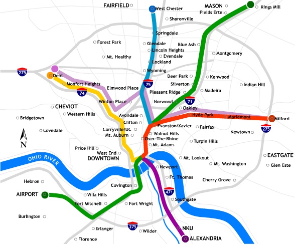
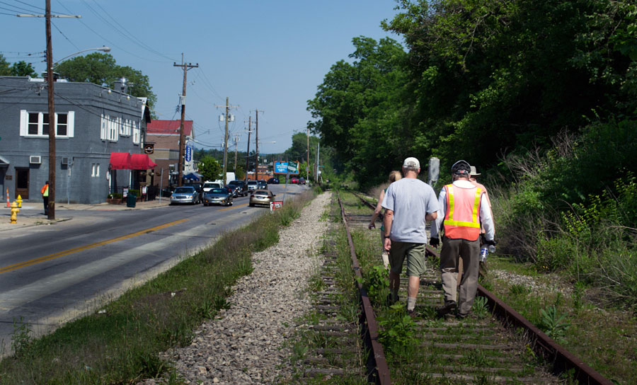
The corridor has long been in regional transit plans as the location for a light rail line, but recent advocacy efforts have been working to convert the abandoned freight rail right-of-way into a recreational trail for bicyclists and pedestrians.

Following UrbanCincy’s controversial editorial opposing the corridor’s conversion into a bike/ped trail, the conversation has shifted to one focused on creating a multi-modal corridor that accommodates the long-planned light rail and the newly envisioned recreational trail.

The next stage of that dialogue will occur this Thursday back at the Niehoff’s Community Design Center in Corryville.

Over the past semester, interdisciplinary students from the University of Cincinnati have been studying the Wasson Corridor and will be presenting their work at this event.

Following the open house where guests can view the final projects, UrbanCincy will then host a panel discussion with Michael Moore, Director of Cincinnati’s Department of Transportation & Engineering (DOTE); Eric Oberg, Manager of the Midwest Rails to Trails Conservancy; Mel McVay, Senior Planner at Cincinnati DOTE; Nern Ostendorf, Executive Director of Queen City Bike. The discussion will be moderated by UrbanCincy’s Jake Mecklenborg.

The event is free and open to the public. The open house portion of the evening will take place from 5pm to 6pm, and the panel discussion will follow immediately at 6pm and go until about 7:30pm.

Light food and refreshments will be provided and a cash bar will be available during the open house. The Niehoff’s Community Design Center can be accessed directly off of Short Vine at the southeast corner of Daniels and Vine Street.

Categories
Business News

BuyCincy Holiday Event Aims to Give Local Shops $500,000 Bump

The final two months of the year are often the make-or-break month for retailers. In some cases this relatively short time period can account for more than a third of a retailer’s annual revenues.

There is always much hype surrounding what specials the big retailers are offering on Black Friday, but there are also opportunities to support small, locally owned businesses this holiday shopping season.

What was previously known as Cincinnati Unchained will return this year as an expanded four-day event meant to encourage area shoppers to support locally owned shops, restaurants and bars. The BuyCincy Holiday Event will take place the week before Black Friday from Thursday, November 21 to Sunday, November 24.

East Walnut Hills Retail
Woodburn Avenue in East Walnut Hills. Photograph provided by 5chw4r7z.

According to Kurt Myers, co-founder and business director of BuyCincy, this will mark the seventh season for the event and that in previous years some merchants have reported that it ends up being their busiest day of the year.

There are more than 300 businesses participating in this year’s event, and that those shops are located in over 25 neighborhoods throughout the region. Organizers say that their goal is to generate new spending from over 35,000 customers, which would create an estimated economic impact of more than $500,000 with each shopper spending approximately $15.

“Supporting locally owned businesses has a three-and-a-half-times greater impact on the economy than shopping at a store that is not owned locally,” Myers explained. “Plus you get to support your friends and neighbors businesses and keep Cincinnati unique.”

In order to help encourage local shoppers to participate in the event, the Greater Cincinnati Independent Business Alliance (CiNBA) is working with retailers to offer raffle prizes. When customers visit a participating business they will receive a ticket to use in the raffle of thousands of dollars of prizes. To help further promote the effort, organizers are also encouraging people to use the #BuyCincy tag on social media.

A full list of the participating businesses and neighborhood business districts can be found at BuyCincy.com. Those businesses that are still interested in participating can do so by registering online and submitting a $25 minimum raffle donation.

If you want to support local businesses but are not quite sure about what to buy for that special someone, then you can also purchase them a Downtown Gift Card, which is redeemable at 180 stores and restaurants in Downtown and Over-the-Rhine, including all Findlay Market merchants. Those gift cards can be purchased online, at the offices for Downtown Cincinnati Inc., or at Findlay Market.

Categories
News Transportation

Cincinnati Seeking Feedback on Two Bike Infrastructure Projects

The City of Cincinnati is studying two new streets for potential bicycle enhancements, and officials with the Department of Transportation & Engineering (DOTE) are looking for the public’s feedback.

The first project is on Delta Avenue where they are considering adding a five-foot bike lane on both sides of the street, and the second is a larger project along Central Parkway that is considering adding either striped bike lanes or physically separated cycle tracks along a 2.2-mile stretch of the roadway.

Delta Avenue Bike Lanes
The Delta Avenue project will take place between Columbia Parkway and Erie Avenue, but will not impact Mt. Lookout Square. DOTE officials say that the schedule calls for repaving to begin in early 2014.

Right now planners and engineers are looking at two options for Delta Avenue. One option would maintain the existing roadway conditions that include two 10-foot travel lanes and two 18-foot travel/parking lanes.
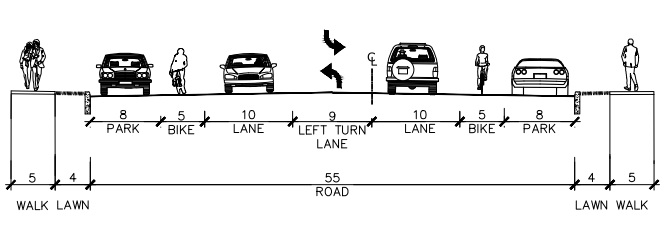
Delta Avenue Proposed Section

The second option would modify this layout to include two 5-foot bike lanes, two 10-foot travel lanes, one 9-foot left turn lane, and two 8-foot parking lanes.

The proposed reconfiguration, DOTE officials say, would provide safety benefits for bicyclists, pedestrians and automobile drivers, and is similar to what was recently installed on Madison Road between Woodburn Avenue and O’Bryonville.

In addition to improving bicycle accessibility along Delta Avenue, the new bike lanes would connect into the recently installed bike lanes on Riverside Drive, which will be extended into the downtown area later this year.

“Delta Avenue is a primary cycling route from Riverside and downtown to the city’s eastern neighborhoods, and these plans will help to calm traffic and make the street safer for cyclists, pedestrians and motorists,” Queen City Bike president Frank Henson stated.

Those interested in sharing their feedback regarding the Delta Avenue project can do so by visiting the City of Cincinnati’s webpage for the project and answering a few brief questions.

Central Parkway Cycle Tracks
The larger Central Parkway project is planned to be built in two phases, with the first phase of work stretching from Elm Street in Over-the-Rhine to Marshall Avenue in Fairview.

Neighborhoods along the first phase of the project have already been approached about the project, and the City of Cincinnati received a $480,000 Transportation Alternative grant from the federal government, administered through the OKI Regional Council of Governments, in June 2013.

This portion of the work is being studied in three separate segments due to existing roadway configuration.
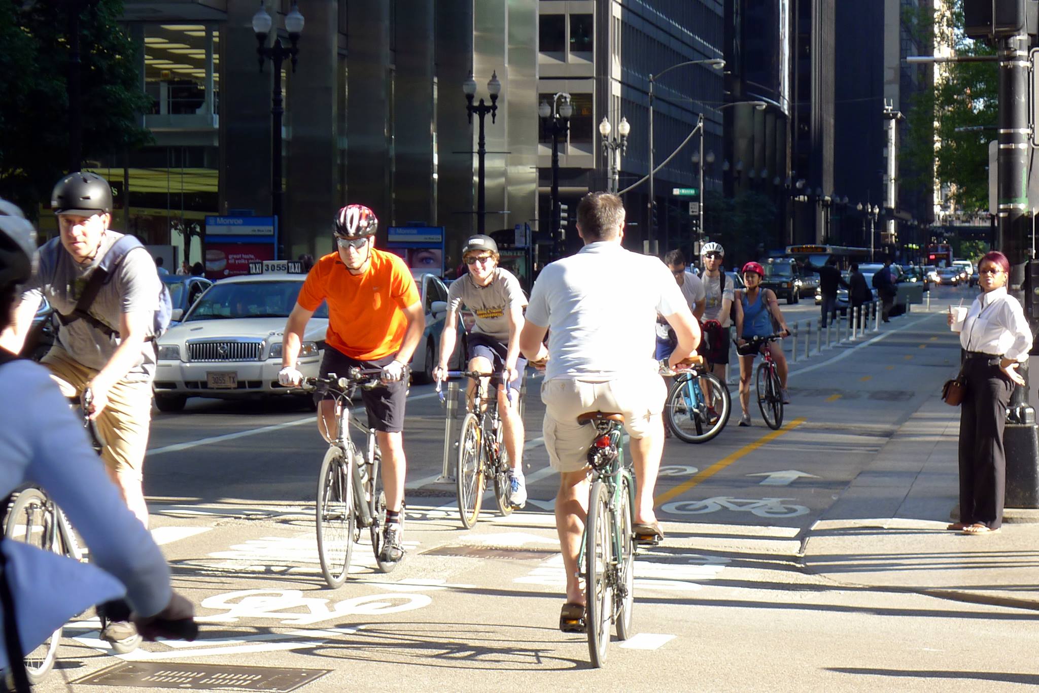
Dearborn Street Two-Way Cycle Track
City officials are looking into the possibility of installing a two-way cycle track along Central Parkway – similar to Chicago’s two-way cycle track on Dearborn Street. Image provided by Active Transportation Alliance.

The first segment is from Elm Street to Liberty Street, and due to the median that divides Central Parkway there, it is considered unfeasible to have a two-way cycle track. As a result, the DOTE is considering only two options – the existing road with no enhancements or one-way cycle tracks on both sides of the street.

The second segment being studied in phase one is from Liberty Street to Brighton Avenue, and is studying three options in addition to the existing conditions. The first would be a 14-foot, two-way cycle track on the west side of the street, the second would be 7-foot-wide one-way cycle tracks on both sides of the street, and the third would be 5-foot bike lanes on both side of the street.

The final segment within the first phase of the Central Parkway project is from Brighton Avenue to Marshall Avenue. Here, the same three options are being considered as for the second segment. The only difference being the two-way cycle track on the west side of the street would be 12 feet wide instead of 14 feet.

“Adding a cycle track to Central Parkway will create a safer, family-friendly space for people on bicycles and will exponentially increase the number of people using bicycles in this corridor,” explained Mel McVay, senior city planner with Cincinnati DOTE. “This project is a game changer for Cincinnati – it has the ability to completely change the way people feel about riding bicycles in our city.”

Those looking to share their thoughts on which design option would be best can do so by completing a very short survey on the Central Parkway project’s webpage.

The second phase of work along Central Parkway would then progress northward from Marshall Avenue to Ludlow Avenue, where the city’s first green bike lanes were installed in November 2012. The details have not yet been worked out for this phase of work, but will progress as soon as funds become available.

“Both of these projects would be extremely beneficial if completed,” noted Queen City Bike executive director Nern Ostendorf. “What bike lanes and especially cycle tracks do is they expand the accessibility of biking on city streets to more users who consider biking on roads without special bike facilities too dangerous, or at least too stressful.”
This story was originally published in the July 19, 2013 print edition of the Cincinnati Business Courier. UrbanCincy readers are able to take advantage of an exclusive digital membership and access all of the Business Courier‘s premium content by subscribing through UrbanCincy‘s discounted rate.

Categories
Business Development News Opinion Transportation

Cincinnati’s Wasson Railroad Corridor Should Not Be Converted Into Recreational Trail

In the post-industrial United States cities all across America have been left with an abundance of rail right-of-way that once served industrial properties. Cities have since struggled to find a use for these rail corridors.

In many cases the rail right-of-way either gets built over, or makes room for some other use – most typically a park or trail of some sort. The most famous, and perhaps most unique, example of this is New York City’s Highline which converted an abandoned freight rail corridor into an elevated park. In most cities, however, much simpler trails are developed in order to cater to bicyclists and pedestrians.

These are great projects, but in the cases where rail right-of-way is needed in order to introduce rail transit, they should not be done. The acquisition of right-of-way can be one of the most difficult hurdles to clear when developing rail transit, so if you have a prime corridor intact, you should do everything in your power to preserve it for future rail transit.


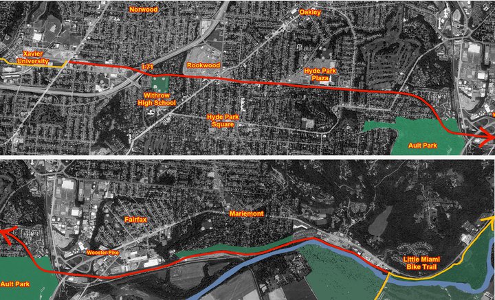
Map of the proposed Wasson Way Project.

The reason this is particularly important in Cincinnati right now is because on March 6, advocates of what is being called Wasson Way Project will present their ideas for converting the Wasson Corridor into a bike/ped trail to City Council’s Strategic Growth Committee.

The idea is not a bad one on face value, but should it proceed it would eliminate one of the most valuable rail corridors in the city. A corridor that could connect neighborhoods like Hyde Park, Oakley, Evanston, Norwood, Mt. Lookout, Fairfax and Mariemont with light rail and eventually connect those neighborhoods to the region’s two largest employment centers – uptown and downtown – without much additional track or right-of-way acquisition.

“I know of no example in the United States where a former railway that has been converted to a bike/hike trail has ever been returned to passenger rail service,” explained Cincinnati transit advocate John Schneider (aka “Mr. Transit”). “Once it’s gone, it’s gone.”

Rail corridors that run through areas of limited potential transit ridership like the Oasis Line should be redeveloped into trails. It just makes sense. There is less automobile traffic and the riverfront trail provides a scenic ride for bicyclists and connects its users to a string of riverfront parks.

The Wasson Line, however, is ripe for light rail service with its densely populated neighborhood, vibrant business districts and key attractions along the line. The Oasis Line should become a bike/ped trail, but the Wasson Line should not.

Unfortunately the exact opposite is progressing for both of these lines in Cincinnati. Hamilton County officials continue to explore funding options to turn the Oasis Line into a commuter rail corridor, and a citizen-led group is strongly advocating for the conversion of the Wasson Line into a bike/ped trail.

While UrbanCincy supports conversion of some rail right-of-ways into other uses, we believe it needs to be done in a thoughtful manner that considers the future transit needs of the region. The Wasson Line is too valuable to convert into a bike/ped trail and should be preserved for an urban light rail line.

The upcoming committee meeting is scheduled to take place at 12pm on Tuesday, March 6 at City Hall (map). We would like to urge you to come out and support the future of regional light rail in the Cincinnati region, and request that the Wasson Corridor not be converted into a recreational trail.