Categories
News Transportation

Everything You Need to Know About the Proposed Elmore Street Viaduct

In the mid-2000s, ODOT designed a $1 billion reconstruction of I-75 between the Ohio River and I-275 that attracted little attention from the Cincinnati media. Who would win and who would lose as access points were shifted, added, or permanently closed?

Aside from a successful effort in 2006 by OKI to retain access at Galbraith Road over ODOT’s objections, virtually no public objections were made as multi-million dollar contracts were let; and work commenced in 2011 on a mega-project that will shape Cincinnati’s traffic patterns and property values for the next fifty years.

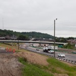
ODOT’s design strategy for the Mill Creek Expressway (Western Hills viaduct to Paddock Rd.) and Thru the Valley (Paddock Rd. to I-275) projects aimed to improve capacity and safety by reducing points of access and mitigating complex merging movements. This means most of I-75’s left-side ramps will be rebuilt as right-side ramps, and odd partial interchanges, such as the Towne Street ramps in Elmwood Place and the famous southbound “canyon” ramps in Lockland, will be permanently removed.

ODOT has already closed a lightly-used ramp providing access to I-75 southbound from Spring Grove Avenue, and another exiting I-74 westbound at Powers Street in Northside.

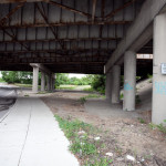
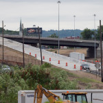
In 2016, ODOT plans to permanently close two ramps near Cincinnati State Technical and Community College. One provides access to I-75 northbound from Central Parkway, while the other provides access to Central Parkway from I-74. The planned closure of this final ramp – an unremarkable 250-foot deck girder overpass spanning I-75 near the Ludlow Viaduct – has been public knowledge for nearly a decade, but only recently has its closure generated opposition.

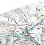
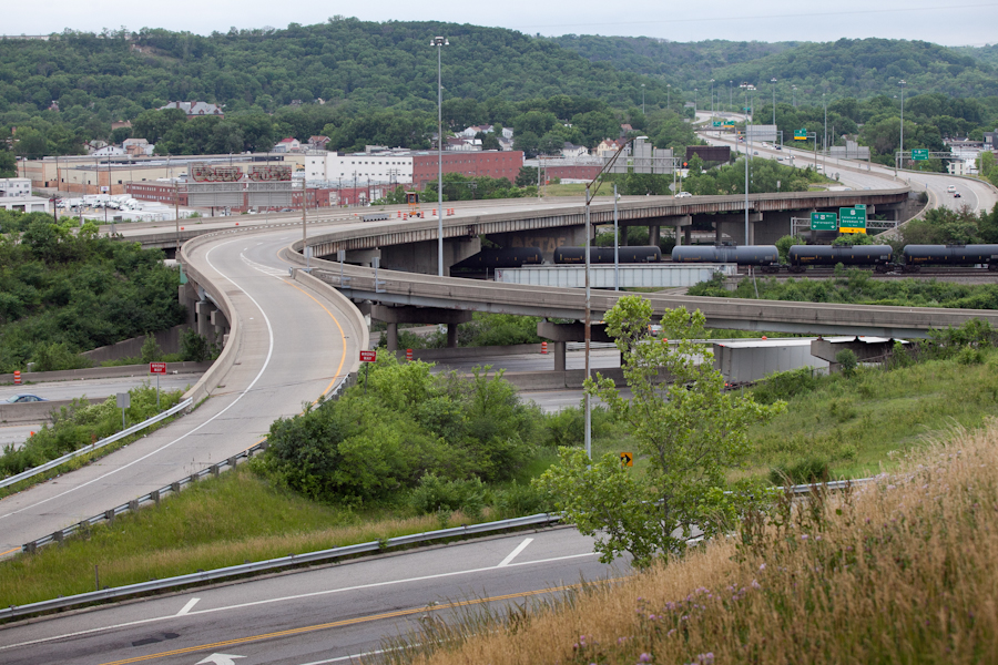
Evidence suggests that replacement of Central Parkway access from I-74 was discussed in the mid-2000s via an aerial structure approximately 10 times longer than the current 250-foot overpass. A drawing from February 2007 illustrates that the flyover ramp would have diverged from I-74 near the Colerain and Beekman Street interchange, bridged Elmore Street, then deposited traffic onto Central Parkway very close to the location of the current ramp.

Despite an effort led by Cincinnati State and then Vice Mayor Roxanne Qualls (D) several years ago, ODOT has not capitulated to recent pleas by Cincinnati State and the City of Cincinnati to reestablish the access provided by the existing 250-foot exit ramp with a similar ramp forking from the planned I-74 east to I-75 north ramp.

Such a ramp would not comply with current Federal Highway Administration guidelines, which discourage local access ramps built in close proximity to “system” interchanges, and local access ramps that diverge or join system interchange ramps. In fact, construction of a new ramp similar to what currently exists would violate Section 6.2.11 and Section 6.2 of FHWA code.

ODOT’s refusal to permit reconstruction of the I-74 ramp to Central Parkway, however, is inconsistent with its recent activities elsewhere in the state.

As part of the $200+ million reconstruction of the I-71/I-670 interchange in Columbus, an exit ramp to Leonard Avenue, a local residential street, was built in the middle of a “system” interchange. No reciprocal access to I-71 south was built, meaning this new ramp violates two sections of the FHWA’s guidelines and created a new situation identical on paper to the one ODOT seeks to eliminate in Cincinnati.

Access to Cincinnati State Community College from I-74 after 2017
In 2015, the City of Cincinnati, with the endorsement of Mayor John Cranley (D), outlined plans for an entirely new 2,500-foot viaduct connecting Elmore Street in South Cumminsville with Central Parkway at Cincinnati State. Ostensibly the proposed viaduct will restore the easy access from I-74 that Cincinnati State will lose in 2017; and, according to Cincinnati State President O’Dell Owens, help attract and retain students who commute from the city’s western suburbs.

To be sure, the proposed viaduct will improve access to I-74 westbound, as no direct access currently exists. But inbound travel will be significantly slower than what presently exists, and not much faster than what would exist if it weren’t built at all.

Perhaps the Elmore Street Viaduct, or something similar to it, could have been better integrated with the I-74 Beekman Street ramps if access to Central Parkway had been deemed a priority 10 years ago – instead ODOT completed a significant rebuilt of the interchange in 2014 with no provision for a new viaduct to Central Parkway.

Access to Cincinnati State Community College from I-75 after 2017
Missing from the Elmore Street Viaduct conversation, however, is the character of Cincinnati’s access from I-75. Currently, commuters from city’s northern neighborhoods must pass Cincinnati State on southbound I-75, exit at Hopple Street, then backtrack one mile north along Central Parkway. Commuters using I-75 north must exit a mile south of the college, traverse the new jug handle connection between Martin Lurther King Drive and Central Parkway, then drive one mile north.

If the current circuitous path I-75 commuters use to reach Cincinnati State isn’t discouraging attendance by prospective students from those neighborhoods, why does President Owens contend that use of the very same Hopple Street exit ramp will discourage I-74 commuters?

Why No Ludlow Avenue Interchange?
Missing from I-75’s initial 1950s construction, and its current reconstruction, is a full interchange at Ludlow Avenue. A new diamond interchange on the Ludlow Viaduct would have created ideal access to Cincinnati State, a new alternative route to the University of Cincinnati and the hospitals, and significantly increased property values in Northside.

Construction of a new interchange at Ludlow Avenue does not appear to have entered into ODOT’s conversations a decade ago, nor did construction of an interchange at Vine Street in St. Bernard.

MetroMoves and the Future of the Rapid Transit Right-of-Way
In 2002, Hamilton County voters defeated MetroMoves, a half-cent sales tax that would have funded improved countywide bus service and construction of various modern streetcar and light rail lines. The initiative planned for the convergence of two light rail lines above the I-75/I-74 interchange that would have provided direct access to Cincinnati State via a station located on the west face of its hill above Central Parkway.

The convergence of two lines just north of the property promised frequent train service for the community college, even during off-peak hours; however, no call for improved public transportation has been heard from those currently pushing for the Elmore Street Viaduct.

What’s more, there has been no call to incorporate a provision for rail transit on the proposed Elmore Street Viaduct. When looking at ODOT’s 2007 drawing, it is plain to see how the proposed structure could be integrated into the light rail network, thus eliminating the high expense of a dedicated light rail viaduct over the I-75/74 interchange in the future.

Meanwhile, ODOT’s reconstruction of I-75 will leave the old Rapid Transit Loop right-of-way mostly intact between the subway portals and Cincinnati State – meaning only a 100-foot bridge over Marshall Avenue will be necessary to construct a fully grade-separated surface line between the subway portals and Cincinnati State.

EDITORIAL NOTE: After this article was published, Mayor John Cranley’s office, through spokesperson Kevin Osborne, contacted UrbanCincy and provided additional information regarding the efforts of then Vice Mayor Roxanne Qualls to piece together funding for a smaller, yet similar project years ago. This article has been updated to reflect that reality.
Categories
News Transportation

Ohio Maintains Position As Nation’s 16th Best State for Bicyclists

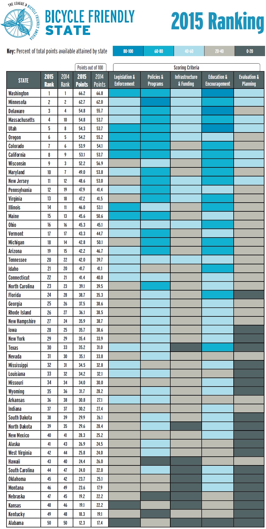
Bicycle Friendly State Ranking 2015Ohio has maintained its ranking as the 16th best state for bicycling in 2015, according to the League of American Bicyclists. The Buckeye state was previously ranked 16th in 2014, after a big jump from 32nd the previous year. This position places the state as the fourth best in the Midwest, behind just Minnesota, Wisconsin and Illinois.

The ranking is issued after compiling the results of a Bicycle Friendly State questionnaire that is answered by a coordinator in each state, and is based on five criteria: Legislation and Enforcement, Policies and Programs, Infrastructure and Funding, Education and Encouragement, and Evaluation and Planning.

The state scored a total of 45.3 points out of a possible 100, and fared best in terms of its Education and Outreach, but scored lowest in its Evaluation and Planning.

“I’m excited about where Ohio is,” Frank Henson, President of Queen City Bike, told UrbanCincy. He said that he felt that even though Ohio gained in its scoring of points, the reason it did not move higher in the ranking is due to the investments being made elsewhere around the country.

“While Ohio continued to do a lot of great things, especially here in Cincinnati and neighboring communities, other states were ramping up,” Henson said.

Leadership at Queen City Bike believes that Ohio has the potential to move up in next year’s ranking with the possible passage of House Bill 154.

Chuck Smith, Chairman of the Ohio Bicycle Federation, agreed and said that the top two suggestions from the League of American Bicyclists to improve the state’s ranking are both addressed in the bill. The first is a statewide requirement for vehicles to provide three feet of clearance when passing bikes, which is already an ordinance in Cincinnati. The second is a “dead red” law, which would allow all vehicles, including bicycles, to proceed through an intersection if they are not detected by traffic control devices.

“It’s important for cyclists to be legal, but bikes are sometimes outside of the system” Smith said in reference to many traffic control devices that are unable to detect the presence of people riding bikes.

One of the other major items recommended by the League of American Bicyclists is the adoption of a statewide Complete Streets policy – something both state and local officials continue to struggle with all over Ohio.

Julie Walcoff, Bicycle and Pedestrian Program Manager of the Ohio Department of Transportation, said there are several other actions being taken at the state level that could further bolster the state’s national ranking.

“We’re putting together a safety coalition that will encompass advocates, communities around the state, and other organizations that are interested in bicycle and pedestrian safety,” Walcoff told UrbanCincy. “We’ll be using that group to help develop a statewide educational campaign that focuses on road users of all types and on law enforcement.”

In addition, ODOT recently kicked off an initiative to designate proposed US and state bike routes throughout the Ohio, connecting the 17 largest cities in the state. ODOT officials say that these routes will use roads that already have an acceptable level of safety, along with existing paths.

While many have described ODOT as an agency almost entirely focused on highway building, Walcoff says they pride themselves on their working relationships with bicycle advocacy organizations throughout the state. This, she says, can help not only maintain Ohio’s current ranking but help it get even better in the future.

In Columbus, advocacy group Yay Bikes! is working with the city to increase the focus on design and engineering of the street infrastructure. Executive Director Catherine Girves says that to help improve the current situation, they are having engineers budget time each week to ride the streets with their group in order to better understand the needs of those people riding bikes.

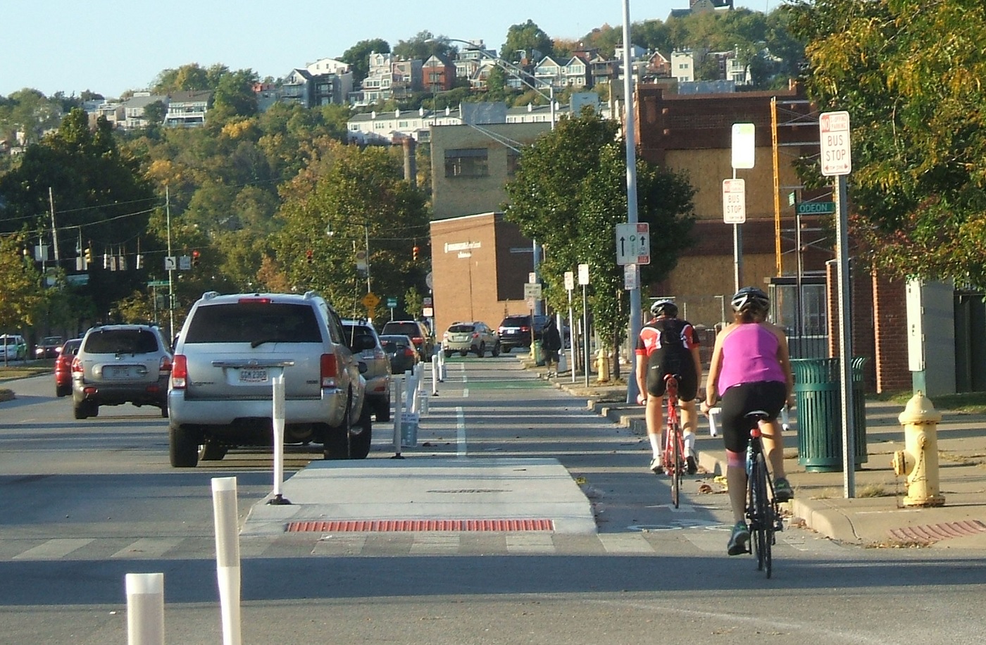
Back in Cincinnati, Henson noted the addition of Cincy Red Bike and the Central Parkway protected bike lane – the first of its kind in Ohio – as two key developments over the past year that have helped state’s ranking. Following the Cincinnati’s lead, both Cleveland and Columbus are now planning protected bike lanes of their own.

While much of the focus has been on core cities, Queen City Bike is also working with the Connecting Active Communities Coalition, which is comprised of representatives from nine communities in Cincinnati’s northern suburbs: Blue Ash, Evendale, Glendale, Lockland, Montgomery, Reading, Sharonville, Woodlawn and Wyoming. As of now, this group is working to develop a coordinated network for bicycling and other non-motorized modes of transportation on a multi-jurisdictional level.

Kentucky, meanwhile, ranked as the second worst state in the nation with just 18.3 points. This represented a 0.8 point drop from the previous year.

Categories
News Transportation

Long-Planned $30M Lytle Tunnel Rehabilitation to Begin Next Week

Ohio Department of Transportation officials have announced that work will begin next week on the $30 million rehabilitation of Lytle Tunnel.

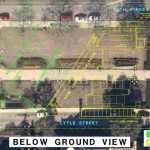
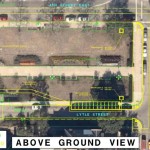
Construction crews will begin work on Tuesday, May 26 to add ITS cameras, a fire detection system, upgrade tunnel lighting, repair existing concrete and tiling, upgrade mechanical and ventilation systems, install a new power supply and replace existing underground vaults under the Fourth Street sidewalk.

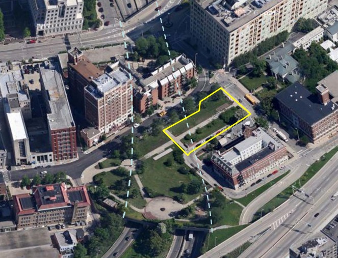
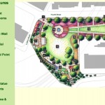
In addition to this, ODOT crews will move the tunnel’s ventilation system and add new access hatches to several locations so as to not interfere with future plans for Lytle Park.

The work will require Lytle Park itself, and portions of Lytle Street to be closed while construction takes place. Gary Middleton, ODOT District 8 Acting Deputy Director, says that the effort will take approximately two years, with completion coming near the end of 2017.

Over that period of time, the work is expected to cause some headaches for those driving in the immediate area. In particular, project officials are saying that they will go to great lengths to avoid impacts during major events like the All-Star Game, Riverfest and Oktoberfest.

While numerous small disruptions will occur, project officials have noted that the work will force an entire weekend closure of southbound I-71 and the southbound I-71 ramp to Third Street. The southbound I-71 ramp to Third Street will be closed at a later period for 20 consecutive calendar days. The longest closure off all, however, will be when the Second Street ramp to northbound I-71 is closed for 60 consecutive calendar days.

While some scheduling details have yet to be ironed out, Middleton says that a detailed road closure schedule will be released in mid-June.

The road closures will add to those already found all over the center city due to the huge volume of construction taking place that is adding hundreds of residences, hotel rooms, offices and introducing new public transportation and park amenities.

While officials at the City of Cincinnati have not made a specific statement on the matter, the road closures, once finalized, are expected to be posted and updated on RoadmapCincy.com.

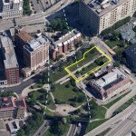
The work may also require the closure of the eastern portions of the 2.3-acre park to be closed for up to 10 months.

“This essential project will complete a major rehabilitation of the tunnel and its mechanical and electrical systems, improve safety for drivers and first responders, and ensure future maintenance activities minimize impacts to traveling public and users of the park,” Middleton said.

While the work on Lytle Tunnel, which was originally built in 1970, will be largely unseen, the updates will bring the tunnel into compliance with current fire codes and design standards. It is also presenting a unique opportunity to make improvements to Lytle Park at the same time – an effort that Western & Southern Financial Group has been strongly advocating.

According to ODOT documents, the project is currently on-schedule, but is now estimated to cost approximately $8 million more than what was originally planned.

Categories
News Transportation

Phase One of Ohio River Trail West Secures $1.3M in Funding

River West Working Group has announced that the western leg of the Ohio River Trail through Cincinnati has been awarded a $1 million Federal Congestion Mitigation/Air Quality grant. An additional funding commitment of $261,000 from the City of Cincinnati’s Bicycle Transportation Program brings the total to $1.3 million.

Project leaders say that the money will be put toward construction of the first phase of the bikeway and greenway project along Cincinnati’s western riverfront.

“We greatly appreciate the initiative of the City’s Department of Transportation & Engineering in developing and submitting the grant application, and the support of Mayor John Cranley, who set up the bike program funding that seeded the Federal grant,” said Tom Croft, co-chair of River West Working Group.

Croft, a Price Hill community activist, also credited the work of ODOT, OKI Regional Council of Governments, State Senator Bill Seitz (R), and Representatives Bill Blessing (R) and Lou Terhar (R).

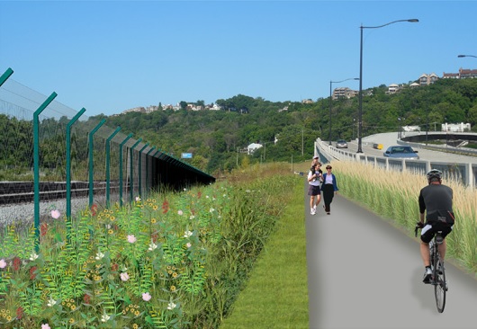
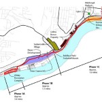
The first phase of work will extend roughly 3.7 miles downriver from the planned Price Landing park to the Gilday Recreation Center. The recently allocated funds will go toward constructing more than half of this phase of work.

The overall plan for Ohio River Trail West is a 28-mile bikeway and greenway network, separated from nearby roads, that serves as a connection between Smale Riverfront Park and Shawnee Lookout.

The river alignment of this trail makes it unique to any other east/west corridor on Cincinnati’s west side in that it does not traverse steep or extended hills. Such an orientation will allow cyclists the opportunity to get to the trail and have a level path into the city center.

Due to the relationship of the project to the existing freight railroad lines, project leaders say that additional coordination is needed before the group is able to move forward with the third segment of work within the first phase of construction activities.

“We are not going to announce work on that until we have negotiated some type of agreement”, Dave Zelman, co-chair of River West Working Group told UrbanCincy.

Further complicating matters is that the City of Cincinnati recently worked with the freight railroad companies to rebuild the four tracks along that stretch in recent years. Regardless, neighborhood leaders and project proponents are confident that the work will progress and serve as a major benefit for the communities along the corridor.

“The Ohio River Trail West is a big factor in the ongoing revitalization of our western Hamilton County neighborhoods, many of which are underserved by this kind of amenity,” concluded Zelman. “It will encourage access to the Ohio River and its surrounding hillsides, our greatest natural assets.”

Categories
Up To Speed

What if we calculated level of service for pedestrians?

What if we calculated level of service for pedestrians?.

Level of Service. Chances are, unless you’re in a field related to transportation planning or engineering, or are a total geek, you probably have not heard of this term before. LOS, however, has come to define how we design and build or roadways. Almost by its structure, LOS favors cars over the function or safety of any other mode of transportation. So what would happen if we took the same approach for other modes, like walking? More from Urban Kchoze:

The point of a traffic engineer in most studies is to keep level of service as low as possible to avoid delays for drivers, helping them drive faster and have to wait less for other traffic. Now then, some of you may ask “well, what about pedestrians and cyclists? How is level of service measured for them?” Well, the answer to that is that the default method says: F#!% ’em.

So let’s suppose that we calculate a level of service for pedestrians based on the same basis as for vehicles. Pedestrians can stop and accelerate to regular walking speed almost instantaneously and so we don’t have to calculate delay caused by lower than desired speeds during acceleration and deceleration. So delay is limited essentially only to the wait time before they can go ahead and cross (supposing car drivers respect pedestrian priority).

…crosswalks with medians and stop signs should be preferred to traffic lights for areas with a focus on pedestrians. It also means that the habit of channeling all the traffic on a few wide arterials, forcing each intersection to have multiple turn lanes and many through lanes, is absolutely terrible for pedestrians. A street grid with densely packed streets would do a better job of responding to all users, as it would dilute traffic on many streets, all these streets could be narrow, with 3 or 4 lanes only (1 per direction plus a shared left-turn lane or 2 per direction). Ideally, I believe there should not be any width of pavement greater than 12 meters (40 feet) in a city, any pavement wider than that should be broken in two with a median wide enough to use as a pedestrian refuge.