Categories
News Transportation

Everything You Need to Know About the Proposed Elmore Street Viaduct

In the mid-2000s, ODOT designed a $1 billion reconstruction of I-75 between the Ohio River and I-275 that attracted little attention from the Cincinnati media. Who would win and who would lose as access points were shifted, added, or permanently closed?

Aside from a successful effort in 2006 by OKI to retain access at Galbraith Road over ODOT’s objections, virtually no public objections were made as multi-million dollar contracts were let; and work commenced in 2011 on a mega-project that will shape Cincinnati’s traffic patterns and property values for the next fifty years.

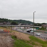
ODOT’s design strategy for the Mill Creek Expressway (Western Hills viaduct to Paddock Rd.) and Thru the Valley (Paddock Rd. to I-275) projects aimed to improve capacity and safety by reducing points of access and mitigating complex merging movements. This means most of I-75’s left-side ramps will be rebuilt as right-side ramps, and odd partial interchanges, such as the Towne Street ramps in Elmwood Place and the famous southbound “canyon” ramps in Lockland, will be permanently removed.

ODOT has already closed a lightly-used ramp providing access to I-75 southbound from Spring Grove Avenue, and another exiting I-74 westbound at Powers Street in Northside.

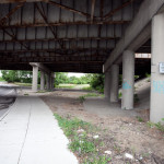
In 2016, ODOT plans to permanently close two ramps near Cincinnati State Technical and Community College. One provides access to I-75 northbound from Central Parkway, while the other provides access to Central Parkway from I-74. The planned closure of this final ramp – an unremarkable 250-foot deck girder overpass spanning I-75 near the Ludlow Viaduct – has been public knowledge for nearly a decade, but only recently has its closure generated opposition.

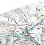
Evidence suggests that replacement of Central Parkway access from I-74 was discussed in the mid-2000s via an aerial structure approximately 10 times longer than the current 250-foot overpass. A drawing from February 2007 illustrates that the flyover ramp would have diverged from I-74 near the Colerain and Beekman Street interchange, bridged Elmore Street, then deposited traffic onto Central Parkway very close to the location of the current ramp.

Despite an effort led by Cincinnati State and then Vice Mayor Roxanne Qualls (D) several years ago, ODOT has not capitulated to recent pleas by Cincinnati State and the City of Cincinnati to reestablish the access provided by the existing 250-foot exit ramp with a similar ramp forking from the planned I-74 east to I-75 north ramp.

Such a ramp would not comply with current Federal Highway Administration guidelines, which discourage local access ramps built in close proximity to “system” interchanges, and local access ramps that diverge or join system interchange ramps. In fact, construction of a new ramp similar to what currently exists would violate Section 6.2.11 and Section 6.2 of FHWA code.

ODOT’s refusal to permit reconstruction of the I-74 ramp to Central Parkway, however, is inconsistent with its recent activities elsewhere in the state.

As part of the $200+ million reconstruction of the I-71/I-670 interchange in Columbus, an exit ramp to Leonard Avenue, a local residential street, was built in the middle of a “system” interchange. No reciprocal access to I-71 south was built, meaning this new ramp violates two sections of the FHWA’s guidelines and created a new situation identical on paper to the one ODOT seeks to eliminate in Cincinnati.

Access to Cincinnati State Community College from I-74 after 2017
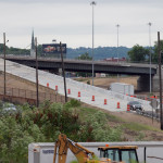
In 2015, the City of Cincinnati, with the endorsement of Mayor John Cranley (D), outlined plans for an entirely new 2,500-foot viaduct connecting Elmore Street in South Cumminsville with Central Parkway at Cincinnati State. Ostensibly the proposed viaduct will restore the easy access from I-74 that Cincinnati State will lose in 2017; and, according to Cincinnati State President O’Dell Owens, help attract and retain students who commute from the city’s western suburbs.

To be sure, the proposed viaduct will improve access to I-74 westbound, as no direct access currently exists. But inbound travel will be significantly slower than what presently exists, and not much faster than what would exist if it weren’t built at all.

Perhaps the Elmore Street Viaduct, or something similar to it, could have been better integrated with the I-74 Beekman Street ramps if access to Central Parkway had been deemed a priority 10 years ago – instead ODOT completed a significant rebuilt of the interchange in 2014 with no provision for a new viaduct to Central Parkway.

Access to Cincinnati State Community College from I-75 after 2017
Missing from the Elmore Street Viaduct conversation, however, is the character of Cincinnati’s access from I-75. Currently, commuters from city’s northern neighborhoods must pass Cincinnati State on southbound I-75, exit at Hopple Street, then backtrack one mile north along Central Parkway. Commuters using I-75 north must exit a mile south of the college, traverse the new jug handle connection between Martin Lurther King Drive and Central Parkway, then drive one mile north.

If the current circuitous path I-75 commuters use to reach Cincinnati State isn’t discouraging attendance by prospective students from those neighborhoods, why does President Owens contend that use of the very same Hopple Street exit ramp will discourage I-74 commuters?

Why No Ludlow Avenue Interchange?
Missing from I-75’s initial 1950s construction, and its current reconstruction, is a full interchange at Ludlow Avenue. A new diamond interchange on the Ludlow Viaduct would have created ideal access to Cincinnati State, a new alternative route to the University of Cincinnati and the hospitals, and significantly increased property values in Northside.

Construction of a new interchange at Ludlow Avenue does not appear to have entered into ODOT’s conversations a decade ago, nor did construction of an interchange at Vine Street in St. Bernard.

MetroMoves and the Future of the Rapid Transit Right-of-Way
In 2002, Hamilton County voters defeated MetroMoves, a half-cent sales tax that would have funded improved countywide bus service and construction of various modern streetcar and light rail lines. The initiative planned for the convergence of two light rail lines above the I-75/I-74 interchange that would have provided direct access to Cincinnati State via a station located on the west face of its hill above Central Parkway.

The convergence of two lines just north of the property promised frequent train service for the community college, even during off-peak hours; however, no call for improved public transportation has been heard from those currently pushing for the Elmore Street Viaduct.

What’s more, there has been no call to incorporate a provision for rail transit on the proposed Elmore Street Viaduct. When looking at ODOT’s 2007 drawing, it is plain to see how the proposed structure could be integrated into the light rail network, thus eliminating the high expense of a dedicated light rail viaduct over the I-75/74 interchange in the future.

Meanwhile, ODOT’s reconstruction of I-75 will leave the old Rapid Transit Loop right-of-way mostly intact between the subway portals and Cincinnati State – meaning only a 100-foot bridge over Marshall Avenue will be necessary to construct a fully grade-separated surface line between the subway portals and Cincinnati State.

EDITORIAL NOTE: After this article was published, Mayor John Cranley’s office, through spokesperson Kevin Osborne, contacted UrbanCincy and provided additional information regarding the efforts of then Vice Mayor Roxanne Qualls to piece together funding for a smaller, yet similar project years ago. This article has been updated to reflect that reality.
Categories
News Transportation

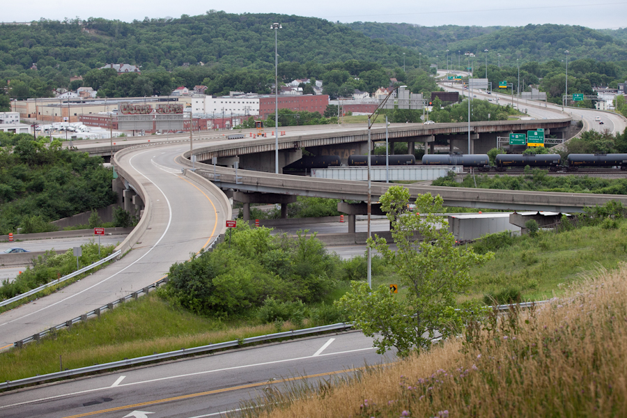
Phase One of Ohio River Trail West Secures $1.3M in Funding

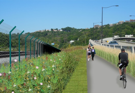
River West Working Group has announced that the western leg of the Ohio River Trail through Cincinnati has been awarded a $1 million Federal Congestion Mitigation/Air Quality grant. An additional funding commitment of $261,000 from the City of Cincinnati’s Bicycle Transportation Program brings the total to $1.3 million.

Project leaders say that the money will be put toward construction of the first phase of the bikeway and greenway project along Cincinnati’s western riverfront.

“We greatly appreciate the initiative of the City’s Department of Transportation & Engineering in developing and submitting the grant application, and the support of Mayor John Cranley, who set up the bike program funding that seeded the Federal grant,” said Tom Croft, co-chair of River West Working Group.

Croft, a Price Hill community activist, also credited the work of ODOT, OKI Regional Council of Governments, State Senator Bill Seitz (R), and Representatives Bill Blessing (R) and Lou Terhar (R).

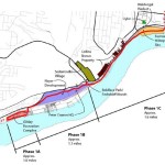
The first phase of work will extend roughly 3.7 miles downriver from the planned Price Landing park to the Gilday Recreation Center. The recently allocated funds will go toward constructing more than half of this phase of work.

The overall plan for Ohio River Trail West is a 28-mile bikeway and greenway network, separated from nearby roads, that serves as a connection between Smale Riverfront Park and Shawnee Lookout.

The river alignment of this trail makes it unique to any other east/west corridor on Cincinnati’s west side in that it does not traverse steep or extended hills. Such an orientation will allow cyclists the opportunity to get to the trail and have a level path into the city center.

Due to the relationship of the project to the existing freight railroad lines, project leaders say that additional coordination is needed before the group is able to move forward with the third segment of work within the first phase of construction activities.

“We are not going to announce work on that until we have negotiated some type of agreement”, Dave Zelman, co-chair of River West Working Group told UrbanCincy.

Further complicating matters is that the City of Cincinnati recently worked with the freight railroad companies to rebuild the four tracks along that stretch in recent years. Regardless, neighborhood leaders and project proponents are confident that the work will progress and serve as a major benefit for the communities along the corridor.

“The Ohio River Trail West is a big factor in the ongoing revitalization of our western Hamilton County neighborhoods, many of which are underserved by this kind of amenity,” concluded Zelman. “It will encourage access to the Ohio River and its surrounding hillsides, our greatest natural assets.”

Categories
News Transportation

New Cincinnati Bike Map Aims to Change the Way New, Old Cyclists View the City

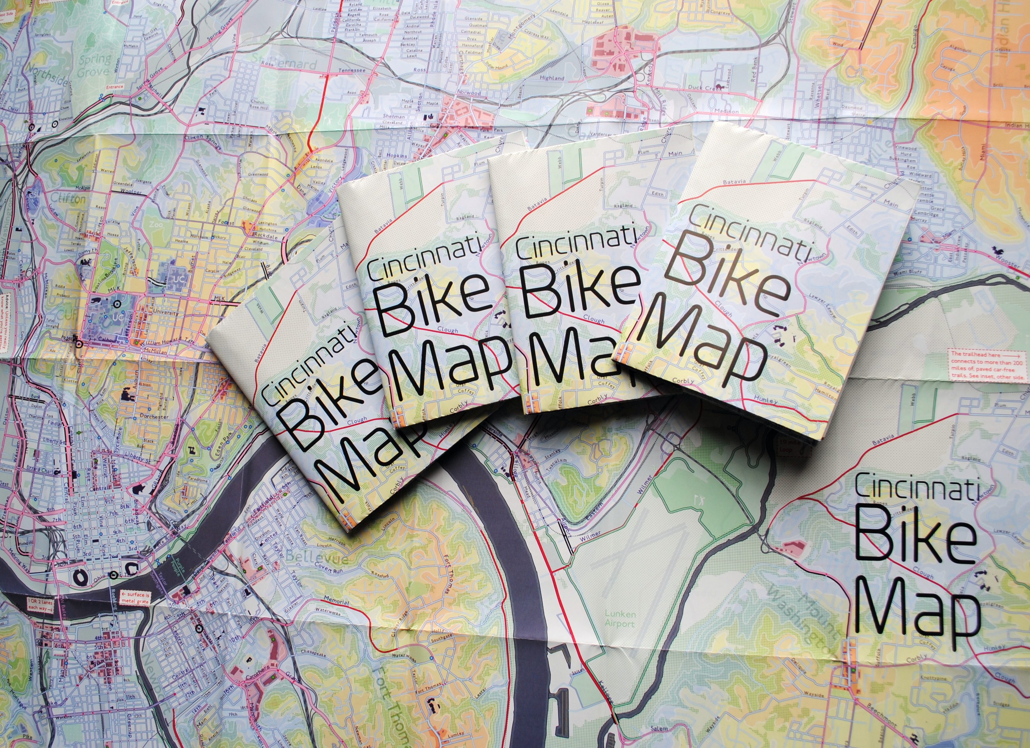
In 2011 Nate Wessel sought out to change the way Cincinnati mapped its transit. In a region with multiple transit operators that all use traditional bus mapping visuals, it was quite the daunting task. But after successfully raising more than $2,000 on Kickstarter, Wessel was able to fund his effort to print tens of thousands of his newly designed maps that ultimately received national praise.

Since that time he has continued his quest to improve the visual nature of map-making in Cincinnati, including serving as UrbanCincy’s official contributing cartographer, but he also embarked on another major endeavor. Instead of a transit map with bus frequencies, Wessel this time focused his energies on creating a new regional bike network map.

“Imagine someone kept taking, and reproducing and sharing, very unflattering photos of you or someone you loved. If you’re like me, you’d probably let the first one slide,” Wessel stated. “Maybe it was an accident, but by the fifth or sixth one, you’d start noticing a pattern and you’d start getting kind of miffed about it.”

This is the feeling the twenty-something urban planner, cartographer and fashion designer felt about the region’s existing bike maps, and he wanted to take control of the situation and improve it.

“This is a subtle visual game and words won’t do,” Wessel explained. “You need to make your own photo that shows the beauty you see in what you love; and then get other people to see what you see.”

One of the ways to accomplish that, he says, is to get the maps into people’s hands – digital maps are not enough. While the physical presence of a printed map gives it a sense of permanency and seriousness, producing a hard copy map also comes with its challenges.

After finishing the design for the Cincinnati Bike Map, Wessel said that he received feedback from the binder recommending a redesign to better accommodate the way the paper would fold, but that it was too late in the process. As a result, he wishes the maps folded a bit better, but that he is otherwise quite pleased with the final product. Perhaps leading to that feeling of satisfaction, however, is the fact that no compromise was needed since the project was entirely self-funded.

“Both times I’ve raised money for these projects it was in advance of having a real demonstrable product,” said Wessel. “In neither project have I ever had to check anything with a sponsor, supervisor or co-designer. The maps were totally my own in both cases, held to my own standards alone and uncompromised. That is very unusual for print maps.”

While quite unusual, it was a situation he preferred. In fact, Wessel says that a local organization very generously offered to fully fund the printing of Cincinnati Bike Map should he work with their graphic designer. A generous offer indeed, but one that came with risks that the final product not turn out as originally envisioned.

The release of the new regional bike map last month comes at a time when Cincinnati is in the national spotlight for its dramatic gains in bike ridership and development of new bike infrastructure.

Now that the project is complete, the goal now shifts to distributing the stack of Cincinnati Bike Maps that now exist. In addition to distributing the maps to local bike shops and organizations, Wessel is also mailing out copies of the map. His hope is that new or unfamiliar riders feel empowered by the maps, and that experienced riders use them to explore new routes throughout the region.

“Regular cyclists have found their favorite routes and will probably stick with what they know,” said Wessel. “Though, I totally discovered Fort Thomas through this map. Every map I’d seen made it look like a pretty crappy, suburban place to ride and I always avoided it; but the streets are beautifully wooded and very slow with 25mph speed limits.

Of course, all of this would not have been possible without access to the treasure trove of data on-hand at Cincinnati City Hall, and with the OKI Regional Council of Governments.

Those who would like to get a free copy of the Cincinnati Bike Map can do so by emailing Nate Wessel at bike756@gmail.com and informing him of your name, how many copies you want, and the address to which he can ship them.

Categories
News Politics Transportation

Region’s Transportation Funding Disproportionality Favors Cars Over All Other Modes

Research continues to show that Americans are driving less, but are biking, walking and using transit more. This is true in Cincinnati to the extent that transit ridership has increased in recent years.

While originally attributed to the economic downturn at the beginning of the century, these trends have continued while the economy has rebounded – leading many to believe it is an indication of new market forces being driven by aging Baby Boomers and emerging Millennials. Perhaps predictably so, governments have been slow to change with the changing economic forces.

Despite a growing number of trips for biking, walking and transit, funding has not increased correspondingly. In fact, many communities have seen funding for these non-automotive forms of transportation decrease as governments have worked to cut spending at all levels. This, new research finds, is only exacerbating the problem of having underfunded these modes of transportation for many years.

“Conventional statistics tend to under report active travel because most travel surveys under-count shorter trips (those within a traffic analysis zone), off-peak trips, non-work trips, travel by children, and recreational travel,” stated Todd Litman, Executive Director of the Victoria Transport Policy Institute, in a summary of his report entitled Whose Roads? Evaluating Bicyclists’ and Pedestrians’ Right to Use of Public Roadways.

“More comprehensive surveys indicate that active travel is two to four times more common than conventional surveys indicate, so if statistics indicate that only 5% of trips are by active modes, the actual amount is probably 10-20%.”

Litman indicates that funding levels tend to be much lower than even the low 5% trip share estimates, and recommends changing those levels to reflect not only the current trip share levels, but those that could be achieved should investments be made.

Unequal Funding Allocations at Regional Level
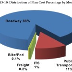
At the local level, the same situation of unequal funding allocation exists. In the 2040 Regional Transportation Plan, developed by the OKI Regional Council of Governments, approximately 88% of the nearly $21.5 billion in funding is recommended to go toward roadway projects, just 11% to transit and a mere 0.1% to bicycle and pedestrian improvements.

While the level of investment in transit appears closely aligned with current ridership levels for commute-related trips, it is far below ideal levels for bicycle and pedestrian investments.

“Relatively aggressive pedestrian and cycling improvement programs only cost about 1-4% of the total per capita roadway expenditures, or just 4-10% of general taxes spent on local roadways,” Litman contests. “Since walking and cycling represent about 12% of total trips, and a much larger share of short urban trips, and since most North American communities have under-invested in walking and cycling facilities for the last half-century, much larger investments in walking and cycling facilities can be justified to meet user demands and for fairness sake.”

OKI leadership contends that the organization’s regional planning document does not accurately reflect the level of investment being made in bicycle and pedestrian infrastructure, noting that many of the “roadway projects” in their plan actually include bike and pedestrian elements.

To that end, some recent improvements have been made with regard to bicycle infrastructure. The City of Cincinnati has installed around 40 miles of new on-street bike lanes or paths over the past several years, and has plans to install a total of 290 miles by 2025. The City’s Bicycle Transportation Plan, however, has been plagued by a lack of funding and has been relegated to only moving forward when roadway resurfacing projects emerge.

Not everyone is convinced, however, that enough is being done in terms of the overall investment needed for bike and pedestrian improvements.

Implications for Regional Transit
Of the money being recommended for transit investments, not including operations, approximately 96% is targeted for the contentious Oasis Line – a commuter rail line connecting Cincinnati’s far eastern suburbs with downtown.

Furthermore, the vast majority of OKI’s recommended transit funding is aimed to pay for ongoing operations – not pay for system expansions or improvements.

This grim financial picture for transit gets even worse when considering contributions from state and local governments.

In Ohio, the City of Cincinnati is the only local jurisdiction that provides a dedicated stream of funding for the Southwest Ohio Regional Transit Authority (SORTA), which was also recently found to perform better than average given its low levels of investment from local, regional and state partners.

In Kentucky, meanwhile, communities struggle with state law that prohibits any dedicated source of transit funding – thus forcing the Transit Authority of Northern Kentucky (TANK) to go before the state legislature every year seeking money, similar to how Amtrak must annually go before Congress.

Impact on Environmental Justice Populations
These dire funding and political situations have led to Greater Cincinnati taking the title of being the most populated region in North America without any rail transit; while even far less populated regions advance their own regional transit plans.

What makes the figures more troubling is that those most affected by the imbalanced funding appropriations are minority, low-income and disabled populations. While only 6% of the region takes transit, bikes or walks to work each day, that number escalates to 17% for African Americans, 11% for Hispanics and 10% for people with disabilities; while low-income commuters see that number spike to 21%. Quite simply, the lack of funding for non-automotive forms of transportation is most damaging to those who can least afford it.

The results of this inequality sparked a recent lawsuit by the ACLU of Wisconsin Foundation and Midwest Environmental Advocates filed a complaint against the Wisconsin Department of Transportation over a $2 billion highway interchange project. In MICAH & Black Health Coalition of Wisconsin v. Gottleib, the ACLU states:

“WisDOT explicitly refused to consider transit expansion (or transit in any way) as part of this proposal. This will further widen the already large gap between transit-dependent communities of color and disproportionately white suburban commuters. The ACLU of Wisconsin Foundation was one of the organizations that have complained about the government’s decision-making and reporting process, as well as how the project would exacerbate segregation and disparities in transportation access for low-income people to jobs.”

And while some of these mode shares may seem low, it has been noted by the U.S. National Household Travel Survey that commute trips are the lowest for walking and biking, while personal trips and trips less than one mile are significantly higher for both modes.

“In much of the region where we have large concentrations of EJ populations the sidewalk network is already quite developed, the roadway network is quite developed and available to bicyclists and the transit service is good,” countered Bob Koehler, Deputy Executive Director at OKI. “We do, as a community, need to do a better job at sharing the road and being aware of pedestrians to make these facilities better for all modes.”

Highway Building Frenzy
Even though young people are increasingly either delaying or choosing not to get a driver’s license at all, user fees collected from the gas tax continue to decline, total vehicle miles traveled (VMT) has been decreasing since 2007 and annualized VMT has been decreasing for nearly a decade, the nation and Cincinnati region continue to build new capacity.

Of the roughly $8.3 billion being recommended for roadway projects in OKI’s planning documents, approximately 73% of that is targeted for additional lanes, new facilities or new interchanges, while reconstruction and improvements to existing roadways account for the rest.

“Although VMT may be slightly declining in recent years in some parts of the country this may not be a long-term trend. Clearly the region has many needs,” explained Brian Cunningham, Director of Communications at OKI. “This plan addresses the significant existing safety and congestion needs. The plan is updated every four years and will provide an opportunity to revisit the assumptions.”

Litman argues that shifting some of the investment from roadways to bicycle and pedestrian projects due to their proven ability to reduce congestion and improve safety not only for bicyclists and pedestrians, but motorists as well. He also believes that such policy directives empower people by giving them the ability to choose between multiple transportation options for each of their trips.

“It is important to recognize the unique and important roles that active modes [biking and walking] play in an efficient and equitable transportation system, and the various benefits that can result when walking and cycling are improved, including indirect benefits to people who do not currently use those modes,” Litman concluded.

“Just as it would be inefficient to force travelers to walk or bike for trips most efficiently made by motorized modes, it is inefficient and unfair to force travelers to drive for trips most efficiently made by active modes, for example, if children must be chauffeured to local destinations because their communities lack sidewalks, or if people must drive to recreational trails due to inadequate sidewalks and paths near their homes.”

This information comes at a time when the region has been identified as failing to develop walkable urban places, and thus putting itself behind its national competitors.

Categories
Development News

OKI Looking for Additional Feedback About How Region Should Grow

The Ohio, Kentucky, Indiana Regional Council of Governments (OKI) is looking for more feedback for its ongoing update of their Strategic Regional Policy Plan.

Once complete, the plan will include 32 strategic policy recommendations for the Cincinnati region in the areas of housing, transportation, land use, public facilities and services, natural systems and economic development.

The original plan was completed in 2005 but due to an evolving context in the wake of the Great Recession, and in the midst of significant demographic changes, the organization is updating the document.

OKI officials say that the planning process will address the same four questions as the original 2005 Plan: Where are we as a region? Where are we going given current trends? Where do we want to go? How do we get there?

Specifically, the core and supplemental questions are looking to see where the 2.2-million-person region stands in terms of its preferences for various transportation, land use and economic development policies.

OKI, the region’s federally mandated metropolitan planning organization, has revised the 32 policy recommendations over the last year-and-a-half; and a draft is now ready for public viewing and comment.

It is hoped that the sleek, attractive and user-friendly website can be easily navigated by anyone interested in giving feedback. OKI is also utilizing a variety of social media tools to bolster participation, including several videos that have been uploaded to YouTube to help disseminate information and inspire people to get involved.

“We are focusing on presenting information in a more accessible way through the website,” said OKI planner Thomas DiBello, “People will be able to review the information whether they are at their computer or on a smartphone.”

This viewing format contrasts traditional multi-page documents that are increasingly being seen as dated ways to engage with a more tech-savvy public.. The website is interactive and input can be given with a series of clicks through short questionnaires.

The change in approach comes after OKI had an initial public input campaign with more than 2,400 individuals responding in the fall of 2012. The online format proved successful beyond the organization’s expectation, and will now be the vehicle for encouraging people to take a look at the draft and express their opinions as they move into the finalization of the plan in coming months.

In addition to standard questions, the online portal where those giving their feedback can also share their thoughts in more open-ended comments.

OKI officials say the comment period will remain open through the end of June. You can view the plan and give input through the How Do We Grow websiteThose who prefer to read through the material on paper can do so by downloading the information from the website as well.