Categories
Development News Politics Transportation

Funding questions loom while reconstruction of I-75 progresses

In the early 2000s the Ohio Department of Transportation (ODOT) formulated plans to rebuild and widen Interstate 75 between the Ohio River and I-275. The overall plan was divided into three project areas: The Brent Spence Bridge, Millcreek Expressway (Downtown north to Paddock Road), and Thru the Valley (Paddock Road north to I-275).

Originally all fifteen miles of work were expected to be completed by 2020, but ODOT’s financial crisis has meant just three of the 17 phases comprising the Millcreek Expressway and Thru the Valley sections have commenced construction. The complex character of the planned reconstruction means some phases must be built before others but little benefit to safety and traffic capacity will be realized until nearly all sections are complete.


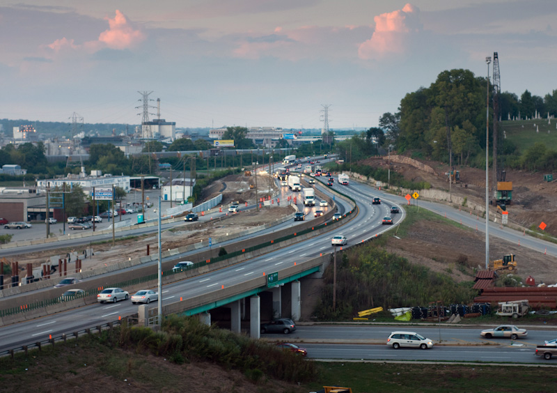
September 2012 I-75 reconstruction photographs by Jake Mecklenborg for UrbanCincy.

In short, work currently underway will build retaining walls and build new overpasses for an expanded highway, but the expressway itself cannot be widened in these areas until adjacent phases are completed.  So improvements currently under construction at Mitchell Ave. might be decades old before they are put to full use – or worse, these future phases might never be built.

Thus far, ODOT has only completed the $7.1 million second phase which rebuilt the Monmouth Street overpass in Camp Washington. Originally planned to be built as part of Phase 5 (Hopple Street to Mitchell Avenue), the Monmouth Street Overpass was deemed “shovel-ready” and funded through the American Recovery & Reinvestment Act of 2009.

The $53 million reconstruction of the Mitchell Avenue Interchange (Phase 1) began in 2011. Construction crews are presently demolishing the 57-year-old Mitchell Avenue and Clifton Avenue overpasses and preparing the right-of-way necessary to widen I-75 from six to eight lanes.

ODOT has scheduled a summer 2014 completion for the Mitchell Avenue work.

Modification of the Colerain/Beekman/I-74 Interchange (Phase 3) also commenced in 2012. This $13 million project is also currently taking place, and is also scheduled for completion in 2014.


An ODOT official explains what led to the financial troubles of ODOT at a Transportation Review Advisory Council meeting in 2011. Video by Jake Mecklenborg for UrbanCincy.

Yesterday ODOT Director Jerry Wray announced funding for the first phase of the $467 million Thru The Valley project.  Although funding is now programmed for reconstruction of I-75 between Shepard Lane and Glendale-Milford Rd. beginning in 2021, there is still no definite timetable for the Thru the Valley’s other 7 phases.

These delays in work on I-75 in Cincinnati illustrate the central problems with state and federal gasoline taxes: the taxes are not automatically adjusted with inflation, causing revenues to drift downward over time, and proceeds fall when high gas prices motivate people to drive less. Until either or both gasoline taxes are raised, or ODOT identifies new funding sources, reconstruction and widening of I-75 will proceed at a glacial rate, and drivers will realize little benefit from completed early phases.
Categories
Business Development News

Washington Park to celebrate grand reopening this Friday

Those who frequently spend time in Over-the-Rhine have dealt with the reconstruction of Washington Park over the past one-and-a-half years.

The $48 million growing pains, project officials claimed, would be worth it as the renovated and expanded park would enhance quality of life while also providing 450 new parking spaces tucked neatly underground beneath the park’s new northern lawn space.


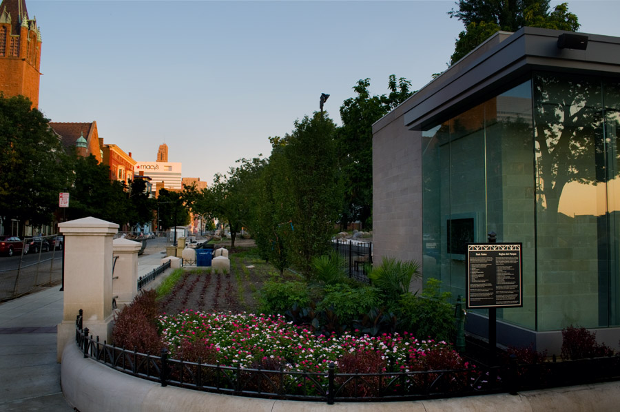
Looking south along Race Street at the nearly finished Washington Park. All Washington Park photographs were taken last week by Jake Mecklenborg for UrbanCincy.

Project and city officials will gather with the community on Friday to celebrate Washington Park’s grand reopening. The moment comes at perfect timing as the World Choir Games, and its thousands of visitors, will begin populating the center city this weekend.

New features of the park include an interactive playground, dog park, open lawn space, performance space, and interactive fountains in addition to the overall upgrades made to the rest of the existing features.

The park’s completion marks the end of an era of change for the area that began with the demolition of Washington Park Elementary School, and included the addition of the School for Creative & Performing Arts (SCPA). Those changes, when combined with the future Music Hall renovation and Cincinnati Streetcar, have led to dozens of nearby buildings being renovated into new housing and commercial space.

Those who have not visited Washington Park in some time may want to check it out during the World Choir Games. The new look and feel of the area may surprise you.

Categories
Business News Politics

Cincinnati’s hillside overlooks profiled in new brochures

The Queen City has long been defined by the Ohio River and its surrounding hills which reminded early German settlers of the Rhine River Valley, but the hills have also provided natural corridors through the city along with valuable real estate for homes and businesses.

In order to help celebrate and promote this unique natural asset, The Hillside Trust is in the process of distributing 50,000 brochures highlighting Cincinnati’s dynamic views from places like Eden Park, Mt. Echo and Bellevue Park.

“These overlooks represent an iconic part of Cincinnati’s landscape and livability,” exclaimed Eric Russo, Executive Director of The Hillside Trust.

Eastern view from Wilson Commons Overlook in East Price Hill [TOP], and Jackson Hill Park Overlook looking southwest from Mt. Auburn [TOP]. Photographs provided by The Hillside Trust.

Russo went on to say that Cincinnati’s numerous overlooks are an asset that can be used to market and promote the city as a unique place to live and work.

The 18 overlooks profiled in the brochures cover the city’s western, central and eastern hillsides. Each of the overlooks were also identified as “high priority” for protection in the 2007 Cincinnati Scenic View Study produced by The Hillside Trust for the City of Cincinnati.

The brochures were funded through $15,000 provided by two family foundations, and are currently being distributed to regional convention and visitor bureaus, the Cincinnati USA Regional Chamber, and libraries and parks throughout the city for free distribution to the public.

The family foundations wanted to see the brochures used in a way to attract attention and encourage the public to visit the prominent overlooks. In addition to photographs of the views from each location, the brochures also include unique facts, features and history about the sites.

“These overlooks originate from park lands, dead end streets, roadways and public staircases,” explained Russo. “All offer unique and spectacular viewing experiences.”

The brochures were designed by Cincinnati-based Linserpelle Creative, and include locator maps so that they may be used for self-guided tours. The brochures can also be downloaded for free on The Hillside Trust’s website.

Categories
Business News

Third tilt-shift video of 2012 highlights Cincinnati’s urban amenities

Video production company 7/79 created a video for the recent CEOs for Cities national conference held in Cincinnati. The nearly three-minute video takes viewers throughout the city’s urban core, and is perhaps the best use of tilt-shift videography in Cincinnati to date.

Previously, UrbanCincy has profiled Brian Spitzig’s tilt-shift videos filmed on and around the University of Cincinnati’s uptown campus. Spitzig has informed UrbanCincy that he is currently working on additional videos that would cover more ground throughout the city.

In the mean time, Cincinnati – A New Perspective is an enjoyable sequence and includes some interesting statistics about the Queen City throughout the video.

Categories
Business News

Google’s new maps feature takes users inside Cincinnati businesses

Cincinnatians have been able to use Google Maps for finding directions, transit information, traffic congestion, topography and other natural features, examining aerial imagery, and getting a first-person view of street scenes around the city. Now, Cincinnatians will be able to walk right inside of businesses and get a first-person view inside buildings.

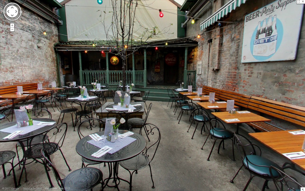
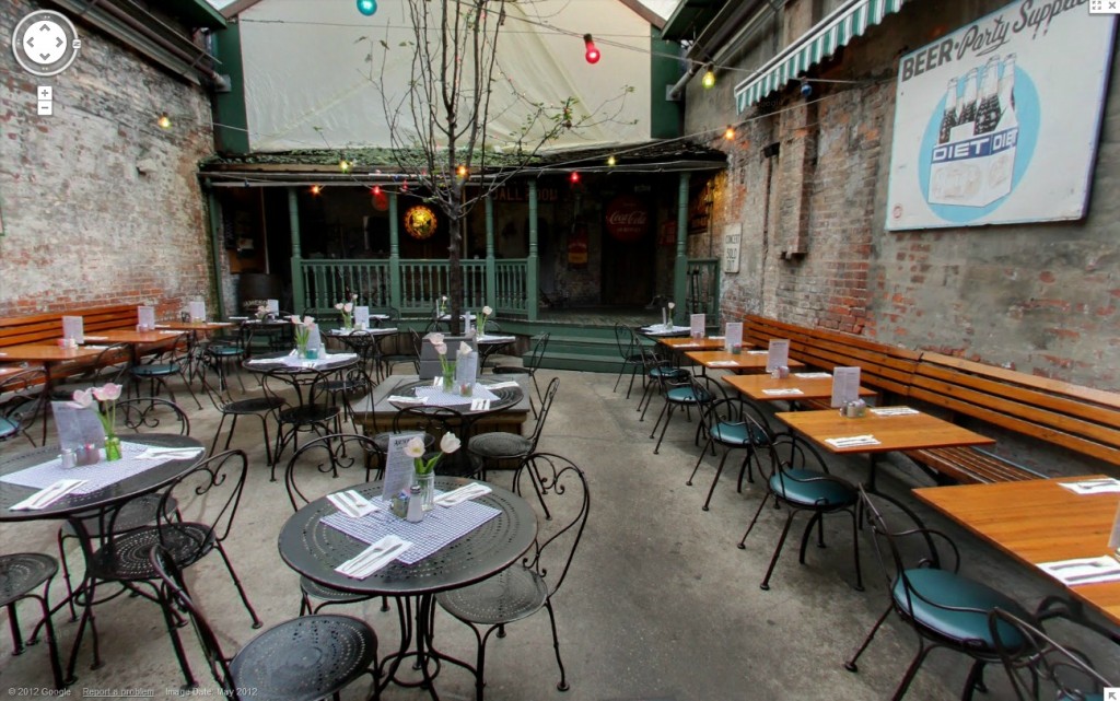
The first Cincinnati-area location to receive this enhanced Google Maps feature is Arnold’s Bar & Grill. The historic downtown establishment can be viewed in all its glory with users being able to examine bar and dining areas, along with the famous courtyard and second floor.


Google’s new Business Photos feature takes users inside businesses, like Arnold’s Bar & Grill, through their Google Maps platform.

“Instead of just passing by on Google Maps Street View, you will be able to walk right in and tour the entire place in full 360, just as you would in normal street view,” explained Arnold’s Bar & Grill general manager, Chris Breeden.

The photography work was done by Cincinnati-based Alias 360 Photos. The company, owners say, is a new offshoot from the more established Alias Imaging, and is a certified member of Google’s Trusted Photographer program.

To use Google’s new Business Photos feature, simply go to the street view in front of Arnold’s and double-click on the doorway. Once inside, you will be able to navigate the establishment in the same fashion you would a normal street view.

Google’s indoor, 360-degree views were first announced in May 2010. Any business interested in having their interiors photographed for inclusion can do so by applying online.