Categories
Development News Transportation

Cincinnati officials are looking for design ideas as they work to cap urban highway

Billions of dollars of public and private investment has transformed Cincinnati’s central riverfront over the past decade. What was once a flood-prone industrial center turned unusable waterfront property, is now home to a new park, neighborhood, museums, and professional sports venues.

The investments made to date have been so successful, in fact, that they are creating spinoff investment in the Central Business District. A remaining hurdle, however, is the crossing of Third Street, Fort Washington Way (FWW), and Second Street.

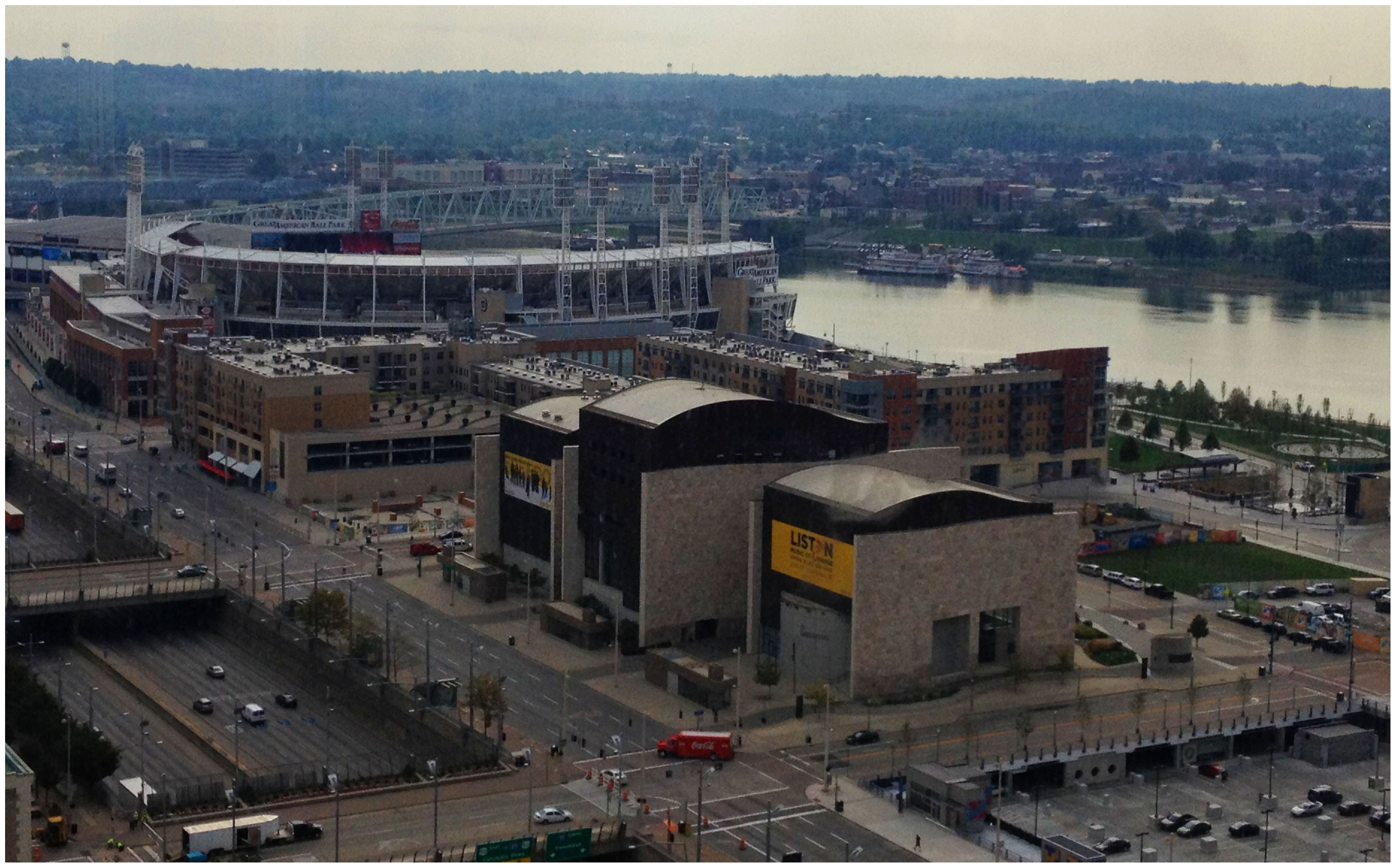
The nearly 300-foot span of roadways was significantly reduced in width when Fort Washington Way was reconstructed in 2001, but the span remains a visual barrier for many of those in the Central Business District or at The Banks.

Cincinnati officials are looking to build off of recent success by capping Fort Washington Way. Photograph by Randy A. Simes for UrbanCincy.

The problem was expected by city officials, in the 1990s, during original planning efforts for the central riverfront’s transformation. As a result, city leaders worked to raise $10 million to construct pile foundations that could one day support a cap over the interstate highway running beneath street level on FWW.

The pile foundations are capable of extending 600 feet over the highway roughly between Elm Street and Main Street. According to engineers who worked on FWW’s reconstruction, the caps could support the weight required for a park, or built structures depending on height and building materials.

No specific development plan for the caps has been developed however, and now the city is launching a design competition called Connect the Blocks to establish a vision for space.

“The Banks is well underway, downtown is growing, and now we must begin thinking about what we as a community want to see over Fort Washington Way to connect downtown and the riverfront,” City Manager Milton Dohoney stated in a prepared release. “We must first have a common vision of what we want, then we can establish the roadmap to get there.”

The national competition is calling on architectural, engineering and design professionals to create and submit concepts and cost estimates for the caps that are to be built over FWW. According to city officials, three to five finalists will be selected and awarded stipends to further refine their designs.

St. Louis has dealt with similar issues as it has tried to bridge the divide created by I-70 between downtown and the Gateway Arch grounds. While I-70 will not be capped entirely, a one block portion is envisioned to connect Jefferson National Expansion Memorial with Kiener Plaza in the CityArchRiver 2015 plan.

In Ohio, the only similar example of such a project exists in Columbus where a $7.8 million cap was constructed over I-670 along N. High Street. It includes approximately 25,000 square feet of street-level retail and connects Columbus’ downtown with its Short North district.

The City of Cincinnati held the first of two public meetings, on the design competition, last Wednesday in Madisonville. The second meeting is scheduled to take place on Tuesday, October 9 at 6pm at the Main Public Library (map). The public is also invited to weigh in on the process by participating in an online survey going on now, and officials also say that the public will be invited back to view the finalists’ designs once they are selected.

Full details about how to participate in the eight-month design competition can be found on the project’s website. The implementation of any winning design, officials say, will be dependent upon the availability of funding.

Categories
Business News Politics

Cincinnati aims to revise plumbing code to allow for rainwater harvesting by November

In early 2011, Cincinnati City Council signed a motion to develop a task force that would oversee the creation of new building code standards to allow for rainwater harvesting throughout the city. The work of the Rainwater Harvesting Task Force, however, may now be jeopardy due to a lack of clarity about who is responsible for maintaining such systems.

The initial goal of Cincinnati’s Rainwater Harvesting Task Force was to develop a code to allow for the reuse of rainwater for non-potable uses such as flushing toilets. One of the concerns with such a system is the potential for backflow of non-potable water into potable water sources.

To that end, one of the biggest advances over the past year was the release of a new national standard in March 2012. And according to the Task Force, it is that national standard that is being used as a template for Cincinnati.


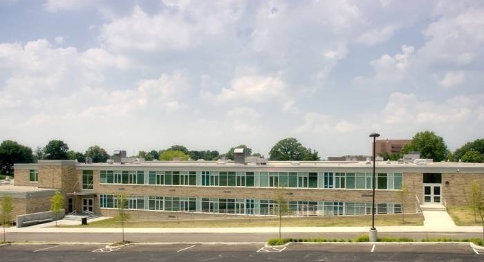
Dater Montessori 2009 renovation achieved LEED Gold standards, and also boasts the city’s first, and only, rainwater harvesting system. Photograph by Glaserworks.

“There is no community in Ohio that has a procedure in place to allow this [rainwater harvesting] to happen,” Bob Knight, Green Partnership for Greater Cincinnati and the Rainwater Harvesting Task Force, explained to Cincinnati’s Livable Communities Committee on September 25. “Significant hurdles have been resolved in Cincinnati, and we are working on eleven additional items now.”

Some of the eleven additional items that still need to be resolved include the finalization of water quality requirements, inspection processes, certified maintenance protocols, metering, and development of tailored language from the new national code that will work for Cincinnati. Knight, however, is optimistic that the task force will meet the goals of city council and have an amended plumbing code in place by late November.

To date, the only rainwater harvesting system in place in Cincinnati was installed in 2009 at Dater Montessori School on the city’s west side. The Dater system, however, has not yet been used due to lack of agreements between various agencies and institutions. Specifically, Cincinnati Public Schools (CPS) is concerned about being responsible for maintaining the system once it is operational.

“I’m afraid the direction the Task Force is taking is not taking us in the direction we want to be,” Terry Elfers, Chief Operating Officer of CPS, exclaimed. “CPS does not want to be responsible for treating water.”

CPS is not alone in their hesitation to move forward, as Greater Cincinnati Water Works has also expressed concern about where responsibility will lie in these systems that are envisioned to help reduce water consumption while also helping Cincinnati reduce water runoff as is required by a federal consent decree.

“The heart of the problem is allowing the agencies that are responsible for this decision, to be able to point to a standard that they can defend,” Knight explained. “With this model code, the agencies can now point to it and can say that they will follow this direction.”

The Rainwater Harvesting Task Force hopes to have the language in place for Cincinnati’s plumbing code within 60 days so that they can meet their deadline. Absent that direction and approval from City Council, the activation of Dater’s rainwater harvesting system may have to continue to wait, along with other potential systems around the city.

“It would be wonderful for the City and CPS if we could resolve this so that we could support moving forward with this project,” Eflers stated as he reminded the committee that CPS has served as a leader in the community when it comes to environmental sustainability issues over the past decade.

Categories
Up To Speed

Chicago’s Cabrini-Green redevelopment taking cues from Cincinnati’s City West

Chicago’s Cabrini-Green redevelopment taking cues from Cincinnati’s City West.

Chicago is moving on from its infamous Cabrini-Green housing projects with a plan to create a mixed-income neighborhood. The plan, however, is facing early criticisms that have also troubled Cincinnati’s similarly built City West development. More from Salon:

“They still be gangbangin’ out here at night,” says Andrea of the neighborhood. Still, it’s nothing like it once was. There’s now a supermarket, a Starbucks, bicyclists riding by, and these immaculate apartment buildings. Andrea says it’s the nicest space she’s ever lived in. A 150,000-square-foot Target is in the works, and an urban farm sprung up nearby in 2007.

But though Andrea likes the new buildings and the neighborhood, she recognizes that this sort of carefully engineered milieu is an environment that doesn’t exactly feel natural, even to the people who live here. “We have meetings where people talk to each other,” she says, referring to activities organized by the management. But aside from that, she says there’s not much interaction between the low- and high-income residents. “You can’t barbecue on the property,” says Andrea. “People aren’t really hanging out together.”

Categories
Arts & Entertainment News Transportation

Prize to be awarded for best idea at improving urban mobility at September’s URBANexchange

Due to the Reds home schedule, we had to adjust our regularly planned meeting time for this month’s URBANexchange at the Moerlein Lager House. Instead of being held on the first Tuesday of the month, we will be holding it on Thursday, September 13 from 5pm to 7:30pm.

This month we will be getting together just as we have been, but to jumpstart the conversation we thought we would give it a transit theme. We hope you come to discuss ideas that could help improve urban mobility.


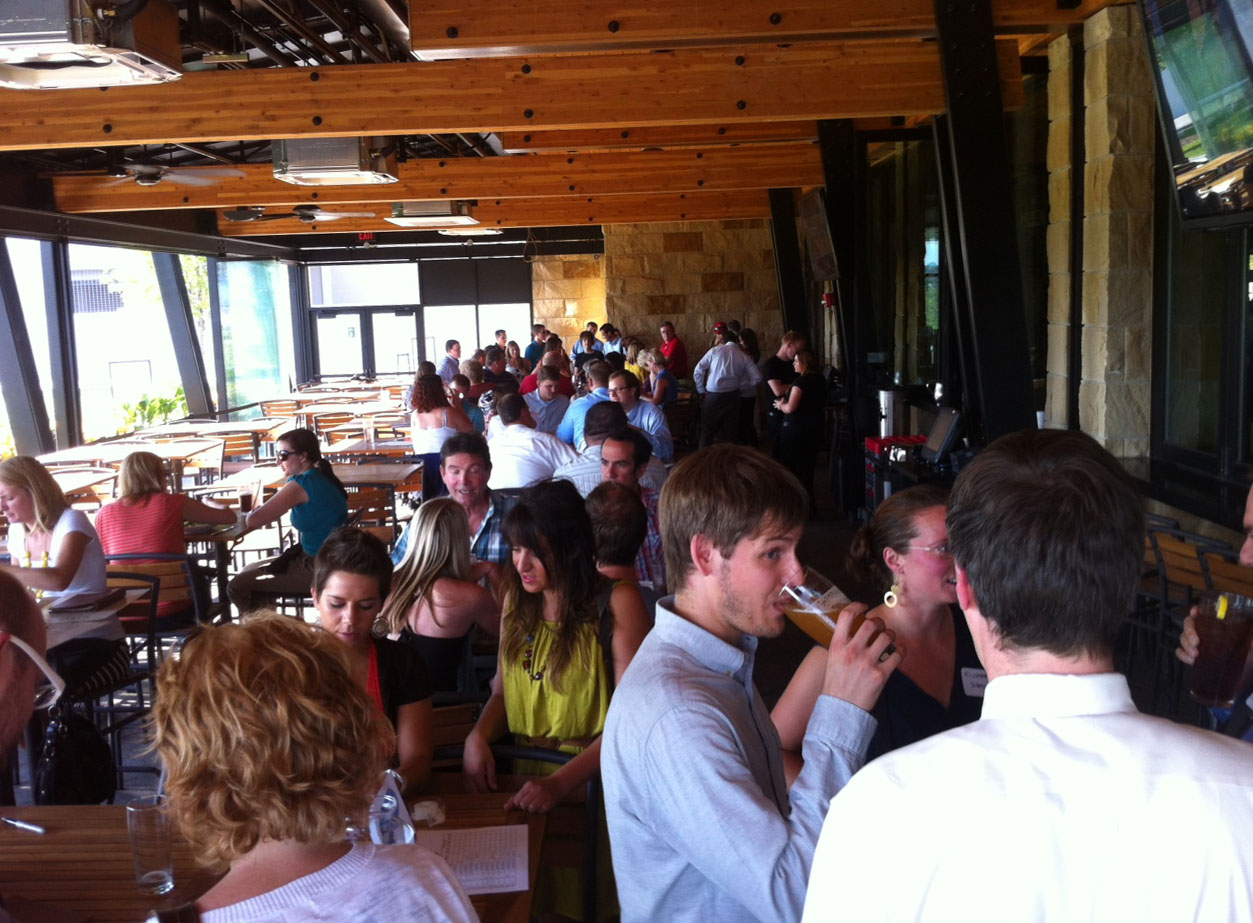
Attendees enjoy the Moerlein Lager House and conversation at the August 2012 URBANexchange. Photograph by John Yung for UrbanCincy.

All of the ideas submitted will be reviewed by the UrbanCincy team. The person with the winning submission will then have their idea profiled in an UrbanCincy.com feature story. Will we also do a drawing, from the submitted entries, for a free Metro monthly bus pass courtesy of the Southwest Ohio Regional Transit Authority (SORTA).

The themed transit discussion corresponds with the Metropolis & Mobility Seminar taking place at the University of Cincinnati, and we have confirmed that Paul Grether, Metro’s Manager of Rail Services, will be among those in attendance.

Other notable transportation experts are also expected to be confirmed within the coming days, so stay tuned for those announcements as we get closer to the event date.

Those interested in attending are encouraged to stop by the biergarten at the Moerlein Lager House (map) anytime between 5pm and 7:30pm. There is no entry fee, but we do strongly encourage you to support our host establishment by purchasing food or drink while you are there.

Due to scheduled events at the Moerlein Lager House, it is expected to be a bit more crowded than usual. As a result, we recommend that you arrive early so that we can reserve additional space as is necessary.

Categories
Development News Politics Transportation

Plan Cincinnati aims to guide city back towards its urban roots

After a three-year planning process, Cincinnati’s first comprehensive plan in 32 years will be shared with the city’s Planning Commission. The hearing marks a ceremonious occasion for city employees that have worked tirelessly on the plan since Mayor Mark Mallory (D) tasked them to work with the community on putting together an updated plan for the Queen City.

The City of Cincinnati Planning Department will share the 228-page document with the Planning Commission at 6pm today at City Hall (map). From there the document will move on to City Council’s Livable Communities Committee, and then the full City Council for approval where officials do not expect much, if any, pushback from the nine-member elected body. After formal approval from City Council, the document will become Cincinnati’s policy guide for everything from financial to environmental decisions, and beyond.


The city’s new comprehensive plan, Plan Cincinnati, places a strong focus on creating and building upon walkable neighborhood centers. Photograph by Randy A. Simes for UrbanCincy.

The tone for the city’s new vision is set early and often throughout the document stating, “The vision for the future of Cincinnati is focused on an unapologetic drive to create and sustain a thriving inclusive urban community, where engaged people and memorable places are paramount, where creativity and innovation thrive, and where local pride and confidence are contagious.”

The focus on a comprehensive urban approach is a bold diversion from Mayor Charlie Luken’s (D) administration which ultimately left the city without a Planning Department after a heated debate over whether to allow Vandercar Holdings to build a suburban-style development at what is now the Center of Cincinnati big-box development.

In the early 2000s, Vandercar had agreed to go along with Cincinnati’s Planning Department and build a mixed-use development on the site. Disagreements over the project led to a change of heart by the development team, and a strong reaction by both Mayor Luken and then City Manager Valerie Lemmie to dismantle the city’s planning department.

The renewed focus on urbanism in the Plan Cincinnati document establishes 11 goals that range from growing the city’s population, to becoming more aggressive with economic development, to developing a culture of health. One of the key goals set out by Plan Cincinnati calls on leadership to build on the city’s existing assets. To that end, the plan identified 40 Neighborhood Centers that should serve as the diverse, walkable centers of activity throughout the city.

Of those 40 nodes, approximately 28 percent are recognized as “urban” neighborhood centers while the remainder are identified as “traditional” neighborhood centers.

       
Plan Cincinnati recognized 40 Neighborhood Centers throughout the city [LEFT], and identified 14 preliminary areas to examine for future investments that could lead to new Neighborhood Centers [RIGHT]. Maps provided.

“Our neighborhoods are structured around centers of activity that contain all of the amenities that we need to go about our daily life,” the Plan Cincinnati document states. “We will focus our development on these centers of activity, and strategically select areas for new growth.”

From there the plan recognizes which of those neighborhood centers are doing a good job at serving as diverse, walkable centers. Seven are seen as well off and simply needing maintenance; 12 are identified as areas that need to evolve and become more walkable, and the remaining 21 are called on to be transformed with large-scale changes such as infill, redevelopment, and public improvements.

“We will permeate our neighborhoods with compact, walkable mixed-use development, bikable streets and trails, and transit of all types (such as bus, light rail, bus rapid transit, light rail transit, streetcar/circulator vehicles, and passenger rail),” declares the Plan Cincinnati document. “The development of a Complete Streets policy and adoption of a form-based code are tools that will help reach this goal.”

A sobering fact, presented within the plan, is that roughly 22 percent of all Cincinnati households have no automobile, while only a percentage of those households have safe and easy access to the jobs, goods and services they need.


Approximately 22% of Cincinnati households do not own a car, and are not within easy access to the goods and services they need. Map provided.

To help solve that issue, city planners hope to build upon the goal of creating a healthy, sustainable community by eliminating food deserts and providing fresh produce within a half-mile, or 15-minute walk or transit ride, from all residential areas.

City planners acknowledge, however, that building upon existing assets will not be enough in order to create the envisioned outcomes identified within PLAN Cincinnati. As a result, the document identifies 14 preliminary opportunities (see second map) for future mixed-use development that can eventually serve as new neighborhood centers where they are currently lacking.

While the visioning document looks to be unapologetic about its urbanist movement, it also looks to firmly establish Cincinnati as the unapologetic leader within the larger region, stating that consolidation of government services and municipal boundaries will be efforts led by the City of Cincinnati.

PLAN Cincinnati goes into much greater depth on many more topics. Those interested in learning more can download the entire document online, or attend tonight’s Planning Commission meeting where staff will be on hand to answer questions afterwards.