Categories
Arts & Entertainment News

URBANexchange Hosts Vice Mayor at Short Vine Taste of Beligum

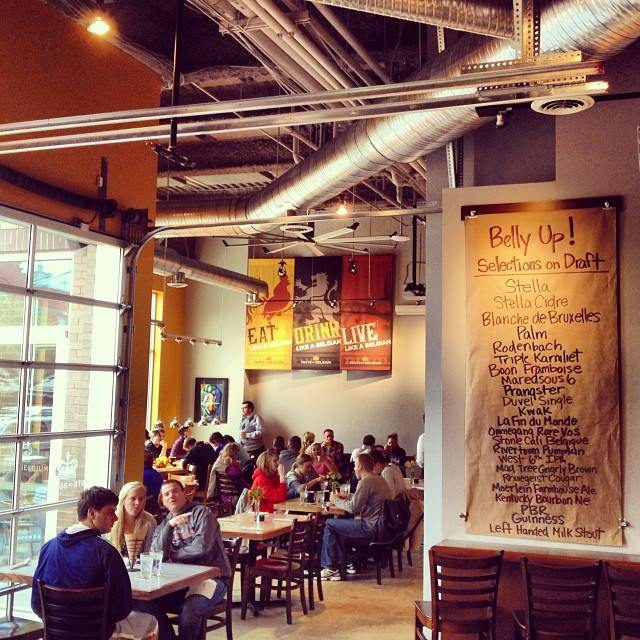
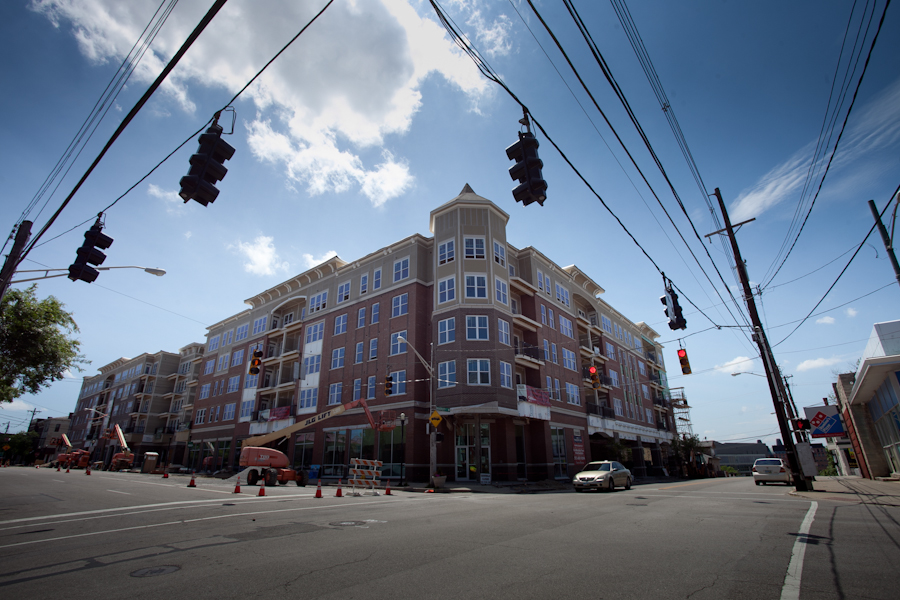
Snow may still be on the ground but we will have warm waffles at this month’s URBANexchange event! That’s right, we are pleased to announce that for this month’s event we have moved to Taste of Begium’s Short Vine location. Come down for some waffles and chicken or some Belgian beers this Thursday from 5:30pm to 8:00pm. This is a great opportunity to check out the new development that has opened in Uptown.

As always, the event will be a casual setting where you can meet others interested in what is happening in the city. We will gather in a space near the bar so that each person can choose how much or little they buy in terms of food or drink. Although we do encourage our attendees to generously support our kind hosts at Taste of Belgium.

We are pleased to announce that Vice-Mayor David Mann (D) has indicated he will be attending the event. Mr. Mann has a distinguished career in the city as a former Mayor and Councilman. He returned to City Council last November.

Short Vine Taste of Belgium

As always URBANexchange is free and open to the public. This month we are giving away two $25 gift cards  to Taste of Belgium as door prizes so be sure to drop your name into the raffle.

We will be situated near the bar in the center of the restaurant but you can also ask the host where the UrbanCincy group is located and they will be happy to assist.

Taste of Belgium is located on Vine Street in Correville between the University of Cincinnati’s east and west campuses and is located just two blocks from a future uptown streetcar stop. If you choose to bike there is free and ample bike parking is available outside the building. The venue is also served by Metro’s Metro+ bus , as well as routes  #19, #78 and #46 buses.

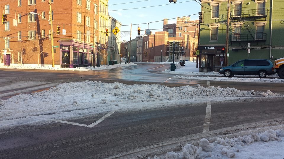
Photo by Jake Mecklenborg

Categories
News Transportation

Snow Accumulation Highlights Cincinnati’s Over-Engineered Streets through ‘Sneckdowns’

Our streets sometimes seem to be over-engineered. Their capacities are designed for peak usage, turning radii for the largest trucks, and speeds for the fastest movement. For the easy movement of cars and trucks this may be good, but for everyone else it is dangerous and less livable.

To combat such situations, many communities across the United States have begun building curb extension to help slow down traffic and make the public right-of-way more hospitable for everyone who is not in either a car or truck. Some people call these curb extensions, and similar improvements, neckdowns.

While most of our streets have not been improved in such a way, it becomes easy to see how and where neckdowns could be placed when it snows. This is because only the areas of the road that are used become cleared. The rest stay covered in snow and are a very obvious display of the aforementioned over-engineering.

During the city’s last snow event, the UrbanCincy team took to social media and asked Cincinnatians to submit photos of area sneckdowns – snowmade neckdowns. If you see any around your neighborhood make sure you take a shot of it and send it to editors@urbancincy.com, tweet us @UrbanCincy, or upload your photos in the comment section of this story.

Categories
Development News Transportation

VIDEO: Are ‘Protected Intersections’ the Next Bicycle Infrastructure Innovation?

The City of Cincinnati and other area municipalities have been working to improve the region’s bicycle infrastructure in order to both make cycling more attractive and safer. Those improvements have included new bike lanes, sharrows, cycle tracks, trails and dedicated parking for bikes.

City officials say that protected bike lanes, like the cycle tracks to be installed along Central Parkway, offer the larger population an incentive to get out on their bicycles. Those officials point to results from public polling that show large percentages of people that would be open to riding bikes if they felt safer on the roads, and that protected bike lanes would do wonders to accomplishing that.

But Nick Falbo, an urban planner and designer at Alta Planning+Design, thinks protected bike lanes aren’t enough.

“Protected bike lanes lose their benefits when they reach intersections,” Falbo states in his six-minute-long video proposal. “The buffer falls away and you’re faced with an ambiguous collection of green paint, dashed lines and bicycle markings.”

In his submission to the George Mason University 2014 Cameron Rian Hays Outside the Box Competition, Falbo proposes what he calls the Protected Intersection – a design overhaul for intersections that he says will not only improve the value and safety of protected bike lanes, but also make the intersection more usable for all modes of traffic.

“It doesn’t matter how safe and protected your bike lane is, if intersections are risky, stressful experiences. We need to make intersections just as safe and secure as the lanes that lead into them. What the protected bike lane needs is a protected intersection.”

Categories
Up To Speed

Silicon Valley would look much different if employees lived there

Silicon Valley would look much different if employees lived there 

In the latest UrbanCincy podcast we talked about tech companies such as Google and Microsoft investing in private buses to transport their employees from the center city to their suburban office campuses. But what if local zoning allowed these tech companies to build housing for their employees on-site? A recent post via the Atlantic Cities takes a look into an alternative future:

In a series of new 3D visualizations, Berkeley designer Alfred Twu imagined what Silicon Valley would look like if tech giants replaced the parking around their headquarters with on-site housing. In order to accommodate all of the workers, Twu filled the campuses of Apple, Google, and Facebook with 20 to 50-floor towers, all filled with 800-square foot apartments.

Categories
News Transportation

INFOGRAPHIC: The Abandonment of Cincinnati’s 1914 Subway and Rapid Transit Loop

Cincinnati’s abandoned rapid transit project is a subject of continual interest. Although many are familiar with the unused two-mile tunnel beneath Central Parkway, little remains of the ten miles of surface-running right-of-way built in the mid-1920s between Camp Washington and Norwood.

This graphic by Andy Woodruff, from the UW-Madison Department of Geography, illustrates which sections of the so-called Rapid Transit Loop were built, which parts were replaced by expressways, and which parts were planned but not funded and built.

Cincinnati Subway System

So why was the Rapid Transit Loop started but not completed?

The project had several forces working against it, especially wealthy Downtown landowners who stood to lose money and influence if the city’s most valuable property shifted from Fountain Square north to Central Parkway. The likelihood of that happening was heightened by the Rapid Transit Commission’s decision to forego construction of the Walnut Street Subway as part of the project’s first phase.

Those who owned property lining Central Parkway knew that construction of a tunnel under Mt. Adams, linking the Loop’s never-built eastern half, would likely cost less than construction of the Walnut Street Subway and cause the loop’s traffic to bypass the city’s established epicenter entirely.

The second interest acting to scuttle the subway project was the consortium of seven steam railroads that commenced construction of Cincinnati’s spectacular Union Terminal in 1929.

An ancillary feature of the Rapid Transit Loop was its intention to serve the area’s electric interurban railroads at a multi-track terminal centered beneath the intersection of Race Street and Central Parkway. The interurban terminal’s more convenient location promised to erode the redundant services of the steam railroads.

Editorial Note: In addition to focusing on UrbanCincy’s transportation coverage, Jake authored a book about Cincinnati’s infamously abandoned subway and rapid transit project. First published in 2010, Cincinnati’s Incomplete Subway: The Complete History is considered to be the most comprehensive analysis of the events leading up to and after one of the city’s most notorious missteps.