Categories
Development News Transportation

Bike Lanes Included as Part of Cincinnati’s Annual Street Rehabilitation Program

The City of Cincinnati kicked off its annual street rehabilitation program last week. This year’s program will focus work on 113 segments of roadway in 22 neighborhoods.

According to officials within Cincinnati’s Department of Transportation & Engineering (DOTE), the 2013 Street Rehabilitation Program will include work that replaces layers of deteriorated paving with new surfacing, fixes problem areas where needed, and then install new curb work as necessary.

While the primary focus of the program is to rebuild streets and curbs, it also offers the city the opportunity to implement components of its city-wide bike plan.

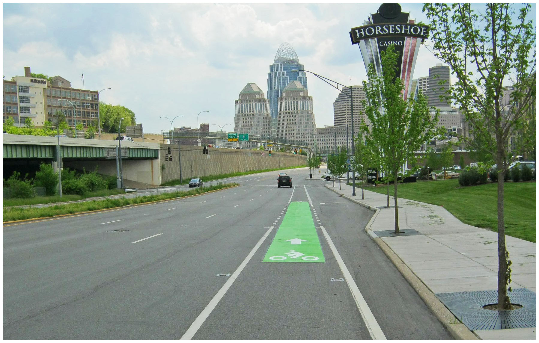
Gilbert Avenue Green Bike Lane
Recently installed bike lane with green markings on Gilbert Avenue heading south into the central business district. Image provided.

“Installing bike lanes in conjunction with the street rehabilitation program really gives us the best bang for our buck,” explained Mel McVay, senior city planner with the DOTE. “In this case, city council has already allocated money for repaving the street, so the cost to the bike program of the additional stripe for the bike lane is really minimal.”

Through this program, five streets will see new bike facilities installed over the course of the coming months as streets are rebuilt through the summer and fall.

The biggest stretch of roadway that will see a new bike facility installed under this program will be Winton Road in Spring Grove Village, where a 1.8-mile stretch will see a shared path put in place when the roadway is rebuilt.

In the West End and Queensgate, buffered bike lanes will be installed along Bank Street from Linn Street to Dalton Avenue. Meanwhile, bike lanes will be installed on Dalton Avenue between Linn Street and Eighth Street, and on Western Avenue between Hopkins Street and Findlay Street.

McVay says that the “buffered” bike lanes will include a striped buffer area of three to four feet separating the travel lane and the bike lane. Within the city, both Beechmont Avenue and E. Mitchell Avenue currently include buffered bike lanes.

The final piece of bike-related work to be completed as part of the 2013 Street Rehabilitation Program will be a climbing lane on Woolper Avenue between Vine Street and Clifton Avenue.

Additional bike projects are in the works besides the five to be completed as part of this program, but the lack of funding and political will continues to serve as barriers to doing more.

With the improvements on-tap for the remainder of this year, the City of Cincinnati will be just less than halfway toward its goal of installing 104 miles of on-street bike facilities by 2015

The Bicycle Transportation Plan, which was adopted in June 2010, includes an ultimate goal of installing 454 miles of on-street and off-street bike facilities by 2025.

“At this point, working with the street rehabilitation program is really our best opportunity to significantly increase the number of bike lanes around the city,” McVay concluded.

Categories
News Opinion Transportation

REVIEW: ‘Walkable City’ Offers Clear Guidance on How to Improve Cities

Walkable CitiesIn his 2012 book, Walkable City, Jeff Speck, coauthor of Suburban Nation and The Smart Growth Manual, branches out on his own to nail down a comprehensive guide to walkability.

He contends that a great deal of money and muscle have gone into streetscape improvements, but how important are these in convincing people to walk? The book is rooted in Speck’s ‘General Theory of Walkability’, that for walking to be favored, it must be useful, safe, comfortable and interesting.

  1. Useful: Most aspects of daily life close at hand and well-organized
  2. Safe: Streets that are designed to be safe and also feel safe to pedestrians
  3. Comfortable: Urban streets as outdoor living rooms
  4. Interesting: Sidewalks lined by unique buildings with friendly faces

Speck then prefaces his ten steps to walkability with some notable cases studies proving the economic advantage of walkable places, real estate premiums of walkable urbanism versus drivable suburbansism, the personal and health benefits those in walkable places gain, the environmental impacts of driving, and one’s risk of dying in a traffic crash versus murder by a stranger.

“It is the places shaped around automobiles that seem most effective at smashing them into each other.”

The book is a useful read for those looking to better understand urban design and transportation policy practices, and how they influence our behaviors in cities. Here is a summary of Speck’s analysis and thoughts on working towards a more walkable community using his ‘Ten Steps of Walkability.’

Step 1: Put cars in their place
Speck acknowledges that the auto will remain a fixture of our communities given the Federal Government’s historic and current interest, with some nudging from the “Road Gang” lobby, in road building and the inverse relationship between highway investment and property values.

He argues that traffic studies are “bullshit” by nature and that all transportation decisions should be made in light of induced demand, the phenomenon rooted in the economic theory of supply and demand where demand from drivers tends to quickly overwhelm new supply.

He goes on to attack state DOTs and their involvement, or lack thereof, in the new American Main Street – the state road running right through town. He is against pedestrian zones, for congestion pricing, and notes how the automobile has not moved us any faster, just further.

Step 2: Mix the uses
Speck notes the historical impetus for Euclidean Zoning and that it now undermines the success of cities.

Humans can no longer work, shop, eat, drink, learn, recreate, convene, worship, heal, visit, celebrate, and sleep all within downtown, and the primary inadequacy of housing prevents all other activities from thriving. However, the housing inadequacy should not be made up with more affordable housing, as cities have too much of it, but affordable housing should come through inclusionary zoning and accessory dwelling units.

Step 3: Get the parking right
The author also points out something we’re all affected by on a daily basis but rarely think about, the amount of off-street parking that exists and how its cost in all forms is “diffused everywhere in the economy.”

Speck notes that employer-subsidized parking and minimum parking requirements undermine urbanism and instead advocates for in-lieu fees to fund shared municipal parking and parking cash out programs for employees of large companies.

Speck also carefully addresses the more exact science of on-street parking using parking guru Donald Shoup, author of The High Cost of Free Parking. Speck summarizes this discussion with a comparison between the Chicago parking meter lease where profit for Morgan Stanley (now CPM) bears no relation to parking occupancy, and San Francisco’s managed congestion-pricing regime that seeks goal occupancy of 80%, meaning rates ranging from $0.25/hour to $6.00/hour throughout eight neighborhoods.

Step 4: Let transit work
“With rare exceptions, every transit trip begins and ends with a walk. As a result, while walkability benefits from good transit, good transit relies absolutely on walkability.”

Speck is an advocate of well-planned modern streetcars. He points to the failures of the Dallas Area Rapid Transit system “where parking is as ubiquitous as it is cheap, the only significant constraint to driving is the very congestion that DART hopes to relieve.”
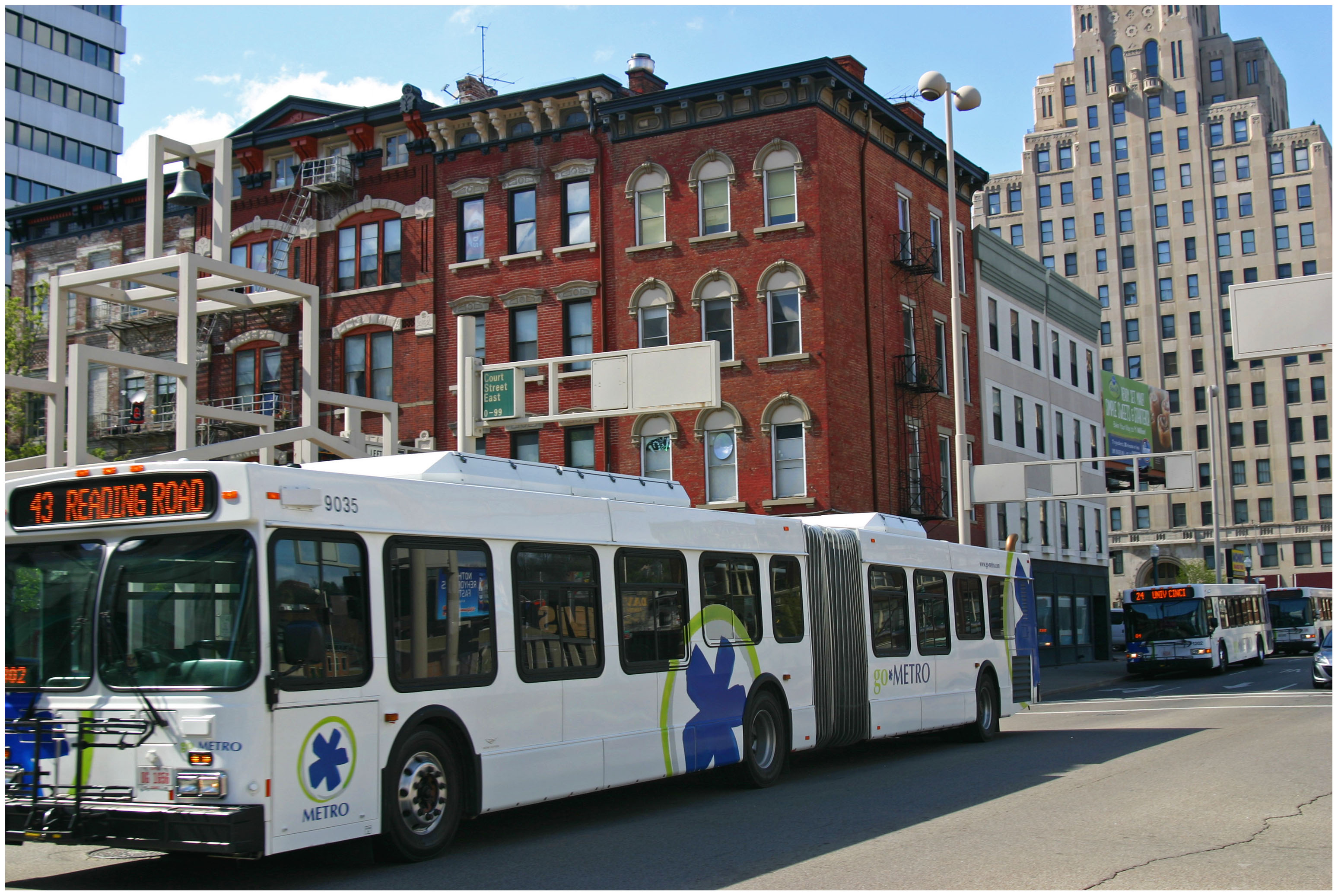
Metro Buses
Speck strongly supports the expansion of bus service to provide greater accessibility and mode choices. Photograph by Randy Simes for UrbanCincy.

He contends streetcars should not be means of reducing traffic, but should act as pedestrian accelerators that make the most sense when a large area of vacant or underutilized land sits just beyond walking distance from a walkable downtown, and that private parties should want to help pay for it. For the rare routes where other transit can offer a superior experience to driving, there must be urbanity, route clarity, frequency and pleasure; and traditional buses have a hard time being efficient and pleasurable.

Step 5: Protect the pedestrian
“Will potential walkers feel adequately protected against being run over, enough so that they make the choice to walk?”

Speck first advocates small block lengths with many blocks per square mile providing route options and shorter distances between destinations. Next, he addresses design speed and how four lanes roads can encourage weaving and how effective road diets can be when they include left turn lanes. He advocates for the historic lane width of 10 feet, rather than 12 feet which is the standard for cars going 70mph and how pedestrians are much more likely to survive being hit at 20mph than 45mph.

He then addresses the psychology of intersections and risk homeostasis, naked streets and shared spaces saying, “nobody drove dangerously through this intersection, precisely because the intersection felt dangerous.”

Speck does not believe one-way streets are appropriate for downtowns, especially retail areas where traffic is distributed unevenly and cross-street visibility is reduced and also addresses bike lanes, trolleys and curb cuts impact on pedestrians.

“What makes a sidewalk safe is not its width, but whether it is protected by a line of parked cars that form a barrier of steel between the pedestrian and the roadway.”

Step 6: Welcome bikes
“A street with bikes, once the drivers get used to them, is a place where cars proceed more cautiously.”

Streets with bicycle infrastructure have proven safer for pedestrians and drivers, with the biggest factors in establishing a biking city being urbanism and infrastructure. Portland increased the population of people biking to work from 1% to 8% in 15 years with only $50 million or 1% of their transportation funding.

He goes on to point out the obvious dangers of cycling, especially vehicular cycling, and how bike lanes can be used as part of road diets but should not replace curbside parking or be and impediment in retail areas.

Step 7: Shape the spaces
“If a team of planners was asked to radically reduce the life between buildings, they could not find a more effective method than using modernist planning principles”- Jan Gehl.

Speck hits on one of the more well-known urban design tenets – that pedestrians enjoy a sense of enclosure and need it to feel comfortable. The trouble is, however, that the typical American urban experience is a profound lack of spatial enclosure, “a checkerboard city devoid of two-sided streets,” and that figural space (the public realm) is in a battle with the figural object of modernist architects.
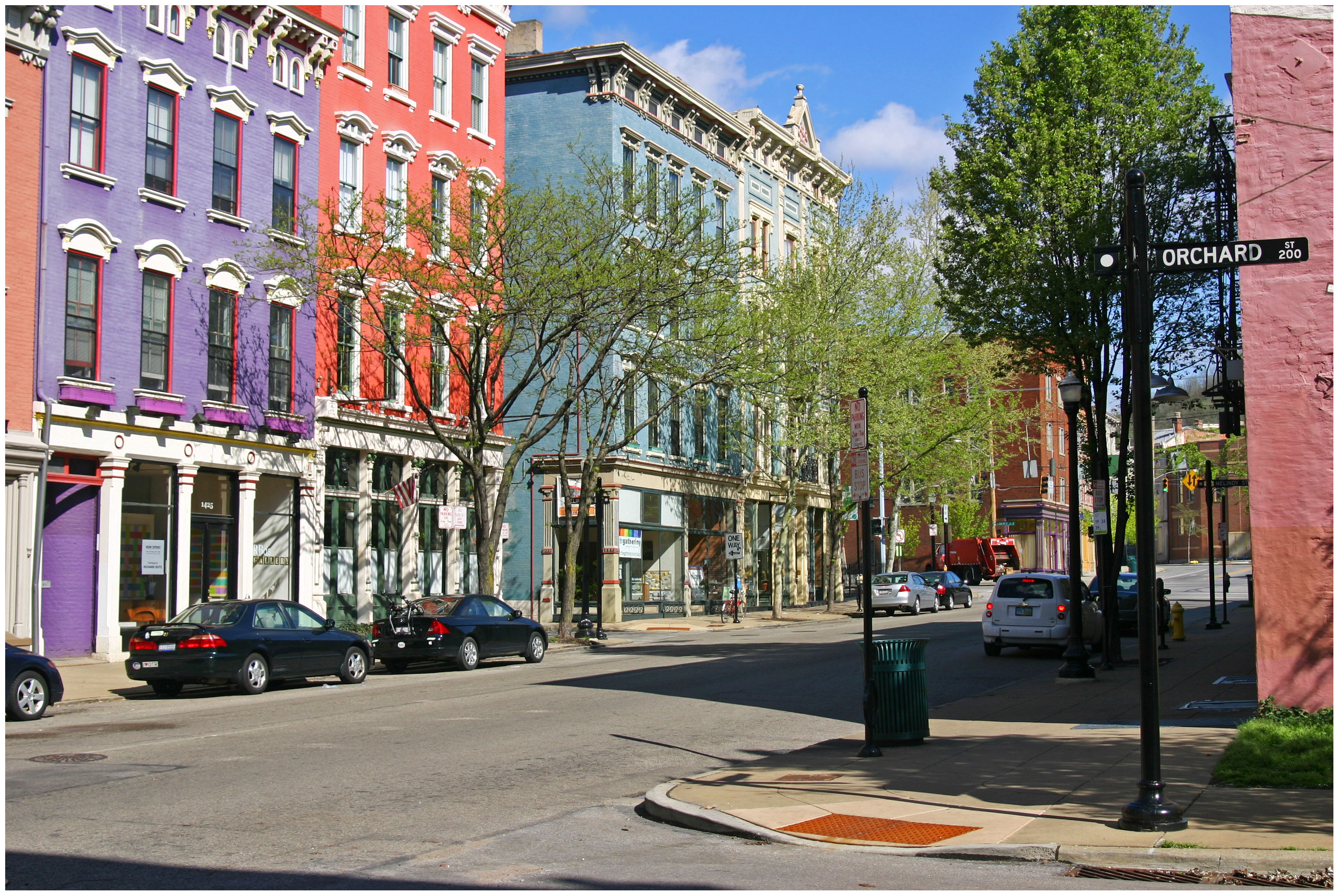
Main Street
Planting street trees and creating a buffer between pedestrians, like along Main Street in Over-the-Rhine, Speck says is critical for success. Photograph by Randy Simes for UrbanCincy.

He goes on to state that tall buildings are not necessarily needed to create this enclosure, or density, and can actually be a detriment to downtown development.

Step 8: Plant trees
Trees can also create a cathedral-like enclosure over streets and have other environmental, health, safety and economic benefits. Street trees provide an obvious buffer between sidewalks and automobiles, though DOT’s and county engineers have seemingly chosen the safety of drivers over that of pedestrians by categorizing street trees as “fixed hazardous objects.”

Trees close to the roadway also capture CO2 and rain more effectively and should be part of the solution to combined sewer overflows. The author goes on to mock how little it takes to achieve the Tree City USA designation, the return on investment trees can provide, and varying species block-by-block to guard against disease.

Step 9: Make friendly and unique faces
Pedestrians demand almost constant stimulation, and parking lots, windowless storefronts, and landscapes fail to do this. Where there is parking, surface lots can be hidden from view by mere one-story buildings, and parking structures should be hidden from view by liner buildings or at least have upper floors that appear to be inhabited.

Cities need active, open and lively building edges with transparent building facades and features that add depth such as awnings, deep window sills and columns. Facade geometries should also be oriented vertically and limited in width to provide the appearance of a shorter walk and building variety.

He is critical of modernist architect’s disinterest in pedestrian activity and singles out Frank Gehry, but goes on to bail modernism, but not brutalism, out by stating “what matters is not whether the details were crafted by a stone carver or a cold extruder, but whether they exist at all.”

Lastly, he reiterates that the greening of the city in an untraditional manner should be avoided as open spaces can encourage people to take walks, but do not cause people to embrace walking as a practical form of transportation.

Step 10: Pick your winners
Finally, Speck acknowledges there is a finite supply of financial resources to create walkability and therefore it should be spent where the most difference can be made- where there’s already an accommodating private realm with comfort and interest to support an improved public realm.

Speck then uses this logic to create his urban triage plan for walkability that steers financial resources to the identified network. He states that though it may not be viewed as equitable, that this plan should happen first in downtowns as they are shared places and are important to the city image and attracting investment.
Categories
Development News Transportation

What’s for Cincinnati to Learn From the Indianapolis Cultural Trail?

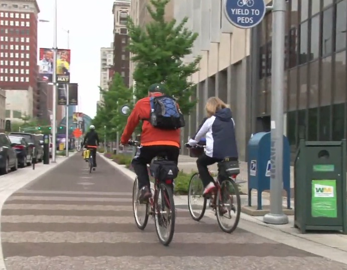
Unlike Cincinnati, Indianapolis has wide streets. The streets are so wide that there is room to do some neat things within the right-of-way with regards to non-automobile forms of transportation.

As a result, Indianapolis Mayor Greg Ballard (R) made it a priority of his administration to not only support the eight-mile Indianapolis Cultural Trail, but to create a city-wide bicycle network that he hopes will have 200 miles by 2015.

It’s a steep change for a city that had virtually no on-street bike lanes in 2007, and only 70 to 75 miles of on-street bike lanes now.

“It feels different when you’re riding a bike, because of how it’s been built and what’s underneath it,” Mayor Ballard told Clarence Eckerson Jr. from Streetfilms. “It’s the part about connecting up everything that’s really made a dramatic impact and is getting the international attention.”

The $63 million project was largely funded through private contributions, and has now created a physically separated pedestrian and bicycle facility that connects many of the city’s significant attractions and center city neighborhoods.

As Cincinnati works on developing a bicycle network of its own, complete with physically separated facilities like the Cultural Trail, what do you think the Queen City should do the same or do differently?

Categories
Business Development News Politics Transportation

Parking Lease Deal to Move Forward Following Appeals Court Ruling

photo (5)This morning the Hamilton County Court of Appeals released its decision on the court case (Lisa McQueen, et al. vs. Milton R. Dohoney, Jr., et al.) concerning whether the City of Cincinnati had the right to enact emergency ordinance provisions in leasing its parking assets to a third party. The decision from the court struck down a lower court’s ruling and in turn upheld the city’s parking lease ordinance and the right for City Council to enact emergency ordinances.

The decision means that the City of Cincinnati can enact its Parking Modernization & Lease Plan, which was passed by City Council 5-4 in March. The ruling also states that citizens do not have the right to file a referendum on items passed with an emergency clause, thus eliminating the possibility of a public vote on the parking lease deal this November.

Immediately following City Council’s March vote, opponents of the plan filed a taxpayer lawsuit against the plan and Judge Robert Winkler issued a restraining order preventing the city from using the emergency ordinance clause for this issue or any issue before the City of Cincinnati. In this particular case, Judge Winkler’s restraining order was issued within minutes of its vote.

Judge Winkler then heard arguments the following week and made a ruling in early-April that allowed a referendum on the emergency ordinance to move forward by questioning the clarity of the city’s charter provisions on the matter.

In May the Court of Appeals heard arguments from both sides. Today the long-awaited decision was announced. In making its decision the Court of Appeals considered several things.

  1. Whether the Plantiff in the case followed the proper legal procedure in filing for the taxpayer lawsuit. The decision documents state in three separate paragraphs that the plaintiffs failed to make the necessary $325 deposit. “The plaintiffs-relators intimate that they cured the deficiency by paying the $325 deposit after the common pleas court had entered its judgment. But the record certified on appeal does not demonstrate that any deposit was made.” Paragraph 23.
  2. Emergency Ordinances are subject to referendum if provisions are provided within the city’s charter: The city’s charter has language outlining the way the city can pass ordinances and emergency ordinances. It also outlines the provisions for referendums. The charter also defaults to state law provisions for what the charter does not cover. Since there were no provisions in the charter for referendum of emergency ordinances, they cannot be challenged to referendums.
  3. The court found that the Emergency Powers provision was backed up by 90 years of case law. In the 90+ years since the enacting of the city’s charter government, Hamilton County and State level courts have ruled in defense of the city’s emergency powers provisions.
  4. The court found that the city properly outlined the nature of the emergency in enacting the emergency ordinance.
  5. The City’s Charter was not ambiguous. The court took the path of interpreting the charter as a whole instead of the sum of its parts.

The ruling is being considered a major victory for the City of Cincinnati as it is now able to move forward with its Parking Modernization & Lease Plan, which will provide an upfront payment of $92 million and annual installments of $3 million from the Port of Greater Cincinnati Authority.

It also defends a wide array of city actions, that are passed with the emergency ordinance clause, from being subject to public referendums. Over the past several years, a host of decisions made by a plurality of City Council had been subject to what some believe is an inefficient way of running a government.

“While Cincinnatians for Progress did not take a position on the parking lease, we believe that good governance is critical to the city of Cincinnati, and we believe that our representative democracy as outlined in the city’s charter is good governance,” Derek Bauman, Co-Chair for Cincinnatians for Progress, told UrbanCincy. “In addition, it is vital for the city to have the ability to pass ordinances as an emergency when necessary. We welcome the appeals court ruling.”

What has yet to be decided is what will happen with the $92 million upfront payment, which was originally planned to cover the city’s budget gap and provide funding for a host of economic development deals.

Since that time, the City of Cincinnati has passed a budget, which originally was to get $25.8M from the parking lease deal, and found alternative funding sources for a number of the projects ($20M for MLK Interchange, $12M for 4th/Race Apartment Tower) involved in the original list.

The result is a $57.8 million question now put before Mayor Mallory’s Administration and City Council.

Categories
Business Development News Politics

Cincinnati Receives Federal Approval for Innovative Green Infrastructure CSO Fix

Last week the U.S. Environmental Protection Agency (EPA) approved the solution proposed by the Metropolitan Sewer District of Greater Cincinnati (MSD) for fixing its combined sewer overflows (CSOs) into the Mill Creek.

Cincinnati is one of many cities struggling to fix their CSOs, which are caused by a combination of higher water runoff and sewer systems that were designed to accommodate both stormwater runoff and sewage. What it means in real terms is that when there are heavy rain events, the stormwater fills up the sewers and then mixes with the sewage.

According to the EPA, raw sewage contains pathogens that threaten public health, leading to beach closures and public advisories against fishing and swimming, and is a problem that particularly affects older urban area.

Lick Run Project
MSD’s plan to reduce 1.5 billion gallons of CSOs from the Mill Creek will include the transformative Lick Run project in South Fairmount.

As a result, under a 2010 consent decree, the MSD was required to either construct a deep-tunnel system under Mill Creek, or conduct further analysis and propose an alternative plan. What is unique about Cincinnati’s approved plan is that it deviates from the standard ‘gray’ tunnel solution, and instead proposes using green infrastructure fixes to reduce stormwater runoff.

“We are very excited to move forward with our innovative wet weather solution that not only provides highly cost-effective compliance with our Consent Decree but simultaneously sets the groundwork to enhance our communities,” James A. “Tony” Parrott, MSD’s Executive Director, said in a prepared release.

In addition to the environmental benefits of Cincinnati’s alternative plan, it is also expected to save taxpayers approximately $200 million upfront and remove 1.78 billion gallons of CSOs annually from the Mill Creek.

The savings come from not building a new deep-tunnel system to accommodate the excess stormwater runoff, and instead aiming to reduce the amount of stormwater flowing into the sewer systems during heavy rains.

The green infrastructure solution being pursued by Cincinnati is already being viewed as a national model for other cities looking to clean up their waterways.

Lick Run View (Northwest) Lick Run View (Southwest)
The $192M Lick Run project would create a linear park through South Fairmount along a newly ‘daylighted’ stream. Images provided.

The hallmark feature of the plan is the $192 million Lick Run Project, which will ‘daylight’ the former creek through the heart of South Fairmount and creating a linear park that officials say will convey stormwater and natural drainage to the Mill Creek. This project alone is estimated to reduce overflows into the Mill Creek, from the largest CSO in the system, by 624 million gallons annually.

“This plan is good news for the residents of Cincinnati and for communities along the Ohio River,” said Cynthia Giles, assistant administrator for EPA’s Office of Enforcement and Compliance Assurance. “Not only will this innovative plan ensure that significant volumes of polluted stormwater and raw sewage are kept out of local waterways, but it will also cost less than more traditional approaches, saving money for ratepayers and the city.”

In addition to the Lick Run Project, MSD’s phase one fixes will also include upgrades to the West Fork, Kings Run, and Bloody Run watersheds that will result in an additional 422 million gallons CSO reduction.

The combined phase one work is planned to take place over the next five years and is estimated to create nearly 1,000 full-time equivalent construction jobs.

MSD officials say that plans for phase two work will be submitted in 2017, and will aim to address CSOs in the Lower Mill Creek watershed. While the plans are not yet finalized, both MSD officials and regulators believe the final remedy will also use an integrated watershed plan approach.