Categories
News Transportation

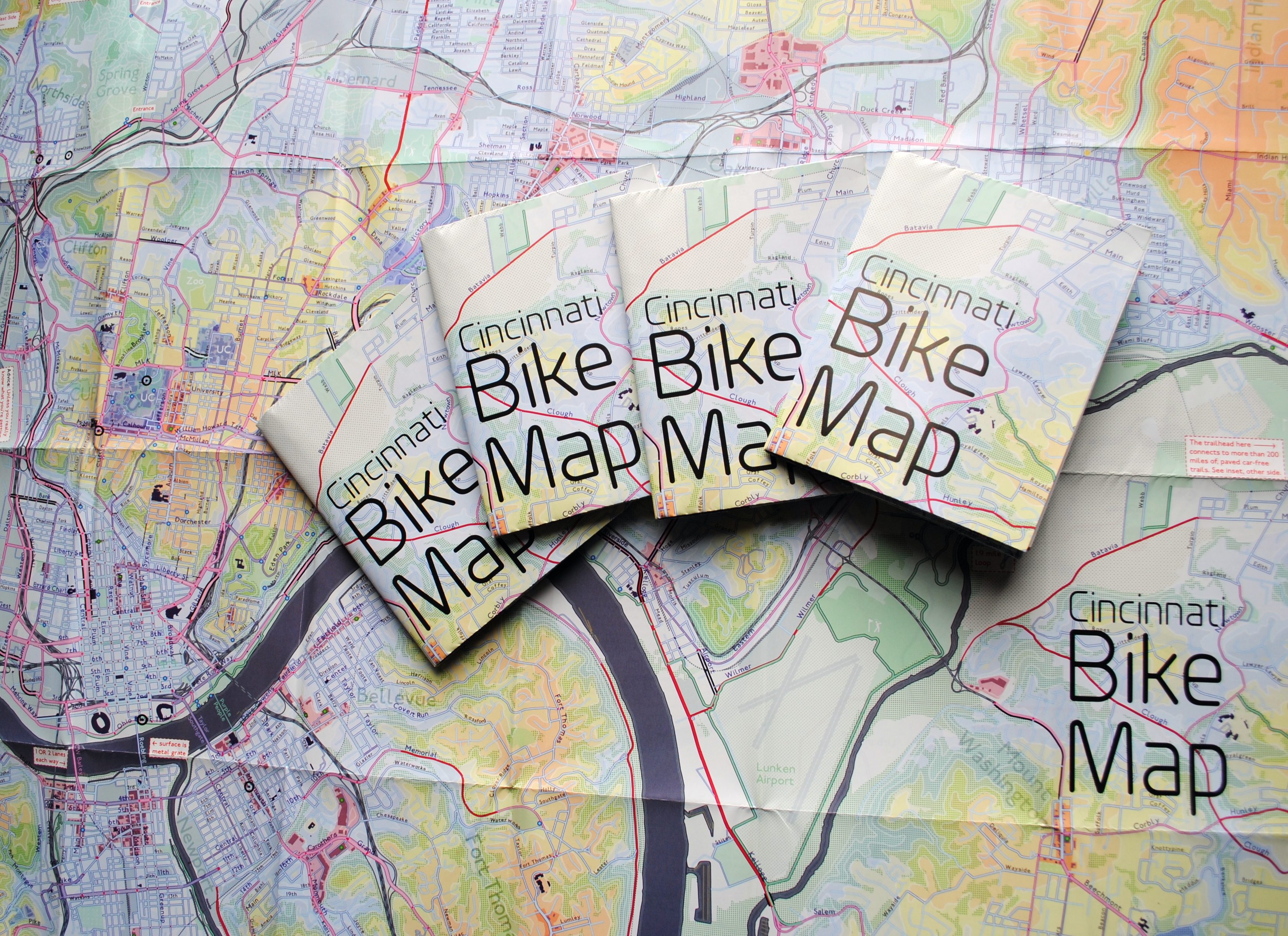
New Cincinnati Bike Map Aims to Change the Way New, Old Cyclists View the City

In 2011 Nate Wessel sought out to change the way Cincinnati mapped its transit. In a region with multiple transit operators that all use traditional bus mapping visuals, it was quite the daunting task. But after successfully raising more than $2,000 on Kickstarter, Wessel was able to fund his effort to print tens of thousands of his newly designed maps that ultimately received national praise.

Since that time he has continued his quest to improve the visual nature of map-making in Cincinnati, including serving as UrbanCincy’s official contributing cartographer, but he also embarked on another major endeavor. Instead of a transit map with bus frequencies, Wessel this time focused his energies on creating a new regional bike network map.

“Imagine someone kept taking, and reproducing and sharing, very unflattering photos of you or someone you loved. If you’re like me, you’d probably let the first one slide,” Wessel stated. “Maybe it was an accident, but by the fifth or sixth one, you’d start noticing a pattern and you’d start getting kind of miffed about it.”

This is the feeling the twenty-something urban planner, cartographer and fashion designer felt about the region’s existing bike maps, and he wanted to take control of the situation and improve it.

“This is a subtle visual game and words won’t do,” Wessel explained. “You need to make your own photo that shows the beauty you see in what you love; and then get other people to see what you see.”

One of the ways to accomplish that, he says, is to get the maps into people’s hands – digital maps are not enough. While the physical presence of a printed map gives it a sense of permanency and seriousness, producing a hard copy map also comes with its challenges.

After finishing the design for the Cincinnati Bike Map, Wessel said that he received feedback from the binder recommending a redesign to better accommodate the way the paper would fold, but that it was too late in the process. As a result, he wishes the maps folded a bit better, but that he is otherwise quite pleased with the final product. Perhaps leading to that feeling of satisfaction, however, is the fact that no compromise was needed since the project was entirely self-funded.

“Both times I’ve raised money for these projects it was in advance of having a real demonstrable product,” said Wessel. “In neither project have I ever had to check anything with a sponsor, supervisor or co-designer. The maps were totally my own in both cases, held to my own standards alone and uncompromised. That is very unusual for print maps.”

While quite unusual, it was a situation he preferred. In fact, Wessel says that a local organization very generously offered to fully fund the printing of Cincinnati Bike Map should he work with their graphic designer. A generous offer indeed, but one that came with risks that the final product not turn out as originally envisioned.

The release of the new regional bike map last month comes at a time when Cincinnati is in the national spotlight for its dramatic gains in bike ridership and development of new bike infrastructure.

Now that the project is complete, the goal now shifts to distributing the stack of Cincinnati Bike Maps that now exist. In addition to distributing the maps to local bike shops and organizations, Wessel is also mailing out copies of the map. His hope is that new or unfamiliar riders feel empowered by the maps, and that experienced riders use them to explore new routes throughout the region.

“Regular cyclists have found their favorite routes and will probably stick with what they know,” said Wessel. “Though, I totally discovered Fort Thomas through this map. Every map I’d seen made it look like a pretty crappy, suburban place to ride and I always avoided it; but the streets are beautifully wooded and very slow with 25mph speed limits.

Of course, all of this would not have been possible without access to the treasure trove of data on-hand at Cincinnati City Hall, and with the OKI Regional Council of Governments.

Those who would like to get a free copy of the Cincinnati Bike Map can do so by emailing Nate Wessel at bike756@gmail.com and informing him of your name, how many copies you want, and the address to which he can ship them.
Categories
News Opinion Transportation

Transit Users Will Need 7 Hours to Commute to ODOT Public Transit Meeting

An event making the rounds on social media hosted by the Ohio Department of Transportation (ODOT) provides an opportunity for citizens to tell Governor John Kasich’s (R) administration about public transportation improvements they’d like to see in their city. The public meeting to discuss statewide transit needs is hosted on Friday, October 31 from 10am to 12pm at the Warren County OhioMeansJobs Center in Lebanon.

While the gathering has good intention, it fails to meet the basic criteria of planning a public involvement meeting:

  1. Never host a public meeting on a holiday.
  2. Never host a public meeting on a Friday or weekend.
  3. The location of a public meeting should be accessible to all members of the community and able to attract a diverse group of citizens.

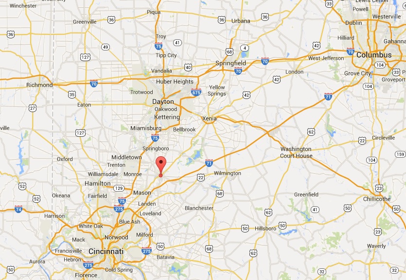
By car, Lebanon is roughly a one hour drive north of Cincinnati, and a 30-minute drive south from Dayton. It’s also the city where the regional ODOT office is located; understandably why the administration would opt to hold a public involvement meeting here. What went unconsidered are the needs of people that the public meeting is focused on: citizens reliant on public transportation.

The closest Metro bus stop to Lebanon is 8.3 miles away, near Kings Island in Mason. Let’s say we’re feeling ambitious and attempt to take the bus, then bicycle the remaining journey to Lebanon. It would take 48 minutes to cycle to the meeting in addition to the 1 hour, 11 minute ride on the bus. Cincinnati Metro, the region’s bus system, only offers select service to the northern suburbs. In order to arrive on time for the 10am meeting, a person dependent on transit would have to catch the 71x at 7:45am, arrive in Mason at 8:52am, then continue to the meeting on bicycle.

Getting back home is another story. The public involvement meeting adjourns at 12pm, but the bus route that services Mason is a job connection bus, meaning it only runs traditional hours when people are going to and from work. After another 48 minutes of cycling back to the bus stop, the inbound 71x picks up shortly after 3pm and returns to Cincinnati at 4:40pm.

In summary, if a citizen dependent on bus transportation wishes to give ODOT their input, they would spend 7 hours commuting to the two hour meeting, and need to able-bodied to ride a bicycle for eight miles. What about senior citizens and people with disabilities? Who can afford to take an entire day off work to attend a meeting? As a transit rider who has a car, driving an hour each way to attend the meeting –in the middle of the work day– for me, is inconvenient and unfeasible.

The poor choice of trying to combine Cincinnati and Dayton into one meeting was an unfortunate oversight in event planning. Instead, meetings should be hosted in the downtown of each city, just like they have been in Columbus and Cleveland which are also participating in the ODOT series.

Since 2011, Governor Kasich has cut $4 million from the state’s public transit budget, leaving Ohio with one of the lowest funded transit systems in the country. If there’s a genuine interest in hearing how those cuts affect the people that rely on public transportation the most, the administration needs to schedule a second meeting in Cincinnati near Government Square where those people can actually get to.

Of course, this isn’t the first time area transit users have been ignored when it comes to public meeting locations. Earlier this year, Ohio Secretary of State Jon Husted (R) upheld a decision to relocate Hamilton County’s Board of Elections office to a location that would take up to four hours to access by transit.

Categories
Arts & Entertainment News Transportation

PHOTOS: Metro Partners With Richard Renaldi on ‘Touching Strangers’ Bus Shelter Exhibit

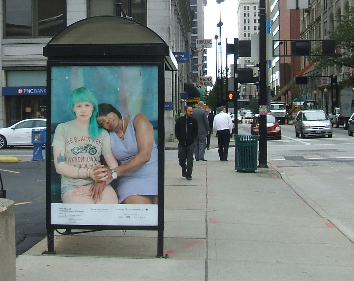
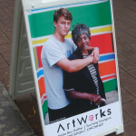
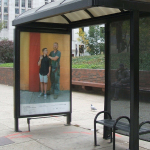
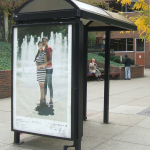
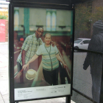
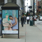
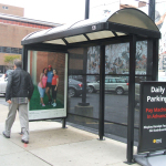
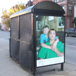
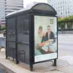
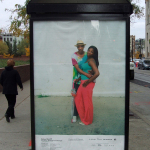
As part of the latest partnership of the Southwest Ohio Regional Transit Authority (SORTA) and ArtWorks, 60 bus shelters throughout the city of Cincinnati now feature photographic portraits of local residents, part of a project by nationally renowned photographer Richard Renaldi.

Due to a 2013 decision by Cincinnati City Council to prohibit advertising in the city right-of-way, SORTA as been left with the question of how to fill sign panels in Metro bus shelters. Last year, the transit agency partnered with ArtWorks to present a series of graphic prints, inspired by works of literature, on 24 bus shelters.

This year the entities have again teamed up to present Touching Strangers: Cincinnati. This project is also part of the 2014 edition of Fotofocus, a biennial celebration of the art of photography.

Originally from Chicago, Renaldi now works out of New York, and his work has been exhibited in galleries and museums around the world.

Renaldi took the photos during a June visit to the city. Residents of Cincinnati area posed for the photos; most feature two people, but in several of the images three are included. The subjects were strangers to each other, having met only for the taking of the pictures, yet are positioned in poses in that suggest a level of intimacy.

Four ArtWorks youth apprentices and two local professional photographers worked with Renaldi and produced additional Touching Strangers portraits.

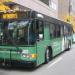
Renaldi and several of the apprentices dedicated the collection of photos at an event on October 16 at a shelter on Sycamore Street downtown. On hand was a Metro bus that has been wrapped with one of the images from the collection.

Many of the shelters featuring the portraits are centrally located downtown and in Over-the-Rhine, the West End, and Uptown, but others are scattered around the city in neighborhoods such as Westwood, Roselawn, and Oakley.

Categories
Up To Speed

What can cities do to roll out BRT faster?

What can cities do to roll out BRT faster?

The Southwest Ohio Regional Transit Authority (SORTA) introduced its first Metro*Plus route in 2013. This type of service is often described as “bus plus”, meaning that it has some benefits over standard bus service, but is not quite up to the level of true bus rapid transit (BRT).

According to a recent post on Portland Transport, rolling out small, incremental improvements to bus service (as SORTA has done) may be more effective than focusing all effort into a small number of BRT routes. It may also be the best way to improve bus service while minimizing the number of political hurdles:

Don’t focus on “BRT” as a separate product, just focus on bus service improvements. In much of Europe, there is no “BRT”–the standard for basic bus service (at least on corridors) often involves things like greater stop-spacing, offboard fare payment, larger vehicles with all-door boarding, signal priority, and exclusive lanes (though not necessarily for the entire length of the route). […]

In many cases, do these quietly, without much fanfare, and without a big splashy project. Big splashy big-ticket projects are more likely to attract political opposition and political opportunism. As Harry S Truman said, “it’s amazing what you can accomplish if you do not care who gets the credit.”

Categories
News Transportation

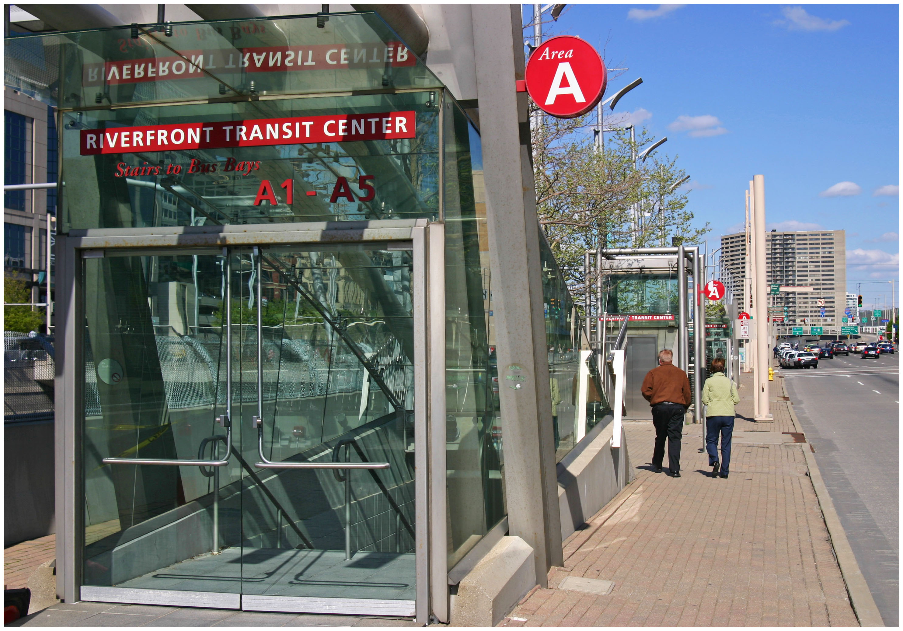
Can Metro, Megabus Come to Terms on Moving the Intercity Bus Operator Into the Riverfront Transit Center?

Following the announcement last week that Megabus would relocate its downtown Cincinnati stop to a parking lot at 691 Gest Street in Queensgate, there has been a new round of public calls for the intercity bus operator to move its stop into the underutilized Riverfront Transit Center.

The move is just the latest in a series of moves after Megabus was forced out of its original stop at Fourth and Race due to construction taking place at Mabley Place, and complaints from neighbors about noise and loitering. Those complaints have since plagued Megabus as it has tried to find a new stop somewhere in the center city.

Perhaps the most troublesome complaint has been allegations of public urination at Megabus stops by their riders. As a result, city leaders have been looking for a more permanent stop location that includes public restrooms. This has led to a number of people to suggest Findlay Market and the Horseshoe Casino, near the existing Greyhound station, as possible locations.

But through all of this there appears to be a growing sentiment that the Riverfront Transit Center be used not only to accommodate Megabus, but all intercity bus operators serving Cincinnati.

“There is, of course, plenty of parking available, and riders can wait in a safe and secure enclosed area, out of the elements and with restrooms available,” stated Derek Bauman, urban development consultant and chairman of Cincinnatians for Progress. “Megabus will benefit by finally having a permanent home that was built for just this purpose.”

In addition to there being plenty of parking nearby, the Riverfront Transit Center, designed to accommodate up to 500 buses and 20,000 passengers per hour, also has plenty of capacity.

Beyond Megabus, there may be an even greater upside for other operators, like Greyhound and Barons Bus, to relocate into the Riverfront Transit Center.

“Greyhound could benefit by moving from and selling its current location near the casino, which would then be ripe for development as a hotel or other higher use. This would also save the company millions in capital dollars to fund needed upgrades and rehab of the current facility.”

As has been noted by Vice Mayor David Mann (D), someone who has served as a leader on trying to find a solution to this problem, there are difficulties with getting Megabus and others into the transit center neatly tucked beneath Second Street.

The Riverfront Transit Center is technically owned by the City of Cincinnati and operated by Metro, which uses the facility Metro*Plus layover, special events and leases some of its east and west aprons for parking. According to transit agency officials, these operations generate approximately $480,000 in annual revenue and net roughly $170,000 in annual profit for Metro.

Therefore, any new operators or changes to this structure would not only present logistical issues, but also potentially negatively affect Metro’s finances unless new revenues are collected – something Megabus has not been particularly keen of thus far.

“It’s our understanding that Megabus pays a fee to share transit facilities in other cities,” Sallie Hilvers, Metro’s Executive Director of Communications, told UrbanCincy. “As a tax-supported public service, Metro would need to recover the increased costs related to maintenance, utilities, security, etc. from Megabus, which is a for-profit company.”

Hilvers also stated that while Metro is open to the idea, that there would also be some legal and regulatory issues that would also need to be addressed.

Nevertheless, the Riverfront Transit Center seems to be the logical place to consolidate intercity bus operators. The facility is enclosed, includes bathrooms, waiting areas, is centrally located and within close proximity to other transportation services such as Government Square, Cincinnati Streetcar and Cincy Red Bike.

“Welcoming visitors to Cincinnati at the RTC at The Banks showcases our city and is much more welcoming than a random street corner in Queensgate outside of downtown,” Bauman emphasized. “This just makes sense, it’s as simple as that. Everyone involved should continue do whatever is necessary to come to an agreement and make it happen.”

EDITORIAL NOTE: Cincinnati Vice Mayor David Mann (D) did not respond to UrbanCincy‘s request for comment on this story.