Categories
News Politics

Council Candidates Talk Urbanism at Forum

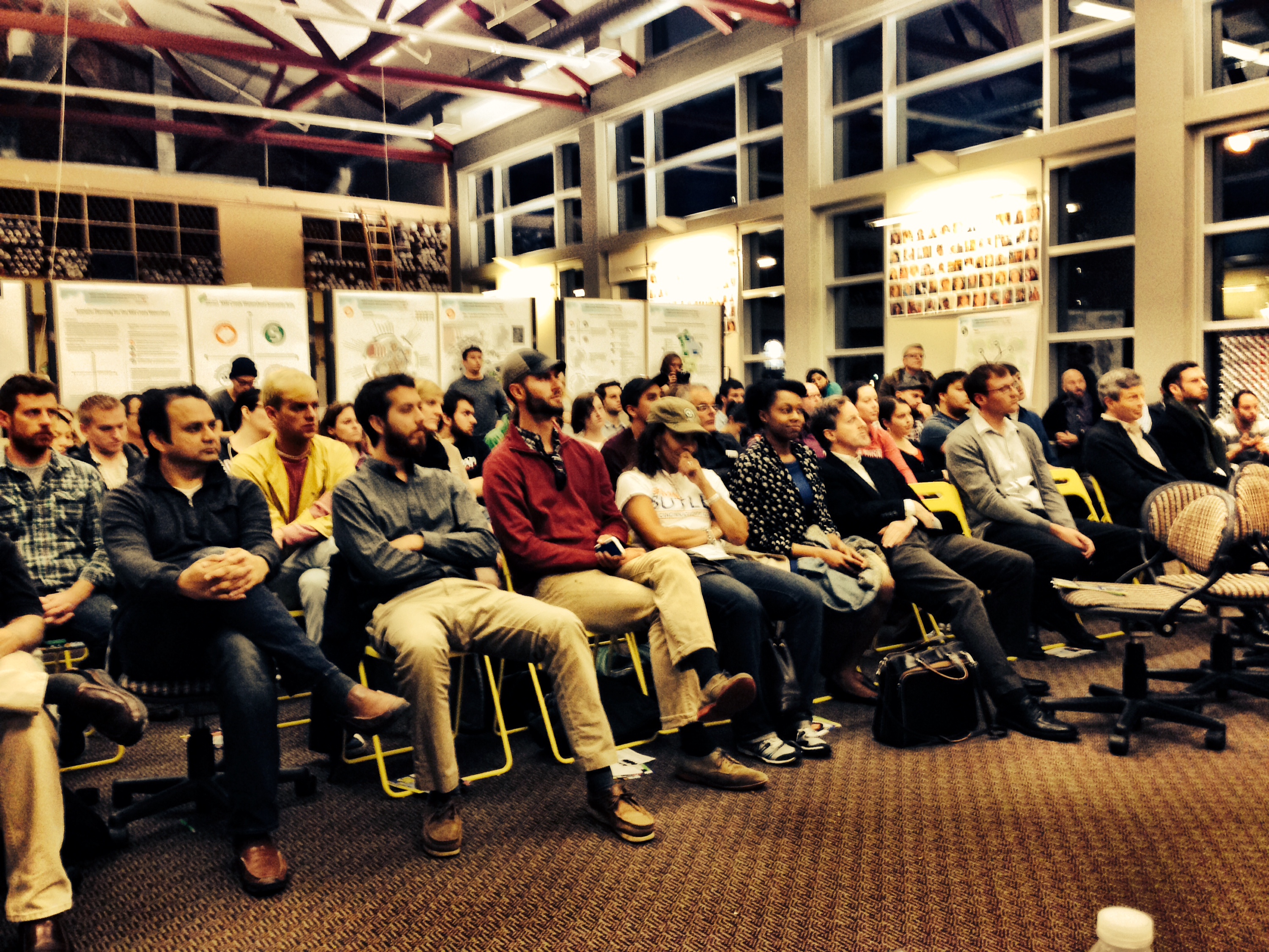
This past Wednesday we collaborated with the Niehoff Studio to host our first Urbanists Council Candidates Forum. The event drew a large group of young professionals and university students as 10 City Council candidates answered several questions about urban design, immigration, transportation and land use policy.

The first question outside of general introductions involved the candidates stance on immigration and what the city could do to attract new populations. These issues had been discussed before in our podcast on immigration. In general the candidates deferred to national policy including the immigration however some candidates pushed for an effort to increase bilingual signage.

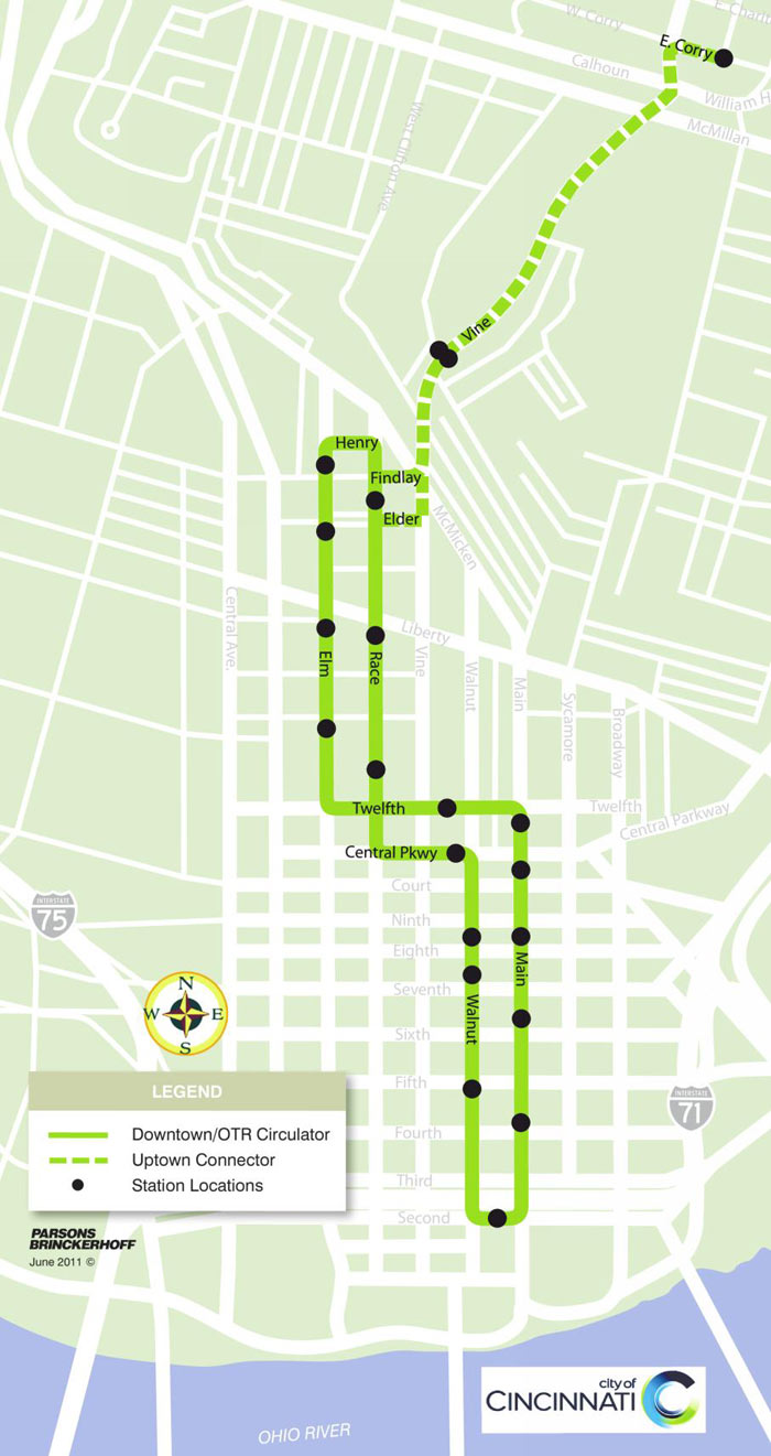
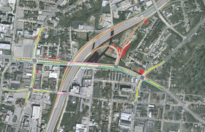
The second question asked candidates about updating the regional mass transit plan. The plan, commonly known as MetroMoves, went to a vote in 2002 for funding through a sales tax increase. The tax failed that year and plans moved forward for the streetcar portion of the plan since the tax was widely supported within the city limits.


Video by Andrew Stalhke for UrbanCincy and Niehoff Urban Studio.

Candidates took the opportunity to use the question to elaborate on their positions regarding the streetcar. Candidate Greg Landsman (D)  reiterated his views on the streetcar from the op-ed published on UrbanCincy a few months ago, and mentioned that both an extension of the streetcar and the implementation of a regional transit system will require support from the private sector. P.G. Sittenfeld (D) said he would support a larger plan than the current system being constructed.

Candidate Melissa Wegman (R) responded by calling for more road connections to the west side and better highways. Councilmember Laure Quinlivan (D), meanwhile, called for the development of a comprehensive multi-modal system that includes more bicycle infrastructure.

The remaining candidates were asked about upgrading Union Terminal for inter-city passenger rail service. Councilman Wendell Young (D) provided a very in-depth response citing the conditions of the terminal and the freight companies that would need to be engaged in the discussion.

Three audience members also asked questions ranging from metro government, public safety to developing a sense of community.

Attendees said they came away feeling more informed about making decisions about candidates.

“I’m encouraged that public transportation has become a pivotal point for a lot of the candidates and I am encouraged by a lot of their answers,” AJ Knee, a UC student pursuing his Masters Degree with the School of Planning told UrbanCincy, “It was very helpful to have this kind of community engagement.”

It has long been a priority of UrbanCincy to better engage young people in the public policy discussions affecting their future. The large, predominately young turnout in Corryville is evidence that young people are becoming increasingly involved. For the 10 candidates that participated in our first Urbanist Council Candidates Forum last week, let’s hope your message resonated with those young urbanist voters.

Categories
Business News Politics

UVA Demographer’s Map Illustrates Cincinnati’s Racial Segregation

Dustin Cable, a demographic researcher at the University of Virginia’s Weldon Cooper Center for Public Service, recently published a map of the United States that shows an individual dot for each of the nation’s 308,745,538 people.

On their map each dot was assigned one of five colors based on the racial and ethnic affiliation. Whites are blue; African-Americans, green; Asians, red; Hispanics, orange; and all other racial categories are coded as brown. Cable used publicly available 2010 data from the U.S. Census Bureau.

When viewed in its entirety from afar, the map makes cities look like integrated places with a merging of all the colors to create a purple shade. This, however, is not the most accurate portrait of the racial segregation found throughout American cities.

When viewing Cincinnati at a more detailed level, for example, one can see the clear separation of White, Black, Hispanic and Asian populations.

The dots are evenly distributed throughout their assigned Census Block, so some dots (or people) appear to be living in areas where they cannot (i.e. parks, water, streets).

The specific areas of interest inside Cincinnati city limits are several Uptown neighborhoods where a dense cluster of Asian individuals live, and the Lower Price Hill and East Price Hill area where a small concentration of Hispanic individuals call home.

When looking elsewhere around the region it is also interesting to observe the Hispanic population cluster in Butler County near in and around the City of Hamilton.

Categories
Business News Politics Transportation

Ludlow Avenue: The Case for a Pedestrian Streets Ordinance

The stretch of Ludlow Avenue from Whitfield Avenue to the west to Ormond Avenue to the east has a decidedly suburban form different from the rest of the gaslight district between Ormond Avenue and Clifton Avenue. This western stretch is part of a two-block commercial main street that is arguably the “most complete neighborhood commercial district in the city,” according to Aaron Renn.

Just being a commercial main street, however, has not been enough to preserve the pedestrian-oriented nature of the street for the entire western half of the district on the south side of Ludlow, and a key gap on the north side of Ludlow at Ormond.

The southern stretch could be described as the Clifton financial district. Between Whitfield and the CVS are three banks – US Bank, PNC and Columbia Savings Bank – all with their own independent access and parking lots surrounding the buildings.

The oddity is not that banks have their own access and parking, but that you have auto-oriented suburban development on a historic commercial main street. This is not a unique problem, but a pedestrian streets ordinance, perhaps modeled after Chicago’s, could help correct faulty land use decisions like this one.

The theory behind such an ordinance is that you have an A and B street hierarchy, with A streets having a high standard of spatial definition and pedestrian interest in a continuous network, and B streets having lower standards for parking lots, drive-thru’s, muffler shops, etc.

This is a neoliberal approach typical of New Urbanism, It compromises for many areas and gives businesses a design choice based on location: a pedestrian main street (A), or an auto-oriented B street.

Chicago’s pedestrian streets ordinance seeks “to preserve and enhance the character of streets and intersections that are widely recognized as Chicago’s best examples of pedestrian-oriented shopping districts. The regulations are intended to promote transit, economic vitality and pedestrian safety and comfort.”

The ordinance then sets the criteria for the pedestrian street designation, lists all street segments within the city that have been deemed pedestrian streets subject to the ordinance, and sets standards for build-to lines, transparency and pedestrian access.

Of particular importance is what it says about parking and driveways:

Parking Location. All off-street parking spaces must be enclosed or located to the rear of the principal building and not be visible from the right-of-way of a pedestrian street.

Driveways and Vehicle Access. Vehicle access to lots located along pedestrian streets must come from an alley. No curb cuts or driveways are allowed from a pedestrian street.

If this the stretch of Ludlow Avenue had a pedestrian streets ordinance, at such time these banks wish to make improvements or redevelopment, these standards would then kick in and require the banks to reconsider their vehicular access, possibly to the point of eliminating driveways and consolidating parking and access off Whitfield.

More realistically, however, the ordinance would help guard other commercial main streets from the auto-oriented nature of drug stores, banks and restaurants without the need for a short-term Interim Development Controls (IDC) district or historic district protections.

Categories
News Opinion Politics Transportation

Greg Landsman: Riding the Cincinnati Streetcar to Success

Downtown to Uptown Cincinnati Streetcar RouteWhether you were for or against the streetcar, here are the facts: contracts have been signed, millions spent, and construction is fully underway. The proverbial train has left the station. Now it is up to both public and private sector leaders to ensure that this new transportation system and driver of economic development is a success.

Like so many, I had been frustrated with the way in which this project had been managed. But with a new and serious project manager in place, my own pragmatism, and firm desire to see Cincinnati succeed mean that I and others get fully on board – and help lead.

To achieve success, the following must happen:

  1. We need a credible operating plan, and it needs private sector support. Taxpayers should not have to pay the full cost to run the streetcar, and with the right deal makers and plan, meaningful partnerships can get done.
  2. The streetcar has to go to Uptown (the Clifton and University of Cincinnati area). So, let’s make it happen. Businesses, property owners, and our institutional partners in Uptown could very well work with the City to ensure the Uptown Connector (Phase 1B) not only happens, but happens as soon as possible.

If elected in November, I pledge to focus on getting the streetcar up the hill to Uptown, not to mention a credible, privately-supported operating plan in place. In fact, I believe we should have a framework for both plans within months, not years.

The work will not end here, of course, and our entire transportation system needs updated. The streetcar should be a catalyst for transforming our transportation system, one that better connects people to jobs and where they want to go – and does so faster.

Cincinnati is on the verge of a major comeback, but long-term growth is not inevitable. Our momentum is real but fragile, and the decisions we make now will determine whether or not Cincinnati is a great city again. Getting the streetcar right, and to Uptown, will be critical. Failure is not an option.

Greg Landsman is a Democratic candidate for Cincinnati City Council. He is currently the executive director for the Strive Partnership, a non-profit dedicated to improving public education, and previously served in the Ted Strickland (D) administration. If you would like to have your thoughts published on UrbanCincy you can do so by submitting your guest editorial to urbancincy@gmail.com.

Categories
Development News Politics Transportation

Financing Falling Into Place for $108M MLK Interchange Project

Planning and financing is progressing for construction of a new interchange between E. Martin Luther King Drive and Interstate 71. The $108 million MLK Interchange will fill the most obvious gap in the area’s expressway system – zero access to Uptown from northbound I-71 and circuitous access from southbound I-71 via the William Howard Taft ramp.

The Taft and McMillan ramps will remain under the state’s current plans, but the new MLK Interchange will become the preferred point of access for the University of Cincinnati, Children’s Hospital, the Cincinnati Zoo, University of Cincinnati Medical Center and surrounding residential neighborhoods.

MLK Interchange Site
Martin Luther King Drive as it passes over I-71 presently. Photograph by Jake Mecklenborg for UrbanCincy.

In addition to the MLK Interchange, the Ohio Department of Transportation (ODOT) broke ground on the reconstruction of I-75’s Hopple Street Interchange. This project will reconfigure W. Martin Luther King Drive west of McMicken Street to meet Hopple Street on a new bridge above Central Parkway.

Two years ago UrbanCincy reported on these two transformative projects, planned for each end of Martin Luther King Drive, which will dramatically change the way motorists access the region’s second largest employment center.

The MLK Interchange has been the subject of considerable attention during the first half of 2013 due to the controversy generated by COAST when it worked to block Cincinnati’s Parking Modernization & Lease deal. The deal, which is now proceeding after a lengthy legal battle, was originally envisioned as the source for the $20 million local contribution to the interchange project.

In addition to blocking the parking deal temporarily, the injunction prevented the City of Cincinnati from passing emergency ordinances. This detail jeopardized the streetcar project, as it was timed perfectly to coincide with council’s need to allocate additional funds after construction bids returned much higher than expected.

MLK Interchange Preferred Alternative
Financing is beginning to fall into place to fund the preferred alternative for the $108M MLK Interchange. Provided.

In April, an effort led by COAST and City Council member Chris Smitherman (I) gathered the necessary signatures to place the parking lease ordinance on the November 2013 ballot. However, on June 12, the parking lease injunction was overturned by Judge Penelope R. Cunningham, wife of anti-streetcar and anti-parking lease 700 WLW talk host Bill Cunningham.

With the ballot issue avoided, streetcar and MLK Interchange planning resumed.

On July 9, the Ohio Controlling Board approved $4.2 million for property acquisition near the planned MLK Interchange in anticipation of a July 2014 start date for the project. Then, on July 22, Ohio Governor John Kasich (R) announced that a portion of his $3 billion lease of the Ohio Turnpike will fund the state’s contribution for the project.

The turnpike deal, which is similar in its strategy to Cincinnati’s parking lease, has hypocritically been spared the legal obstructionism of COAST or the criticism of talk radio hosts.

The City of Cincinnati is hosting a neighborhood meeting on July 24 at the Hampton Inn & Suites in Corryville at 3024 Vine Street between 5pm and 7pm. According the city, the meeting is “intended to guide the Uptown neighborhoods, institutions and city in visioning the future character and nature for the corridor.”

City officials say that formal presentations will be given on the half-hour, and that those who are unable to attend can still submit their comments or questions until Friday, August 2, 2013. Those wishing to submit their comments outside of the meeting can either email info@uptownconsortium.org or send in written correspondence to the Uptown Consortium at 629 Oak Street, Suite 306, Cincinnati, OH 45206.