Categories
Development News Politics

Properly implementing form-based codes is essential to success

[This op-ed was originally published in the Cincinnati Business Courier on July 9, 2010. Visit the original op-ed for more comments, thoughts and opinions on how to effectively apply form-based codes – Randy.]


As Cincinnati officials move closer toward their goal of implementing some variation of form-based codes in Cincinnati it is important that the application is done correctly. Form-based codes, when done correctly, offer a simpler approach to land planning than their awkward land use/design overlay contemporary. In order to achieve the full benefits of a form-based code there are a few practices that should be followed.

Keep It Simple:
The problem with contemporary zoning codes is that they feature layers upon layers of regulations that are complicated to understand by the general public and developers. Most zoning codes have an underlying Euclidean Zoning Code which regulates land use and basic design elements like building setbacks, heights, and densities. Then in the more stringently regulated areas there are often overlay districts created that layer an additional set of regulations on top of the land use regulations. These overlay districts tend to focus more on design features within a given area, and allow any land use regulations that are not covered in their guidelines to fall back into the realm of the underlying zoning code.

The primary functional gain of form-based codes is that they presumably eliminate this layered zoning effect that creates confusion. As a result, form-based codes should NOT be implemented in a layering manner. Form-based codes should completely replace any existing overlay districts and all land use zoning codes that currently exist in the area. The end result would be a district that has only a code that regulates the urban form of an area without the constraints of land use controls and the arbitrary design standards set out therein.

The reason this is often not done is due to a fear that form-based codes will not have the teeth to prevent communities from being destroyed by “undesirable” uses. I assert that this fear is misguided as our current zoning practices were set out during an industrialization period in the United States that saw many polluting industries locating in or around residential neighborhoods. This is certainly not what is desired, but this will not occur in modern society for two main reasons.

  1. Industries locate based on transportation access. An industrial user will seek out access to freight rail, barge, air, and truck access, and as a result, this will eliminate the vast majority of our residential neighborhoods from consideration as they have self-selected to locate in areas away from these industrial amenities.
  2. If a form-based code is done well an “undesirable” will often not be able or willing to locate in a higher transect district. A good example would be Cincinnati’s T6 “Urban Core Zone” where presumably a coal cleaning facility could set up shop due to the lack of land use controls, but if it were to open, the coal cleaning facility would have to design its facility to fit the form of that found in the T6 Urban Core Zone. Such a form would not only be undesirable for such a use, but it would also be cost-prohibitive for its business function.

Forget the Piecemeal Approach:
Many form-based codes are applied in a piecemeal approach that selectively implements the form-based controls in a particular neighborhood or business district. In the Cincinnati region this is presently being done in both Bellevue, KY and Covington, KY as those cities incorporate form-based codes of their own.

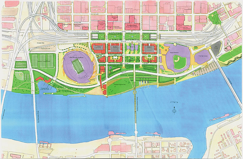
The problem with this approach is that it ignores the all-important transect for which a form-based code is derived. The piecemeal approach allows for the individual form-based codes to be developed in an insular manner without taking into consideration the form of the urban region.

The reason this is problematic is that form-based codes are meant to be living, breathing creatures that can change as a community changes. Cincinnati’s center city has not always been as densely built as it is today, and it got to this point by growing and changing over time. This means that a code that can change with the city is more ideal than one that cannot. If a neighborhood or business district wants to evolve upward from T4 “General Urban Core” to a T5 “Urban Center Zone” it should be able to do so, but if that individual form-based code is developed without these other districts in mind, it prevents such evolution from taking place.

Form-based codes offer a variety of tangible benefits, but they can only fully be realized if we leave the fear of the unknown behind and truly take a risk on something bold and new. No major American city has embarked on such a dramatic reform of its land-planning techniques, but what better city is there than Cincinnati – where modern planning was first implemented – to explore such an effort?

Categories
Business Development News

Moerlein Lager House to open August 2011, new details announced

Details on the much-anticipated Moerlein Lager House were announced today by Cincinnati Mayor Mark Mallory and the development team which consists of the Cincinnati Park Board, Christian Moerlein Brewing Company, Cunningham Restaurant Group, Tilsley & Associates Architects, Schumacher-Dugan Construction, Cincinnati Growth Partners and the City of Cincinnati. The $4 million restaurant and microbrewery will boast a large outdoor biergarten capable of seating 600 people in addition to the 500 people that can be held inside the restaurant.

“This is huge for the Park Board,” said Willie F. Carden, Jr., Director of Cincinnati Parks. “The Moerlein name is synonymous with the history of Cincinnati and beer, and it’s just huge to bring that back. The Moerlein Lager House will really identify the city with its brewing and beer heritage.”

The brewery portion of the Moerlein Lager House will produce 5,000 barrels of beer annually and will be open for tours. Menu items will also be prepared to compliment the beer and replicate items often found on menus in Over-the-Rhine’s 19th Century biergartens.

“Our mission is to breathe new life and vigor into the grand brewing tradition that made Cincinnati one of the world’s greatest brewing meccas over a century ago,” said Greg Hardman President & CEO of Christian Moerlein Brewing Company. “The Moerlein Lager House in Cincinnati Riverfront Park will become an economic driver that will significantly propel Cincinnati’s heritage tourism industry. Patrons will experience what is authentic and unique about this city and its compelling history with every visit to the Moerlein Lager House.”

The development team stated that the 15,000 square-foot, two-story building will be built to LEED standards, and will include a geothermal heating and cooling system, green roof, and sun shading features among other things. The team also said that they have set a goal of 30% Small Business Enterprise hiring on this project.

The new structure is being built in conjunction with phase 1 of the new $120 million Cincinnati Riverfront Park, and once complete, will feature expansive views of Great American Ball Park, the Ohio River, Paul Brown Stadium, Roebling Suspension Bridge, and the new park.

“The design of the Moerlein Lager House was inspired by its magnificent location, the buildings surrounding it, and the design elements of the park, created by Sasaki Associates of Watertown, Massachusetts,” said Greg Tilsley, founder, Tilsley & Associates Architects. “ We wanted to conceive an almost unexpected, iconic building that would convey both a sense of our region’s future and honor for its past. So the dramatic use of glass and steel on the exterior is ‘outward’ and ‘forward’ looking’; while materials for the interiors, such as wood for beamed ceilings, bricks from former breweries, and stone are more reminiscent of the region’s legendary brewing heritage.”

In June 2010, Cincinnati City Council approved a 40-year lease for the Moerlein Lager House. The terms of the agreement maintain the City of Cincinnati as the owner of the restaurant site with no rent being paid in the first year of operation. After that point, the Moerlein Lager House will $150,000 rent in 2012, and $225,000 in rent annually each year after that. The agreement also requires payment of 1.875% of the total gross sales to the City. According to officials, this money will go towards covering operation costs of the new 45-acre Cincinnati Riverfront Park.

“Every little bit helps because what is not raised will be covered by the taxpayers,” Carden said about the the park’s costs. “We are doing everything we can to mitigate taxpayer responsibility and our seven different revenue centers at the Cincinnati Riverfront Park, including the Moerlein Lager House and one other restaurant, will help to do that.”

Construction on the new Moerlein Lager House will being fall 2010 and is expected to create 150 construction and 100 full-time jobs. Once complete in August 2011, the Moerlein Lager House will be open 11am to midnight Sunday through Wednesday, and 11am to 2am Thursday through Saturday.  It will feature live entertainment and is expected to become a major anchor of Cincinnati’s central riverfront redevelopment.

“This new establishment will contribute mightily to the vision of Cincinnati Riverfront Park as the ultimate destination park,” said Willie F. Carden, Jr., Director of Cincinnati Parks. “What’s more, every member of the Moerlein Lager House team that is creating this unique restaurant and brewery is rooted in this community. They make their lives and livelihoods here and so they are driven to deliver a world-class restaurant and brewery to the citizens of Greater Cincinnati and to our region’s new destination park. We have always had outstanding local talent in this community—and we are bringing the very best to the table on this project.”

Categories
Development News Politics Transportation

Hidden Assets of Fort Washington Way Saving Taxpayers Millions of Dollars

Each Wednesday in July, UrbanCincy is highlighting Fort Washington Way (FWW), the I-71/US-50 trench bisecting the Cincinnati riverfront from its downtown. Part-one of the series discussed what the area looked like prior to reconstruction a decade ago, and how that reconstruction made way for the development along Cincinnati’s central riverfront. This week’s piece will discuss some of the unseen assets included in the project that continue to benefit Cincinnatians in a variety of ways today, and will continue to do so well into the future.

Those who enjoy spending their summer evenings at Great American Ball Park to watch our first-place Reds, or our defending AFC North Champion Bengals, have probably seen the stairway entrances to the Riverfront Transit Center. Below Second Street, along the southern portion of FWW, lies an underground multi-modal transit facility. Demonstrating a tremendous amount of foresight, engineers constructed a transit center reportedly capable of moving 500 buses into and out of the heart of downtown in an hour.  This is in addition to Second Street which is designed to also accommodate light rail and streetcars at street level while the underground portion is capable of accommodating light rail, commuter rail, and buses.  And all of this was designed with future transit connections to Northern Kentucky via the Taylor Southgate Bridge, and Cincinnati’s eastern and western suburbs via Riverside Drive and Longworth Hall respectively.

As The Banks development continues its exciting march toward completion, its visitors along with those frequenting Great American Ball Park, the National Underground Railroad Freedom Center, and Paul Brown Stadium will use the anticipatory infrastructure available at the transit facility that could eventually be home to trains serving downtown on a regional light rail network – an inclusion that will eventually save taxpayers millions of dollars once light rail begins to serve Cincinnati central riverfront.

But the Riverfront Transit Center is not the only instance of transportation foresight included with the FWW redesign ten years ago. The roadways that span FWW at Main and Walnut streets were both built to withstand the weight or rail transportation. Furthermore, the sidewalks on each of the roadways connecting Second and Third streets over FWW are some of the widest in the city. Knowing the untapped potential of the area that would later become The Banks development, engineers and city officials determined it prudent to build the spans to support pedestrian, vehicular, bus and rail transportation. Now, as the city builds the Cincinnati Streetcar, it can easily and seamlessly connect the central riverfront to the rest of downtown and beyond because the engineers planned for it a full ten years ago.

Another problem along Cincinnati’s central riverfront was the presence of combined sewer overflows (CSOs). The CSOs are the result of an outdated sewer and water pipe system that becomes overloaded during heavy rainfall events. The result is the combination of solid waste and water runoff into our natural waterways like the Ohio River and its tributaries. Due to the health and ecological concerns, the city and county are under a decree to fix the problem over the next decade or so.

Ten years ago, during the reconstruction of FWW, engineers knew that the problem needed to be addressed eventually, so they built storage tunnels along the trench below Third Street. These pipes act as de facto storage tanks when it rains, allowing runoff and raw sewage to stay in the pipes until it can be treated. From this foresight, the number of raw sewage spills in the immediate area has decreased from about 150 per year to around four or five – an achievement determined by ORSANCO to have provided “measurable water quality improvements to the Ohio River.”

Had the engineers not thought to include the transit center below Second Street, installed wide sidewalks for pedestrians, included the capability to safely transport a streetcar, and built water pipes that can withstand the rain, current and future taxpayers would be burdened with the cost of redoing something we constructed a mere decade ago. Building these features before the need arose ensured that the area is not in a constant state of construction. Furthermore, it allows development to proceed more quickly and without additional unnecessary costs.

Ignoring long-term needs is a foolish, dangerous, and potentially expensive way to run a city. While some city leaders of yesterday and today do indeed deserve criticism for a lack of long-term planning, we ought to give credit where credit is due. And the reconstruction of Fort Washington Way is one of those instances. The decisions made by city leaders over a decade ago have saved taxpayers tens of millions of dollars.

Next Wednesday’s segment will discuss how a project involving so many different interested parties could even be accomplished. In the final article, we will provide ideas for the future of the area, and seek feedback from our readers on what the city can do to make the area more inviting.

Categories
Arts & Entertainment Development News

Take a mini-tour of UC’s dramatic architecture and urban campus

The campus of the University of Cincinnati has been called one of the most dynamic urban campuses in the world, and recently named one of the world’s most beautiful campuses by Forbes Magazine.  Stunning architecture is met by dramatic urban spaces in the heart of Uptown Cincinnati, and it can all be seen in this video produced by Soapbox Cincinnati.

“There are at least a dozen buildings designed by world-renowned architects in partnership with local architects,” said Michaele Pride, Director, School of Architecture and Interior Design at the University of Cincinnati.  “The highest concentration of these special buildings align with what is now known as Main Street in the center of campus.”

Categories
Development News Politics Transportation

Reconstruction of Fort Washington Way Redefined Cincinnati’s Urban Core

Fort Washington Way might be better known to some Cincinnatians as the I-71/US-50 trench through downtown Cincinnati, but few might know the full story behind how the current area came to be what it is today. Every Wednesday this July, UrbanCincy will cover a part of the history of Fort Washington Way, its construction, the political fights that came with it, and the potential future for the area. Furthermore, the unprecedented foresight that the engineers, politicians, and public alike demonstrated through the construction will be highlighted.

The City of Cincinnati developed where it is today because of its location on the Ohio River. The river served as the primary economic engine for the city and therefore the larger region. As such, the fact that Fort Washington Way bisects the urban core from the riverfront troubles individuals who wish to see the city become whole once again. However, it is important to remember what the stretch of land looked like prior to major renovations a decade ago.

In 1998, construction began on the approximately 1.25-mile stretch of highway. Originally, the plan included burying the stretch of highway completely in order to hide the highway eyesore from the remainder of downtown. However, that idea was overturned in 1996 because many people wanted to ensure that visitors to the city would be able to see it as they traveled through. New plans were completed and construction began.

In 1999, after more than two-thirds of the renovations were complete, there was renewed interest in burying the highway. Proponents claimed that a buried highway would ensure an uninterrupted transition from downtown to the riverfront. The engineers knew that they wouldn’t be able to finish the project on time and on budget if they changed the project so late, so they compromised by sinking the roadway below the level of the rest of downtown’s street grid. Part of this compromise included driving extraordinarily strong support piles into the ground that were engineered to hold caps that could eventually cover the highway if the decision was made to do so at a later date.

The current gaps between segments of the street spanning over Fort Washington Way are spaced such that caps 600 feet wide could be installed with relative ease and with a gap between segments. Gaps ensure that the area is not officially a tunnel, and as a result, the dangers and costs associated with the fire safety precautions of a tunnel are avoided. Engineers state that the pilings supporting the caps could withstand the weight of several feet of dirt, making an unique and exciting urban park possible. Furthermore, the caps could support the weight of buildings approximately four stories high. The latter options would provide the opportunity to link The Banks development with the rest of downtown abutting the current trench.

The major change in the 1998 redesign came by untangling and streamlining the mess of highway on- and off-ramps. Doing so allowed the roadway to carry a greater capacity, increase safety, and dramatically decrease the total width of Fort Washington Way. Once construction was completed, about 40% of the original width was gone as a result of the better design. The space that was saved freed up room for the Great American Ball Park, National Underground Railroad Freedom Center, Paul Brown Stadium and much of The Banks development.

In the next three weeks, UrbanCincy will highlight how this transformation took place. In the process, we will show how the city demonstrated an unprecedented level of foresight, saving current and future taxpayers untold sums of money. The inter-jurisdictional cooperation that this project achieved set the stage for the redesigned area to win more than a dozen national and international awards.

As one engineer told me: “We weren’t highway building. We were city building.” Check back each Wednesday in July to learn more about how Fort Washington Way project impacted current and future development.