Towne Properties recently announced some details regarding their development plan for the empty site right now in between McMillan and Calhoun (GoogleMap) streets in Clifton Heights. The $100 million project is proposed to include roughly 150 apartments, 77,000 square feet of retail space, 2 hotels and about 100,000 square feet of office space.
A public plaza near the western most terminus of the University Park Apartments (UPA) building across the street would also be an important feature of the development that would be privately managed and operated. The development would consist of mid-rise buildings that would sit atop parking garages serving not only the development but the surrounding uses as well.
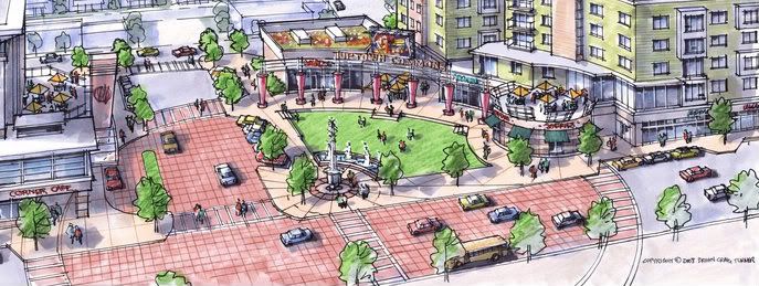 Uptown Commons – Public Plaza Perspective
The Clifton Heights neighborhood business district (NBD) is already a great node for the community. A quality development here, with the right mix of uses could potentially create one of the biggest and best NBDs in Cincinnati (and that’s saying something given the competition).
Rents for the apartments will exceed the $1 per square-foot range which is comparable to the rents charged at UPA. Those apartments actually have a waiting list while also boasting some of the highest prices per square-foot of any rental units in the city. The hotels and office space will add some much needed year-round traffic in an area currently dominated by seasonal students.
Towne Properties cited that work could begin as soon as next Fall if financing is in place. Financing that they feel confident will be there even amidst the financial crisis and lending freezes being seen across the nation. Towne also noted that the development has been drawn up with the streetcar in mind as they are expecting the streetcar system to loop their development.
You can download the detailed site plans courtesy of by Cole + Russell at the following links:
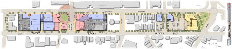 Uptown Commons – Site Plan
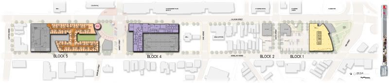 Uptown Commons – Upper Floors Plan


